EstuaryWatch Data Portal
GMC Gellibrand River Estuary Mouth Observation Site
17 September 2017
Observation details
Overview
| Estuary | Gellibrand River Estuary |
|---|---|
| Site | Gellibrand River Estuary Mouth Observation Site |
| Observation ID | #11453 |
| Date and Time | Sunday 17th September 2017 08:40am |
| Approved | Approved |
Notes
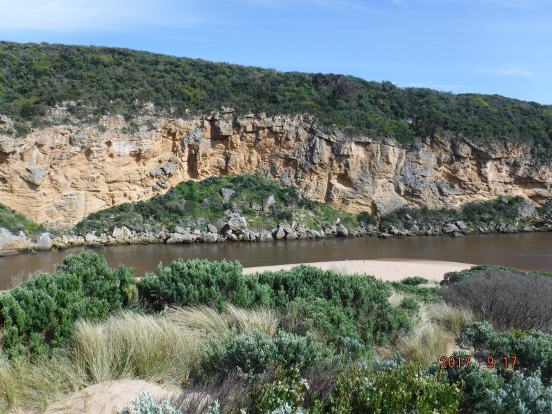
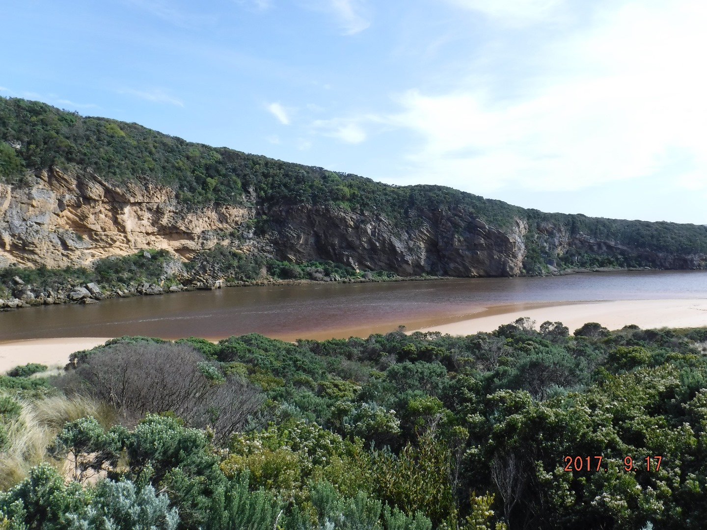
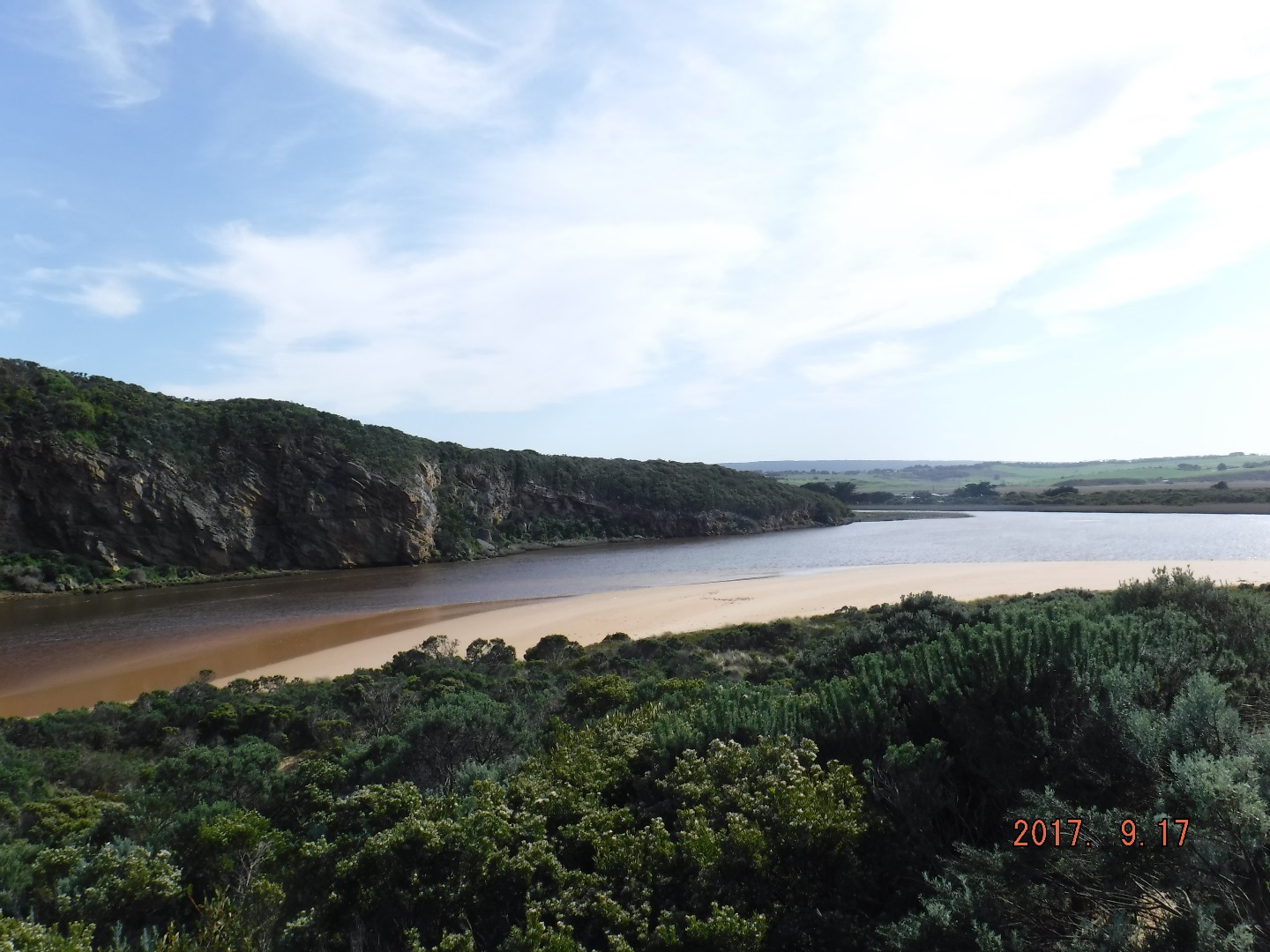
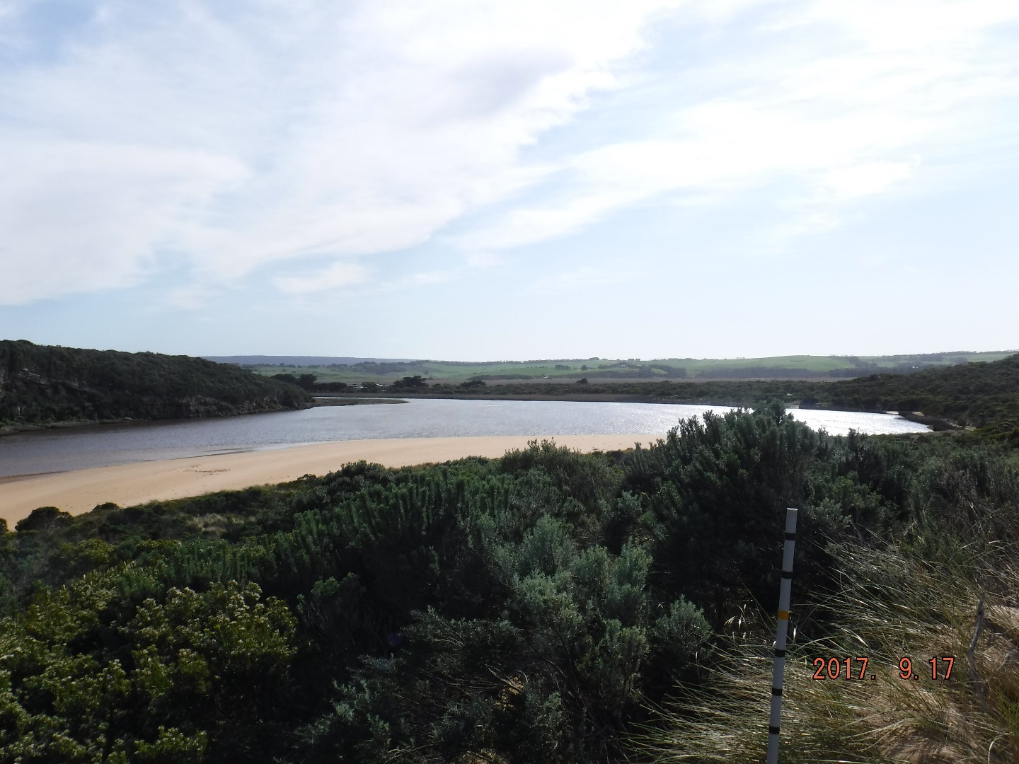
AHD board covered with silt almost un readable
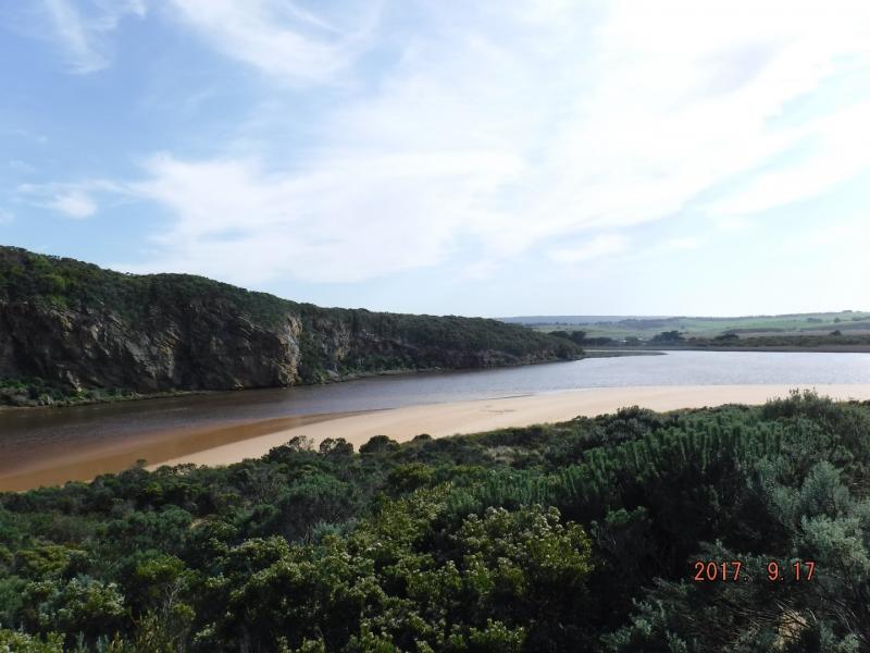
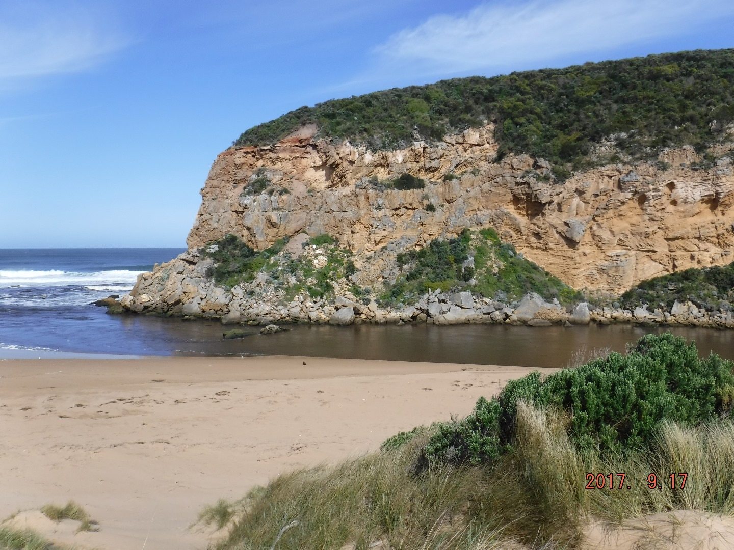
Dark dirty discharge out flowing strongly to east. Strong longshore drift over mouth.
Beach highest at east end. Flow on both sides of rocks.
More rock fall on southern cliff face.
Two Peregrine falcons over cliff. Stick cadis on beach at channel/entrance.
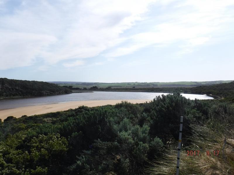
Turbidity very high in estuary.
Waves going along base of cliff S-N direction in estuary
Mouth Observation
| Mouth state | Open |
|---|---|
| Previous | O O O O O O O O O O O O O O O O O O O O P O P C C O O O O O O O C O C C C O O O O O C O O O O O O O O O O O O O O |
| Flow Present? | Yes |
| Previous | Y Y Y Y Y Y Y Y Y Y Y Y Y Y Y Y Y Y Y Y Y Y Y N N Y Y Y N Y Y Y N N N N N Y Y Y Y Y N Y Y Y N Y Y Y Y Y Y Y Y Y Y |
| Flow Direction | Out |
| Previous | O O O O O O O O O O O O O O O I I O O O I O I N N O O I N O O O N N N N N O O O O O N O O O N O O O O O O O O O O |
| Above Sea | Above Estuary | |
|---|---|---|
| Berm Height (m) | ||
| Berm Length (m) |
Physical Condition
| Current | Mode | |
|---|---|---|
| Wind Direction | North | |
| Beaufort Scale | Gentle breeze | |
| Sea State | Rough |


All content, files, data and images provided by the EstuaryWatch Data Portal and Gallery are subject to a Creative Commons Attribution License
Content is made available to be used in any way, and should always attribute EstuaryWatch and www.estuarywatch.org.au