EstuaryWatch Data Portal
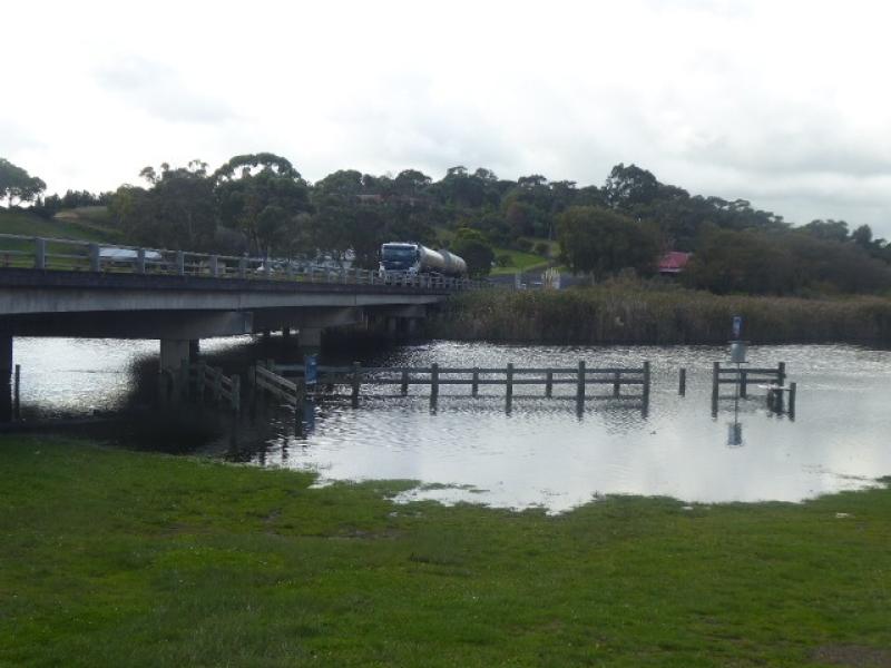
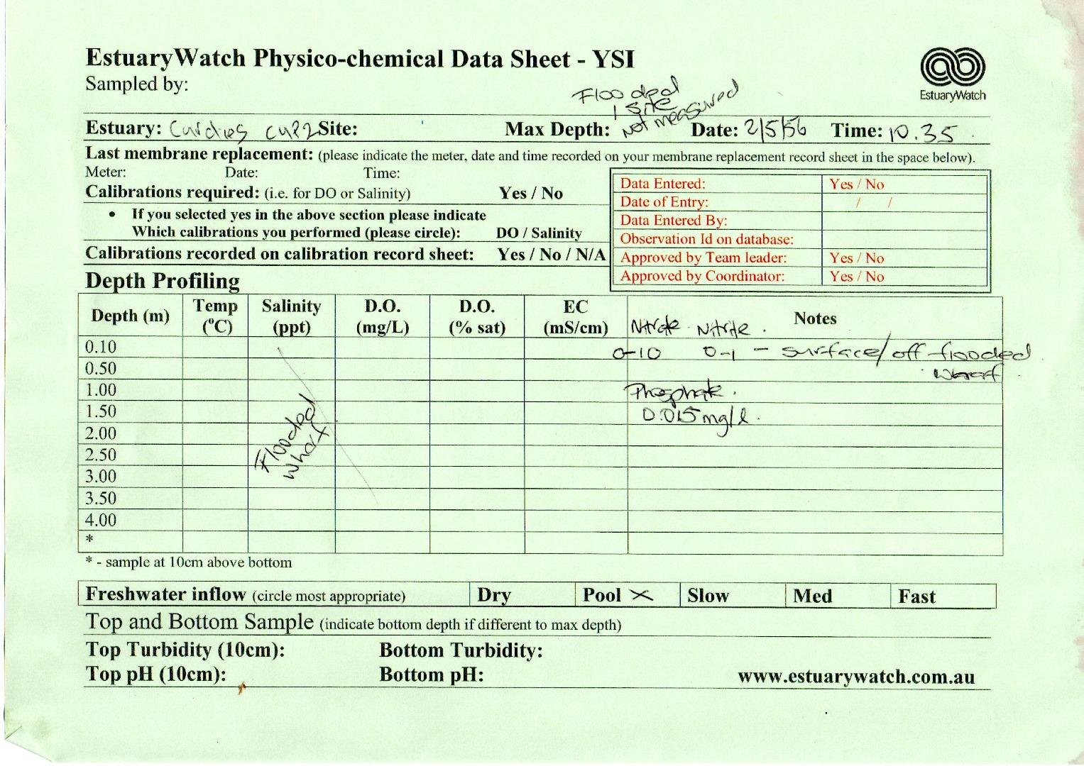
Cu2 Boggy Creek Road fishing jetty
2 May 2023
Observation details
Overview
| Estuary | Curdies River Estuary |
|---|---|
| Site | Boggy Creek Road fishing jetty |
| Observation ID | #15502 |
| Date and Time | Tuesday 2nd May 2023 18:14pm |
| Approved | Approved |
Notes
No sampling was possible because our sampling position was flooded.
We were able to undertake Phosphate, Nitrate and Nitrite tests,
taking samples from a bridge near our sampling position.
Results were: - Phosphate 0.015 mg/l
Nitrate. 0 - 10
Nitrite 0 - 1
Each time I tried to load photos or scans, the program wouj=ld shut down,
so I havd sent the photos and scans to Deirdre Murphy in an email.


All content, files, data and images provided by the EstuaryWatch Data Portal and Gallery are subject to a Creative Commons Attribution License
Content is made available to be used in any way, and should always attribute EstuaryWatch and www.estuarywatch.org.au