EstuaryWatch Data Portal
GMC Gellibrand River Estuary Mouth Observation Site
13 August 2010
Observation details
Overview
| Estuary | Gellibrand River Estuary |
|---|---|
| Site | Gellibrand River Estuary Mouth Observation Site |
| Observation ID | #4162 |
| Date and Time | Friday 13th August 2010 13:06pm |
| Approved | Approved |
Notes
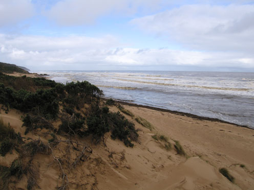
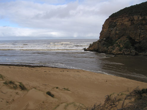
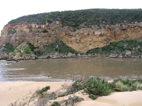
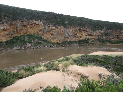
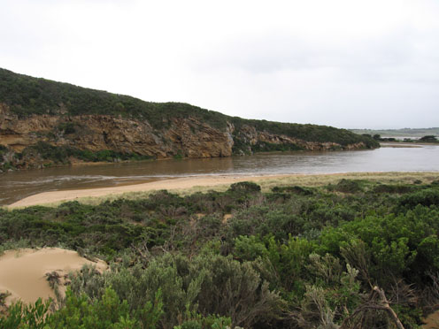
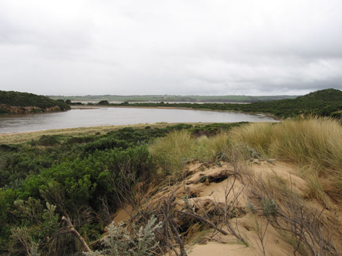
1. Extreme width and force of out flow has cut away south east side of channel causing a 3-4m high cut into the sand dunes
2.Mouth is about 40 to 50m wide, the old breakwater piles are about twice their original height. The base cannot be seen because of the strong flow
3.Beach is covered along the water line by Phragmities debris and logs to height 1m. high - 4m. wide
4.Sea is dark coffee colour and beaches toward Rivernook/Moonlight Head are covered by foam
5.Discharge is visiable to over 1k out to sea
6.Flood seems to have peaked about 07:00
Burrupa 7.0 Bridge totally under water
G6. Water up to top of culverts About 1.5m from bridge deck No markers visiable
G5. bridge underwater
G4. bridge & causeway totally under water
G2 Boardwalk under water
Valley from Princetown to G6 flooded
Flood marker O.O.R 1.2 at 05:30
Water to centre of GOR near Latrobe Creek
Mouth Observation
| Mouth state | Open |
|---|---|
| Previous | O O O O O O O O O O O O O O O O O O O O O O O O O O O O O O O P O O O O O O O O O O O O O O P O O O O O O P O O O O O O O O O O |
| Flow Present? | Yes |
| Previous | Y Y Y Y Y Y Y Y Y Y Y Y Y Y Y Y Y Y Y Y Y Y Y Y Y Y Y Y Y Y Y Y Y Y Y Y Y Y Y Y Y Y Y Y Y Y Y Y Y Y Y Y Y Y Y Y Y Y Y Y Y Y Y Y |
| Flow Direction | Out |
| Previous | O O O O O O O O O O O O O O O O O O O O O O O O O O O O O O O O O O O O O O O O I O O I O O I O O O O I O I O I O O I O O O O O |
| Above Sea | Above Estuary | |
|---|---|---|
| Berm Height (m) | ||
| Berm Length (m) |
Physical Condition
| Current | Mode | |
|---|---|---|
| Wind Direction | North-West | |
| Beaufort Scale | Moderate breeze | |
| Sea State | Rough |


All content, files, data and images provided by the EstuaryWatch Data Portal and Gallery are subject to a Creative Commons Attribution License
Content is made available to be used in any way, and should always attribute EstuaryWatch and www.estuarywatch.org.au