EstuaryWatch Data Portal
GMC Gellibrand River Estuary Mouth Observation Site
17 August 2010
Observation details
Overview
| Estuary | Gellibrand River Estuary |
|---|---|
| Site | Gellibrand River Estuary Mouth Observation Site |
| Observation ID | #4221 |
| Date and Time | Tuesday 17th August 2010 15:30pm |
| Approved | Approved |
Notes
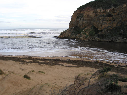
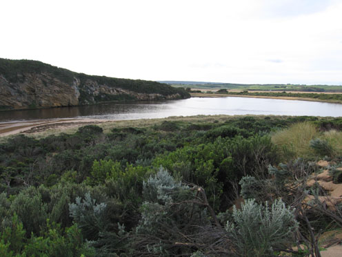
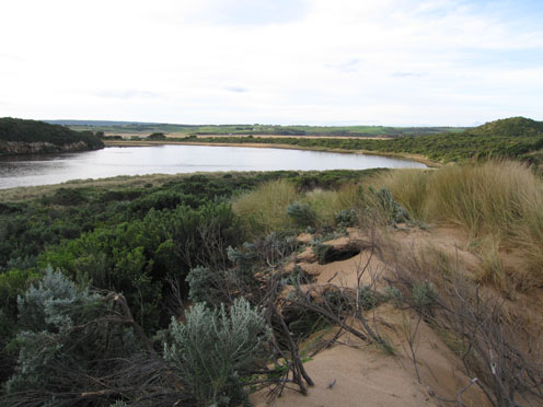
1. Strong outflow, waves dark brown full length of beach and out about 1K. to sea
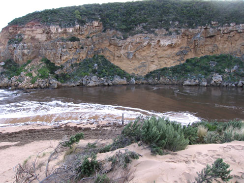
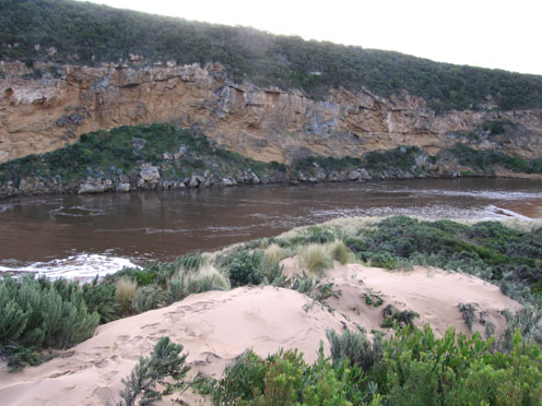
2.Waver travelling into estuary over sand bars & around to east gouging out bank.Bank on south side has sheer front of about 2-3m.cut into dunes
3. Flood water has cut 8-10m. high sheer cliff into dunes on east side of channel
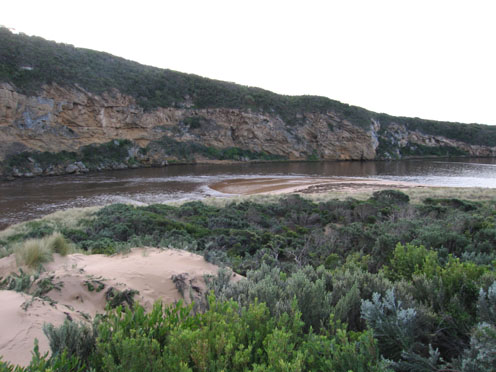
4. Mouth is over 60m. wide(no beach) and 7old piles of break water are exposed
5.Flood water has deposited a huge amount of Phragmites on the beach which is now being returned to the estuary because of reducing force and longshore drift from rough seas
6. Flood water reducing from peak(13.08.10) OOR is clear of water
7.Valley flats are still covered by water
8.G4. deck has been totally removed from bridge and several landslips have occured between G4 &G6.
Mouth Observation
| Mouth state | Open |
|---|---|
| Previous | O O O O O O O O O O O O O O O O O O O O O O O O O O O O O O P O O O O O O O O O O O O O O P O O O O O O P O O O O O O O O O O O |
| Flow Present? | Yes |
| Previous | Y Y Y Y Y Y Y Y Y Y Y Y Y Y Y Y Y Y Y Y Y Y Y Y Y Y Y Y Y Y Y Y Y Y Y Y Y Y Y Y Y Y Y Y Y Y Y Y Y Y Y Y Y Y Y Y Y Y Y Y Y Y Y Y |
| Flow Direction | Out |
| Previous | O O O O O O O O O O O O O O O O O O O O O O O O O O O O O O O O O O O O O O O I O O I O O I O O O O I O I O I O O I O O O O O O |
| Above Sea | Above Estuary | |
|---|---|---|
| Berm Height (m) | ||
| Berm Length (m) |
Physical Condition
| Current | Mode | |
|---|---|---|
| Wind Direction | South-West | |
| Beaufort Scale | Gentle breeze | |
| Sea State | Rough |


All content, files, data and images provided by the EstuaryWatch Data Portal and Gallery are subject to a Creative Commons Attribution License
Content is made available to be used in any way, and should always attribute EstuaryWatch and www.estuarywatch.org.au