EstuaryWatch Data Portal
Observation details
Overview
| Estuary | Barham River Estuary |
|---|---|
| Site | Barham River Observation Site |
| Observation ID | #4281 |
| Date and Time | Saturday 28th August 2010 13:42pm |
| Approved | Approved |
Notes
AIR PRESSURE 1024.2hPa, Rainfall last 48 hrs 9.2 mm
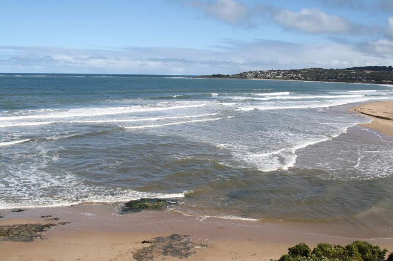
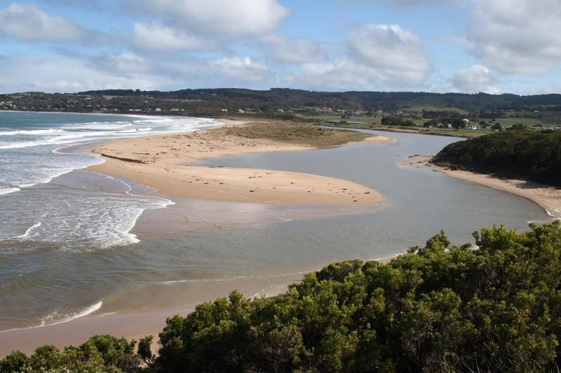
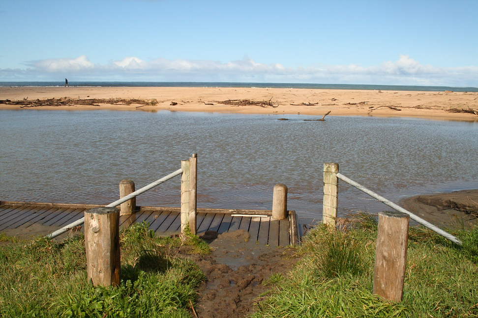
Otway Ranges including Barham Catchment received record rainfall with heavy winds in August. River banks overflowed into the riparian zone, large logs and heavy debris washed to estuary shoreline, and in places overtopped with silt and sand. Estuary mouth has been reshaped due to berm erosion on ocean side. River now back in its banks.
Mouth Observation
| Mouth state | Open |
|---|---|
| Previous | O O O O O C C O O O O O O O |
| Flow Present? | Yes |
| Previous | Y Y Y N Y Y |
| Flow Direction | Out |
| Previous | O O O O O I I N O O O |
| Above Sea | Above Estuary | |
|---|---|---|
| Berm Height (m) | ||
| Berm Length (m) |
Physical Condition
| Current | Mode | |
|---|---|---|
| Wind Direction | South | |
| Beaufort Scale | Light Breeze | |
| Sea State | Moderate |


All content, files, data and images provided by the EstuaryWatch Data Portal and Gallery are subject to a Creative Commons Attribution License
Content is made available to be used in any way, and should always attribute EstuaryWatch and www.estuarywatch.org.au