EstuaryWatch Data Portal
GMC Gellibrand River Estuary Mouth Observation Site
16 October 2010
Observation details
Overview
| Estuary | Gellibrand River Estuary |
|---|---|
| Site | Gellibrand River Estuary Mouth Observation Site |
| Observation ID | #4584 |
| Date and Time | Saturday 16th October 2010 08:55am |
| Approved | Approved |
Notes
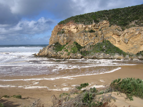
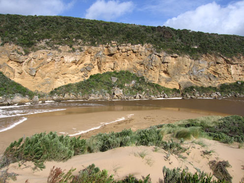
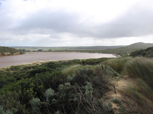
1.Strong outflow, waves in all directions at mouth, foam & waves up to base of dunes. East end of beach has been scoured out -sheer sand cliffs at least 3m high.
Waves entering estuary - up to 30cm impacting on east side
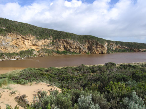
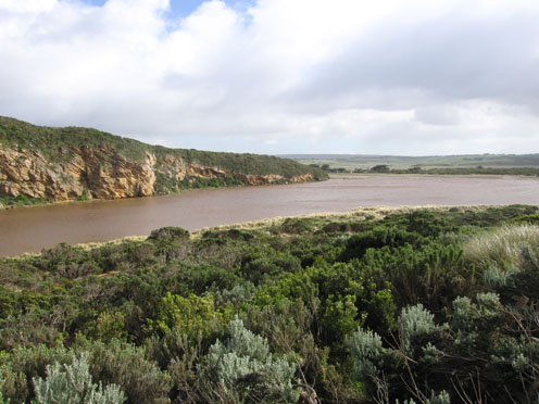
2. Water level has risen due to recent heavy rain. considerable turbidity (150 at G2)
3. Recent storms have re shaped the formation of the dunes. Higher in some areas, also much covered vegetation
4.large increase of sand east of channel between rocks & tunnel
5. Water level of channel is higher directly upstream of rocks
6.Nine dead & dying Shearwaters. 5 around mouth
+ 4 more further to east along beach
7.Senecio elegans in flower,occuring in new areas along tracks and rock face west of the channel.
Serious trampling is occuring in the dunes because the tracks no longer exist. This will increase spread of Senecio and Euphorbia as well as destroying important indigenous vegetation
8.Many fox prints
Mouth Observation
| Mouth state | Open |
|---|---|
| Previous | O O O O O O O O O O O O O O O O O P O O O O O O O O O O O O O O P O O O O O O P O O O O O O O O O O O O O O O O O O O O O |
| Flow Present? | Yes |
| Previous | Y Y Y Y Y Y Y Y Y Y Y Y Y Y Y Y Y Y Y Y Y Y Y Y Y Y Y Y Y Y Y Y Y Y Y Y Y Y Y Y Y Y Y Y Y Y Y Y Y Y Y Y Y Y Y Y Y Y Y Y Y |
| Flow Direction | Out |
| Previous | O O O O O O O O O O O O O O O O O O O O O O O O O O I O O I O O I O O O O I O I O I O O I O O O O O O O O O O O O O O O O |
| Above Sea | Above Estuary | |
|---|---|---|
| Berm Height (m) | ||
| Berm Length (m) |
Physical Condition
| Current | Mode | |
|---|---|---|
| Wind Direction | South | |
| Beaufort Scale | High wind, moderate gale, near gale | |
| Sea State | Rough |


All content, files, data and images provided by the EstuaryWatch Data Portal and Gallery are subject to a Creative Commons Attribution License
Content is made available to be used in any way, and should always attribute EstuaryWatch and www.estuarywatch.org.au