EstuaryWatch Data Portal
GMC Gellibrand River Estuary Mouth Observation Site
22 October 2010
Observation details
Overview
| Estuary | Gellibrand River Estuary |
|---|---|
| Site | Gellibrand River Estuary Mouth Observation Site |
| Observation ID | #4601 |
| Date and Time | Friday 22nd October 2010 09:15am |
| Approved | Approved |
Notes
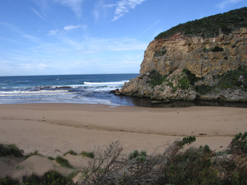
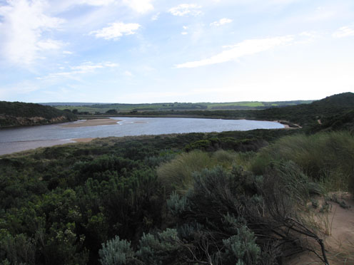
1.Strong flowing dark discharge out to east about 40m from shore
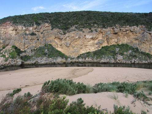
2.More sand build up on east side of channel upstream of rocks
3.Also more sand building up on east side of estuary
4.Channel beside cliff face north of tunnel has remained, with sand bars still to west side of estuary.
5. Prints of Hooded Plover mid to east end of beach
6.Silver gulls 13, White faced heron 1, feeding near mouth
Mouth Observation
| Mouth state | Open |
|---|---|
| Previous | O O O O O O O O O O O O O O O O P O O O O O O O O O O O O O O P O O O O O O P O O O O O O O O O O O O O O O O O O O O O O |
| Flow Present? | Yes |
| Previous | Y Y Y Y Y Y Y Y Y Y Y Y Y Y Y Y Y Y Y Y Y Y Y Y Y Y Y Y Y Y Y Y Y Y Y Y Y Y Y Y Y Y Y Y Y Y Y Y Y Y Y Y Y Y Y Y Y Y Y Y Y |
| Flow Direction | Out |
| Previous | O O O O O O O O O O O O O O O O O O O O O O O O O I O O I O O I O O O O I O I O I O O I O O O O O O O O O O O O O O O O O |
| Above Sea | Above Estuary | |
|---|---|---|
| Berm Height (m) | ||
| Berm Length (m) |
Physical Condition
| Current | Mode | |
|---|---|---|
| Wind Direction | North | North-West |
| Beaufort Scale | Fresh breeze | Fresh breeze |
| Sea State | Moderate | Moderate |


All content, files, data and images provided by the EstuaryWatch Data Portal and Gallery are subject to a Creative Commons Attribution License
Content is made available to be used in any way, and should always attribute EstuaryWatch and www.estuarywatch.org.au