EstuaryWatch Data Portal
GMC Gellibrand River Estuary Mouth Observation Site
17 December 2010
Observation details
Overview
| Estuary | Gellibrand River Estuary |
|---|---|
| Site | Gellibrand River Estuary Mouth Observation Site |
| Observation ID | #4841 |
| Date and Time | Friday 17th December 2010 10:10am |
| Approved | Approved |
Notes
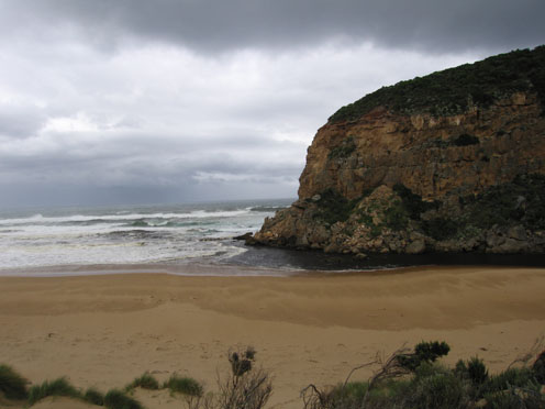
1.Dark discharge around mouth and to east
2.Longshore drift bringing more sand to mouth
3.Strong north wind driving waves 10-20cm.high to mouth, waves entering estuary along east side of channel
4.Wide beach area with gradual slope. Large amount of foam at eastern end.
5.Gladiolus undulatus flowering along low track.
6.Lotus australis found in dunes
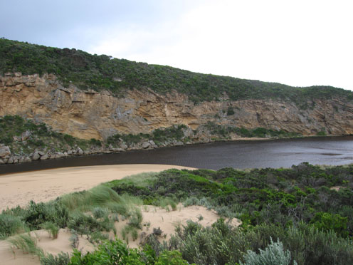
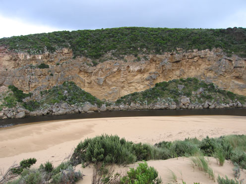
Mouth Observation
| Mouth state | Open |
|---|---|
| Previous | O O O O O O O O P O O O O O O O O O O O O O O P O O O O O O P O O O O O O O O O O O O O O O O O O O O O O O O O O O O O O |
| Flow Present? | Yes |
| Previous | Y Y Y Y Y Y Y Y Y Y Y Y Y Y Y Y Y Y Y Y Y Y Y Y Y Y Y Y Y Y Y Y Y Y Y Y Y Y Y Y Y Y Y Y Y Y Y Y Y Y Y Y Y Y Y Y Y Y Y Y Y |
| Flow Direction | Out |
| Previous | O O O O O O O O O O O O O O O O O I O O I O O I O O O O I O I O I O O I O O O O O O O O O O O O O O O O O O O O O O O O O |
| Above Sea | Above Estuary | |
|---|---|---|
| Berm Height (m) | ||
| Berm Length (m) |
Physical Condition
| Current | Mode | |
|---|---|---|
| Wind Direction | North-West | |
| Beaufort Scale | High wind, moderate gale, near gale | |
| Sea State | Rough |


All content, files, data and images provided by the EstuaryWatch Data Portal and Gallery are subject to a Creative Commons Attribution License
Content is made available to be used in any way, and should always attribute EstuaryWatch and www.estuarywatch.org.au