EstuaryWatch Data Portal
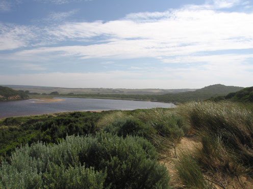
GMC Gellibrand River Estuary Mouth Observation Site
23 December 2011
Observation details
Overview
| Estuary | Gellibrand River Estuary |
|---|---|
| Site | Gellibrand River Estuary Mouth Observation Site |
| Observation ID | #6529 |
| Date and Time | Friday 23rd December 2011 09:05am |
| Approved | Approved |
Notes
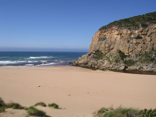
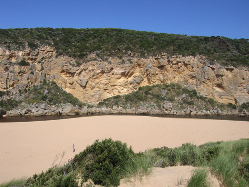
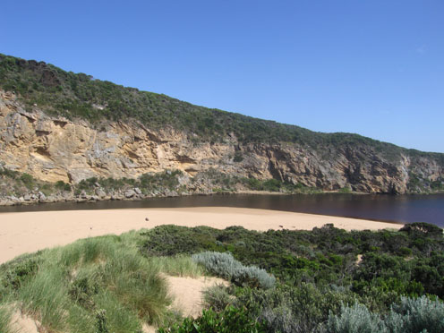
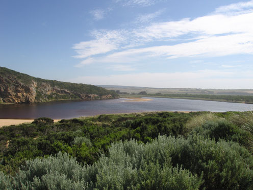
1. Reduced flow -only around mouth
2.Steep sand face at east end of beach has moved closer to dunes (height over 3m.)
3.Steep front to mid beach- sand higher at this point then sloping down west toward mouth -east end of beach much lower
4.Algae visiable in large sheets, bubbles rising & 'skeins' forming on surface - e. side of estuary
5.Many small 1-2cm fish in area e.side of estuary
Mouth Observation
| Mouth state | Open |
|---|---|
| Previous | O O O O O O O O O O O O O O O O O O O O O O O O O O O O O O O O O O O O O O O O O O O O O O O O O O O O O O O O |
| Flow Present? | Yes |
| Previous | Y Y Y Y Y Y Y Y Y Y Y Y Y Y Y Y Y Y Y Y Y Y Y Y Y Y Y Y Y Y Y Y Y Y Y Y Y Y Y Y Y Y Y Y Y Y Y Y Y Y Y Y Y Y Y Y |
| Flow Direction | Out |
| Previous | O O O O O O O O O O O O O O O O O O O O O O I O I O I O I O O O O O O O O O O O O O O O O O O O O O O O O O |
| Above Sea | Above Estuary | |
|---|---|---|
| Berm Height (m) | ||
| Berm Length (m) |
Physical Condition
| Current | Mode | |
|---|---|---|
| Wind Direction | South | |
| Beaufort Scale | Moderate breeze | |
| Sea State | Moderate |


All content, files, data and images provided by the EstuaryWatch Data Portal and Gallery are subject to a Creative Commons Attribution License
Content is made available to be used in any way, and should always attribute EstuaryWatch and www.estuarywatch.org.au