EstuaryWatch Data Portal
GMC Gellibrand River Estuary Mouth Observation Site
14 September 2012
Observation details
Overview
| Estuary | Gellibrand River Estuary |
|---|---|
| Site | Gellibrand River Estuary Mouth Observation Site |
| Observation ID | #7730 |
| Date and Time | Friday 14th September 2012 08:55am |
| Approved | Approved |
Notes
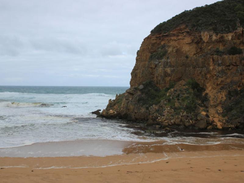
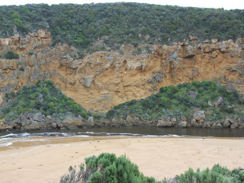
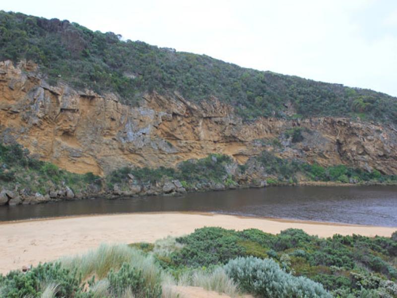
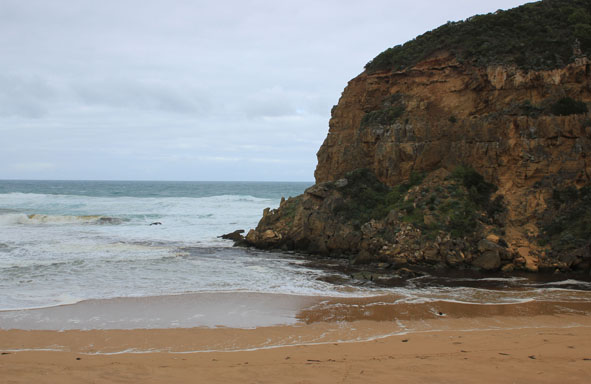
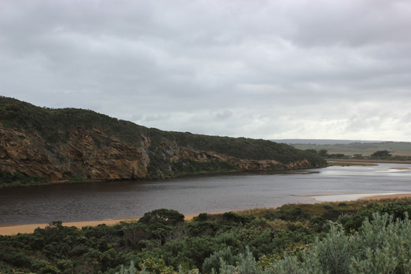
1.Dark discharge flowing out south
2.Waves in all directions at mouth, some entering estuary
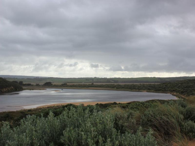
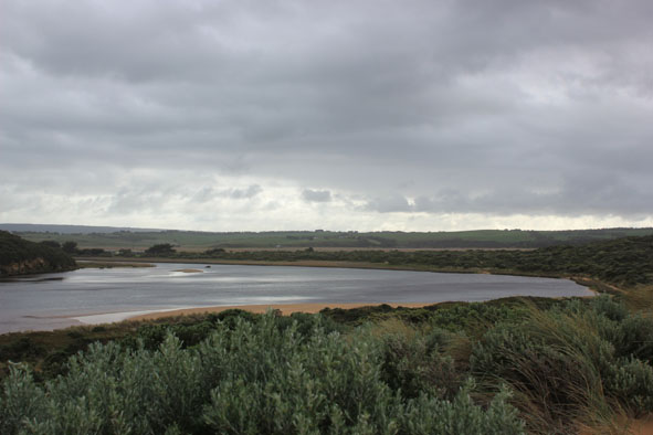
3.Small area of sandbar exposed in estuary
4.Dunes east of channel have been further erroded as has south side of estuary
5.High sand cliffs(mid beach) remain at foot of dunes
6.Water flowing back & forth behind reeds east side of estuary
Mouth Observation
| Mouth state | Open |
|---|---|
| Previous | O O O O O O O O O O O O O O O O O C O O O C O O O O O P P P C O P O O O P O O O O O O O O O O O O O O |
| Flow Present? | Yes |
| Previous | Y Y Y Y Y Y Y Y Y Y Y Y Y Y Y Y Y N Y Y Y N Y Y Y Y Y Y N N N Y N Y Y Y Y Y Y Y Y Y Y Y Y Y Y Y Y Y Y |
| Flow Direction | Out |
| Previous | O O O O O O O O O O O O O O O O N O O O N O O O O O I N N N I N I I O I O O O O O O O O O O O O O O |
| Above Sea | Above Estuary | |
|---|---|---|
| Berm Height (m) | ||
| Berm Length (m) |
Physical Condition
| Current | Mode | |
|---|---|---|
| Wind Direction | South | |
| Beaufort Scale | Moderate breeze | |
| Sea State | Rough |


All content, files, data and images provided by the EstuaryWatch Data Portal and Gallery are subject to a Creative Commons Attribution License
Content is made available to be used in any way, and should always attribute EstuaryWatch and www.estuarywatch.org.au