EstuaryWatch Data Portal
GMC Gellibrand River Estuary Mouth Observation Site
7 December 2012
Observation details
Overview
| Estuary | Gellibrand River Estuary |
|---|---|
| Site | Gellibrand River Estuary Mouth Observation Site |
| Observation ID | #7953 |
| Date and Time | Friday 7th December 2012 09:10am |
| Approved | Approved |
Notes
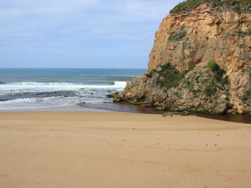
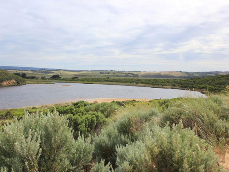
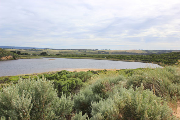
1.Dark discharge around mouth, paler area further out to sea
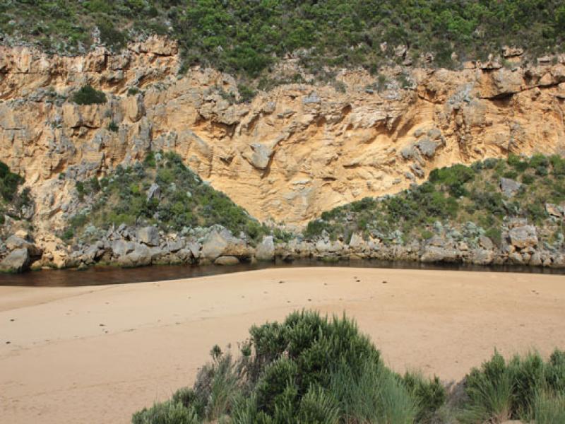
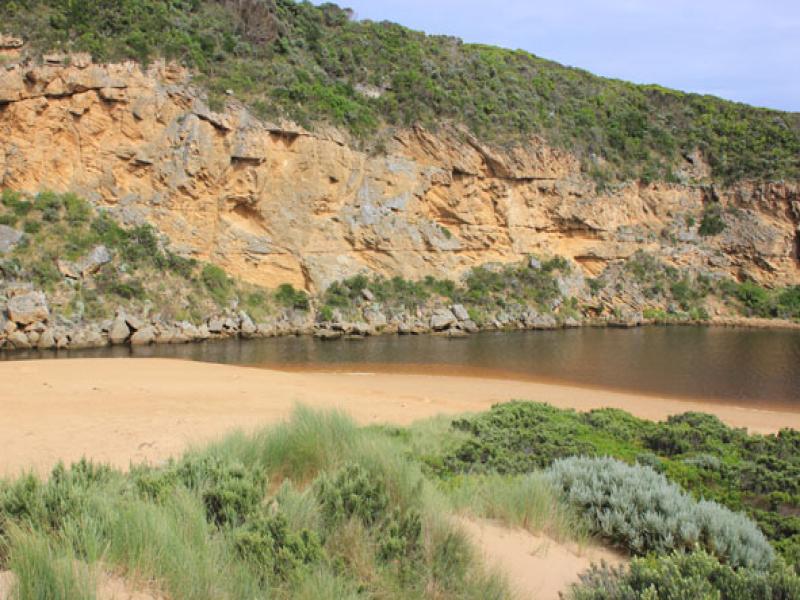
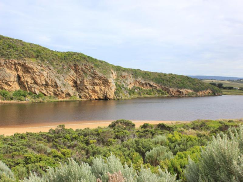
2.Mouth very shallow with large amount of sand on east side showing out level with end of cliff
3. Channel only about 4-5m wide near tunnel but wider just upstream of rocks
4. Very rough seas during week - up to base of dunes & high in estuary damaging sand dunes on south & east sides
5.Many small moth wings in swash line along east side of channel
Mouth Observation
| Mouth state | Open |
|---|---|
| Previous | O O O O O O C O O O C O O O O O P P P C O P O O O P O O O O O O O O O O O O O O O O O O O O O O O O O |
| Flow Present? | Yes |
| Previous | Y Y Y Y Y Y N Y Y Y N Y Y Y Y Y Y N N N Y N Y Y Y Y Y Y Y Y Y Y Y Y Y Y Y Y Y Y Y Y Y Y Y Y Y Y Y Y Y |
| Flow Direction | Out |
| Previous | O O O O O O N O O O N O O O O O I N N N I N I I O I O O O O O O O O O O O O O O O O O O O O O O O O O |
| Above Sea | Above Estuary | |
|---|---|---|
| Berm Height (m) | ||
| Berm Length (m) |
Physical Condition
| Current | Mode | |
|---|---|---|
| Wind Direction | North-East | |
| Beaufort Scale | Gentle breeze | |
| Sea State | Moderate |


All content, files, data and images provided by the EstuaryWatch Data Portal and Gallery are subject to a Creative Commons Attribution License
Content is made available to be used in any way, and should always attribute EstuaryWatch and www.estuarywatch.org.au