EstuaryWatch Data Portal
GMC Gellibrand River Estuary Mouth Observation Site
20 February 2013
Observation details
Overview
| Estuary | Gellibrand River Estuary |
|---|---|
| Site | Gellibrand River Estuary Mouth Observation Site |
| Observation ID | #8131 |
| Date and Time | Wednesday 20th February 2013 10:55am |
| Approved | Approved |
Notes
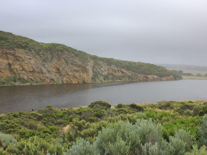
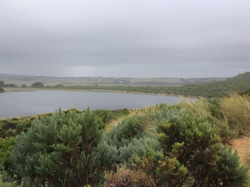
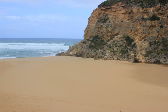
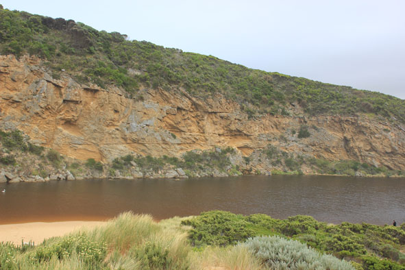
- Beach has changed. Waves are comming over the berm accross a long area.
- Close to the sea, a dip mid berm remains.
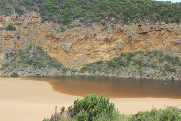
- Estuary front changed, main area further back into estuary with an "exctended arm" against cliff face, terminating in old rock fall about 28m in front (toward sea) of main part of estuary.
- 12 pelicans and huge number of wader birds in flooded areas.
- Deakin staff testing water.
Mouth Observation
| Mouth state | Closed |
|---|---|
| Previous | O O O O P P P C O P O O O P O O O O O O O O O O O O O O O O O O O O O O O O O O O O O O C C C C C C C C C |
| Flow Present? | No |
| Previous | Y Y Y Y Y N N N Y N Y Y Y Y Y Y Y Y Y Y Y Y Y Y Y Y Y Y Y Y Y Y Y Y Y Y Y Y Y Y Y Y Y Y N N N N N N N N Y |
| Flow Direction | N/A |
| Previous | O O O O I N N N I N I I O I O O O O O O O O O O O O O O O O O O O O O O O O O O O O O O N N N N N N N N |
| Above Sea | Above Estuary | |
|---|---|---|
| Berm Height (m) | 0.7m | 0.6m |
| Berm Length (m) |
Physical Condition
| Current | Mode | |
|---|---|---|
| Wind Direction | South | |
| Beaufort Scale | Moderate breeze | |
| Sea State | Moderate |


All content, files, data and images provided by the EstuaryWatch Data Portal and Gallery are subject to a Creative Commons Attribution License
Content is made available to be used in any way, and should always attribute EstuaryWatch and www.estuarywatch.org.au