EstuaryWatch Data Portal
Observation details
Overview
| Estuary | Barham River Estuary |
|---|---|
| Site | Barham River Observation Site |
| Observation ID | #8257 |
| Date and Time | Wednesday 1st May 2013 15:51pm |
| Approved | Approved |
Notes
Rainfall last 48 hrs 11 mm. Air Pressure 1021.3 hPa
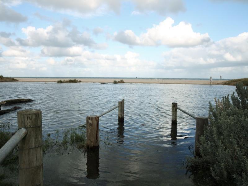
The river level is above the banks, flooding the camp ground, and the horse paddock as well as rest of flood plain near the river edge. Additional rainfall will intensify flooding. The berm opposite the fishing platform at the bridge has risen in height. At the Golf Course observation post the high tide breakers did travel over the closed mouth, but there is no outward flow of river water . Berm across the mouth at high tide is shallow, but wide 35 meters on river side and 7 metres on seaward side.
Mouth Observation
| Mouth state | Closed |
|---|---|
| Previous | O O O O O O O O O O O O |
| Flow Present? | No |
| Previous | Y Y Y Y Y Y Y Y Y Y N N |
| Flow Direction | N/A |
| Previous | O O I O O I I O I I N N |
| Above Sea | Above Estuary | |
|---|---|---|
| Berm Height (m) | 0.6m | 0.3m |
| Berm Length (m) |
Physical Condition
| Current | Mode | |
|---|---|---|
| Wind Direction | West | West |
| Beaufort Scale | Gentle breeze | Fresh breeze |
| Sea State | Moderate |


All content, files, data and images provided by the EstuaryWatch Data Portal and Gallery are subject to a Creative Commons Attribution License
Content is made available to be used in any way, and should always attribute EstuaryWatch and www.estuarywatch.org.au