EstuaryWatch Data Portal
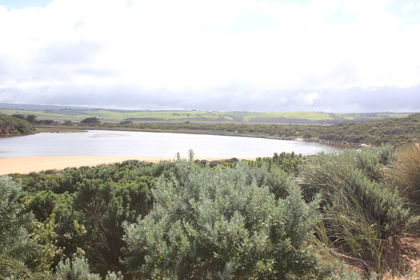
GMC Gellibrand River Estuary Mouth Observation Site
22 September 2013
Observation details
Overview
| Estuary | Gellibrand River Estuary |
|---|---|
| Site | Gellibrand River Estuary Mouth Observation Site |
| Observation ID | #8504 |
| Date and Time | Sunday 22nd September 2013 09:20am |
| Approved | Approved |
Notes
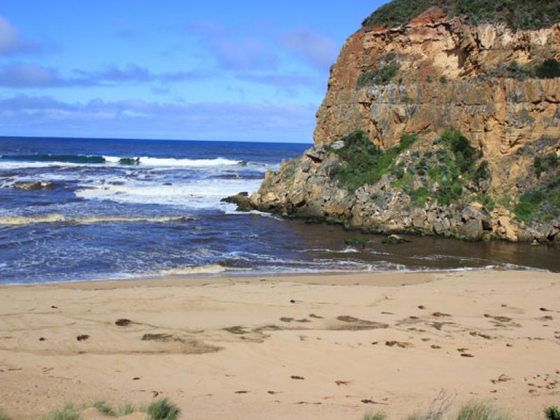
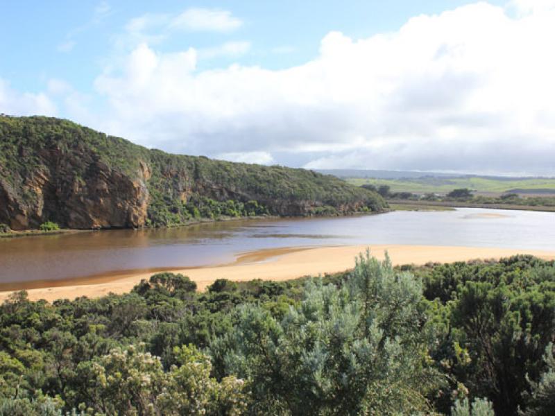
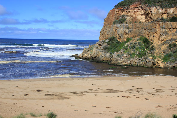
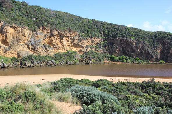
- Strong outflow from recent rainfall, dark discharge around mouth, out to sea, to west and to east
Waves in all directions at the mouth, strong longshore drift- Side of channel near mouth has 1m. high sheer side on east
- many broken shells in previously high wave impacted area east side of estuary(low Track)
- Stick caddis (5) south east side of estuary
Mouth Observation
| Mouth state | Open |
|---|---|
| Previous | O O O O O O O O O O O O O O O C C C C C C C C C C C O O O O O O C C C C O C C C C C C C O O O O P O O O O O O O O O O O O O O O O O O O O O |
| Flow Present? | Yes |
| Previous | Y Y Y Y Y Y Y Y Y Y Y Y Y Y Y N N N N N N N N Y N N Y Y Y Y Y Y N N N N Y N N N N N N Y Y Y Y Y Y Y Y Y Y Y Y Y Y Y Y Y Y Y Y Y Y Y Y Y Y |
| Flow Direction | Out |
| Previous | O O O O O O O O O O O O O O O N N N N N N N N N N O O I O O N N N N I N N N N N N O O O I I O O O O O O I O O I I O O O O O O O O O O |
| Above Sea | Above Estuary | |
|---|---|---|
| Berm Height (m) | ||
| Berm Length (m) |
Physical Condition
| Current | Mode | |
|---|---|---|
| Wind Direction | South | |
| Beaufort Scale | Light Breeze | |
| Sea State | Moderate |


All content, files, data and images provided by the EstuaryWatch Data Portal and Gallery are subject to a Creative Commons Attribution License
Content is made available to be used in any way, and should always attribute EstuaryWatch and www.estuarywatch.org.au