EstuaryWatch Data Portal
GMC Gellibrand River Estuary Mouth Observation Site
6 December 2014
Observation details
Overview
| Estuary | Gellibrand River Estuary |
|---|---|
| Site | Gellibrand River Estuary Mouth Observation Site |
| Observation ID | #9247 |
| Date and Time | Saturday 6th December 2014 09:55am |
| Approved | Approved |
Notes
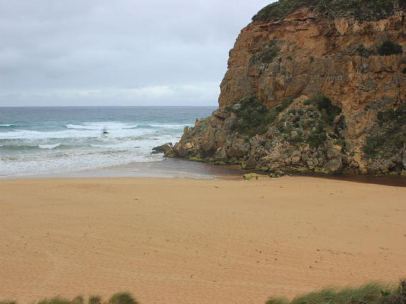
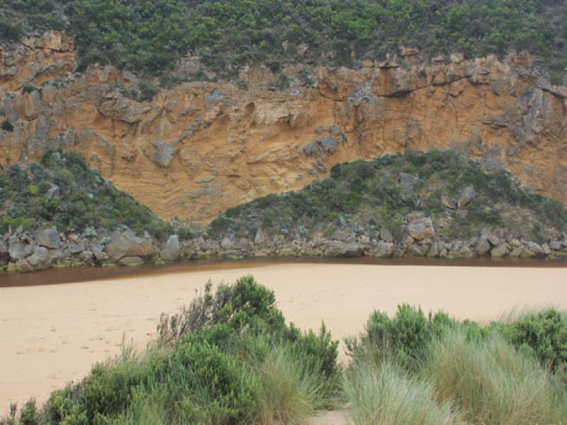
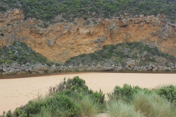
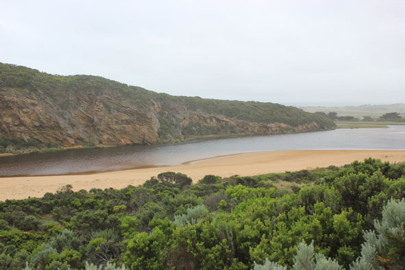
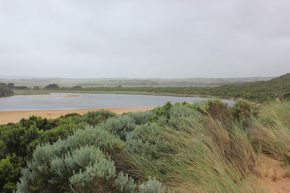
- Pale discharge out around mouth & dispersing along foreshore to east
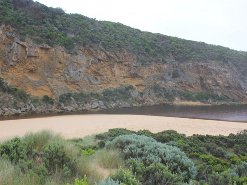
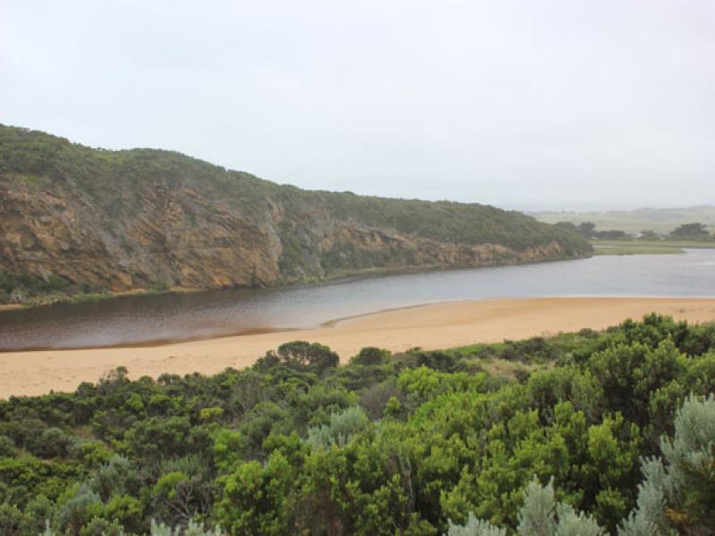
- Waves entering channel both sides of rocks but out flow only between rocks & cliff -more sand in channel
- Strong longshore drift along front of beach meeting return outflow from channel, main impact of s/w swell mid beach
- Beach has returned to horseshoe shape but more sand close to mouth
- Small fish in inlets between vegetation along low track
Mouth Observation
| Mouth state | Open |
|---|---|
| Previous | O O O O O O O O O O O O O O O C C C P C C O O O O O O O O O O O O O O O O O O O O O O O O O O O O O O O O |
| Flow Present? | Yes |
| Previous | Y Y Y Y Y Y Y Y Y Y Y Y Y Y Y N N N Y N N Y Y Y Y Y Y Y Y Y Y Y Y Y Y Y Y Y Y Y Y Y Y Y Y Y Y Y Y Y Y Y Y |
| Flow Direction | Out |
| Previous | O O O O O O O O O O O O O O O N N N I N N O O I O I I O I O O O O O O I O O O O O O O O O O O O O O O O |
| Above Sea | Above Estuary | |
|---|---|---|
| Berm Height (m) | ||
| Berm Length (m) |
Physical Condition
| Current | Mode | |
|---|---|---|
| Wind Direction | South-East | |
| Beaufort Scale | Moderate breeze | |
| Sea State | Rough |


All content, files, data and images provided by the EstuaryWatch Data Portal and Gallery are subject to a Creative Commons Attribution License
Content is made available to be used in any way, and should always attribute EstuaryWatch and www.estuarywatch.org.au