EstuaryWatch Data Portal
GMC Gellibrand River Estuary Mouth Observation Site
3 May 2015
Observation details
Overview
| Estuary | Gellibrand River Estuary |
|---|---|
| Site | Gellibrand River Estuary Mouth Observation Site |
| Observation ID | #9598 |
| Date and Time | Sunday 3rd May 2015 09:25am |
| Approved | Approved |
Notes
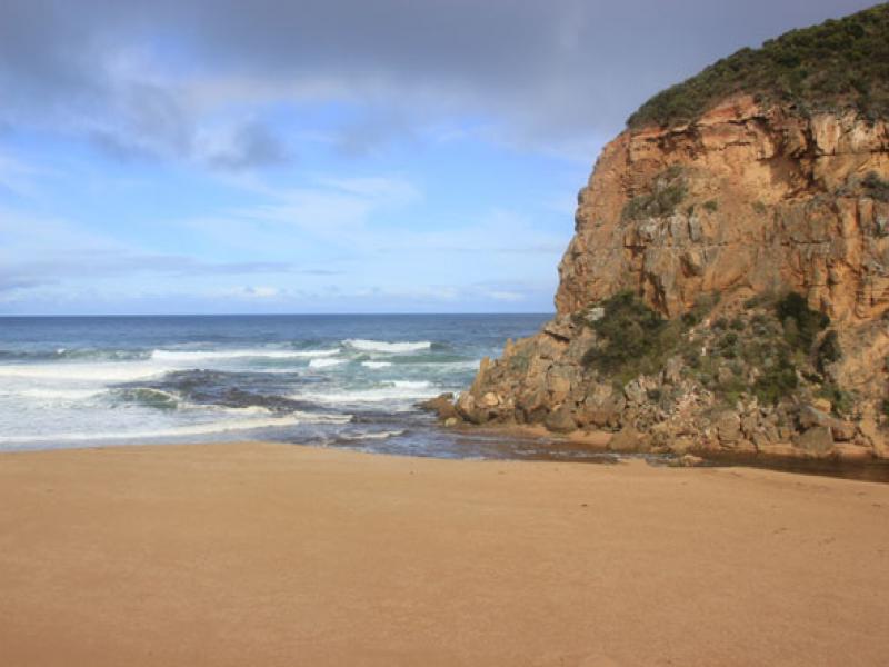
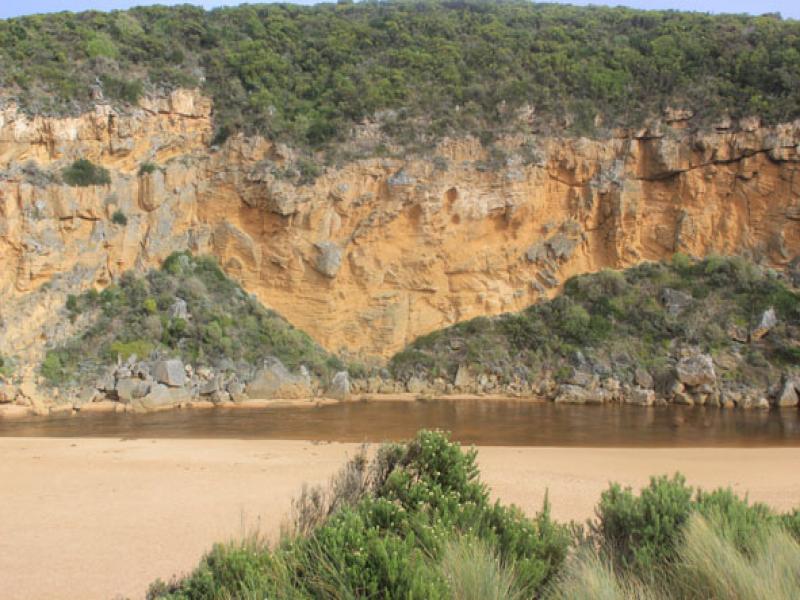
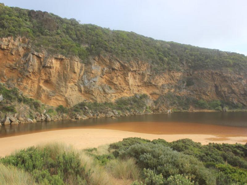
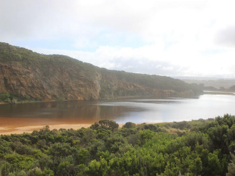
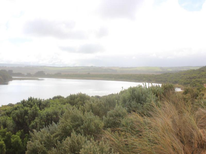
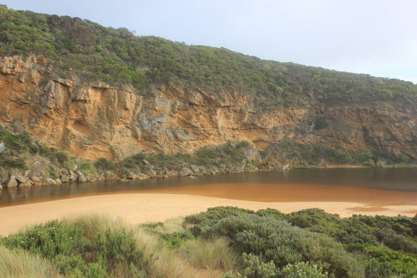
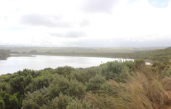
- Mouth opened naturally on 01/05/15
- Entrance about 15-20m wide with water flowing out through cataract between rocks & cliff
- Channel at entrance shallow, turning east as it widens & meets ocean
- Pale discharge along shore line to east, also to south.
- Waves entering channel, active longshore drift & outflow combine to create much turbulence
- Beach is straighter with raised north south undulations.
- Sand higher near mouth
Mouth Observation
| Mouth state | Open |
|---|---|
| Previous | O O O O O O O O O O O O O O O O O O O O O O O O O O O O O O O O O C C C C O O P C C O O O C C C C C C O O O P C |
| Flow Present? | Yes |
| Previous | Y Y Y Y Y Y Y Y Y Y Y Y Y Y Y Y Y Y Y Y Y Y Y Y Y Y Y Y Y Y Y Y Y N N N N Y Y Y N N Y Y Y N N N N N N Y Y Y Y N |
| Flow Direction | Out |
| Previous | O I O I I O I O O O O O O I O O O O O O O O O O O O O O O O O N N N N O O I N N O I O N N N N N N O O O I N |
| Above Sea | Above Estuary | |
|---|---|---|
| Berm Height (m) | ||
| Berm Length (m) |
Physical Condition
| Current | Mode | |
|---|---|---|
| Wind Direction | North | |
| Beaufort Scale | Light Breeze | |
| Sea State | Rough |


All content, files, data and images provided by the EstuaryWatch Data Portal and Gallery are subject to a Creative Commons Attribution License
Content is made available to be used in any way, and should always attribute EstuaryWatch and www.estuarywatch.org.au