EstuaryWatch Data Portal
GMC Gellibrand River Estuary Mouth Observation Site
26 July 2015
Observation details
Overview
| Estuary | Gellibrand River Estuary |
|---|---|
| Site | Gellibrand River Estuary Mouth Observation Site |
| Observation ID | #9747 |
| Date and Time | Sunday 26th July 2015 10:18am |
| Approved | Approved |
Notes
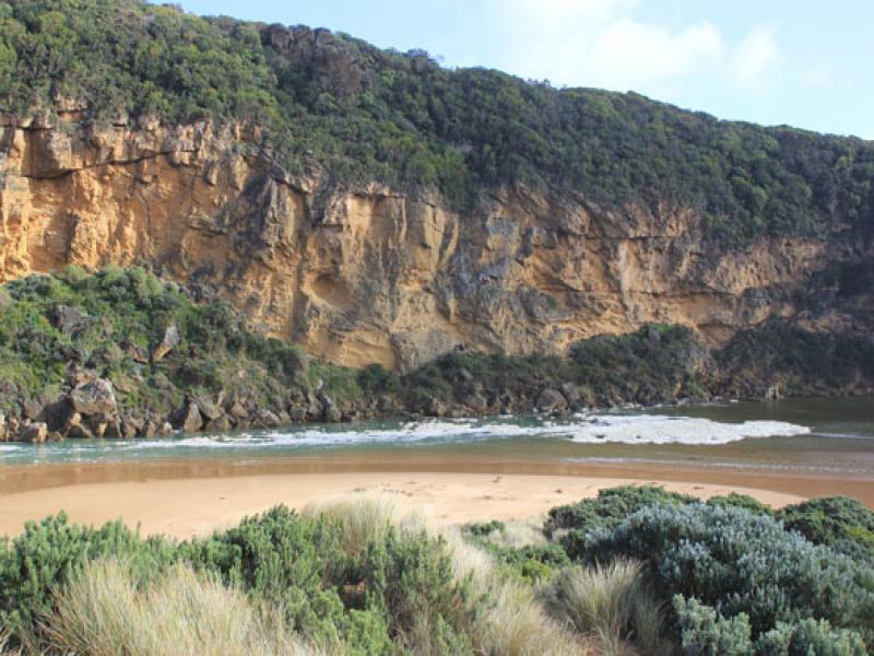
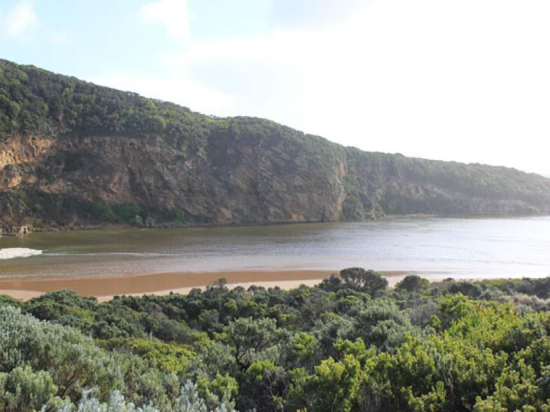
- Near Gale force winds & high sea driving waves over sand build up, covering area across from the mouth to sand dunes -only salt return back down narrow channel
- Very strong longshore drift across mouth. Waves in all directions around rocks & continuing strongly down channel into estuary, large areas of foam swirling
- Waves up to base of dunes at east end of beach removing more vegetation, former sand projection into ocean (mid beach) has been completely removed & beach flattened out.
- Near gale winds from S.E. at Gp1, S. slightly further east, & S.W. closer to east end of beach
- Air temp 5-7C. & 5cm. hail in some areas (covering G.O.R near Lower Gellibrand)
- Rainfall 44.5ml since 24th July.( G6 AHD 2.05)
Mouth Observation
| Mouth state | Open |
|---|---|
| Previous | O O O O O O O O O O O O O O O O O O O O O C C C C O O P C C O O O C C C C C C O O O P C O O O P O O O O O O O O O O O O O |
| Flow Present? | Yes |
| Previous | Y Y Y Y Y Y Y Y Y Y Y Y Y Y Y Y Y Y Y Y Y N N N N Y Y Y N N Y Y Y N N N N N N Y Y Y Y N Y Y Y N Y Y Y Y Y Y Y Y Y Y Y Y |
| Flow Direction | In |
| Previous | O I O O O O O O O O O O O O O O O O O N N N N O O I N N O I O N N N N N N O O O I N O O O N O O O O O O I O I O O |
| Above Sea | Above Estuary | |
|---|---|---|
| Berm Height (m) | ||
| Berm Length (m) |
Physical Condition
| Current | Mode | |
|---|---|---|
| Wind Direction | South-East | |
| Beaufort Scale | High wind, moderate gale, near gale | |
| Sea State | High |


All content, files, data and images provided by the EstuaryWatch Data Portal and Gallery are subject to a Creative Commons Attribution License
Content is made available to be used in any way, and should always attribute EstuaryWatch and www.estuarywatch.org.au