EstuaryWatch Data Portal
BMC Barwon River - Observation Site
Active Mouth Condition 15-12-2007 - 17-04-2024Barwon River Estuary
236 results found (Displaying 21 - 30)
| ID | Date | Status | Details | |
|---|---|---|---|---|
| #4663 | 12 Nov 2010 | Approved | Notes: Bp1 and Bp2 remain inaccessible due to bridgeworks. Sheepwash Rd gaugeboard used but it was very muddy, and the scale was obscured at the level of the water. Water levels estimated. | |
| #4861 | 18 Dec 2010 | Approved |
Notes:
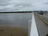
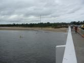
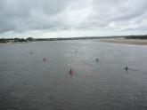
Position of BP1 and BP2 approximate as light towers no longer present on bridge. BP1: 53m from western end of railing on road bridge BP2: 10m west of navigation channel, measured from line of red buoys Construction sign marking BP3 no longer present, grassy knol still obvious. |
|
| #4903 | 1 Jan 2011 | Approved |
Notes:
Depth gauge at Sheepwash Rd corner well above water level. Its base is so muddy that the scale is obscured and would be illegible even if it were in the water. The sign marking the position of BP3 has been removed following restoration of pedestrian access to the western bank of the river. Although pedestrian access is again available on the main bridge, the light posts that marked the positions of BP1 and BP2 have been removed. |
|
| #4990 | 18 Jan 2011 | Approved |
Notes:
Gauge-boards too dirty to see scale. No readings taken. New markers for BP1 &BP2 have not yet been redefined. Bridge reconstruction still proceeding. |
|
| #5001 | 18 Jan 2011 | Approved |
Notes:
1. Position of BP1 and BP2 approximate as per Decembde observations. 2. Water in estuary and 300m past Bluff discoloured brown from recent flooding event. |
|
| #5104 | 6 Feb 2011 | Approved |
Notes:
Gauge boards (at Sheepwash Rd and at restaurant jetty) are both too muddy to read scale. River water is brown and turbid following recent recent heavy rains |
|
| #5202 | 17 Feb 2011 | Approved | Notes: BP1 and BP2 observations not made as light towers marking each position have been removed. | |
| #5262 | 7 Mar 2011 | Approved |
Notes:
We were unable to read water level gauge - too dirty. Bp1 and Bp2 still to be redefined after bridge works Tide condition probably "slack", but the effect of the northerly wind on the surface of water made the flow appear to be "outward". We were surprised that the wind strength was greater at Bp3 (sea level), than at Bp4 (top of the Bluff). Our wind observations were recorded for Bp4 (as usual). |
|
| #5327 | 17 Mar 2011 | Approved | ||
| #5368 | 3 Apr 2011 | Approved | Notes: Gauge board still too dirty to read water level | |

All content, files, data and images provided by the EstuaryWatch Data Portal and Gallery are subject to a Creative Commons Attribution License
Content is made available to be used in any way, and should always attribute EstuaryWatch and www.estuarywatch.org.au

