EstuaryWatch Data Portal
GMC Gellibrand River Estuary Mouth Observation Site
17 September 2016
Observation details
Overview
| Estuary | Gellibrand River Estuary |
|---|---|
| Site | Gellibrand River Estuary Mouth Observation Site |
| Observation ID | #10715 |
| Date and Time | Saturday 17th September 2016 08:50am |
| Approved | Approved |
Notes
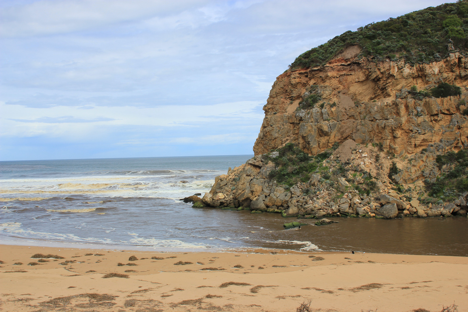
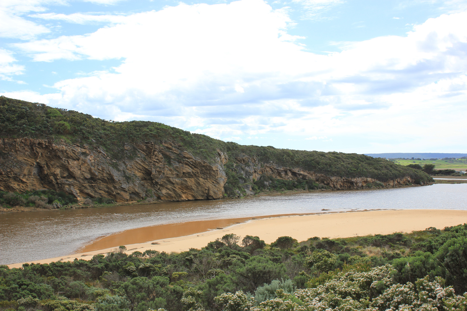
- longshore drift active meeting outflow and incoming S/W swell. waves in all directions, backwash along beach rolling sand
- extremely fast dark dirty flow around mouth to east west and going out to sea about mid beach
- some waves entering over top of out flow and travelling into estuary
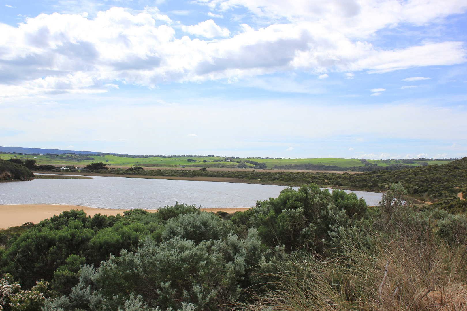
- 2 hooded plovers and 1 young ?
- 2 surfers on jetskis
- 2 canoe paddles found east end of beach
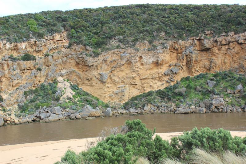
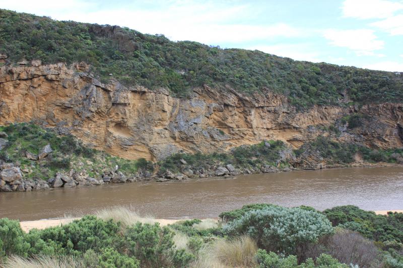
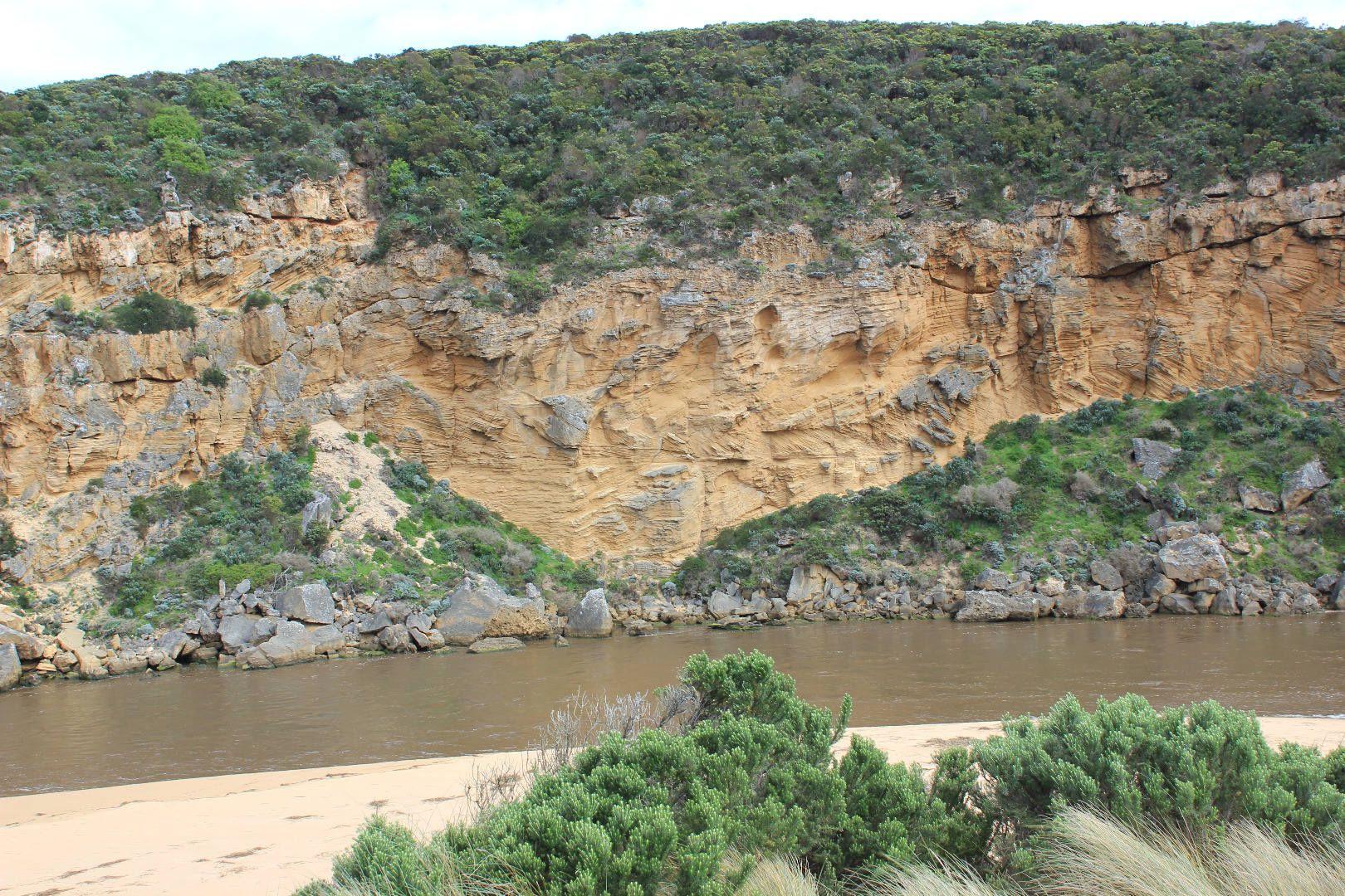
- more erosion to cliff face
- beach very wide
- wavs continue to erode east end of beach to sand dunes (height over 2m)
- beach much higher about 40 m west and extends out to sea
- debris from flood water along beach
- channel has 60cm high sheer sides
- large deposits of frog spawn in debris at side of channel
- Burrupa peaked on 16/9/16
- G6 peaked about 12:40 17/9/16
- water receding all areas 18/9/16
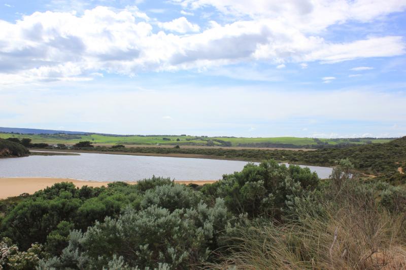
Mouth Observation
| Mouth state | Open |
|---|---|
| Previous | O O O O O O O O O O O C C C C C C O O O O O O C C O C C O C C C C C O O O O O C C C C C C C C C P C O O O O O O O O O O O O O O O |
| Flow Present? | Yes |
| Previous | Y Y Y Y Y Y Y Y Y Y Y N N N N N N Y Y Y Y Y Y N N N N N N N N N N N Y Y Y Y Y N N N N N N N N N N N Y Y Y Y Y Y Y Y Y Y Y Y Y Y Y |
| Flow Direction | Out |
| Previous | O O O O O O O O O O N N N N N N O O O O O O N N N N N N N N N N N O O O O O N N N N N N N N N N N O O O I I I O O O O I O O O I |
| Above Sea | Above Estuary | |
|---|---|---|
| Berm Height (m) | ||
| Berm Length (m) |
Physical Condition
| Current | Mode | |
|---|---|---|
| Wind Direction | North-West | |
| Beaufort Scale | Fresh breeze | |
| Sea State | Rough |


All content, files, data and images provided by the EstuaryWatch Data Portal and Gallery are subject to a Creative Commons Attribution License
Content is made available to be used in any way, and should always attribute EstuaryWatch and www.estuarywatch.org.au