EstuaryWatch Data Portal
GMC Gellibrand River Estuary Mouth Observation Site
24 September 2016
Observation details
Overview
| Estuary | Gellibrand River Estuary |
|---|---|
| Site | Gellibrand River Estuary Mouth Observation Site |
| Observation ID | #10716 |
| Date and Time | Saturday 24th September 2016 11:10am |
| Approved | Approved |
Notes
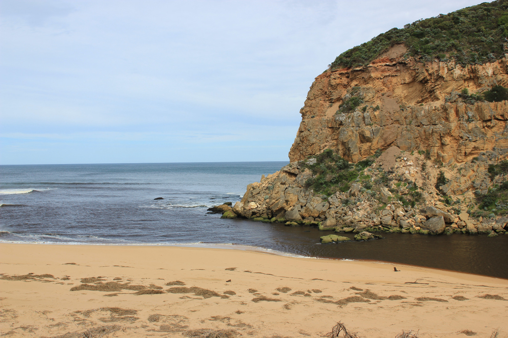
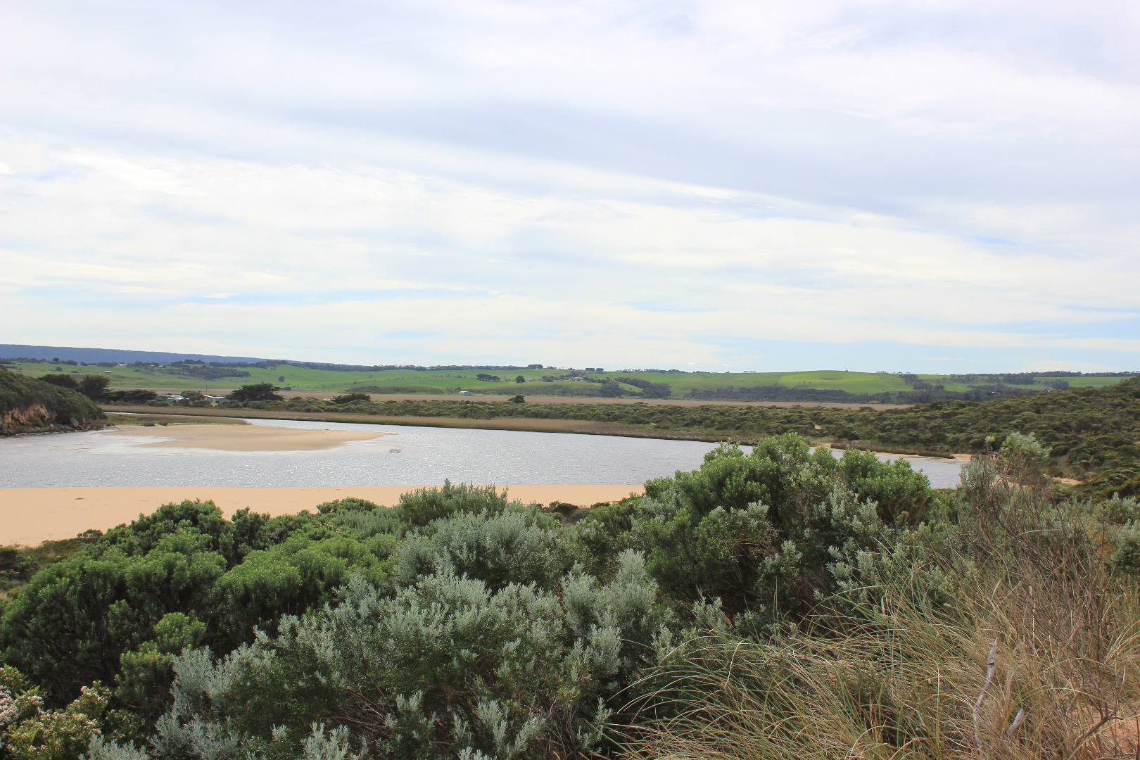
- very dark discharge out around mouth and pale discharge to east and out to sea
- intermittent waves entering mouth
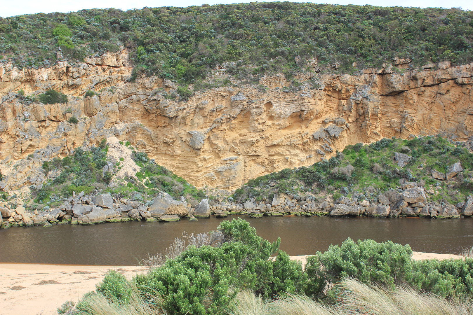
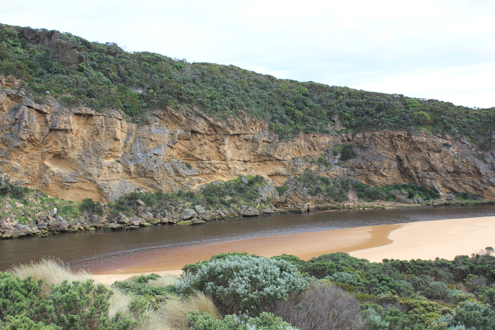
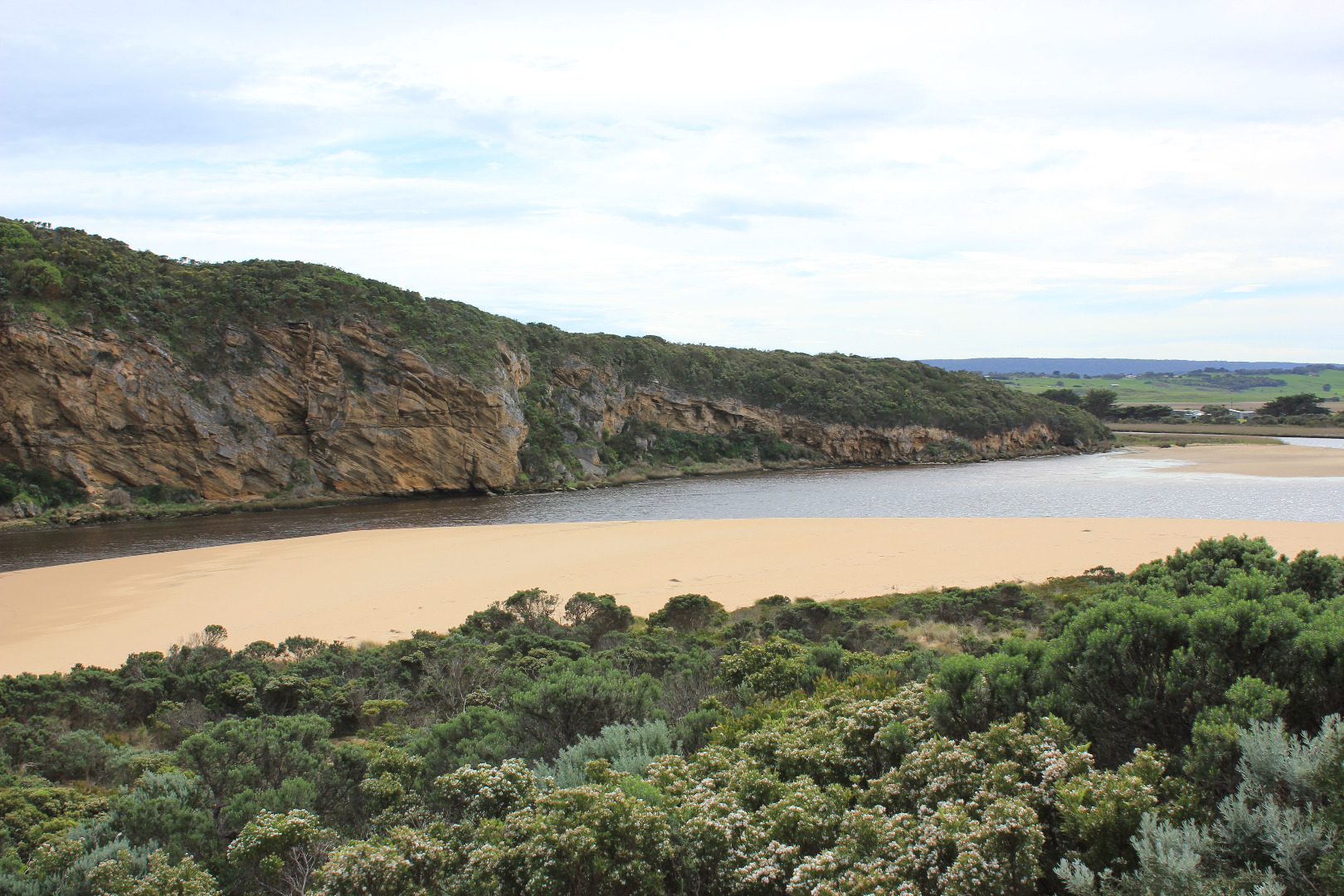
- channel has steep sides in 3 stages 1-1.5m above water
- beach very wide and sloping (low tide) highest near east end
- SW swell continues to impact and erode dunes at east end
- waves going over high beach front near E and and travelling along beach in slight depression to west
- large area of sand exposed S side of estuary
- sandbar nearly completely exposed at low tide
- sand along side of low track exposed showing large areas of sea grass
- no visible flood waters at G4 (rivernook waterlogged but no visible water)
- area upstream still extremely flooded
Mouth Observation
| Mouth state | Open |
|---|---|
| Previous | O O O O O O O O O O C C C C C C O O O O O O C C O C C O C C C C C O O O O O C C C C C C C C C P C O O O O O O O O O O O O O O O O |
| Flow Present? | Yes |
| Previous | Y Y Y Y Y Y Y Y Y Y N N N N N N Y Y Y Y Y Y N N N N N N N N N N N Y Y Y Y Y N N N N N N N N N N N Y Y Y Y Y Y Y Y Y Y Y Y Y Y Y Y |
| Flow Direction | Out |
| Previous | O O O O O O O O O N N N N N N O O O O O O N N N N N N N N N N N O O O O O N N N N N N N N N N N O O O I I I O O O O I O O O I O |
| Above Sea | Above Estuary | |
|---|---|---|
| Berm Height (m) | ||
| Berm Length (m) |
Physical Condition
| Current | Mode | |
|---|---|---|
| Wind Direction | North | |
| Beaufort Scale | Moderate breeze | |
| Sea State | Moderate |


All content, files, data and images provided by the EstuaryWatch Data Portal and Gallery are subject to a Creative Commons Attribution License
Content is made available to be used in any way, and should always attribute EstuaryWatch and www.estuarywatch.org.au