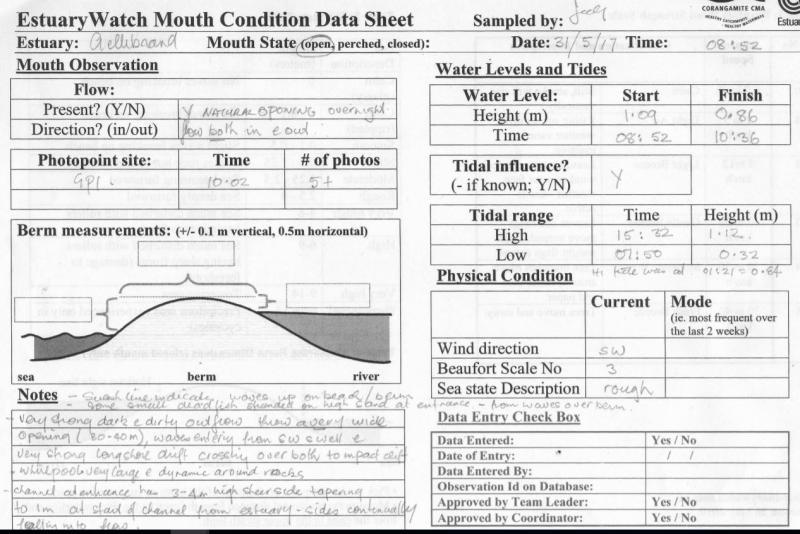
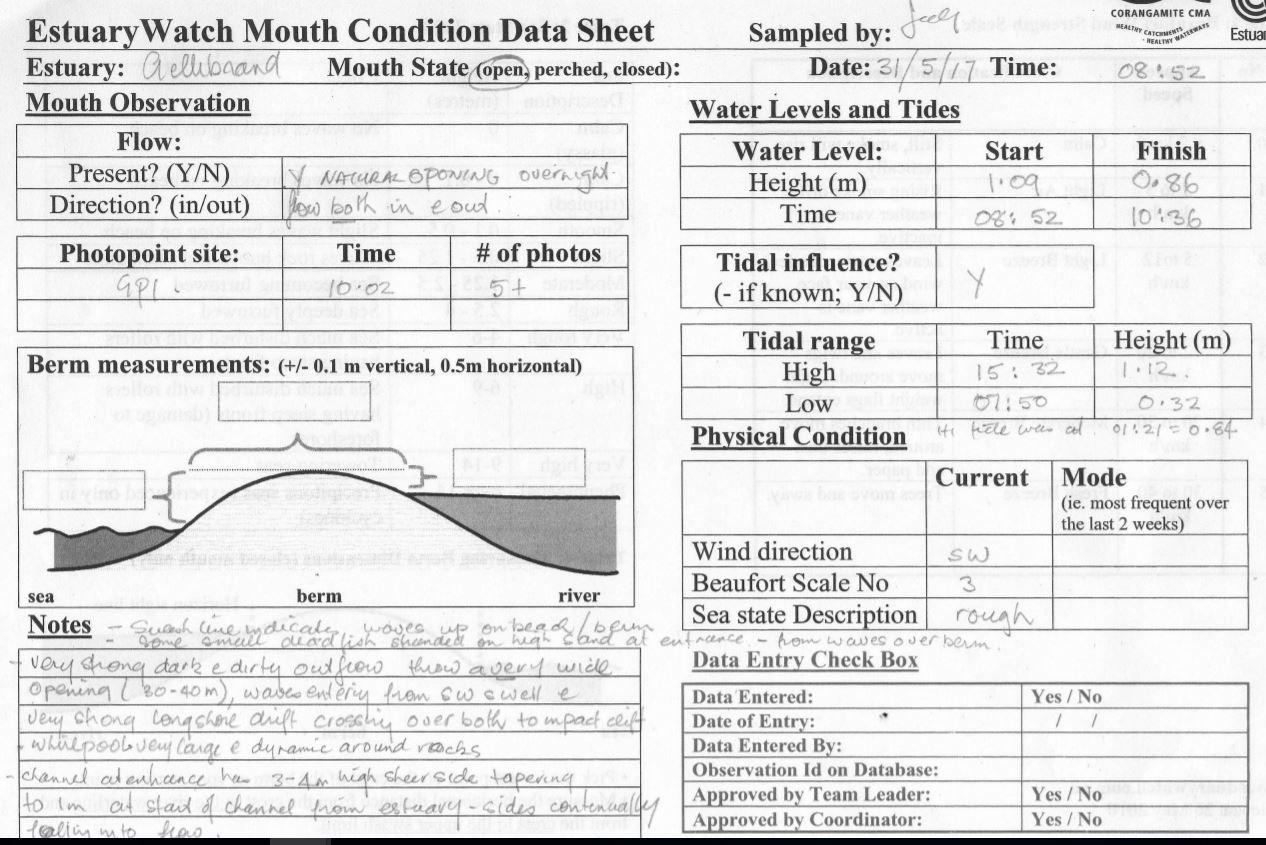
EstuaryWatch Data Portal
GMC Gellibrand River Estuary Mouth Observation Site
31 May 2017
Overview
| Estuary | Gellibrand River Estuary |
|---|---|
| Site | Gellibrand River Estuary Mouth Observation Site |
| Observation ID | #11248 |
| Date and Time | Wednesday 31st May 2017 08:52am |
| Approved | Approved |
Notes
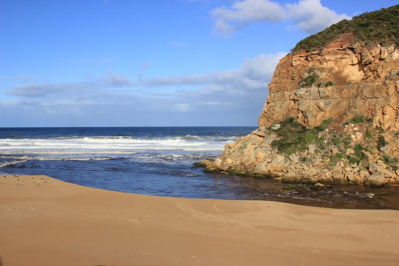
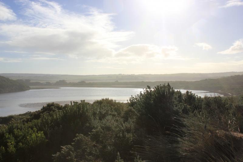
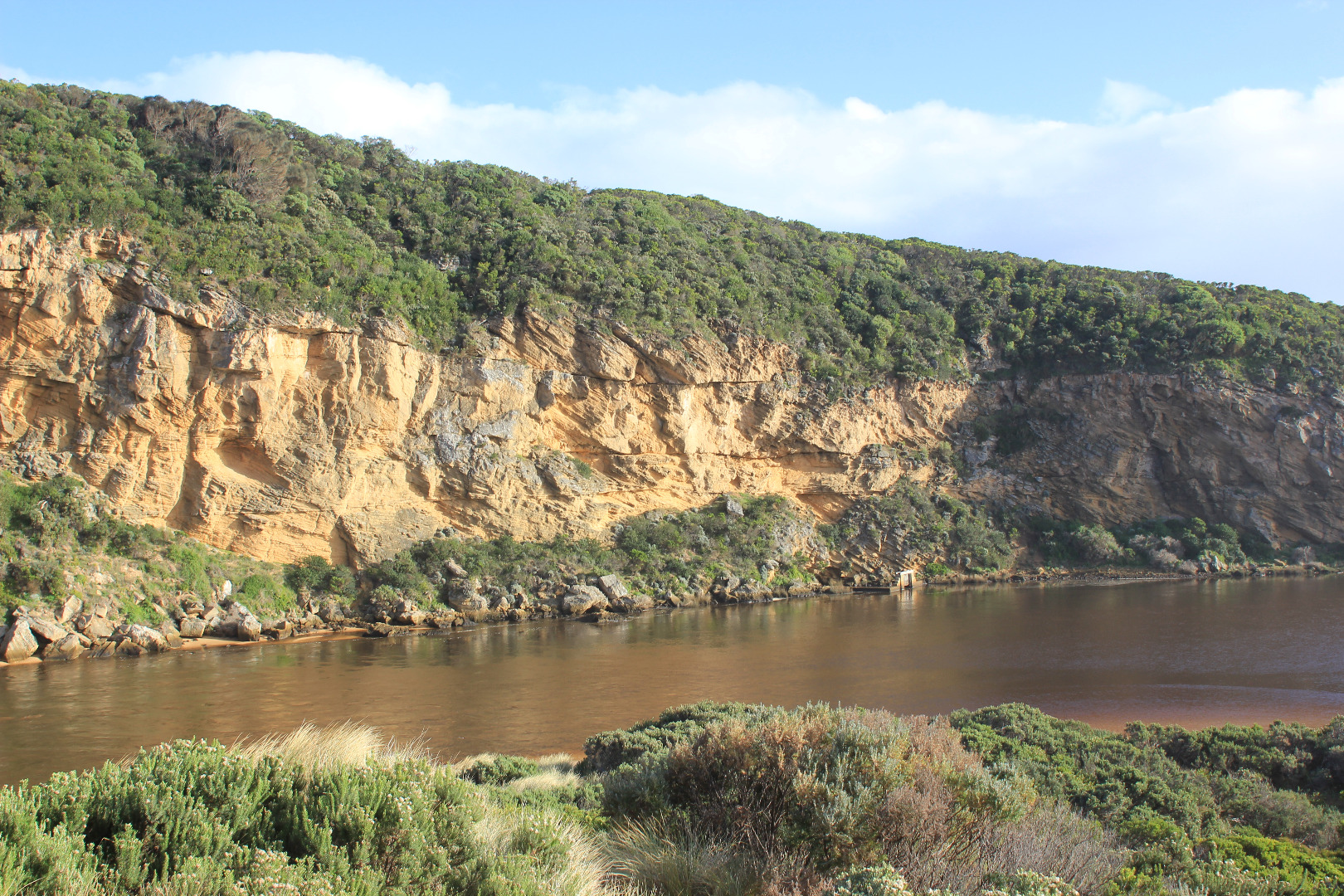
Natural opening occurred overnight. Very strong dark & dirty outflow through a very wide opening 30- 40m., waves entering from SW swell & very strong longshore drift crossing over outflow. Very dynamic whirlpool in outflow around & east of rocks. Wave action has caused 'pulsing' at G2 & Lt1
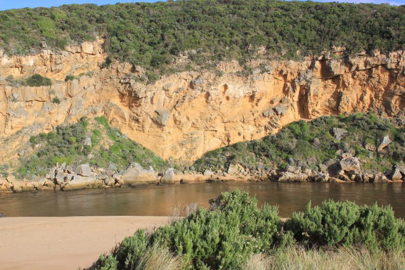
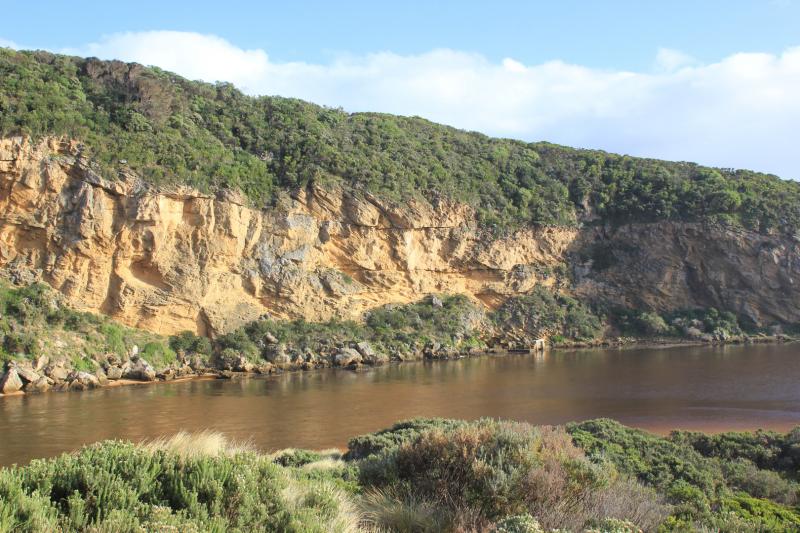
East side of channel has 3 - 4m high sheer side at entrance which reduces to about 1m. on meeting the estuary. This channel entry from estuary is also extremely wide.
Sand is continually collapsing into out flow also from wave action at entrance
Last hi tide mark on beach indicate waves have been over the berm almost up to dunes
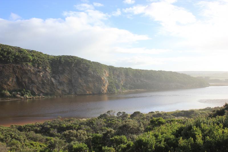
Low track has almost drained but extremely large amounts of dead veg. remained piled high over the start of the track. OCR clear of water between bridge & camp ground but water remains in deep holes east of that area. Camp ground still has water in south & west areas
Mouth Observation
| Mouth state | Open |
|---|---|
| Previous | O O O O O O O O O O O O O O O O O O O O O O O O O O O O O P O P C C O O O O O O O C O C C C O O O O O C |
| Flow Present? | Yes |
| Previous | Y Y Y Y Y Y Y Y Y Y Y Y Y Y Y Y Y Y Y Y Y Y Y Y Y Y Y Y Y Y Y Y N N Y Y Y N Y Y Y N N N N N Y Y Y Y Y N |
| Flow Direction | Out |
| Previous | O O O O I O O O I O O O O O O O O O O O O O O O I I O O O I O I N N O O I N O O O N N N N N O O O O O N |
| Above Sea | Above Estuary | |
|---|---|---|
| Berm Height (m) | ||
| Berm Length (m) |
Physical Condition
| Current | Mode | |
|---|---|---|
| Wind Direction | South-West | |
| Beaufort Scale | Gentle breeze | |
| Sea State | Rough |


All content, files, data and images provided by the EstuaryWatch Data Portal and Gallery are subject to a Creative Commons Attribution License
Content is made available to be used in any way, and should always attribute EstuaryWatch and www.estuarywatch.org.au