EstuaryWatch Data Portal
GMC Gellibrand River Estuary Mouth Observation Site
8 July 2011
Observation details
Overview
| Estuary | Gellibrand River Estuary |
|---|---|
| Site | Gellibrand River Estuary Mouth Observation Site |
| Observation ID | #5801 |
| Date and Time | Friday 8th July 2011 08:52am |
| Approved | Approved |
Notes
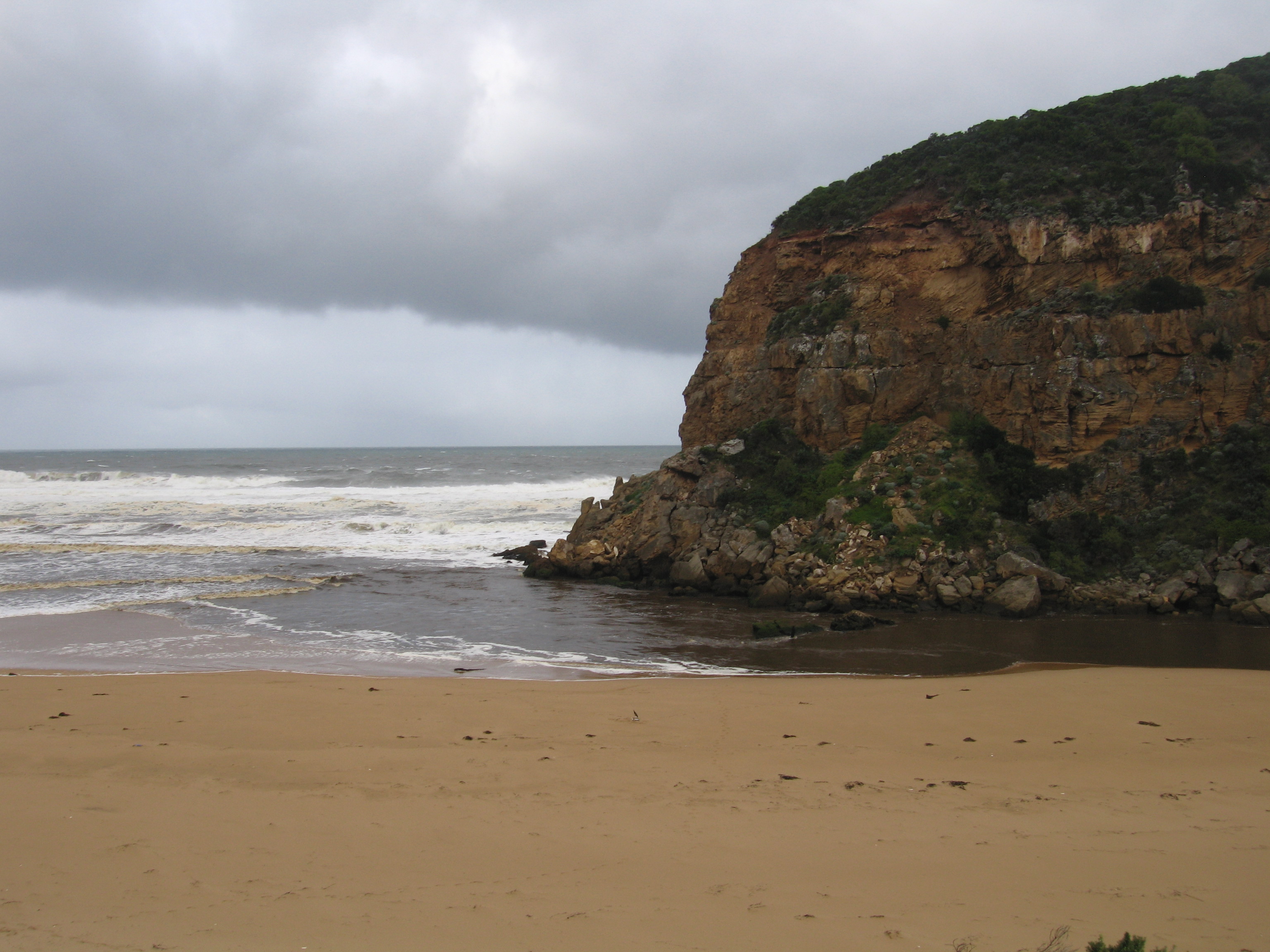
1.Strong outflow with visiable high turbidity
2.Water in all directions at mouth
3.Beach-gradual slope with deep scouring at eastern end. Large amount of foam on edge of beach & sea
4. 17 large logs on beach - more in estuary
5.Waves have been up to base of dunes during past high tides & rough seas.
6.Waves have travelled along sand eastside of channel and impacted on sand dunes south and east of the estuary. Large area has been removed on south side. Flooding of area near carpark has occured
7.Shellduck in estuary 2,
8.Dead Gannet 1, Dead penguins 2.
Mouth Observation
| Mouth state | Open |
|---|---|
| Previous | O O O O O O O O O O O O O O O O O O O O O O O O O O O O O O O O O O O O O O O O O O O O O O O O O O O O O O O O O O O |
| Flow Present? | Yes |
| Previous | Y Y Y Y Y Y Y Y Y Y Y Y Y Y Y Y Y Y Y Y Y Y Y Y Y Y Y Y Y Y Y Y Y Y Y Y Y Y Y Y Y Y Y Y Y Y Y Y Y Y Y Y Y Y Y Y Y Y Y |
| Flow Direction | Out |
| Previous | I O O O O O O O O O O O O O O O O O O O O O O O O O O O O O O O O O O O O O O O O O O O O O O O O I O I O I O I O O O |
| Above Sea | Above Estuary | |
|---|---|---|
| Berm Height (m) | ||
| Berm Length (m) |
Physical Condition
| Current | Mode | |
|---|---|---|
| Wind Direction | North | |
| Beaufort Scale | Strong breeze | |
| Sea State | Rough |


All content, files, data and images provided by the EstuaryWatch Data Portal and Gallery are subject to a Creative Commons Attribution License
Content is made available to be used in any way, and should always attribute EstuaryWatch and www.estuarywatch.org.au