EstuaryWatch Data Portal
GMC Gellibrand River Estuary Mouth Observation Site
15 June 2012
Observation details
Overview
| Estuary | Gellibrand River Estuary |
|---|---|
| Site | Gellibrand River Estuary Mouth Observation Site |
| Observation ID | #7282 |
| Date and Time | Friday 15th June 2012 08:50am |
| Approved | Approved |
Notes
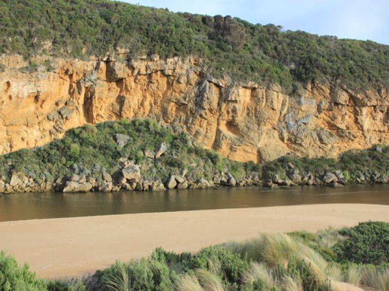
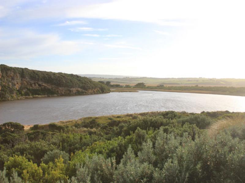
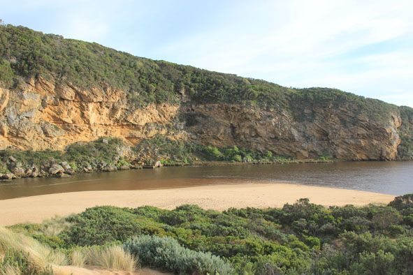
1. Strong outflow curving east of rocks. Flow on both sides. (About 10m.east of rocks)
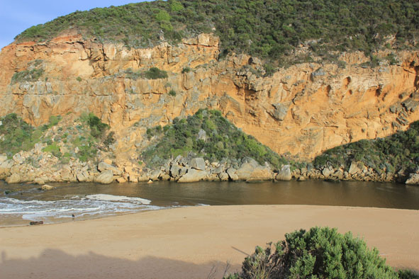
2.Dark discharge along foreshore to east
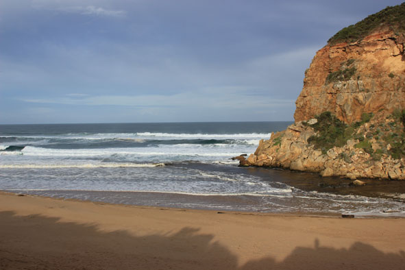
3.Channel wide with waves entering & travelling along east side to estuary scouring side of channel which is about 1.5m high near mouth
4.Sea up to dunes at east end of beach with sand area increasing in height & width toward mouth
5.Sand visiable in waves near mouth
Mouth Observation
| Mouth state | Open |
|---|---|
| Previous | O O O O O O O O O O O O O O O O O O O O O O O O O O O O O O O C O O O C O O O O O P P P C O P O O O P O O |
| Flow Present? | Yes |
| Previous | Y Y Y Y Y Y Y Y Y Y Y Y Y Y Y Y Y Y Y Y Y Y Y Y Y Y Y Y Y Y Y N Y Y Y N Y Y Y Y Y Y N N N Y N Y Y Y Y Y Y |
| Flow Direction | Out |
| Previous | I O O O O O O O O O O O O O O O O O O O O O O O O O O O O N O O O N O O O O O I N N N I N I I O I O O |
| Above Sea | Above Estuary | |
|---|---|---|
| Berm Height (m) | ||
| Berm Length (m) |
Physical Condition
| Current | Mode | |
|---|---|---|
| Wind Direction | North | |
| Beaufort Scale | Moderate breeze | |
| Sea State | Moderate |


All content, files, data and images provided by the EstuaryWatch Data Portal and Gallery are subject to a Creative Commons Attribution License
Content is made available to be used in any way, and should always attribute EstuaryWatch and www.estuarywatch.org.au