EstuaryWatch Data Portal
GMC Gellibrand River Estuary Mouth Observation Site
13 July 2012
Observation details
Overview
| Estuary | Gellibrand River Estuary |
|---|---|
| Site | Gellibrand River Estuary Mouth Observation Site |
| Observation ID | #7423 |
| Date and Time | Friday 13th July 2012 08:20am |
| Approved | Approved |
Notes
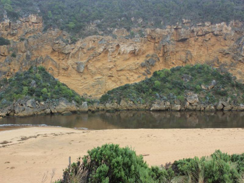
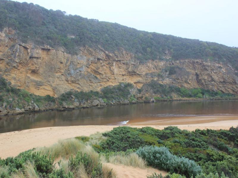
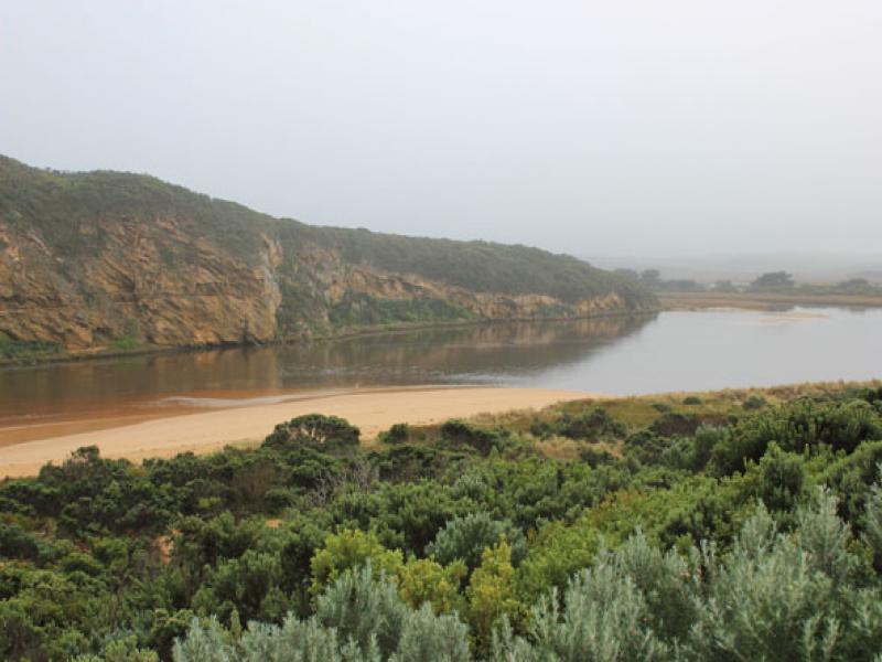
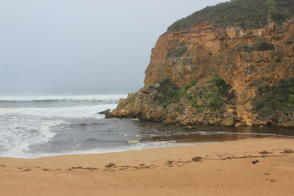
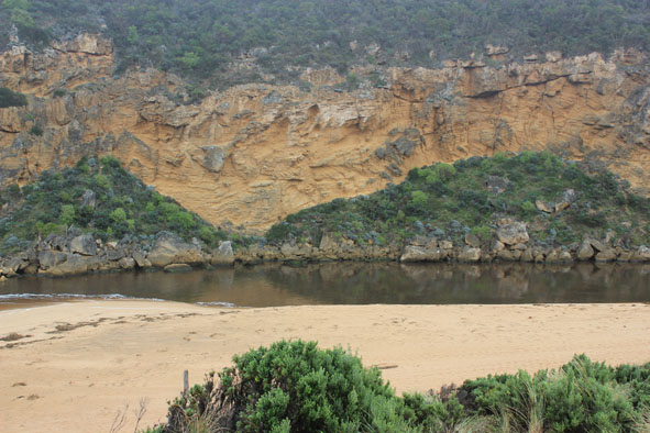
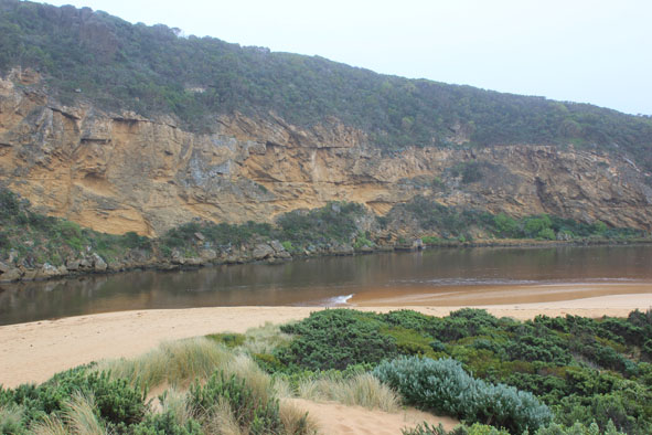
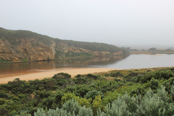
1. Strong outflow, dark discharge around mouth & to east along shoreline
2.Channel upstream rocks very wide but east of rocks sand has built up from a longshore drift occuring after waves have impacted on steep face of high sand(2m+) on beach near mouth
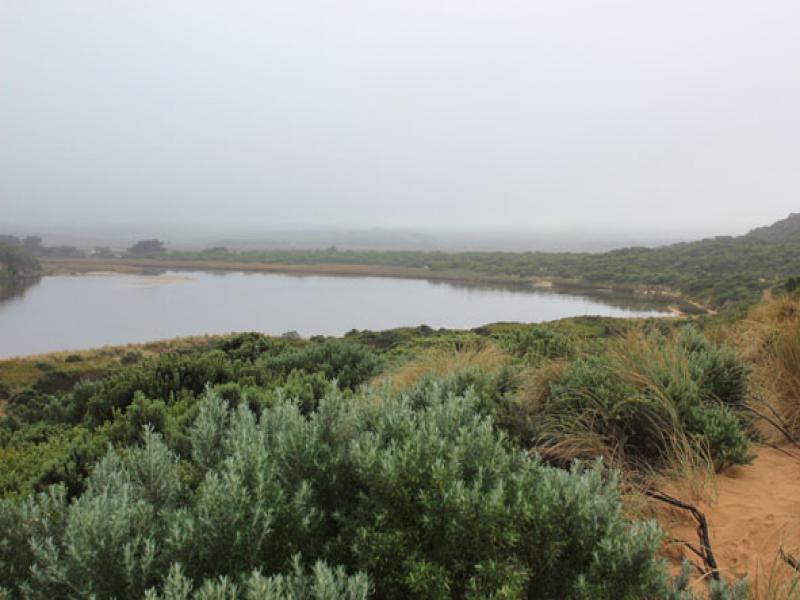
3.Rest of beach to east has long gradual slope
4.Tide has been up high on east side of channel & south & east sides of estuary
5.White egret 1. Black comorants 4.
Mouth Observation
| Mouth state | Open |
|---|---|
| Previous | O O O O O O O O O O O O O O O O O O O O O O O O O O O C O O O C O O O O O P P P C O P O O O P O O O O O |
| Flow Present? | Yes |
| Previous | Y Y Y Y Y Y Y Y Y Y Y Y Y Y Y Y Y Y Y Y Y Y Y Y Y Y Y N Y Y Y N Y Y Y Y Y Y N N N Y N Y Y Y Y Y Y Y Y Y |
| Flow Direction | Out |
| Previous | O O O O O O O O O O O O O O O O O O O O O O O O O N O O O N O O O O O I N N N I N I I O I O O O O O |
| Above Sea | Above Estuary | |
|---|---|---|
| Berm Height (m) | ||
| Berm Length (m) |
Physical Condition
| Current | Mode | |
|---|---|---|
| Wind Direction | North | |
| Beaufort Scale | Light Air | |
| Sea State | Rough |


All content, files, data and images provided by the EstuaryWatch Data Portal and Gallery are subject to a Creative Commons Attribution License
Content is made available to be used in any way, and should always attribute EstuaryWatch and www.estuarywatch.org.au