EstuaryWatch Data Portal
GMC Gellibrand River Estuary Mouth Observation Site
16 May 2015
Observation details
Overview
| Estuary | Gellibrand River Estuary |
|---|---|
| Site | Gellibrand River Estuary Mouth Observation Site |
| Observation ID | #9617 |
| Date and Time | Saturday 16th May 2015 09:25am |
| Approved | Approved |
Notes
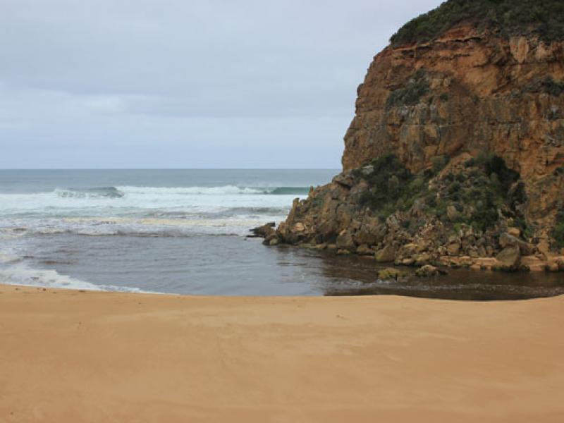
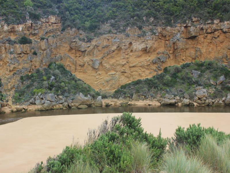
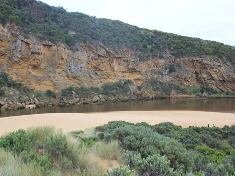
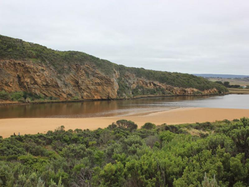
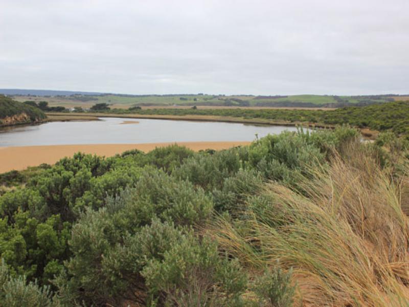
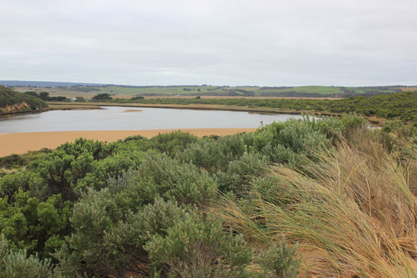
- Natural opening 14/05/15 has now created a very wide opening (30-40m).
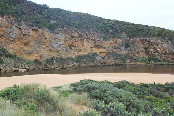
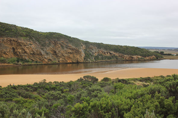
- Large amount of dark discharge travelling both to south & east along foreshore
- Channel to estuary is also wide with steep sheer edge 2-3m above present water level
- Sudden & rapid discharge overnight has revealed sand bar & large expanses of sand extending north into estuary at the south side
- Beach front is projecting out to sea at centre. Large waves scouring out 3m. high sand cliff below dunes at east end of beach
- Strong rip & longshore drift
- Some sand build up in front of rocks at entrance
- Waves at mouth in all directions. Very large amount of sand visible in current
- Low track fully exposed covered with dark silt, slime & debris. This is also over ocean beach
- No sign of any dead fish or invertebrates
- No water over any roads, camp ground still has water in very low areas on south, flats are draining
Mouth Observation
| Mouth state | Open |
|---|---|
| Previous | O O O O O O O O O O O O O O O O O O O O O O O O O O O O O O O O C C C C O O P C C O O O C C C C C C O O O P C O O O P O O |
| Flow Present? | Yes |
| Previous | Y Y Y Y Y Y Y Y Y Y Y Y Y Y Y Y Y Y Y Y Y Y Y Y Y Y Y Y Y Y Y Y N N N N Y Y Y N N Y Y Y N N N N N N Y Y Y Y N Y Y Y N Y Y |
| Flow Direction | Out |
| Previous | I O I I O I O O O O O O I O O O O O O O O O O O O O O O O O N N N N O O I N N O I O N N N N N N O O O I N O O O N O O |
| Above Sea | Above Estuary | |
|---|---|---|
| Berm Height (m) | ||
| Berm Length (m) |
Physical Condition
| Current | Mode | |
|---|---|---|
| Wind Direction | North | |
| Beaufort Scale | Light Breeze | |
| Sea State | Moderate |


All content, files, data and images provided by the EstuaryWatch Data Portal and Gallery are subject to a Creative Commons Attribution License
Content is made available to be used in any way, and should always attribute EstuaryWatch and www.estuarywatch.org.au