EstuaryWatch Data Portal
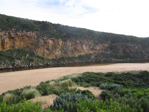
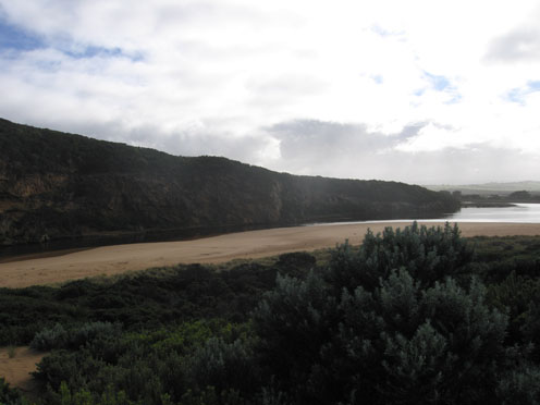
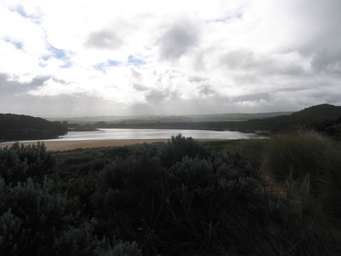
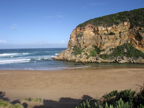
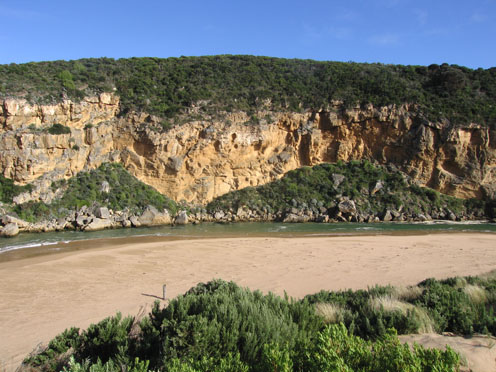
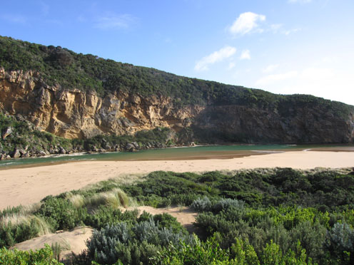
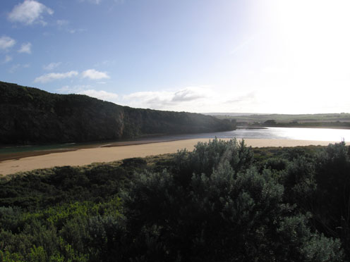
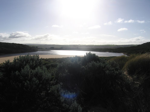
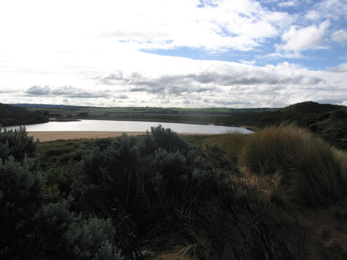
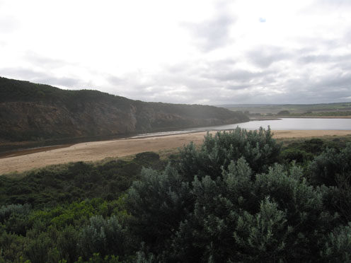
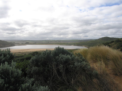
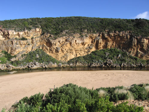
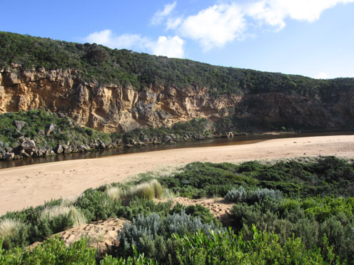
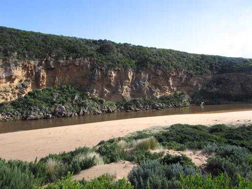
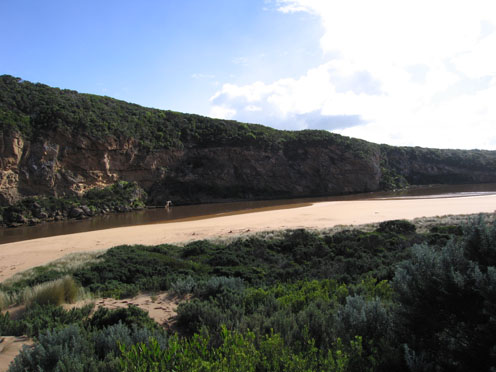
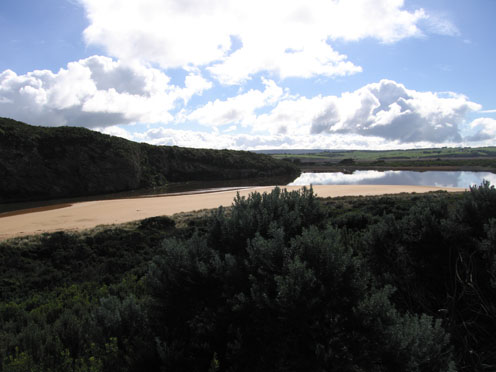
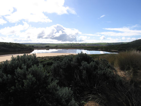
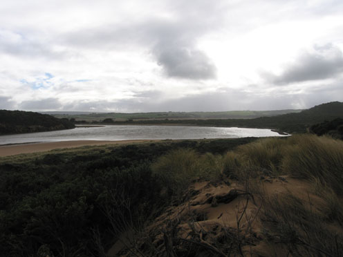
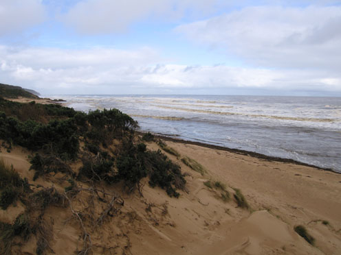
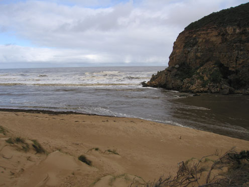
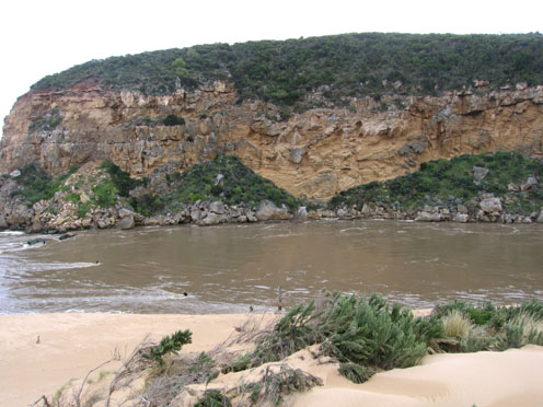
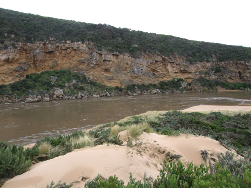
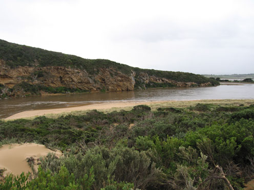
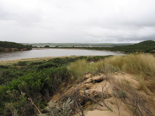
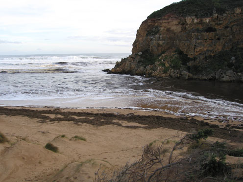
GMC Gellibrand River Estuary Mouth Observation Site
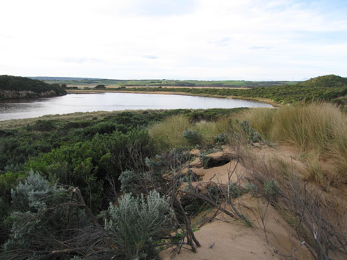
Active Mouth Condition 20-04-2007 - 19-04-2024Gellibrand River Estuary
770 results found (Displaying 181 - 190)
| ID | Date | Status | Details | |
|---|---|---|---|---|
| #4042 | 1 Jul 2010 | Approved |
Notes:
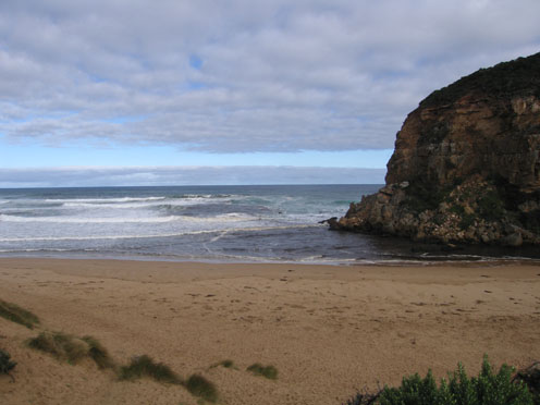
1. Water flowing out but sea entering. Salt / fresh divide visiable (colour change) about 30m. upstream of rocks. Channel depth is reducing. 2.Large increase of exposed sand at end of channel, sandbars also showing. Width of channel near tunnel = 10m. 3. Very steep double sand 'cliff' at centre of beach 4.Pied comorant 1, Singing honeyeater 3. |
|
| #3841 | 3 Jul 2010 | Approved |
Notes:
1.Water flowing out, some discharge around mouth.Waves in all directions - longshore drift bringing back more sand Small waves entering estuary along east side of channel 2.Sand building up in front of rocks 3.Sand 'cliffs' have increased on foreshore, mid beach 4. Sand visiable in breakers out to sea 5. 1 Dead fish 6. 2 Terns, 1 Pied Comorant, 2 silver Gulls |
|
| #3861 | 11 Jul 2010 | Approved |
Notes:
1. Salt water entering mouth and travelling up channel into estuary (green water) 2.Some waves covering rocks. 3.Sand 'cliffs' mid beach up to 2m. high 4.Waves 30cm+ from nw wind in estuary |
|
| #3941 | 16 Jul 2010 | Approved |
Notes:
1. Stronger outflow due to recent rainfall.Increased turbidity causing a dark discharge to about 2/3ds along beach from entrance. 2. Some waves entering into estuary. Waves in all directions at mouth with more sand from long shore drift entering channel 3.Steep cliffs of sand have formed along mid beach and last hi tide has reached nearly up to the dunes 4. Salmon being caught on beach |
|
| #3981 | 23 Jul 2010 | Approved |
Notes:
1. Brown/red discharge visiable to 2/3 along shoreline with larger area around mouth and out about 50m. south Out flow -deeper and stronger than last week but waves the width of the channel are entering and travelling up stream. Waves sometimes cover rocks. 2.Longshore drift bringing more sand into channel 3. |
|
| #4083 | 31 Jul 2010 | Approved |
Notes:
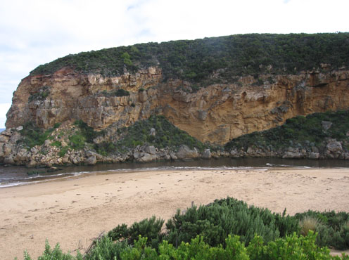
1.Water flowing out but waves entering, salt/fresh divide about 30m. upstream from rocks. 2.Large increase of exposed sand near end of channel (estuary). Channel shallow. Distance from sand to tunnel entrance = 10m. 3.Steep double sand 'cliffs' mid ocean beach 4.Sandbars exposed in estuary 5. Birds - Pied comorant 1, Singing Honeyeaters 3. |
|
| #4103 | 6 Aug 2010 | Approved |
Notes:
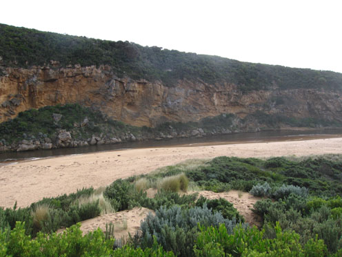
1.Strong outflow with dirty dark brown ochre coloured discharge around mouth & south out to sea. No discharge to east 2.Much turbidity in estuary, water opaque with dark deposits of silt left on sand s/e area (also on east end of beach) 3.Strong outflow from recent heavy rain upstream has caused sand'cliffs' to be formed (1m. high) along channel upstream of rocks 4. Long sand projection into ocean at eastern end of beach. High sand 'cliffs' remain at centre 5.Waves in all directions at mouth, stronger outflow on eastern side of rocks. 6.Longshore drift returning sand back into channel |
|
| #4161 | 12 Aug 2010 | Approved |
Notes:
1.Extremely wide strong dark brown discharge flowing out to both east & west 2.Recent strong gale force winds have caused sand dunes to rise about 50cm at site.Vegetation has dissapeared below sand 3.Channel is over 30 m.wide near mouth. Strong flow has formed 2m. high sand 'cliff' along east side of channel 4.Extensive flooding up stream Burrupa 11: 30 6.5 with east end of bridge in water. G6.Water flowing strongly through both culverts beside bridge, height marker underwater. Water about 2 m. below bridge. Flats flooded from G6 to Mouth. G4. both bridge and causeway totally underwater. O.O.R flood marker 0.1 5.Rainfall at G6 07.08.10 to 12.08.10 118ml. much larger falls upstream |
|
| #4162 | 13 Aug 2010 | Approved |
Notes:
1. Extreme width and force of out flow has cut away south east side of channel causing a 3-4m high cut into the sand dunes 2.Mouth is about 40 to 50m wide, the old breakwater piles are about twice their original height. The base cannot be seen because of the strong flow 3.Beach is covered along the water line by Phragmities debris and logs to height 1m. high - 4m. wide 4.Sea is dark coffee colour and beaches toward Rivernook/Moonlight Head are covered by foam 5.Discharge is visiable to over 1k out to sea 6.Flood seems to have peaked about 07:00 Burrupa 7.0 Bridge totally under water G6. Water up to top of culverts About 1.5m from bridge deck No markers visiable G5. bridge underwater G4. bridge & causeway totally under water G2 Boardwalk under water Valley from Princetown to G6 flooded Flood marker O.O.R 1.2 at 05:30 Water to centre of GOR near Latrobe Creek |
|
| #4221 | 17 Aug 2010 | Approved |
Notes:
1. Strong outflow, waves dark brown full length of beach and out about 1K. to sea 2.Waver travelling into estuary over sand bars & around to east gouging out bank.Bank on south side has sheer front of about 2-3m.cut into dunes 3. Flood water has cut 8-10m. high sheer cliff into dunes on east side of channel 4. Mouth is over 60m. wide(no beach) and 7old piles of break water are exposed 5.Flood water has deposited a huge amount of Phragmites on the beach which is now being returned to the estuary because of reducing force and longshore drift from rough seas 6. Flood water reducing from peak(13.08.10) OOR is clear of water 7.Valley flats are still covered by water 8.G4. deck has been totally removed from bridge and several landslips have occured between G4 &G6. |
|


All content, files, data and images provided by the EstuaryWatch Data Portal and Gallery are subject to a Creative Commons Attribution License
Content is made available to be used in any way, and should always attribute EstuaryWatch and www.estuarywatch.org.au