EstuaryWatch Data Portal
Estuary events Barham River Estuary
102 results found (Displaying 51 - 100)
| Date | Details | |
|---|---|---|
| 05-11-2015 |
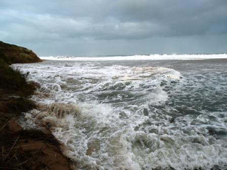
Weather Event checked the beach today 5/11 and the sand profile is very low so it is important not to get high tides with a big swell or the primary dune will be in more trouble. Rose Herben |
|
| 03-08-2015 |
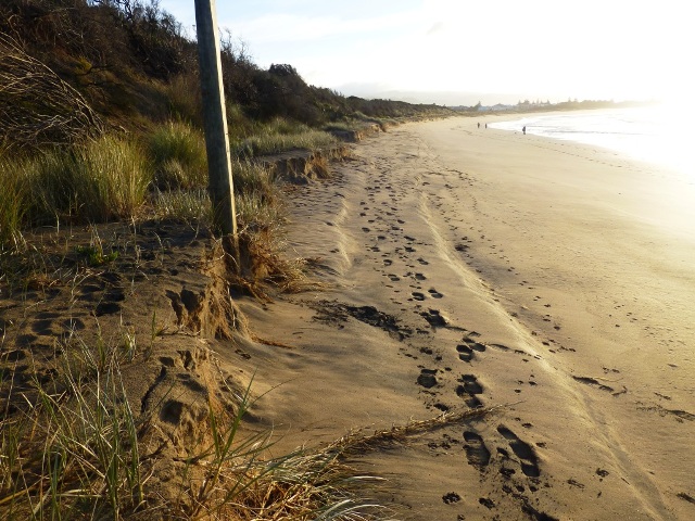
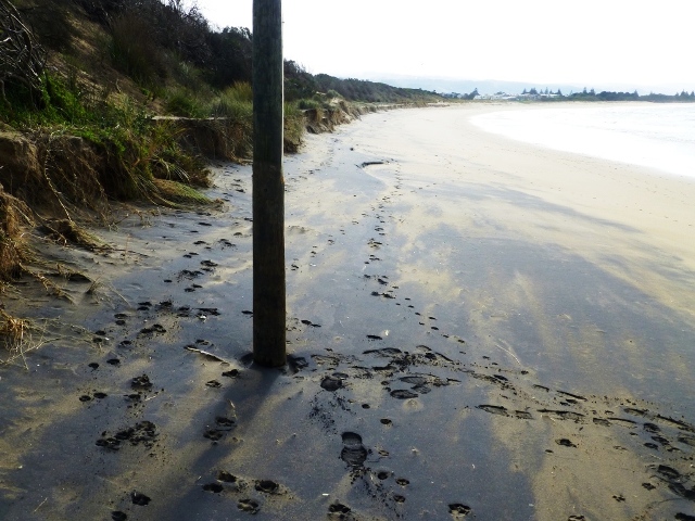
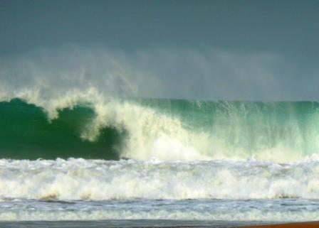
Weather Event The Barham river estuary height was 0.71mAHD and steady on the 01/08/2015. There was 27mm of rain at Marengo in 24 hours and the estuary height was 0.98m at 07.50 on the 03/08/2015. The river mouth is open , the flow is out and the tide is low. At 13.50 there are 2m waves breaking at the river mouth. The river mouth is open but the flow is in and out with the swell. At 14.00 the still water height at the harbour is 1.06m AHD [2.03mCD] and there is a 15kt west wind. At the Paradise Barham river gauge at 14.14 the flow height is 0.534m. Sediment is medium. At 14.07 the estuary height is 1.38mAHD and at 14.30 it is !.40mAHD. The following day 04/08/2015 at 10.00 the estuary height is 0.91mAHD. My conclusion is that the high tide combined with the large swell backed up the river flow and elevated the estuary height from 0.98m to 1.40mAHD. On the 3rd of August much of the primary dune was eroded. The swell with high tide had easy access to the primary dune because the beach sand profile was already very low. A sand height monitoring pole [Pole 2] was located near the Heathfield estate beach carpark. Pole 2 on 05/04/2015 the beach sand was 2.68mAHD on the pole face and the sand was 3,27mAHD on the back of the pole. Pole 2 on 06/06/2015 the sand height was 2.15mAHD. Pole 2 on the 28/07/2015 the sand height was 1.67mAHD Pole 2 on the 03/08/2015 the pole had disappeared; washed away. The beach profile is extemely low and the primary dune that carries the GOR is vunerable to further storm erosion. Phil Lawson |
|
| 03-08-2015 |
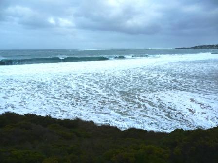
Weather Event In june and july the middle 300m of the marengo/apollo bay beach lost a lot of sand. The profile went down in areas by over a metre. I the first week of August high tides and swell had easy access to the primary dune the Great Ocean road sits on.Over a metre of primary dune was eroded away. There was considerable quantities of sand moving past the river mouth . Estuary heights were slightly elevated for that time of year. Two main beach access points are closed including the photoed sandbag one. Before the event all the sandbags were hidden below sand except the top two. The formed walking track and a car park has been compromised. Rose Herben |
|
| 23-06-2015 |
Weather Event South West of the Barham river mouth the beach profile was very low after a June 2012 storm. With settled weather the beach profile has been steadily rising since that time and is still high at the River Mouth [NE] end of the beach. At the monitoring pole [No 3] near the toilet block the sand height on: 05/04/2015 was 3.21 mAHD 06/06/2015 was 2.71mAHD 23/06/2015 was 1.93mAHD Sand loss was all in May and June. It is usual for the winter minimum estuary height to be below 0.5mAHD. The minimum estuary height recorded this year is 0.69mAHD on the 24/07/2015. Otherwise > 0.8mAHD has been a common minimum estuary level. I believe this is a result of large sand movements around the river mouth. Phil Lawson |
|
| 26-04-2015 |
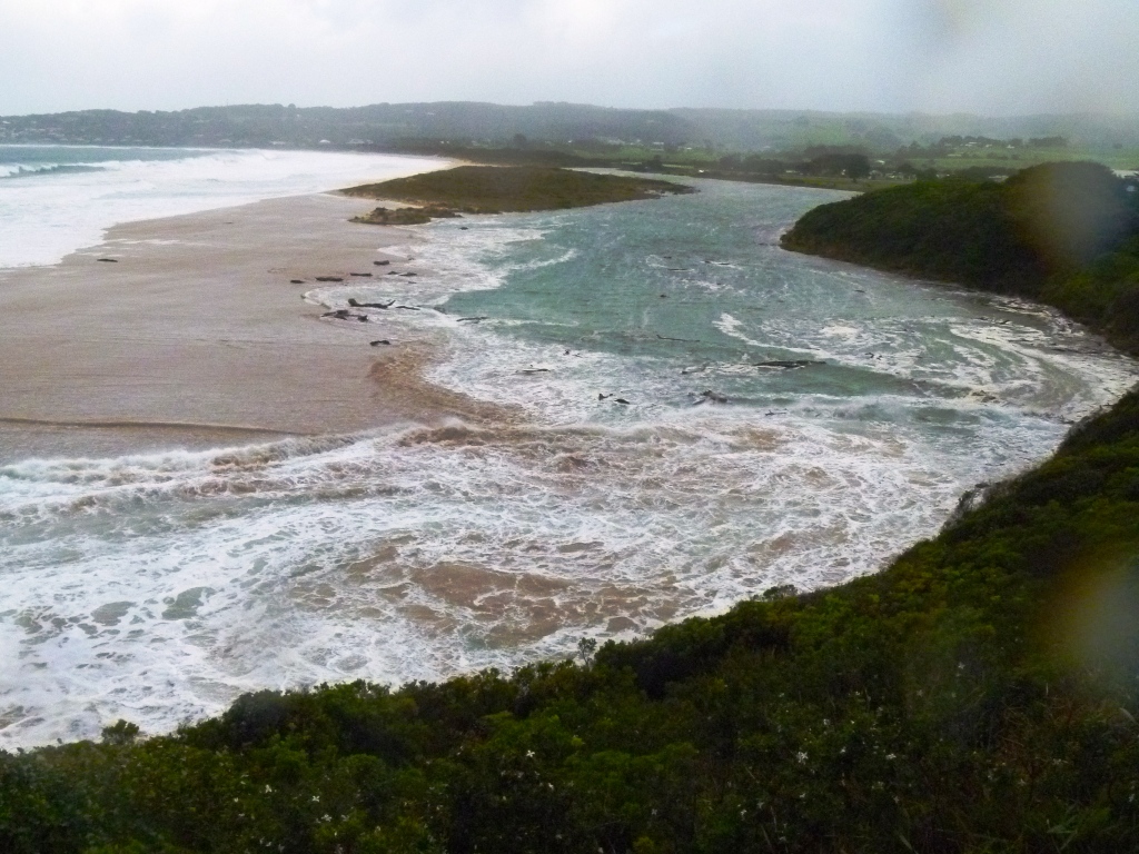
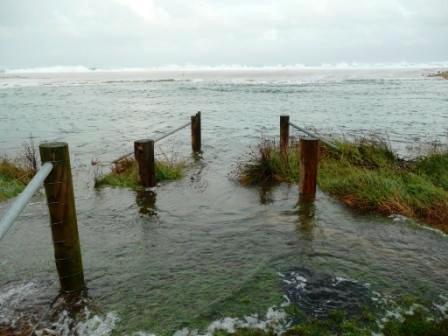
Estuary Entrance Opening Saturday 18/04/2015 at 9.50 the river mouth is open and moderate seas are flowing in. The estuary height is 0.96m. Monday 20/04/2015 at 08.06 the river mouth is closed, the last high tide covered all of the berm. The sea is moderate, the berm clearance is 0.23m and the estuary height is 1.30m. Thursday 23/04/2015 at 16.15 the berm clearance is 0.13m, the estuary height is 1.565m and the high tide waves only crossed the berm at the RM. Friday 24/04/2015 at 11.00 the estuary height is 1.60m. Saturday rain. Sunday 26/04/2015 at 09.20 the river mouth is open. The RM appears to be freshly opened overnight. The estuary height is 1.06m. The river water is free of sediment. Monday 27/04/2015 the estuary height is 0.95m. The last 2 river mouth closures and river mouth opening have continued this autumn's trend of closure with the high high tides; but the berm heights have not been high enough to keep the river mouth closed until the next fortnights high high tide cycle.The river flow has been consistently low to moderate. This season the trend of the estuary maintaing high water levels [above 0.9m] when the river mouth is open I have found interesting. I am not sure of the reason; it may be there is a lot of accumulated sand in the bottom 200metres of the estuary or that the river mouth is further north. Phil Lawson |
|
| 12-04-2015 |
Estuary Entrance Opening Monday 06/04/2015 the Barham river mouth is closed. The seas are slight and the estuary height is 1.01m. Tuesday 07/04/2015 at 09.00 the estuary height is 1.12m, the RM berm clearance is 0.31 and the sea is moderate. Thursday 09/04/2015 at 08.45 the river mouth is closed with a berm clearance of 0.24m. The seas are slight and the estuary height is 1.38m. Saturday 11/04/2015 the river mouth is closed but there has been extensive digging in an attempt to artificially open the RM. The sea is calm, the berm clearance is 0.19m and the estuary height is 1.515m. Sunday 12/04/2015 at 17.45 the estuary height is 1.57m with a berm clearance of approximately 0.1m. The artificial opening channel is nearly facilitating the opening of the RM. Monday 13/04/2015 at 12.12 the river mouth is open and the estuary height is 1.09 m. Friday 17/04/2015 the estuary height is settled at 0.96m. Phil Lawson |
|
| 29-03-2015 |
Estuary Entrance Opening On the 24/03/2015 at 10.55 the river mouth is closed with a berm clearance of 0.3m. The last high tide had clearly been over the full length of the berm. The estuary height was 1.36m AHD. On Friday 27th at 17.15 the river mouth is closed with a slight to moderate sea and the estuary height is 1.815m AHD. 28/03/2015 ,Saturday at 15.00 the estuary height is 1.89m AHD. At the river mouth there has been a fair amount of digging to artificially open the entrance but only a small amount of water from the estuary has flowed out. The berm clearance without the digging is 0.24m On the 29/03/2015 at 13.30 the estuary height is 1.91m AHD. On Monday the 30/03/2015 at 11.00 the river mouth is open and the estuary height is0.94m AHD. Without the artificial opening the estuary height expect the estuary height to get above 2.1m before a natural opening. The high tides were not crossing the berm subsquent to the Friday observation. Phil Lawson |
|
| 19-03-2015 |
Estuary Entrance Opening The Barham river mouth has only been open 2 days and it was closed again. Monday 09/03/2015 at 10.00 the river mouth is closed with a berm clearance of 0.2m and an estuary height of 1.08m AHD. The swell is a clean slight /moderate on Monday and Tuesday; after that seas for this closure that I recorded were only smooth to slight. 14/03/2015at 9.50 the estuary height is 1.44m AHD and the berm clearance is 0.23m. On the 18/03/2015 at 12.30 the berm clearance is 0.1m and the estuary height is 1.59m AHD. On the 19th at 15.15 the berm clearance is minimal and the estuary height is 1.62m AHD. At 09.00 on Friday the 20th the river mouth is open and the estuary height is 1.01m AHD. The river mouth was closed for 11 days. Phil Lawson |
|
| 06-03-2015 |
Estuary Entrance Opening On the 20/02/2015 the Barham River mouth is closed and the estuary height is 0.96mAHD. Prior to closure the height was 0.92m. On the 23/02/2015 at 11.00 the estuary height has risen to 1.17m AHD and the berm clearance is 0.23m. On Friday the 27th at 11.20 the estuary height is 1.403m AHD and the berm height has risen so the clearance is still 0.23m. On the 04/03/2015 at 15.40 the estuary height is 1.56m AHD. On the 06/03/2015 at 17.40 the estuary is at 1.696m AHD with minimal berm clearance. On Saturday the 7th at 19.30 the river mouth is open and the estuary height has dropped to 1.02m AHD. The only significant swell [slight to moderate] I recorded during the closure was on the 5th and 6th of March. The river mouth had been closed for 2 weeks exactly. Phil Lawson |
|
| 04-02-2015 |
Estuary Entrance Opening 24/01/2015 the river mouth closed at 9.00 the estuary is 1.22mAHD and the seas slight and smooth. 25/01/2015 at 8.00 the estuary is 1.39mAHD, slight smooth seas and the berm clearance is 0.23m. The overnight tide had been over most of the long legth of the berm. There were no moderate swells observed during this river mouth closure. By 14.30 on the 30/01/2015 the estuary height has reached 1.62mAHD and the berm clearance is 0.19m. 31/01/2015 the high tide had not crossed the berm at all. 02/02/2015 at 10.30 the stuary height is 1.685mAHD. 04/02/2015 at 1.00 the estuary height is 1.725mAHD and the berm clearance was 0.15m. The width of the berm keeping the river mouth closed was narrow and there was canal half dug by a member of the public playing with the idea of opening the mouth. 06/02/2015 the river mouth had opened with some force but the estuary only fell to 0.92mAHD water height. Prior to the river mouth closing on the 24/01/2015 the estuary had a settled height of 0.94mAHD. The estuary is still at a settled height of 0.92m AHD on the 16/02/2015 even thogh the river flow increased and estuary height raised by an intense rainstorm on Febuary the 13th. Phil Lawson |
|
| 30-12-2014 |
Estuary Entrance Opening The 1st river mouth closure for the season occurred on the 25/12/2014. At 09.15 the estuary height was 1.15mAHD, the berm clearance was 0.15m and the sea conditions were a smooth moderate swell. The estuary height slowly increased over 4 days to 1.46m at 09.00 on the 29/12/2014 with a berm clearance of under 0.1m. At 10.00 on the 30/12/2014 the river mouth was open and flow was out. The estuary height was 1.28m. The river water was just overflowing the top of the berm. The early season river mouth closure for the Barham was predictable in light of the dry spring / summer weather and consistently low river flow. In October the lowest estuary height observation was 0.88mAHD. In November and December the lowest observed height was 0.96mAHD. These very high base levels were as a result of a large sand build up inside and at the river mouth. At 19.00 on the 31/12/2014 the estuary height was back to the December base level of 0.96m. Phil Lawson |
|
| 24-06-2014 |
Weather Event Monday 23/06/2014 11.00 the estuary level is 0.92mAHD. Tuesday 24/06/2014 had strong gale [9] force West winds and Barometer readings below 990. At the harbour the Predicted tide is 1.07mAHD at 8.54. The observed tide is 1.47mAHD at 9.50 and 0.68 mAHD at 14.00. At the Paradise river gauge the flow is loaded with sediment and the gauge is at 0.47 at 10.05 and at 0.58 at 14.12. Estuary water levels are: 9.35 its 1.76mAHD. 10.15 its 1.95mAHD. 10.30 its 1.98mAHD. 12.45 its1.92mAHD 13.58 its 1.80mAHD 15.15 its 1.62mAHD At 11.45 at the river mouth sediment laden water and logs were starting to visibly move out to sea. The observed tide was 0.4m higher than the predicted tide. The seas were rough to very rough. The estuary water height rose to a level 0.51 m higher than the high tide level. On the 25/06/2014 at 7.55 the estuary water height is 1.16mAHD and the river gauge is at 0.59. Phil Lawson |
|
| 16-06-2014 |
Estuary Entrance Opening On Monday 16th June at 08.00 the Barham river mouth is closed and the estuary water height is1.66m. The berm clearance at the river mouth was 0.10m with moderate sea conditions. By 17.15 on the 16th the river mouth was open and the estuary height had fallen to 1.60m. There had been no large rain events, plenty of sand around the river mouth and moderate seas with westerly wind. The result a late season river mouth closure. The closure was typical of this season of only lasting a few days and naturally opening at a level below that which can negatively effect land assets. Phil Lawson |
|
| 23-04-2014 |
Estuary Entrance Opening On Friday the 18/04/2014 at 09.30 the river mouth is open and the estuary height is 0.92m. the sea is moderate and the first moderate to large swells of the season are anticipated. Saturday the 19/04/2014 at 10.30 the river mouth is closed the estuary height is 1.22m and the swell is slightly larger than Friday. Sunday at 08.15 the river mouth is closed and there are rough sea conditions with a clean swell. The estuary height is 1.52m. Monday is similar conditions and the estuary height is 1.61m. Tuesday the 22/04/2014 at 08.15 the estuary height is 1.68m the river mouth is closed and the rough sea has large clean swell. During the night the sea had swept over the full length of the unvegetated berm. However the berm clearance was less than 0.1m. On Wednesday the 23/04/2014 at 09.15 the river mouth was open the sea conditions were back to moderate and the estuary height was 0.90m. On Saturday the 03/05/2014 at 11.20 the sea conditions were rough with a large clean swell. The estuary height was 1.26m but the river mouth was open. A substantial sand cutting at the river mouth indicated the river mouth had been closed. This season the river exit has been well to the North and also my lowest recorded estuary water height is 0.8m. The rock platform at the river mouth which controls the base/low water height of the estuary must be higher with a more Northerly exit. The river mouth exit with the lowest rock platform allows the estuary water level to fall to 0.43m. The Mounts Bay beach has been gaining sand over most of its length. Phil Lawson |
|
| 09-04-2014 |
Estuary Entrance Opening On Thursday the 03/04/2014 the river mouth was closed and the estuary height was 1.15m. On Monday 07/04/2014 at 14.30 the estuary height was1.63m and a moderate sea with fresh to strong breeze. The berm clearance was 0.1m.The highest estuary recording was at 11.00 on Tuesday at 1.68m. At 14.00 on Wednesday the 09/04/2014 the river mouth was open and the estuary height 0.86m. Phil Lawson |
|
| 22-03-2014 |
Estuary Entrance Opening The main river mouth closures leading up to the 22/03/2014: On Friday 14/02/2014 the river mouth was closed and the estuary height 0.80m. With a period of light breezes and smooth sea the estuary height was 1.18m on the 19/02/2014. On Thursday 20/02/2014 with a moderate breeze and sea condition. There was seawater crossing the berm and 11mm of rain had fallen at Marengo. The estuary height was at 1.36m at 14.45. Friday the 21/02/2014 at 13.15 the river mouth was open and the estuary height 1.28m. The river mouth closed on the 02/03/2014 with the estuary height 0.88m. Light breezes and settled conditions meant the estuary height rose slowly. The river mouth opened on the 09/03/2014 and the highest recorded level was 1.20m. The 17/03/2014 the river mouth was closed and the estuary height was 1.19m; the sea conditon was slight with a clean westerly swell. On the 20/03/2014 the estuary height was 1.44m and a berm clearance of 0.24m. On Friday 21/03/2014 at 18.45 the estuary height was 1.535m and 27mm of rain had fallen at Marengo to 16.00hours. 22/03/2014 at 10.30 the river mouth was just open and the estuary height was 1.77m. The river had an unusual exit into the rocks; more Northerly than the usual exit into the sea. After opening the estuary height only fell to 0.92m. Phil Lawson |
|
| 22-03-2014 |
Estuary Entrance Closure Barham River closed 1.77 AHD Rose Herben |
|
| 19-08-2013 |
Weather Event A morning of very rough to high sea conditions created high water levels in the estuary. . At 9.15 the estuary height was 1.50m with the river mouth open and large waves coming in the river mouth. There was light to moderate sediment in the river water and an expected estuary height of approximately 0.9m without sea blockage at the river mouth. At 10.05 the estuary height was 1.51m and the still water height in the harbour was 0.96mAHD. A strong West wind was blowing. At 12.30 the estuary height was 1.44m with the river mouth open and flow out. The sea conditions were down to very rough and the still water height in the harbour was 0.81m At 7.40 on the 20/08/2013 the estuary height was 0.90m. August was a wet month but there were no intense flooding rain events. The estuary height stayed under 1.0m when not influenced by tide or swell. Phil Lawson |
|
| 15-05-2013 |
Estuary Entrance Opening On the 9th May 2013 the Barham river mouth closed; the seas were moderate and the estuary water height was 0.86mAHD. By the 13th of May the estuary height was 1.24m. The river flow was low for this time of year and waves since the 9th were crossing the berm only at the closed river mouth. On the 14th of May rain boosted the river flow. At 07.10 on the 14/05/2013 the estuary height was 1.39m and the berm clearance 0.3m. At 08.05 on the 15/05/2013 the estuary height was 1.79m with minimal berm clearance. By 10.44 on the 15th the river mouth had naturally opened and the estuary height was1.22m. Phil Lawson |
|
| 03-05-2013 |
Estuary Entrance Opening The Barham river mouth closed on 24/04/2013; the next day the estuary water height was 1.16mAHD and the berm clearance 0.27metres. On the 27th and 28th of April high High tides and large swell flooded the estuary with seawater. In 31 hours the estuary height went from1.36m to 1.76m. The berm still had good clearance of 0.28m. The estuary height continued to rise with river flow and some seawater. At 08.10 on the 03/05/2013 the estuary height was 1.9mAHD and the berm clearance 0.3m meaning the estuary water height needed to reach 2.2m before a natural river mouth opening was possible. On the 3rd during the day the river mouth was artificially opened and at 17.25 the estuary height was 1.02m. Phil Lawson |
|
| 02-05-2013 |
Unusual/Extraordinary occurrence! The estuary had been flooded mainly by seawater and the high level was 1.83mAHD. The extended aquatic habitat attracted a very large population of waterbirds including Coots, Moorhen, Black Duck, Cormorants and Darters. Phil Lawson |
|
| 21-04-2013 |
Estuary Entrance Opening At noon on the 11/04/2013 the Barham river mouth was closed with a berm clearance of 0.3m over the estuary water height of 0.9mAHD. The river mouth remained closed for 10 days. During the closure the river flow was moderately low and the sea conditions were slight to moderate. On 16/04/2013 the estuary height was 1.395m. At 16.05 on 21/04/2013 the estuary level was 1.68m and the river mouth berm clearance 0.1m. At 11.15 on 22/04/2013 the estuary water level was 0.84m and the river mouth open. Phil Lawson |
|
| 05-04-2013 |
Estuary Entrance Opening Barham river mouth on the 13/03/2013. 11.30 on 14/03/2013 the estuary height is 1.08m and there is a moderate sea. The river flow is at drought levels. 9.45 on 17/03/2013 the estuary height is 1.415m, the berm clearance is 0.4m and the last high tide fully covered the berm except where there is established vegetation. 20/03/2013 estuary height 1.54m. 28/03/2013 estuary height 1.70m and berm clearance 0.15m. 30/03/2013 estuary height 1.74m. 31/03/2013 at 8.20 the estuary height is 1.802m and the berm clearance is 0.20m. A day of rough sea conditions and high high tide. At 17.00 the estuary height was 1.857m. 02/04/2013 estuary height 1.878mAHD. 05/04/2013 at 9.15 the river mouth is closed and the estuary height is 1.915m and the berm clearance is 0.20m. Later this day the river mouth was artificially opened by machine. 07/04/2013 morning; the estuary height had fallen to and stabilized at 0.74mAHD. Phil Lawson |
|
| 06-03-2013 |
Estuary Entrance Opening 10/02/2013 there are rough sea conditions and the river mouth has closed. The estuary level is 0.98mAHD and the berm clearance is 0.5m. The river mouth was to stay closed for 23 days. The last observation with it closed was 1400 hrs 05/03/2013. The estuary level was 1.485mAHD; the sea was smooth and the river flow was very low. Berm clearance was 0.1m. 8.30 hrs on 06/03/2013 the river mouth was open and the estuary level was 0.88m. An artificial opening by the Public was likely. In the time the river mouth was closed there was consistently low river flow and few instances of swell crossing the berm. The Colac Herald reported there were many dead fish in the estuary on Sunday 24/02/2013. I have been unable to confirm the accuracy of this report. The estuary height was 1.415mAHD on this date. Phil Lawson |
|
| 05-02-2013 |
Estuary Entrance Opening 18/01/2013 the Barham river mouth closed for the first time this spring/summer. The estuary height reached 1.28m on the 20/01/2013 before opening naturally. On the 28/01/2013 the river mouth closed with slight swell; the estuary level was 0.96m. The river mouth was still closed on the 05/02/2013 and the estuary level was 1.58m. There was no observed large swells during this period. The berm clearance was minimal. Phil Lawson |
|
| 12-06-2012 |
Weather Event The flood on the 04/06/2012 has driven out sand from the lower estuary and river mouth. It has left bare the rock base and especially the rock shelf that maintains the minimum water height in the estuary. During the flood on the 04/06/2012 my highest water level recorded was 1.80mAHD on the estuary staff at 15.08. Phil Lawson |
|
| 17-04-2012 |
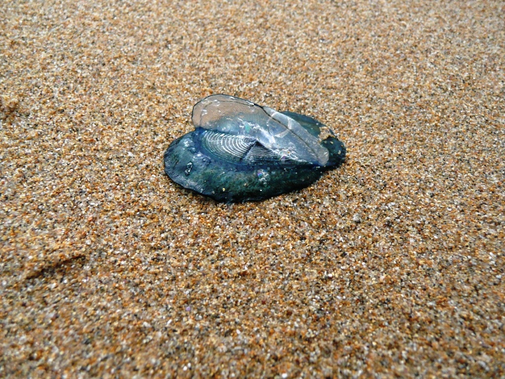
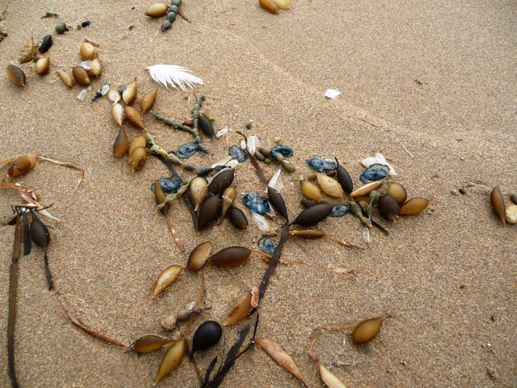
Unusual/Extraordinary occurrence! An East wind of 17 knots created a disturbed sea. The beach from the Barham river mouth to Marengo had a continuous deposit of light detrius left behind at the high wave mark. Objects included clear jellies, light seaweed especially floats, sponges, feathers and blue jellyfish with a sail. No large seaweed or shells were present. The blue jellyfish with sail are identified as "By-the-wind Sailor" [Velella velella]. Their number on the beach would exceed 2 thousand individuals. They were mostly 2 to 3 cms in length. The weather had been ESE to East. The following day I observed only one individual, the others either washed out to sea or covered by sand. Phil Lawson |
|
| 15-04-2012 |
Estuary Entrance Opening River Mouth closurers: On the 11/03/2012 the river mouth closed and the estuary water level was 1.02mAHD. The water level rose to 1.46mAHD by the 15/03/2012. The river mouth opened naturally and the water level fell to 0.70mAHD on 16/03/2012. Subsquently there followed a period of sand build up around and inside the river mouth; especially the period around 27/03/2012. On the 05/04/2012 the river mouth is just open and the estuary water level is 1.16mAHD. The river mouth is closed with a minimum berm height for closure on the 06/04/2012 with a water level of 1.21mAHD. Overnight strong Westerlies with waves coming over the berm raised the height of the berm and the water level to 1.37mAHD on the 06/04/2012. The river mouth remained closed. The water height rose to 1.75mAHD by 10/04/2012. On the !3/04/2012 at 13.00 the water level is 1.885mAHD. A channel had been dug to artificially open the river mouth. The channel was subsquently artificially blocked. 14/04/2012 at 11.00 the river mouth is closed and the water level is 1.90mAHD. 15/04/2012 at 10.30 the river mouth has a natural opening. The water level by 14.30 is 0.82mAHD. Phil Lawson |
|
| 05-08-2011 |
Weather Event An extreme high tide peaked at 14.40 and measured 1.64m AHD in the harbour. The barometer was 1001.9 at 09.00. Near Gale West winds and rough seas meant large swells were entering the Barham river mouth. There had been overnight rain but the amount of sediment in the river was light. The estuary staff read 1.60m at 14.25 and 1.80m at 15.15. A very high water level in the estuary principally caused by an extreme tide. Phil Lawson |
|
| 21-07-2011 |
Weather Event Strong Easterly winds dominate the weather this day. A sea in turmoil with rough conditions from the East. The estuary however was not excessively affected; the estuary staff read as 0.7m at 11.00, 0.96m at 15.20 and 0.70m at 17.00. The still water tide reading in the harbour at 15.30 was 0.84m AHD; not much below the height in the estuary. The great effect of the Easterly wind storm was to the Marengo end of Mounts Bay [the other end of the beach from the Barham river mouth]. The erosion to the foreshore at Marengo was extensive and severe. The walking track, the G.O.Road and underground services are now vulnerable if there is further erosion. The last month has seen the effects of 4 different weater events. June 21st rainfall and a river flood helped by a high tide. July 5th an extreme tide creating very high water levels in the lower estuary. July 9th massive westerly swells elevating the estuary well beyond the still water high tide level. Lastly this Easterly wind storm which had only minor effect on water levels in the estuary, however if it was a common occurrence it might erode the dune system and make a river outlet at the Marengo end of the beach. Phil Lawson |
|
| 09-07-2011 |
Weather Event After 09.00 there was 20 hours of very rough seas and fresh to strong SW to W winds. Barometer was 1015 and my highest recording for the tide in the harbour was 0.84mAHD at 17.15. There was no rain. The estuary staff read 1.44m at 17.18. To me the Westerly swells seemed huge but also close together. The net effect was to raise the estuary water level considerably higher than the high tide level. Damage caused by the sea conditions was on the Apollo Bay foreshore. Phil Lawson |
|
| 21-06-2011 |
Weather Event Overnight rain with a barometer reading of 992 at 02.30; near gale NW wind gusts led to a minor flood coinciding with the afternoon high tide. The harbour high tide reading was 1.41mAHD at 15.55. The estuary staff read 1.10m at 11.30 and peaked at 1.50m at 16.15. There was minor flooding from the rainstorm on Barham floodplain farmland in the hours leading up to high tide. Phil Lawson |
|
| 21-04-2011 |
Weather Event This day had an extremely high King Tide pedicted of 1.34mAHD. As it happened this height was reached with an observed height of 1.35mAHD for still water in the Apollo bay harbour at 14.05. The day also produced a medium to large swell at the river mouth. The net affect was a large inflow from the sea into the Barham estuary and the water level in the estuary peaked at 1.52mAHD at 15.15; the highest level for the season. The estuary level was 1.47mAHD at 14.00. The estuary level was 1.50mAHD at 14.25. Phil Lawson |
|
| 23-03-2011 |
Weather Event This summer season there has been no Barham River river mouth closures. However there has been high tide and swell events bringing a large inflow of sand into the river mouth. The highest estuary water level I have observed since August 2010 has occurred with the large swell of this weather event. At 14.48 the tide level in the harbour was 1.28mAHD. At 15.12 the Estuary water level was 1.34mAHD. The high tide receded and the river mouth was open. At 21.10 the Estuary water level was 1.18mAHD and the following morning it was 0.82mAHD. Winds light. Phil Lawson |
|
| 13-10-2010 |
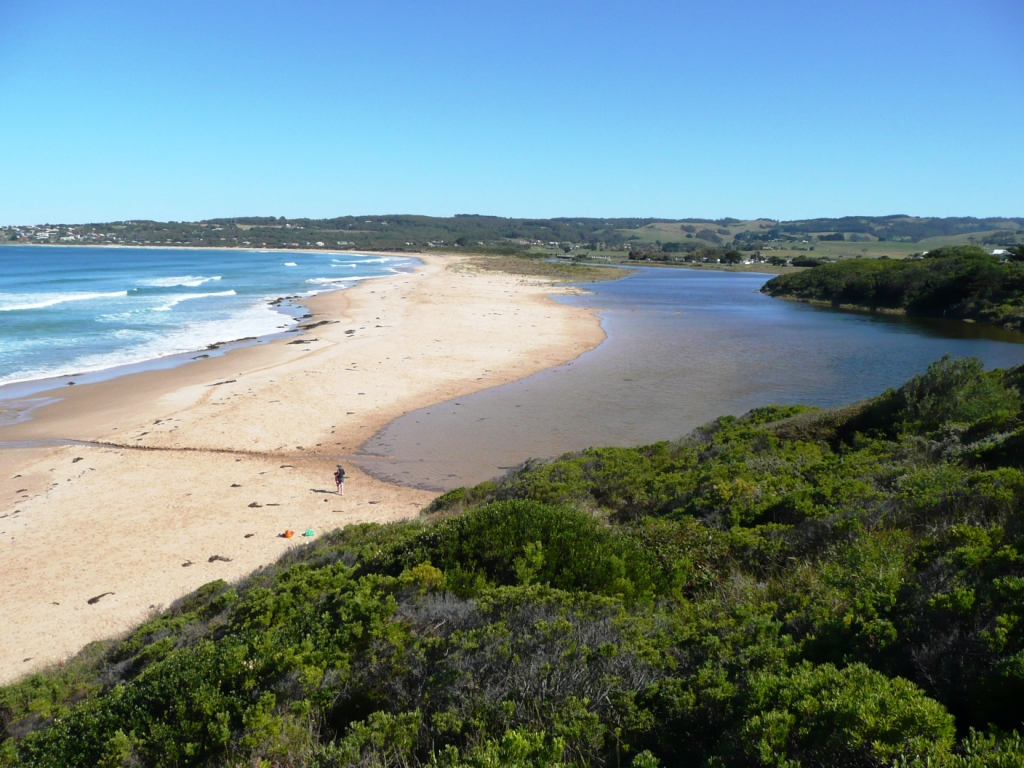
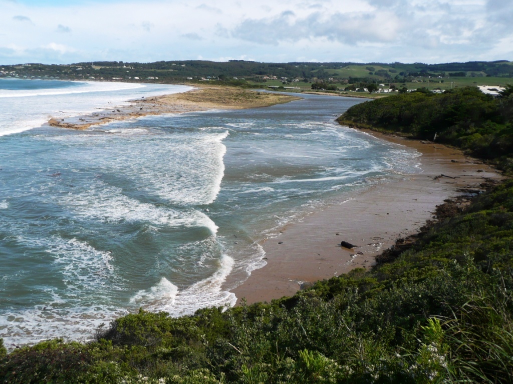
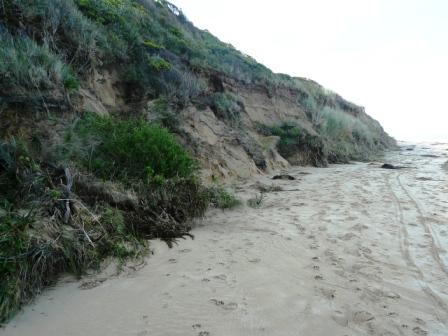
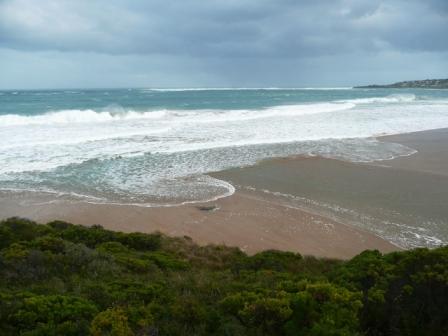
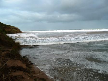
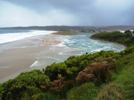
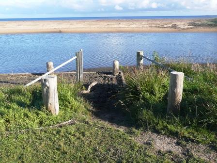
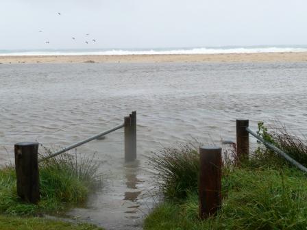
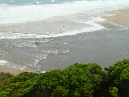
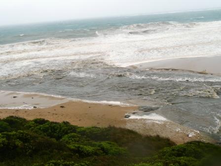
Weather Event The Barham river mouth is at the NE end of the Mounts Bay beach. The toilet block is about half way along the beach. In 1995 there was approximately 12 metres of Primary due behind the toilet block before the dune sloped down to the beach. The back of the toilet block is now close to the precipice. In just the last few months the dune has receded at least 3 metres. My opinion from observations is that events like the Southerly storm of the 11/8/10 lowers the beach profile, taking sand offshore and allowing subsquent large swell events to reach and undermine the Primary dune. I have included 3 photos all looking SW from the same spot at the bottom of the beach access by the toilet block. Now there is no beach access, it is closed as it is a dangerous vertical drop. The recent swell events though have pushed sand well into the river mouth. Phil Lawson |
|
| 28-08-2010 |
Weather Event The Otway Ranges, including the Barham River Catchment, received record rainfall and strong winds during the month of August. The Barham River flooded onto the riparian zone, large logs and heavy debris were washed down stream to lodge around the estuary mouth. Banks of this debris were, in places, topped with silt and sand. The shape and location of the mouth has been altered by these events. Anna Hicks |
|
| 25-08-2010 |
Weather Event A large swell with a NW wind reshaped the Barham river mouth. The berm west of the river mouth had been severely eroded by the river flood on the 11/08/2010 and the river mouth became 50 metres wide. This large swell event further eroded the existing berm to a very small size but also drove sand well up inside the river mouth. At 12.20 the harbour high tide was 0.96 mAHD. At 12.25 the estuary was at 1.22 mAHD. Phil Lawson |
|
| 11-08-2010 |
Weather Event A Southerly storm with large swell on top of a high tide of 1 metre AHD combined with a rain/river flood. The Paradise river gauge was observed at 2 metres giving a river flow consistent with a 1 in 5 year flood event. The Barham Catchment was already saturated, the rain runoff caused many slips in the Catchment and the floodwaters carried a high sediment load. The floodwaters gouged out the river mouth and 200 metres of the berm upstream from the river mouth. Phil Lawson |
|
| 30-06-2010 |
Weather Event The 01/07/2009 to the 30/06/2010 was a quiet year for weather events on the Barham estuary, compared to the previous five years. The highest estuary water level for the year with the river mouth closed was 1.62m AHD on the 07/02/2010. There were no rainfall flood events creating high river levels. The highest water level in the estuary with the river mouth open was 1.6m AHD. This was on the 29/04/2010 from a high tide and large swell. Significantly the more subdued nature of the extreme events for the year has allowed some new vegetation on the berm to survive. The protective berm in recent years has been washed clean of any new plant colonies by the end of autumn. Sea Lavender and Marram Grass commonly germinate by spring. Pockets of Marram Grass has survived on the berm. Phil Lawson |
|
| 09-09-2009 |
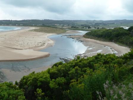
Unusual/Extraordinary occurrence! The Marengo to Apollo Bay beach that is west of the Barham river mouth, by my experience, has a very low sand level. East of the public toilet block, two 10 cm thick seams of Ilmenite,both approximately 40 metres long have been exposed. Large areas of the beach are covered in a black film from the ilmenite washed out by wave action. Attached photos show the extent of the ilmenite seams (. By the 10/10/2009 sand on the beach had built up to the top of the ilmenite seam. By 24/11/2009 the beach was clean and the ilmenite was covered. As of the 25/4/2010 the sand level has continued to rise and would be nearly 1 metre above the level on the 25/9/2009. Phil Lawson |
|
| 28-06-2009 |
Unusual/Extraordinary occurrence! After a number of large swell events up to the 22/05/2009 the rocks inside the river mouth were reasonably bare. from that time to the 28/06/2009 there were no significant rain, wind or swell events. It was very settled weather with the sea coming in the river mouth with the tide and the river going out as the tide receded. Clearly this was ideal conditions for the edible Algae: Enteromorpha Intestinalis [Grass Kelp] as it grew from virtually nothing to 3 - 4 cms in that time. Phil Lawson |
|
| 27-05-2009 |
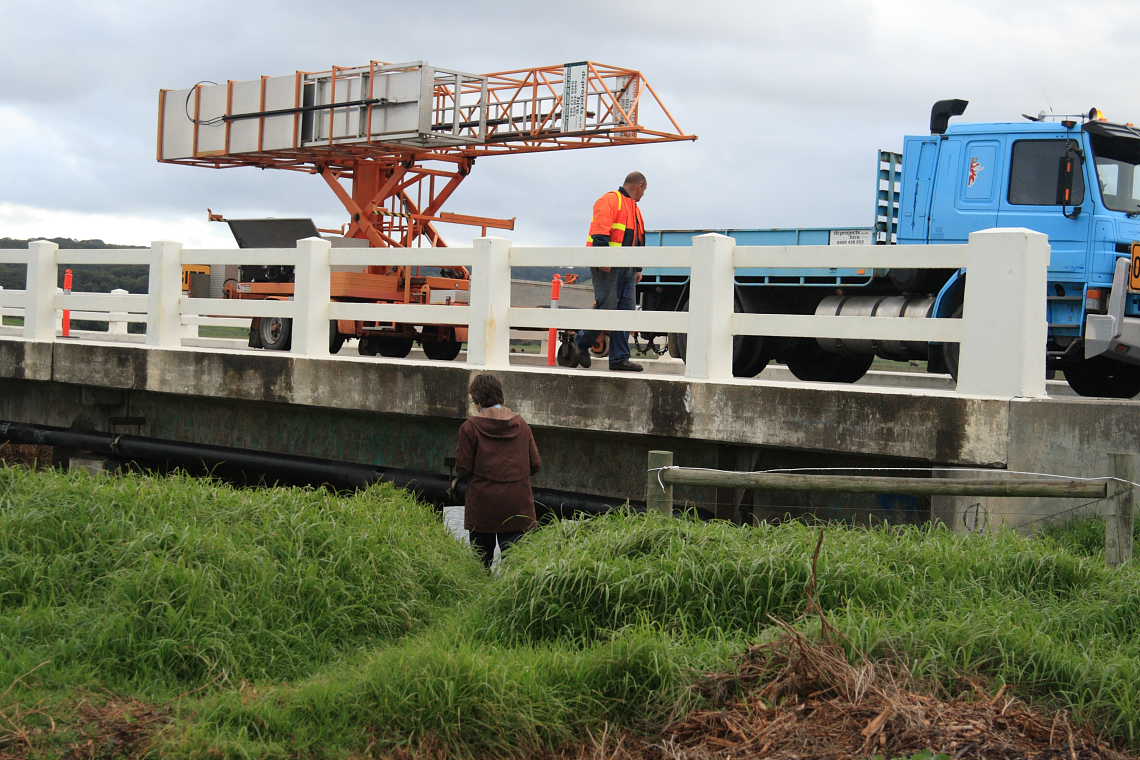
Unusual/Extraordinary occurrence! The bridge across the Barham River at Great Ocean Road is currently undergoing repairs. Heavy machinery in operation. Anna Hicks |
|
| 16-05-2009 |
Weather Event After several days of West to Nth-West winds a large swell had built up and 3 metre waves were coming into the Barham River Mouth. The estuary water height was 1.39mAHD at 10:15 and the river mouth was open with flow out. At 17:15 the estuary water level was 1.78mAHD and the river mouth was still just open with flow in and out.The peak tide recording at the harbour was at 16:33, was 1.19mAHD. As well as the sea flooding the estuary, the large waves entering the river mouth undercut the cliff at the base of Pt Bunbury. One metre and more in depth, 2 to 4 metres in height, the cliff collapsed over a distance of 60 metres. Significant damage to Pt Bunbury under photopoint BmP1 occurred. Phil Lawson |
|
| 27-04-2009 |
Unusual/Extraordinary occurrence! Large flock of terns sighted opposite photopoint 2. Anna Hicks |
|
| 27-04-2009 |
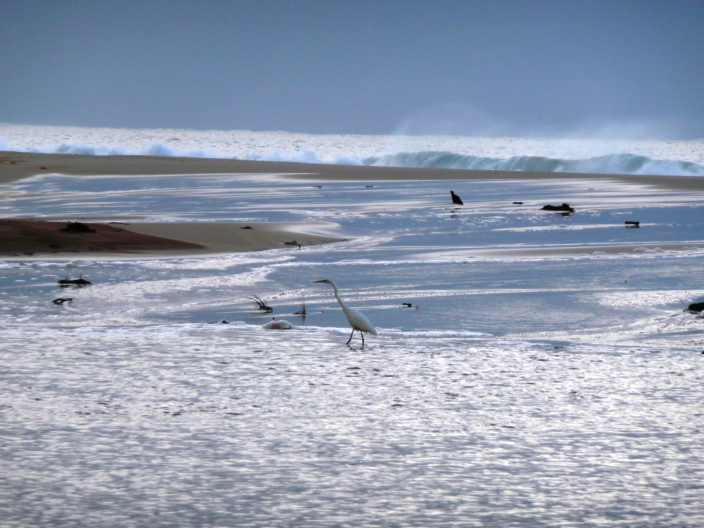
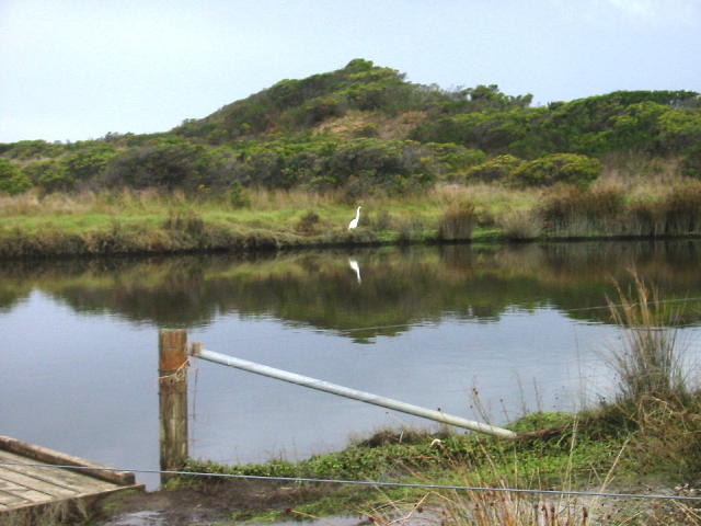
Unusual/Extraordinary occurrence! Large flock of terns on berm opposite photo point, BmP2.2 Large white egret on riparian bank just downstream of bridge, BmP3 Anna Hicks |
|
| 26-04-2009 |
Weather Event The Barham River mouth had been closed since the 27th March with an estuary water level of 0.82mAHD. Settled weather and small swell over the next 4 weeks meant the estuary water level rose slowly. By 6:30 on the 26th April the estuary water level was 1.96mAHD. As the day progressed the swell built to 2 metres and above and coincided with a high high tide in the middle of the day. The combination of the large swell and elevated sea level from the high tide created an extensive sea flood on the farmland that is part of the barham River floodplain/Estuary. The water level reached in the estuary was 2.3mAHDbefore the river mouth opened with the receding tide. Phil Lawson |
|
| 15-03-2009 |
Weather Event At a time of low river flow a moderate swell driven by strong N/W to West winds and combining with a high tide caused a large inflow of seawater into the Barham estuary. At 11:00 the estuary water level was 1.08 metresAHD with the river mouth closed and 1 metre swell. The water level at 17:40 was 1.34 mAHD with waves from a 2 metre swell vigourously crossing the berm and into the estuary. At 18:46 the water level was 1.62 mAHD. At 20:20 waves from 2.5metre swell was still entering the estuary but water was intermittently starting to flow out. The estuary water level peaked at 1.72 mAHD and the river moth opened naturally. Phil Lawson |
|
| 26-12-2008 |
Weather Event The River mouth is scoured out down to the rock platform by river flooding on the 13/12/2008. The estuary water level was 0.498mAHD at the time of the Photos: 16/12/2008 20.50, and the tide level was -0.84mAHD. The lowest estuary water level for 2008 was 0.363mAHD on the 26/12/2008. Phil Lawson |
|
| 19-12-2008 |
Weather Event Several days after the heavy rainfall event, which occurred around the 13th of December, things had settled down at the Barham River Estuary mouth and the sand movement caused by the increased river flows can now be seen. Matthew Khoury |
|
| 13-12-2008 |
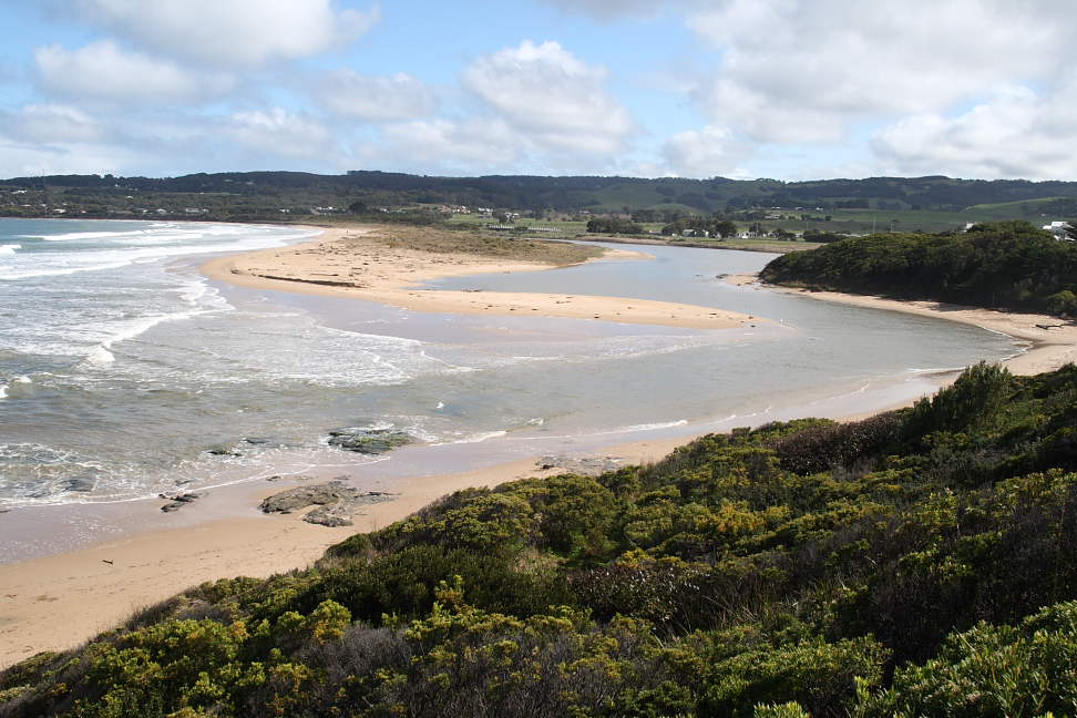
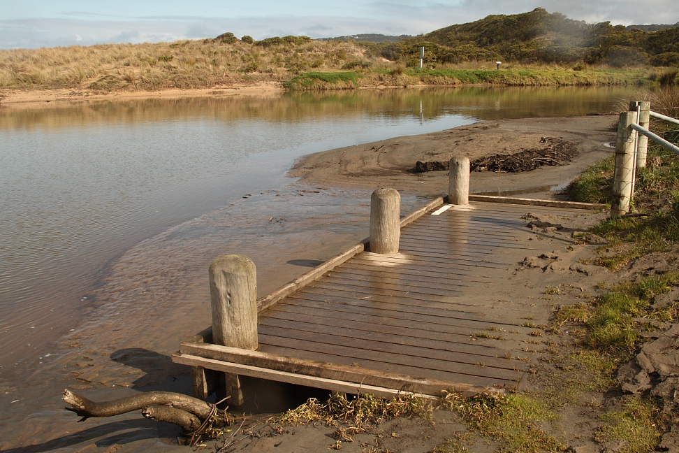
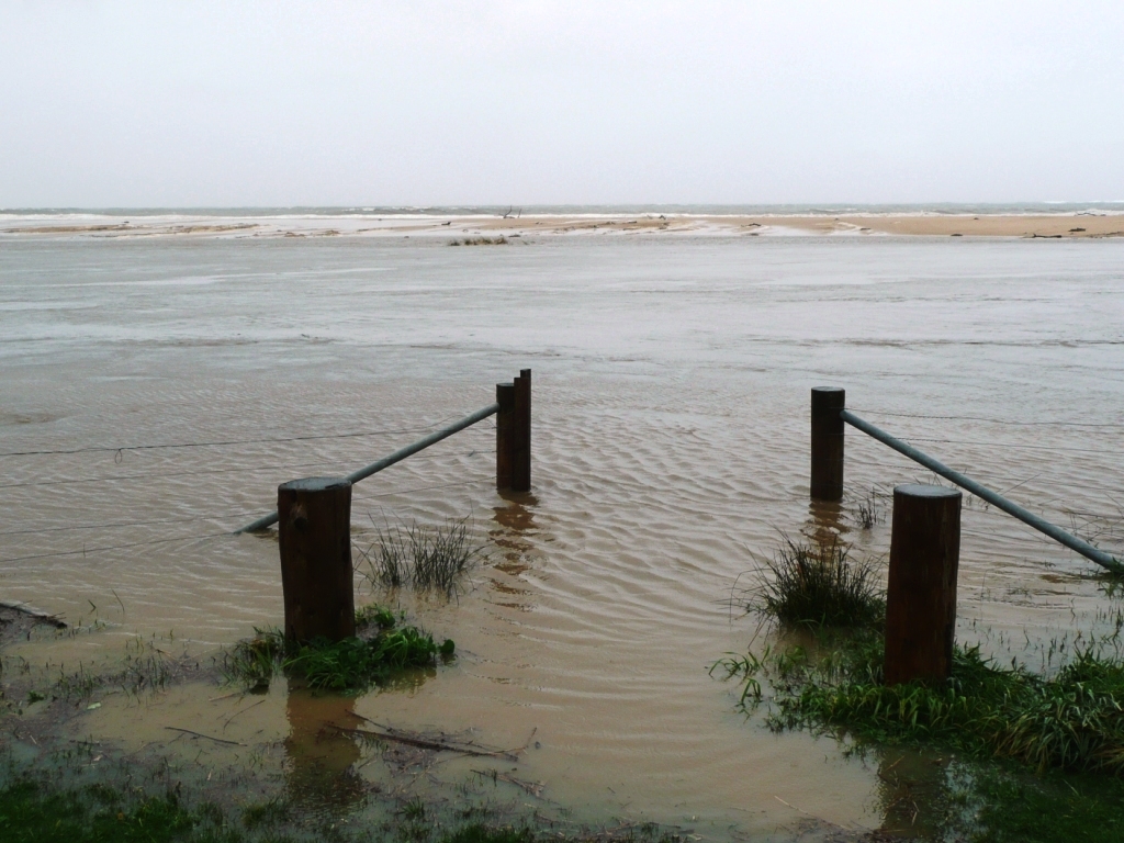
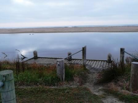
Weather Event On the 13th Dec. there was a small flood on the Barham River. Photos 1 & 2 show the flood water meeting Medium to Large Swell at the River Mouth. The estuary water level is 1.6mAHD and the tide reading is 0.52mAHD Photo 3 is the fish platform with the floodwater peaking at 1.66mAHD. Photo 4 is the fish platform 3 days after the flood. The wooden platform is covered with river sediment. The estuary water level is 0.5mAHD. The river mouth has been scoured out by the flood down to the rock platform. Photo 5 is of the river mouth at 7pm on the 16/12/08. The lowest water level I have recorded for the Barham estuary is 0.363mAHD on the 23/12/08. Prior to the flood scouring out the river mouth: the river mouth was open, water out and the estuary water level at .843mAHD. Phil Lawson |
|
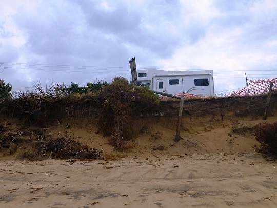
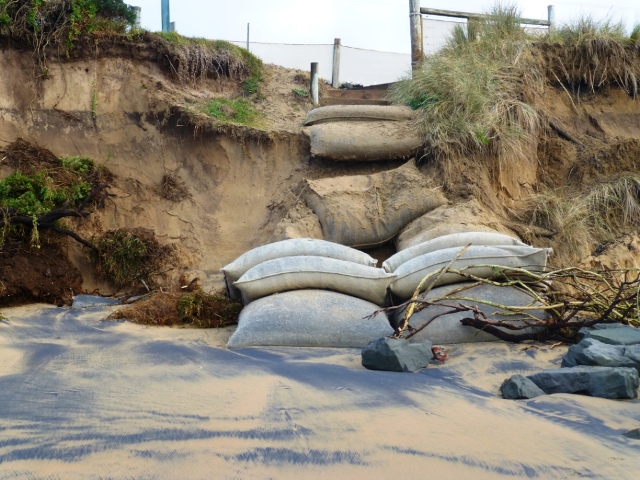
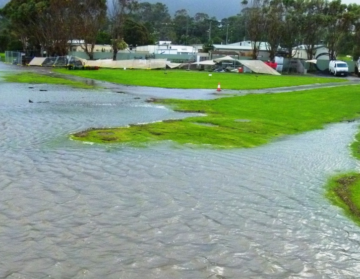
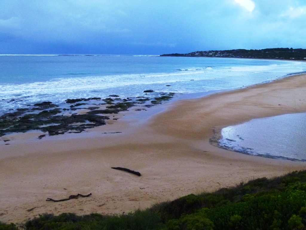
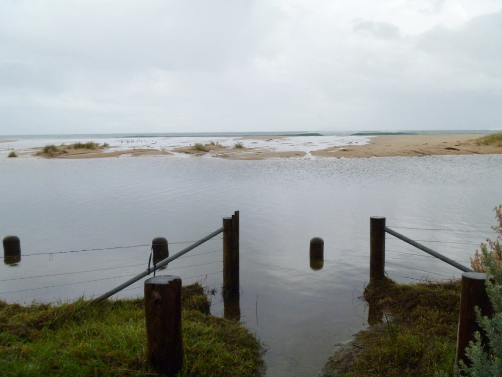
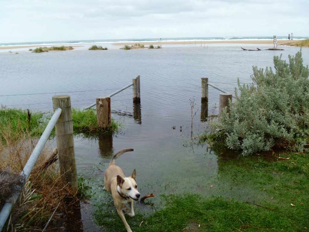
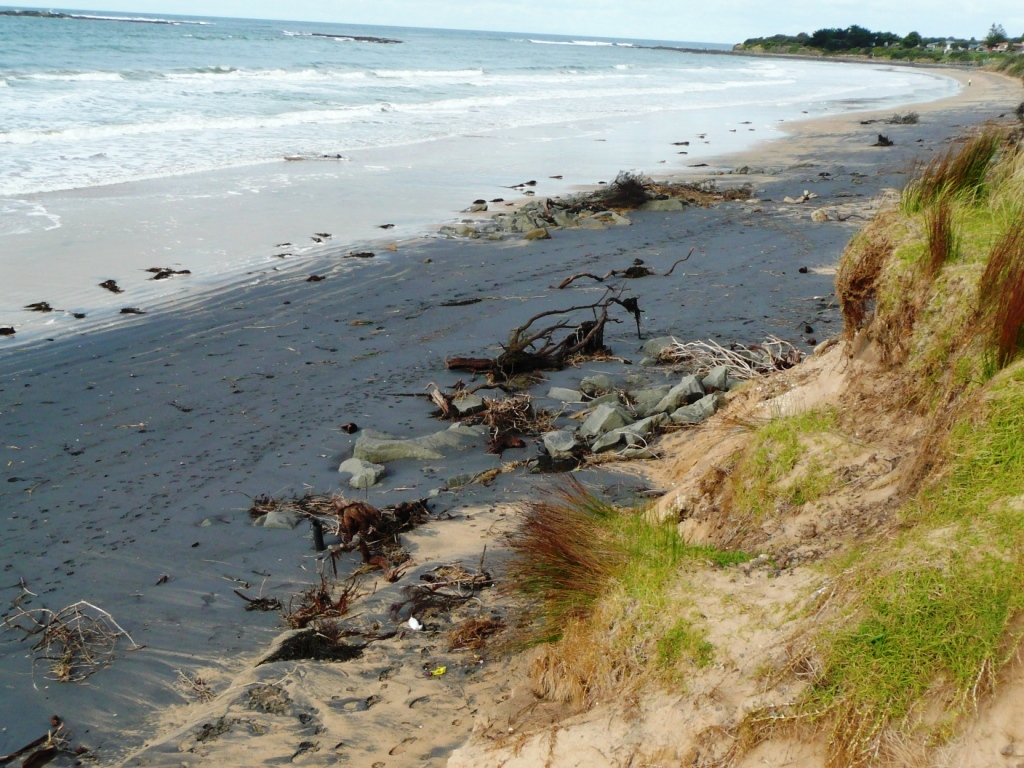
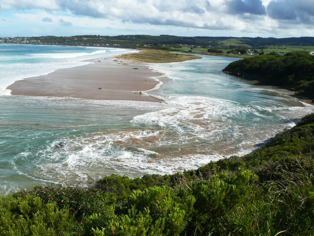
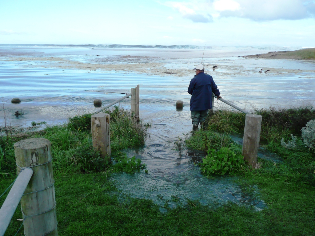
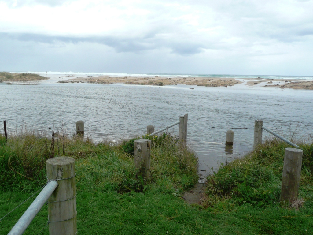
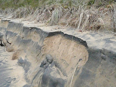
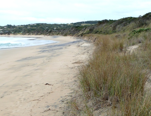
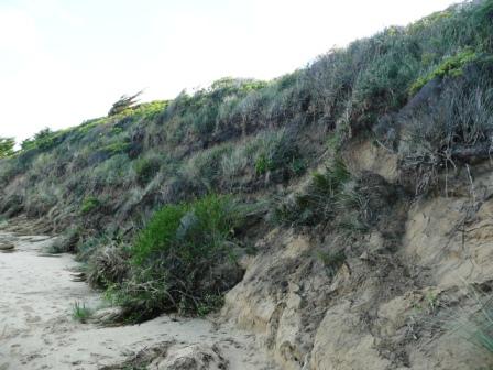
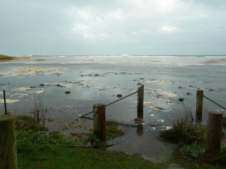
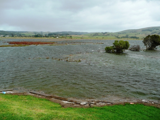
![Past dune erosion has been most severe at the car park beach access [Near Pole 2] and sandbags were installed as a result. The sandbags are proving a success in protecting the dune at this point and keeping the access open.](https://www.estuarywatch.org.au/documents/ccma_document_11510.jpg)

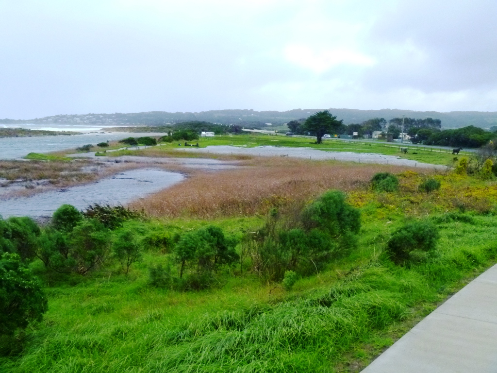

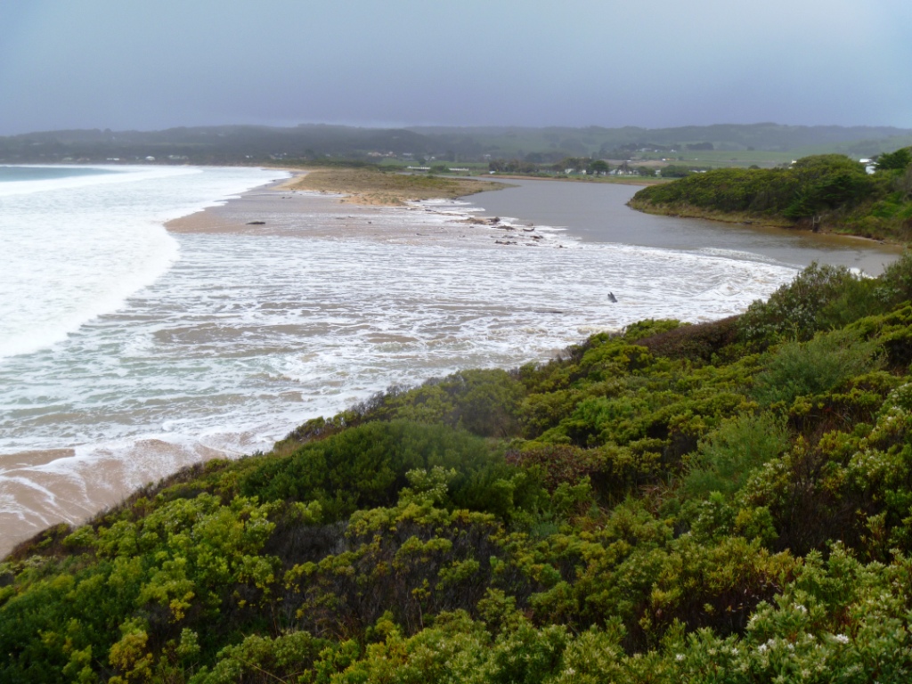
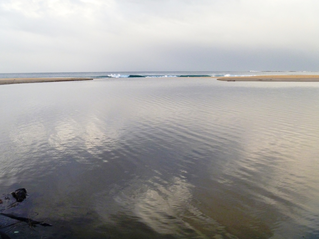
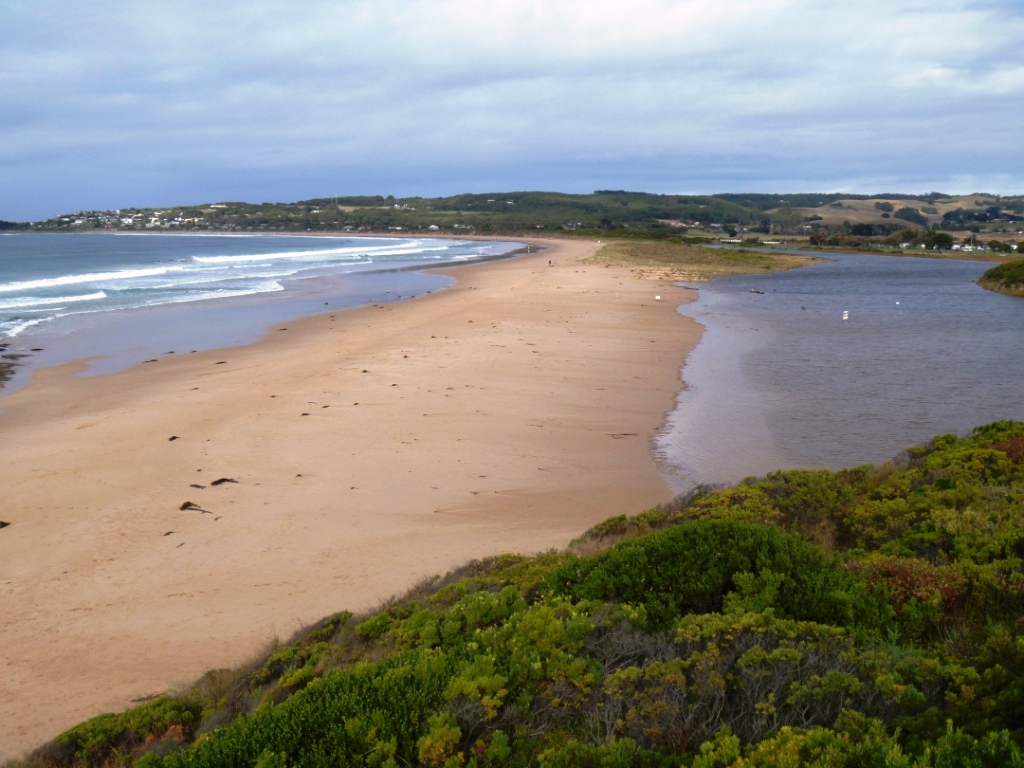
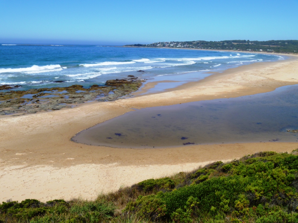
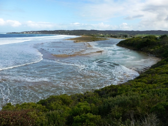
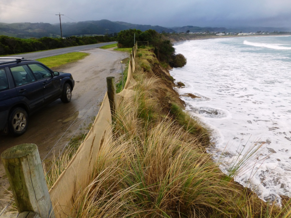
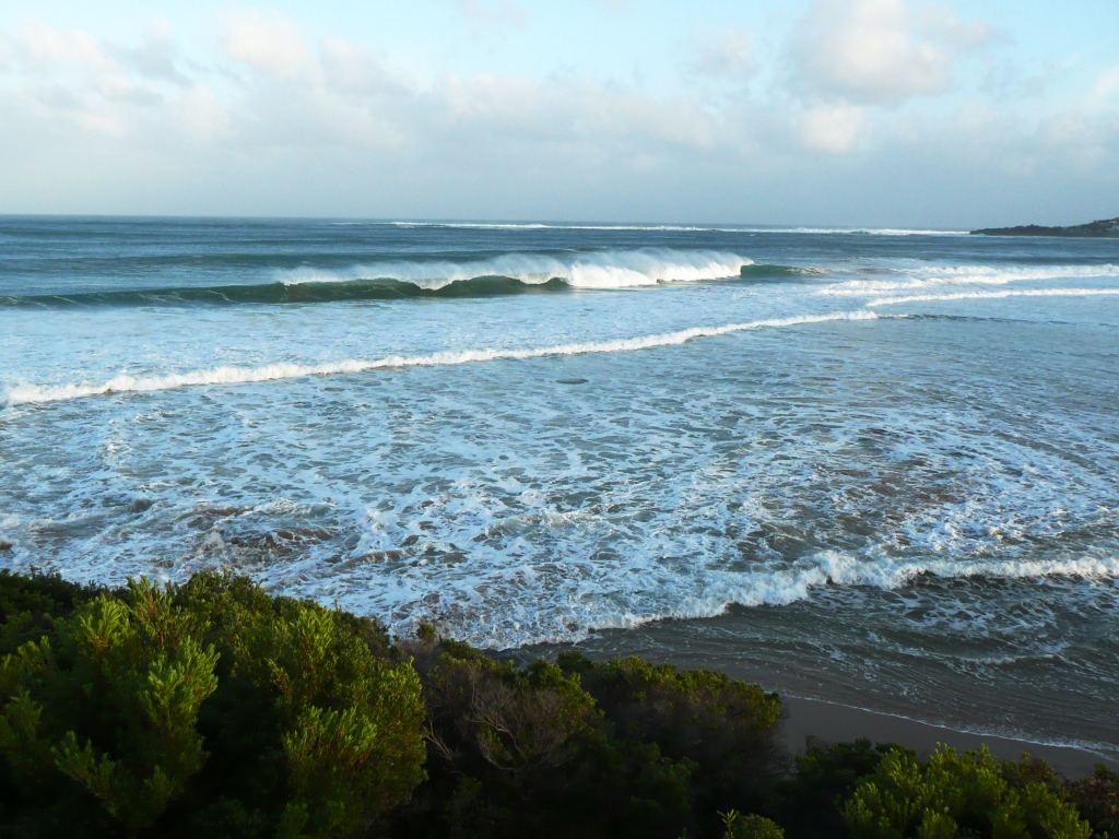
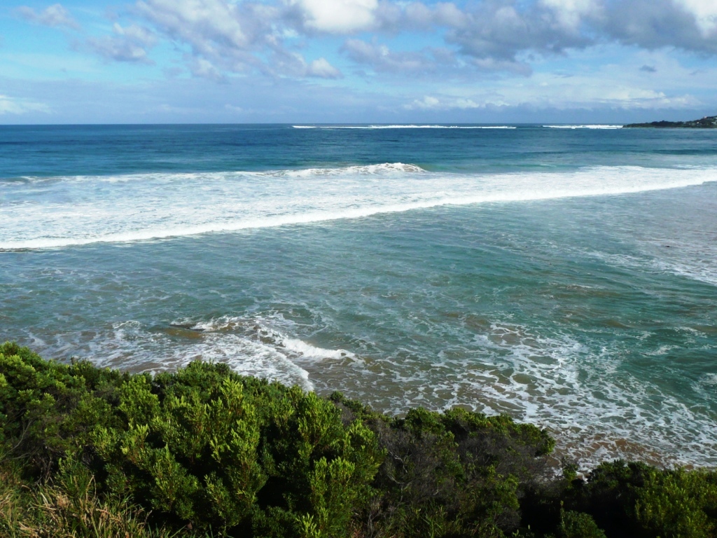
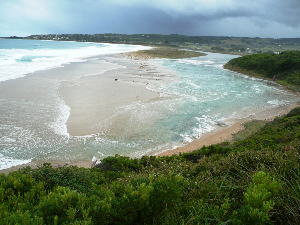
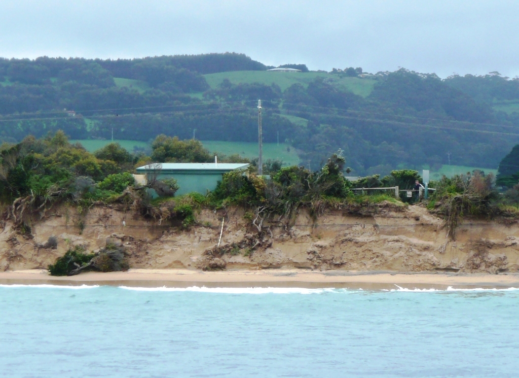
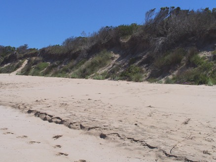
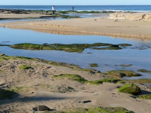
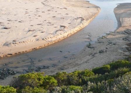
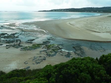
![The rock shelf that controls the minimum estuary water height is directly below BmP1 [right hand side of photo]](https://www.estuarywatch.org.au/documents/ccma_document_7809.jpg)
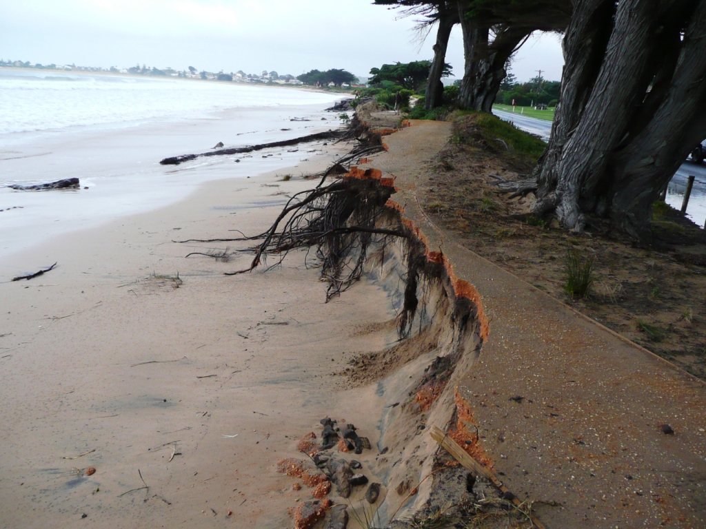
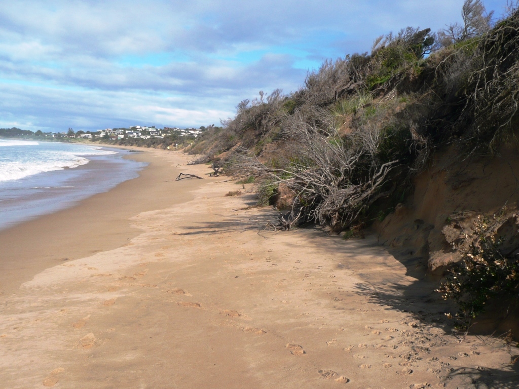

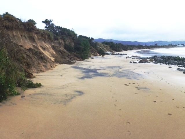
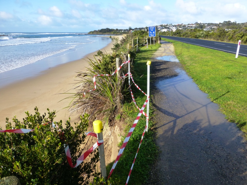
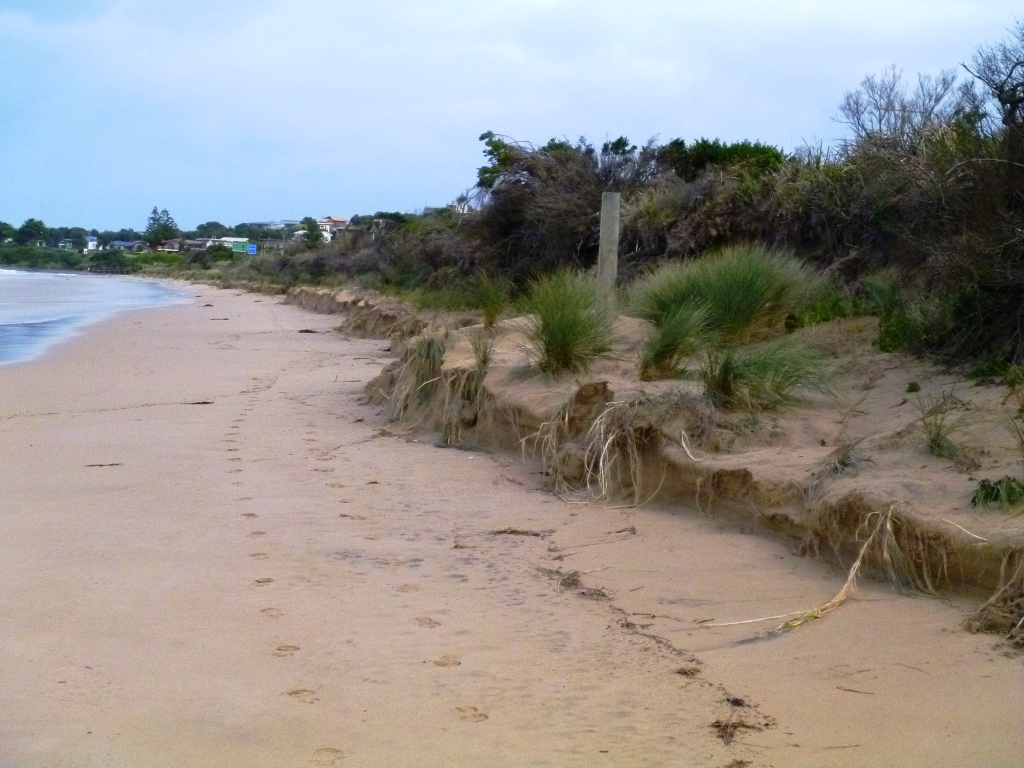
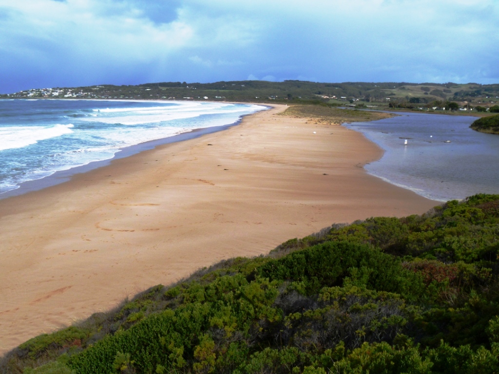
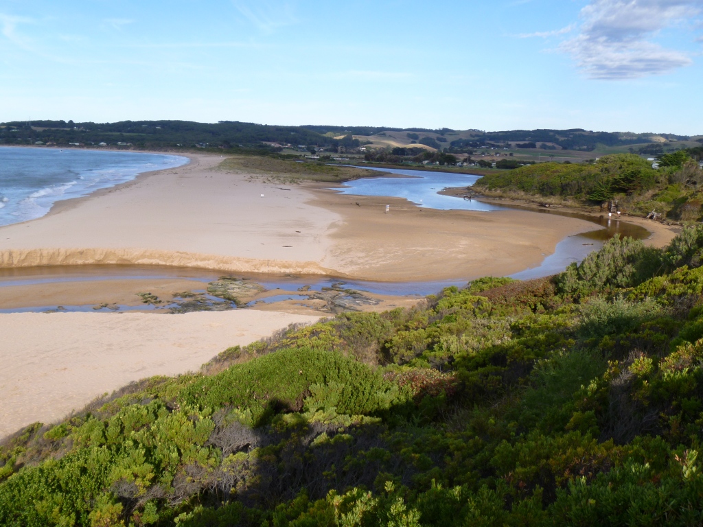
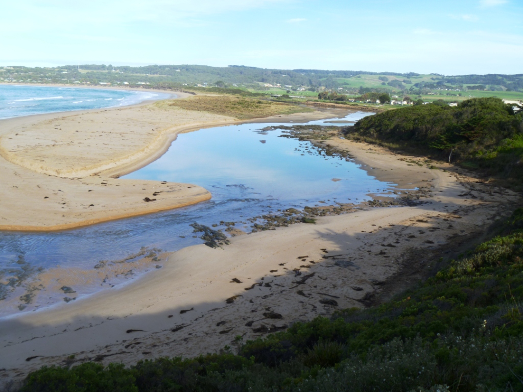
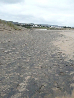
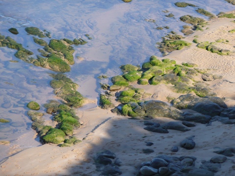
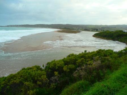
![Same location as photo No 2 [photo taken at distance]. Beach height much lower and seam of ilmenite exposed on beach.](https://www.estuarywatch.org.au/documents/ccma_document_2742.jpg)


All content, files, data and images provided by the EstuaryWatch Data Portal and Gallery are subject to a Creative Commons Attribution License
Content is made available to be used in any way, and should always attribute EstuaryWatch and www.estuarywatch.org.au