EstuaryWatch Data Portal
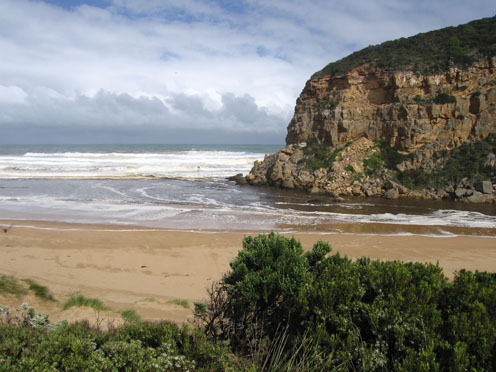
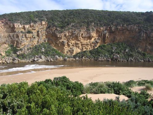
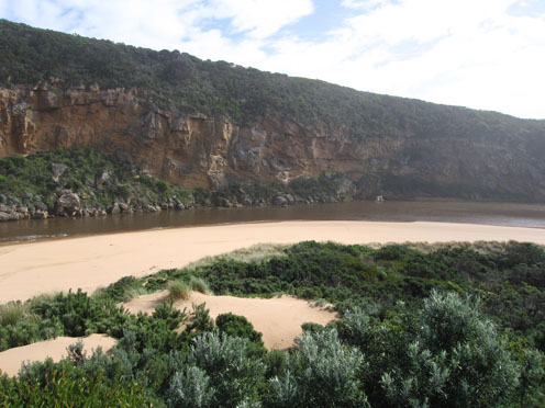
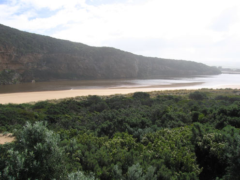
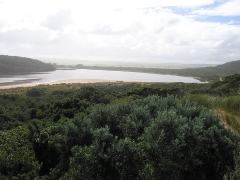
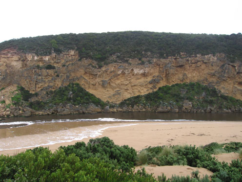
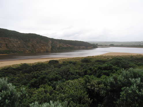
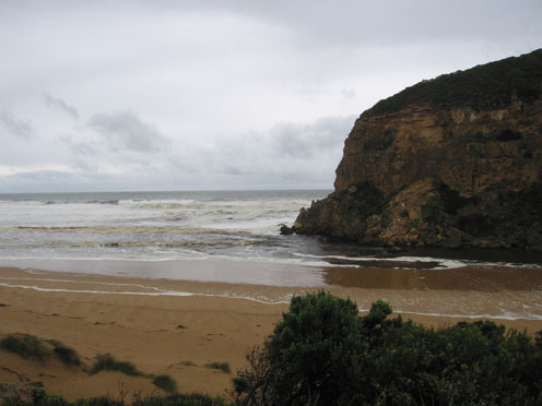
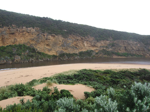
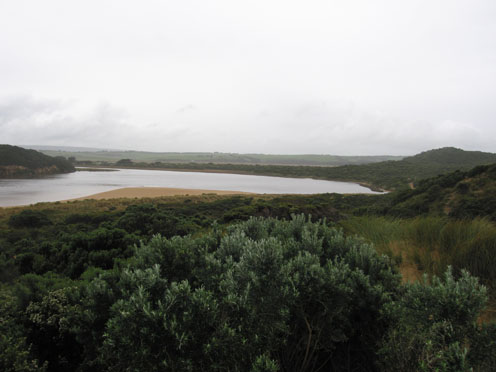
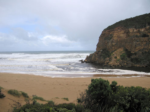
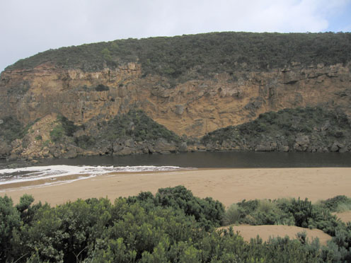
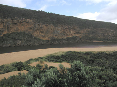
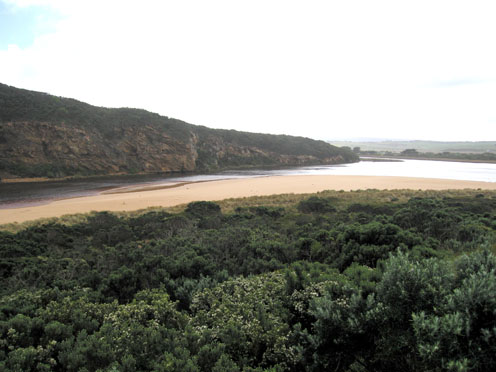
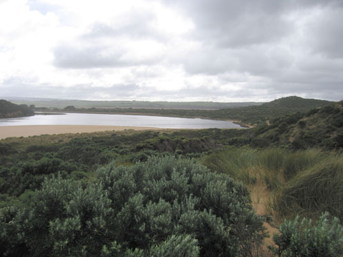
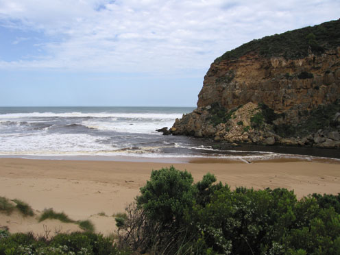
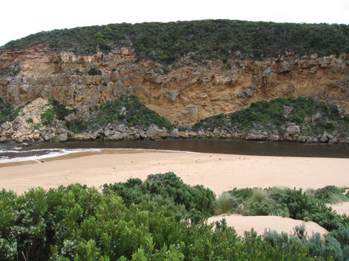
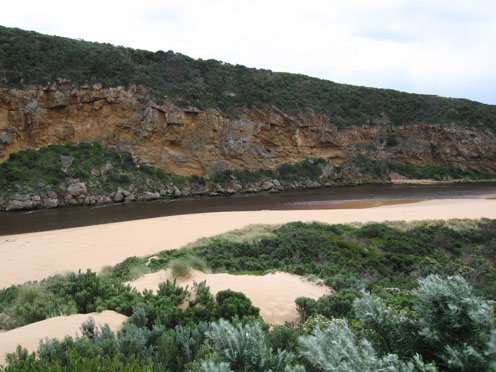
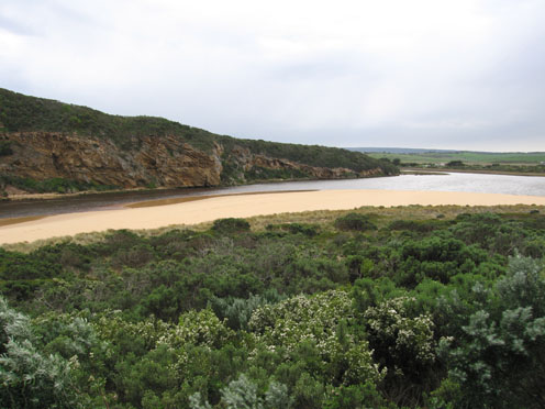
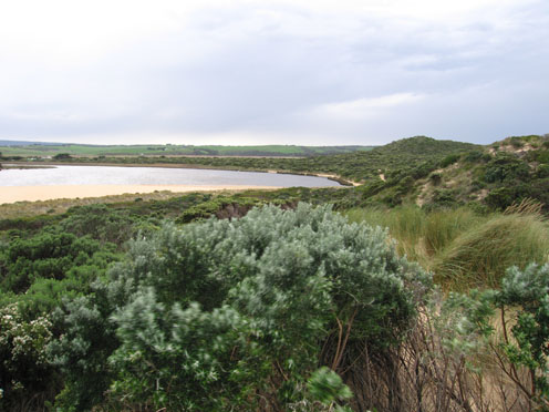
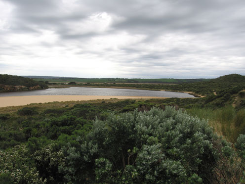
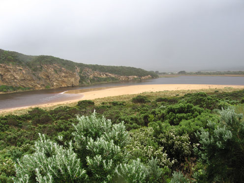
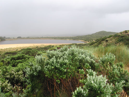
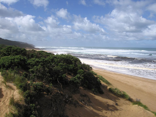
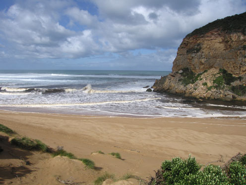
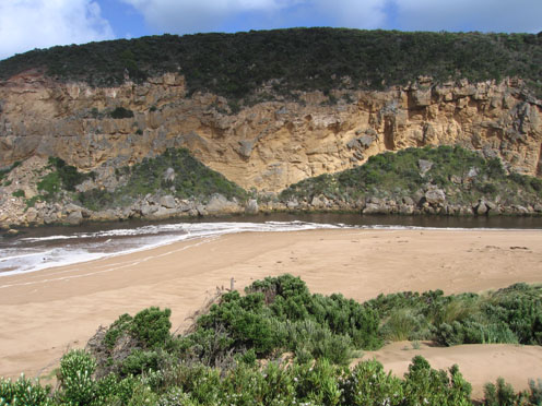
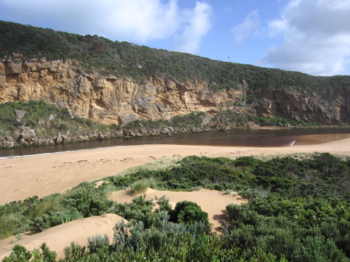
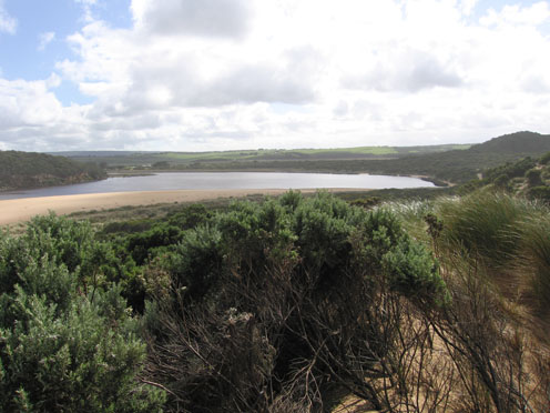
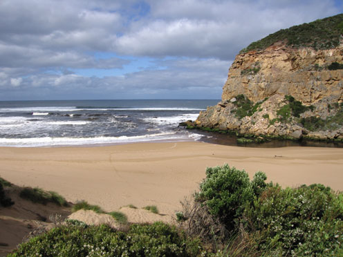
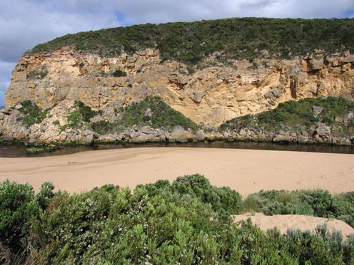
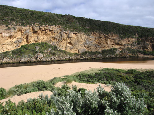
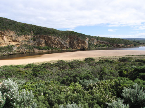
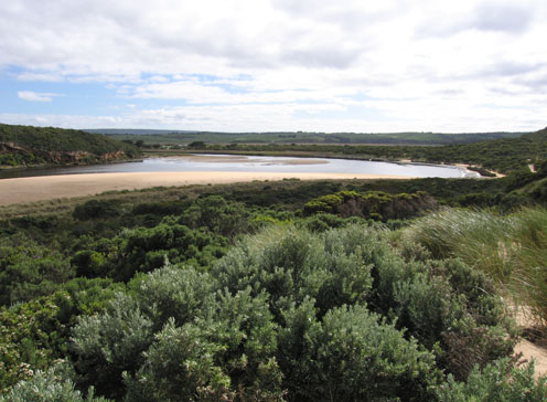
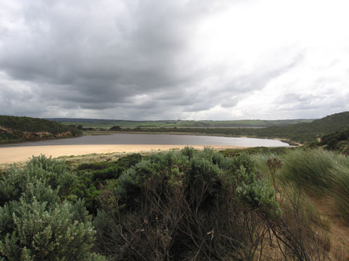
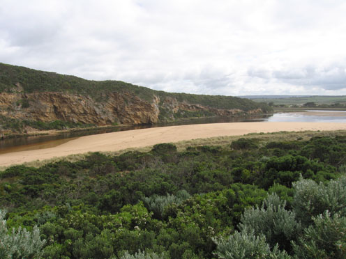
GMC Gellibrand River Estuary Mouth Observation Site
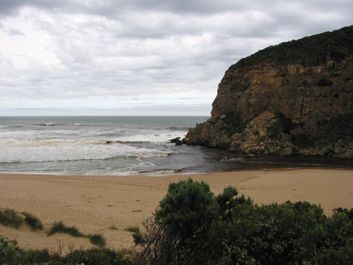
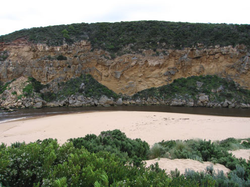
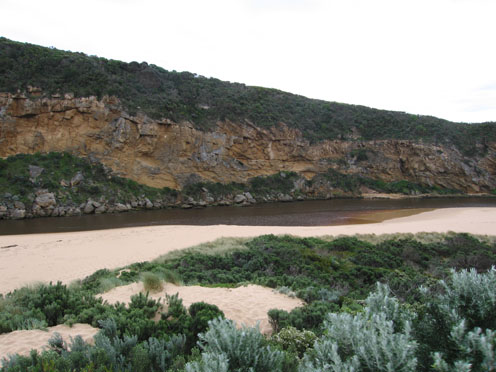
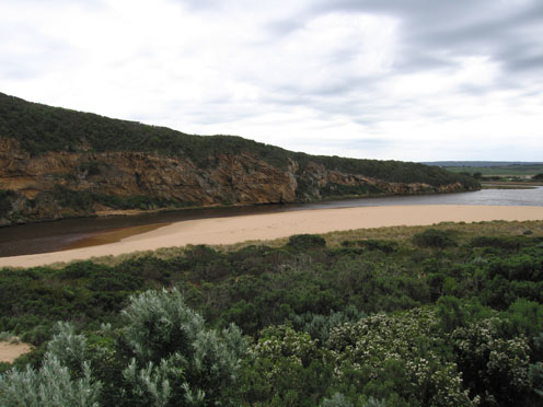
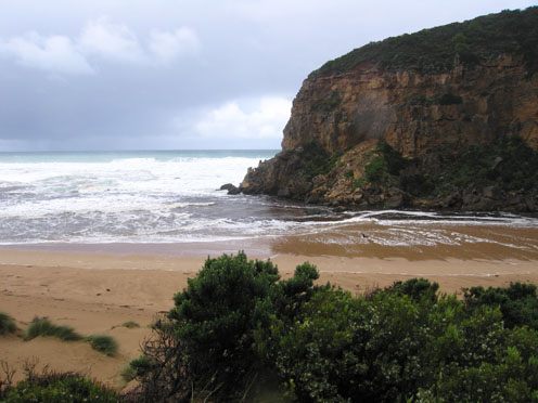
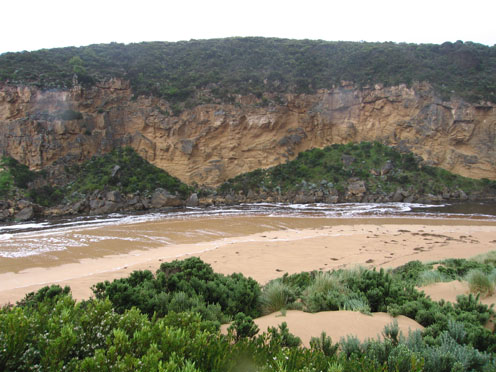
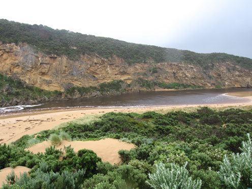
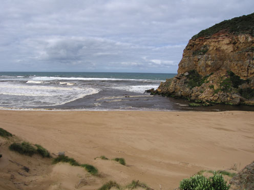
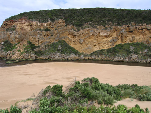
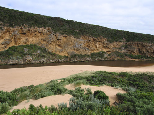
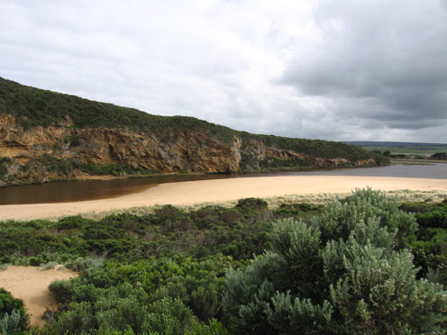
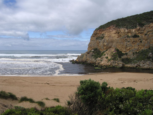
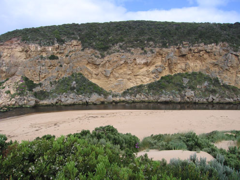
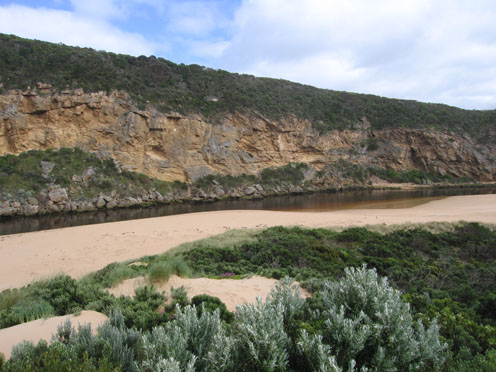
Active Mouth Condition 20-04-2007 - 19-04-2024Gellibrand River Estuary
770 results found (Displaying 131 - 140)
| ID | Date | Status | Details | |
|---|---|---|---|---|
| #2407 | 28 Aug 2009 | Approved |
Notes:
1.very strong outflow. Brown discharge seems to be going out to sea south and possibly s/w as well as along shoreline.Difficult to tell because of foam and white water. 2.Occasional wave along east side of channel into estuary 3.More sand along channel exposed, beach - gradual slope back to ocean.Rocks exposed at east end of beach 4.Water circling at entrance. 5.Huge amount of rubbish along s/e side of estuary(including a lot of plastic) 6.Some large thin fish (15cm.) in reeds e.side of estuary. Water very dirty -Dark redish brown.Turbidity between 50-60 at that area 7.Serious flooding upstream G4. No water over road between Kangaroobie and GOR. 8.AHD G6 - 3.62 at 15:15 |
|
| #2421 | 29 Aug 2009 | Approved |
Notes:
1.Very strong outflow of dark brown water to s, s.w and e. Difficult to estimate because of foam & white water 2.Rocks at east end beach exposed, sand along beach graduslly sloping back to ocean.Waves carrying a lot of sand 3.Waves in all directions at mouth with stronger longshore drift today. Whirlpool on east side of rocks,occasional small wave down east side of channel into estuary 4.Sand build up east side of mouth may be reducing 5.Water receeding - low track can be used, lot of debris high in the dunes surrounding the estuary 6. 1 Tern on s. side of estuary. 7.No water over O.O.R. between kangaroobie and G.O.R. but greatly increased water levels above G4. where the water is flowing between the bearer and deck of bridge |
|
| #2461 | 5 Sep 2009 | Approved |
Notes:
1.Strong very dark brown flow out. Occasional small wave enterind down east side of channel into estuary 2.Dark discharge around mouth and along beach to east, some to south (about 100m. out) and s/w. 3.Beach gradually sloping back to ocean. Longshore drift bringing sand back into channel 4.Large area of foam moving back & forth upstream of rocks. 5.Sand cliff 1.m along east side of channel near tunnel 6.Waves & foam s side of estuary 7.Fox prints & scrapes. 7 comorants, 2 black duck 8.Estuary is flooded upstream from G4.Water flowing between bearer and deck.(G4.) AHD.G6-3.43 |
|
| #2485 | 12 Sep 2009 | Approved |
Notes:
1. Strong dark out flow - east along the beach and also s. & s/w. Dark water out to aprox. 40m., difficult to estimate because of foam. Waves in all directions around mouth. 2. Sand seems to be building up slightly upstream and left of rocks.Circular current in that area, also longshore drift. Waves covering most of beach- lots of rubbish incl. plastic 3.Occasional small wave e.side of channel into estuary 4. Sand projection into estuary extends past 'small rock'. 5.Very strong n. wind driving waves (15 to 30cm.) onto sand at s. side of estuary, foam trails from n. to s.. Sand 'cliffs' opp. tunnel larger. 6.1 Grebe - s.e estuary |
|
| #2503 | 19 Sep 2009 | Approved |
Notes:
1.Strong out- flow of dirty dark brown water mainly around the mouth and to south and S/W. not much visiable to east. 2.Occasional wave down eastside of channel -some travelling almost to north bank of estuary 3. More sand deposited at east end of beach. Mid beach reduced-water closer to dunes. (Beach 'horse shoe' shaped) 4. 31 ml rain Princetown and G6 during week -water levels up stream have risen. |
|
| #2545 | 26 Sep 2009 | Approved |
Notes:
1.Strong out flow of dark water to east & south. Some waves entering estuary down east side of channel and travelling down estuary to opp. camping ground, then much reduced are continuing on to G2. 2.Waves reaching base of dunes on beach (evidence of higher water at high tide). Large sand build up at eastern end of beach. Sand visiable in sea all along coast (recent rock falls west of river) 3.Channel upstream of rocks is reduced. Longshore drift and whirlpool activity visiable 4.Large waves in all directions at mouth |
|
| #2603 | 3 Oct 2009 | Approved |
Notes:
1.Strong dark & dirty out flow to east, stopped by sand build up projecting into sea at east end of beach. Discharge going south and S/W in front of cliffs. Some waves entering estuary along east side of channel 2.Mid beach carved out, water up to dunes.Brown scum mark high on beach. 3. More sand forming around entrance, large build up behind rocks, height of sand between channel and dunes much reduced. |
|
| #2624 | 10 Oct 2009 | Approved |
Notes:
1.Strong out flow - dark discharge around mouth & to west, dark water not visiable to east or south 2.Beach 'horseshoe' shape with increased sand projection out to sea at east end 3.Waves have been nearly to foot of dunes -mid beach. Sand build up east side of mouth, increasing with longshore drift 4.Channel about 4-5m at entrance, rocks more exposed but sand building up directly infront (downstream). Water curving around rocks (3-4 m. wide) and through narrow channel near cliff. 5. Very low water level, gate on tunnel well out of the water and sand bars in estuary well exposed 6.AHD board numbers obscured by flood deposit- difficult to read. 7.D.S.T not added |
|
| #2663 | 17 Oct 2009 | Approved |
Notes:
1.Strong outflow of very dirty water going both east & west - along infront of cliffs west. Discharge east stops at end of beach & turns south for short distance.Dark water can be seen south (about 100m.) 2.Beach still 'horseshoe' shaped but small 'cliffs' building up in center 3.More sand build up from mouth to center of beach,water close to base of dunes but projection at east is rounding off. Evidence of longshore drift carrying sand into channel behind rocks. Channel has steep banks 4.Senecio elegans flowering in dunes and along cliff.Serious increase of infestation since last year 5.Dead sea bird at east end of beach |
|
| #2701 | 24 Oct 2009 | Approved |
Notes:
1. Dark discharge around mouth & slightly to east but main flow seems to be west infront of cliffs. The east flow seems to be stopped by the sand projection near east end of beach. This sand projection (beach) has increased but sea is much closer to dunes (beach) near mouth 2.Sand is building up into 'cliffs' on beach (1/3 from mouth) 3.Sand is visiable in waves out to sea up to70m. Sand is also being deposited into channel by longshore drift 4.Low tide has exposed a very large area of sand bars. Dead and rotting seagrass on eastern side of estuary is also exposed 5.Senecio elegans in full flower. Huge increase from last year. All through the dunes and along western cliff |
|


All content, files, data and images provided by the EstuaryWatch Data Portal and Gallery are subject to a Creative Commons Attribution License
Content is made available to be used in any way, and should always attribute EstuaryWatch and www.estuarywatch.org.au