| #10277
|
30 Apr 2016
|
Approved |
Notes:
- Observations made near low tide
- Berm increased in length. More sand at ocean exposed & more build up out to sea
- Some waves have topped the berm but not gone far up the beach
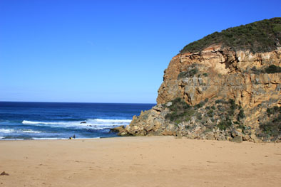
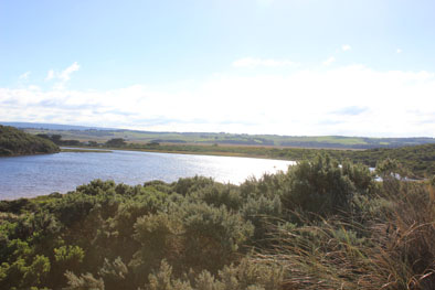
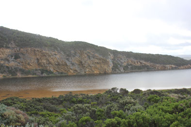
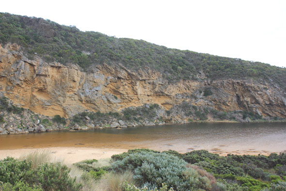
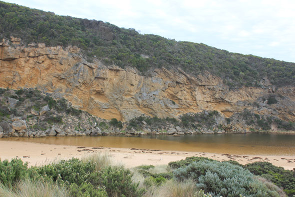
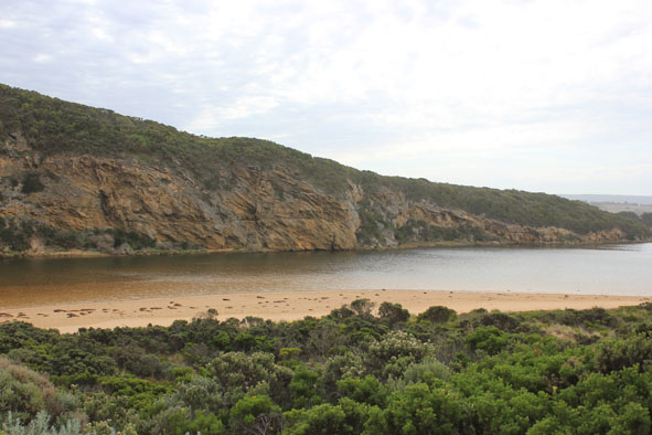
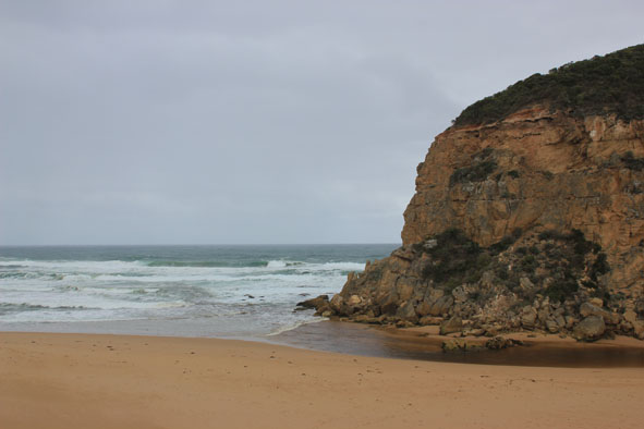
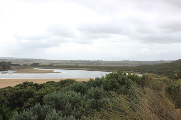
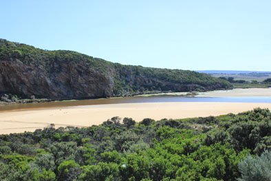
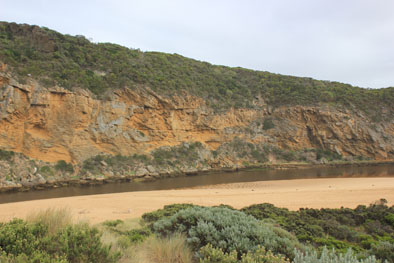
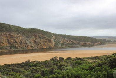
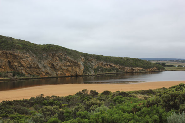
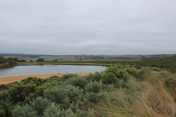
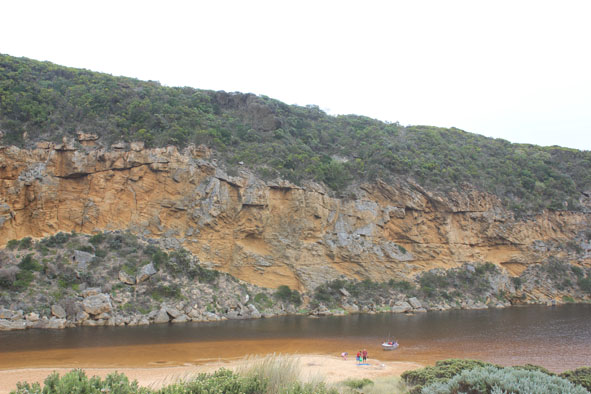
- Beach, wide & curved. At east end, sand projection extending out to sea creating 2nd smaller bay
- WSW swell impacting strongly at east end with longshore drift travelling to projection but not much beyond that area
- Sand build up along berm higher near mouth, reducing in height as it nears western cliff
- Large amount of sand in waves in sea near mouth
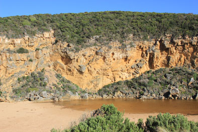
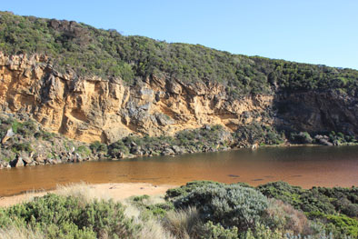
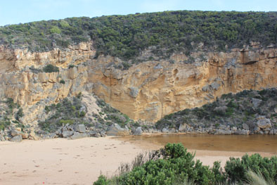
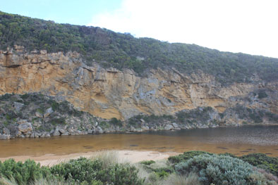
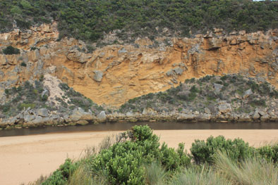
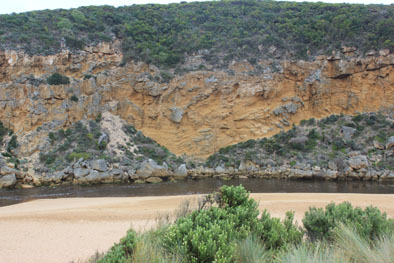
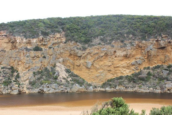
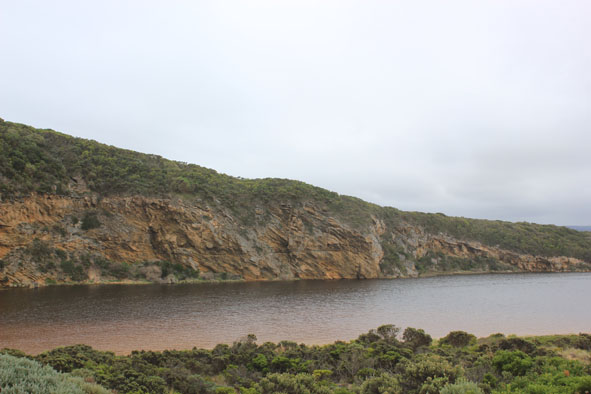
- More erosion along southern end of cliff
- Peregrine falcon along cliff
- Top track has more water cover & water is over the low track up to ocean car park
- Run off in camp ground but no water over OCR. Water only along side of OOR at flood markers
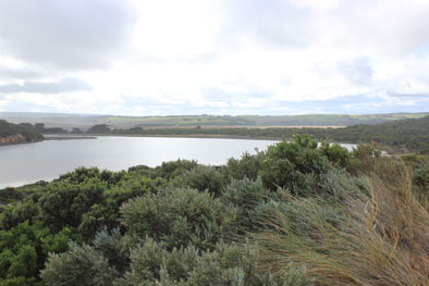
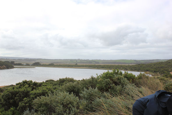
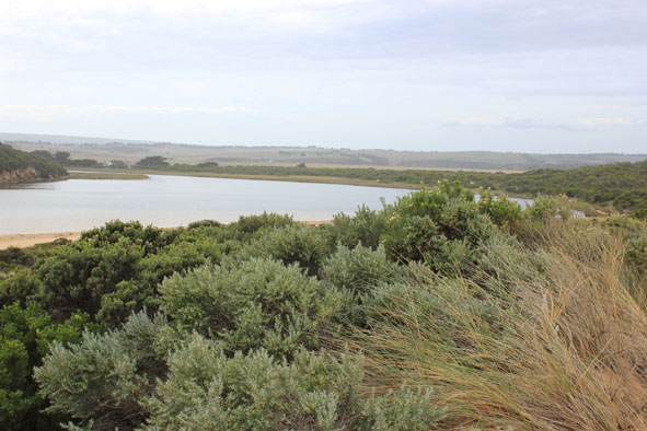
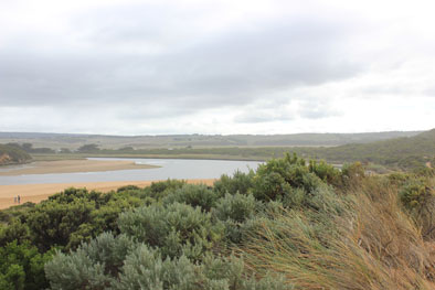
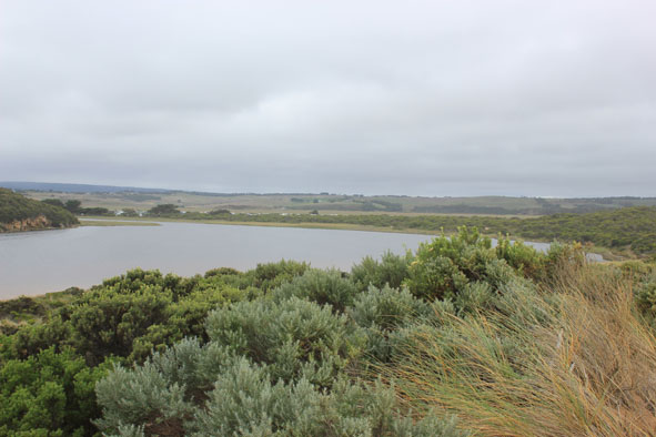
- Princetown wetlands flooded up to G4
- Very large number of water birds in flood waters
- Many o/s tourists photographing birds on wetlands north of Township
- Hooded plover(3) sighted on Rivernook beach
- N wind strengthening throughout monitoring
|
| #10260
|
23 Apr 2016
|
Approved |
Notes:
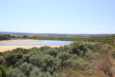
- Mouth closed, some occasional waves from rough sea travelling about 20m. over the berm near the cliff face but not reaching the estuary
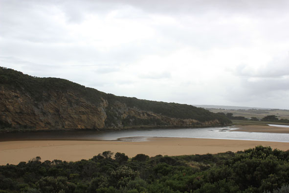
- Length of berm greatly reduced but large area of sand under very shallow water extends from channel into a large area of the estuary
- Waves from south directly impacting area near cliff
- Beach front has straightened out
- Large amount of sand visible in breakers out to sea, especially near western part of beach
- Water starting to come onto low area of top track, none on OCR & only in small areas near the flood markers on OOR (road has recently been reformed)
- Flats flooded from Princetown to G4. Also further upstream on south side only. Some water in all drains from recent run off
- Berm length 34.2m.
|
| #10250
|
16 Apr 2016
|
Approved |
Notes:
- Mouth barred -no flow
- Low track under water, small fish noted
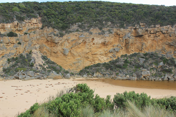
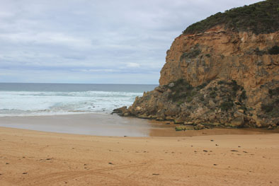
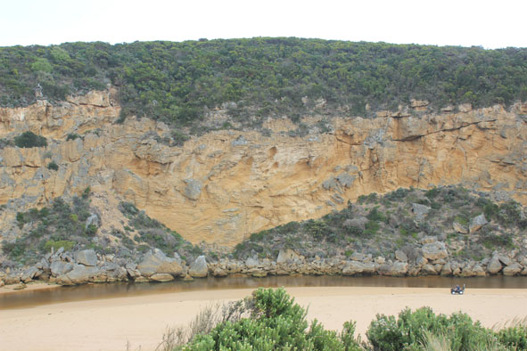
- Sand cliff forming to east on Ocean beach
- Seaweed clumps near mouth & around into the estuary
- Sub surface sand at end of channel extending toward tunnel
- Berm length 84.2m
|
| #10236
|
5 Apr 2016
|
Approved |
Notes:
- Mouth closed between 03/4/16 & 04/04/16. very shallow before that but waves from rough sea going over berm into estuary. Waves over at last hi tide 05/04/16
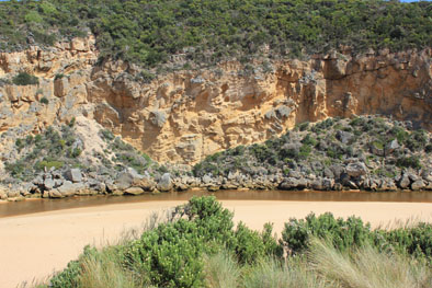
- Very long bar 82.5 m. but starting just around rocks and extending further into the estuary -channel completely filled in
- Berm not high, gradually slopping to ocean. Current swash line around rocks but some waves going further toward estuary
- Extremely large amount of seaweed along ocean beach, continuing around into the estuary & along low track. Also large clumps in water
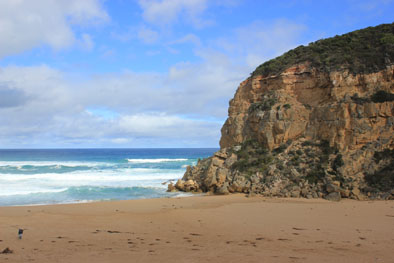
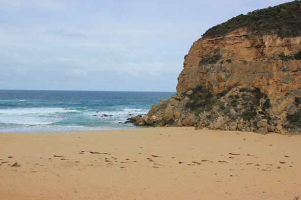
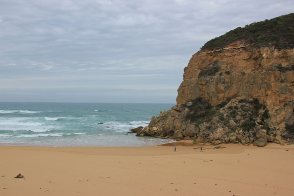
- Ocean beach -horseshoe in shape with highest area about 1/3rd from west cliff
- Red scum/algae along waterline south side of estuary(blown by N wind)
|
| #10230
|
29 Mar 2016
|
Pending |
Notes:
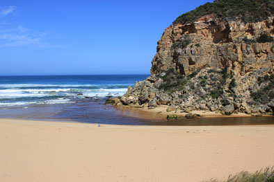
- Narrow shallow flow along channel, between rocks & out over high sand build up. Channel very shallow from start (close to tunnel)
- Sheer 0.40m. side to channel close to rocks
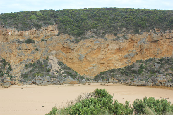
- Previous high area of beach front east of outflow has been greatly reduced by waves from rough seas
- Waves have been high up to sand dunes on beach and around into estuary. Seaweed clumps all along beach and estuary extending along low track to near car park
- Sea rough, sand visible in breakers out from mouth.
- Strong longshore drift crossing over outflow & meeting SW swell resulting in waves in all directions in front of rocks
- Dark swash line along beach intensifying at east end.
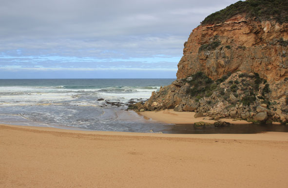
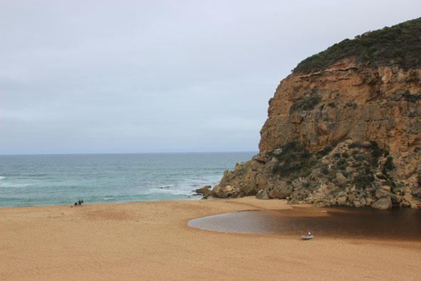
- Low tide, possible to walk around to 2nd. beach(east) where large areas of cliff erosion & areas of deeply scoured sand have occurred. 2 Hooded Plovers in this area feeding along swash line
- 16 Silver gulls, 6 Terns on Princetown beach also 2 Pelicans on sand bar in estuary
|
| #10222
|
19 Mar 2016
|
Approved |
Notes:
- large amount of sand filling in the entrance from rough seas and strong wind.
- longshore drift travelling west across outflow being met by strong south west swell.
- some waves entering channel.
- pale discharge around mouth, practically obscured by waves.
- large amount of sand in breakers out to sea.
- beach sand cliff (small) at centre, rocks at east end exposed.
- sand bar and low track well exposed.
- some areas of exposed seagrass bleaching.
- brown algae scum on sand area on low track.
- iridescent algae left in water depression areas.
- large number of cabbage butterflies on sea kale at start of the low track.
- man small fish on the S/E section of estuary.
|
| #10220
|
16 Mar 2016
|
Approved |
Notes:
- discharge from the estuary was a pale colour.
- water levels in estuary are extremely low.
- large areas of seagrass are exposed.
- increase in seagrass distribution along the side of the lower track and in front of the fishing platform.
- about seven large dead fish in water from G2 to the mouth.
- small pipi shells stranded on drying seagrass.
- large no. of dead and dying small fish in depression with remaining water along the low track. Identified as gudgeons, tupong, galaxias and estuary perch.
|
| #10217
|
14 Mar 2016
|
Approved |
Notes:
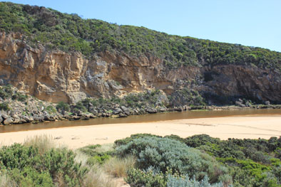
- Steep sides of channel near mouth reduced in height (not ones near ocean)
- Sea rough, waves s/w swell with rip east of mouth meeting strong out flow all of which is being crossed by longshore drift ¿waves in all directions with some entering & traveling up channel.
- Sand bar well exposed with green algae on edges , especially on west side
- Seagrass well exposed along east side has recovered from exposure to drying out & new growth evident.
- Unfortunately many shrimp etc. and small fish have been stranded in this area.
- Further south near an isolated patch of Phragmities there is an extremely large fish kill of small fish- mainly Estuary Perch, flat head etc.
- Also at fishing area on river bank south of camp ground & around auto monitoring station many small shrimp are stranded.
|
| #10214
|
13 Mar 2016
|
Approved |
Notes:
- estuary mouth very wide.
- large amount of foam and sand in the sea and along the beach.
- some longshore drift across the mouth meeting south west swell.
- some waves entering and going upstream.
- many small fish stranded in pools now cut off from flow (estuary perch, flounder, flat head, mullet about 2-4cm)
- thousands of small fish in water and larger schools of tommy rough.
|
| #10211
|
12 Mar 2016
|
Approved |
Notes:
- estuary artificially opened at 13:00
- swash high up on beach.
- river very dark.
- more sand pushed into estuary around rocks.
- foam and algae removed by waves over berm during past few days.
- waves creating curved scoured area on the ocean side of the berm.
- excavation channel started at east side of estuary and curved toward the west. The channel is wide and shallow.
- flow after opening was steady. By 16:40 waves were travelling upstream.
- extremely large number of fish in shallow water near the start of the excavation channel.
|