| #9701
|
9 Jul 2015
|
Approved |
Notes:
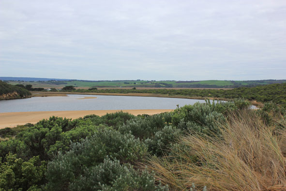
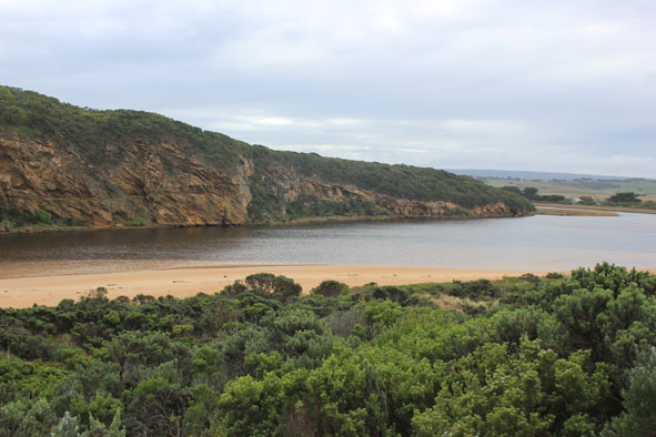
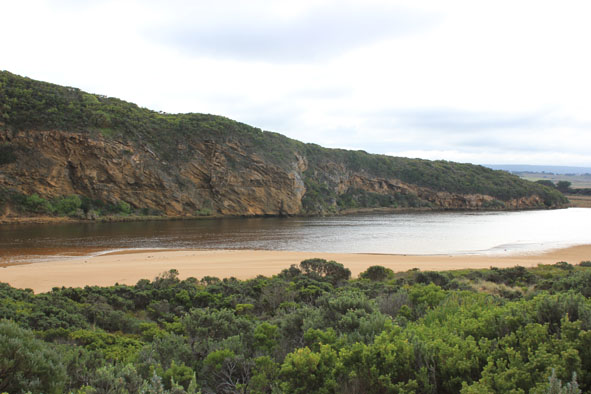
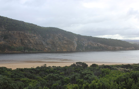
- Dark discharge out around mouth with thin line along foreshore to east
- Steep curved side to channel near rocks (.70m) indicating recent release
- Strong longshore drift to mouth & reduced impact of swell at east end of beach. Now the front of the projection at mid beach has become steep fronted while the rest of the beach has gradual slope
- Sand bar & low track well exposed
|
| #9698
|
4 Jul 2015
|
Pending |
Notes:
- Salt water entering, rough sea with strong longshore drift across mouth over increasing sand build up around rocks & in channel
- East end of ocean beach- increased erosion of dunes, debris washing up over high sand build up mid beach & travelling west to mouth
- Small particles of pumice in swash line near mouth
|
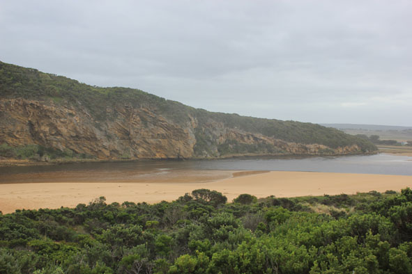
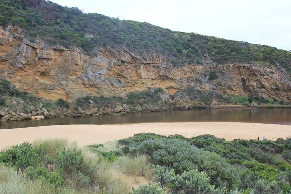
| #9697
|
28 Jun 2015
|
Pending |
Notes:
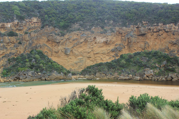
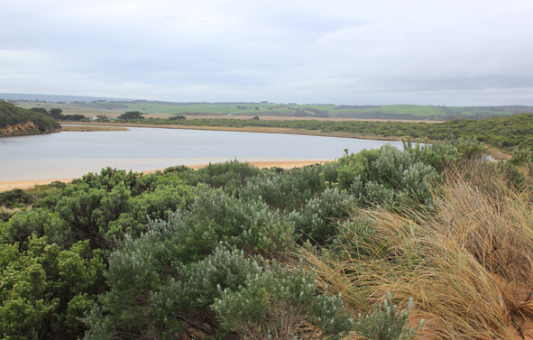
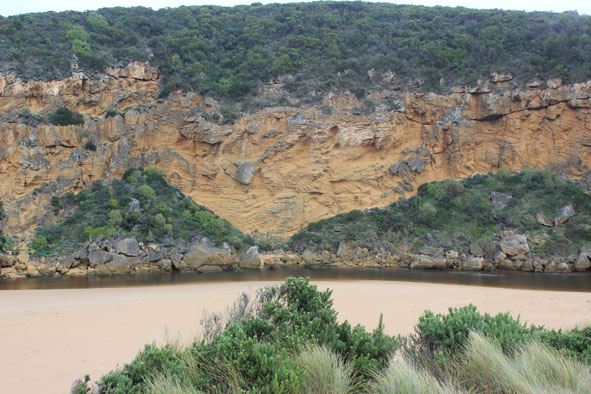
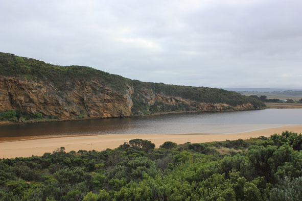
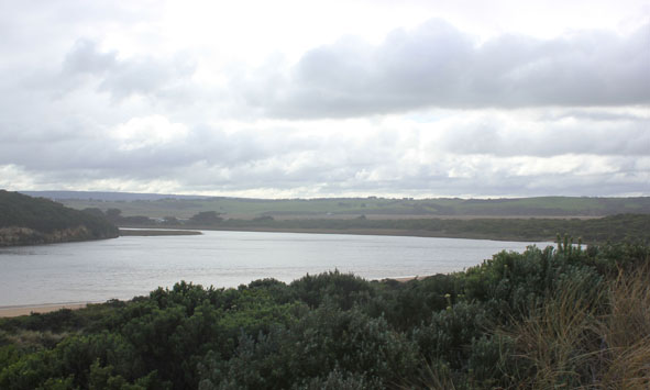
- Flow out through very narrow shallow channel against cliff over large sand build up
- Previous sheer sides to channel have been smoothed out by waves from longshore drift travelling along beach, across mouth & entering channel over wide area
- Beach very much higher just east of mouth with sand extending out to sea at mid beach
- East end continues to scour out & is much lower
- Waves in all directions along beach with much sand visible in breakers, especially at mid beach
|
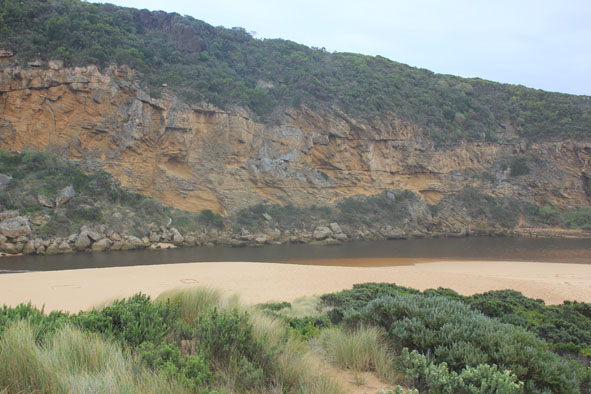
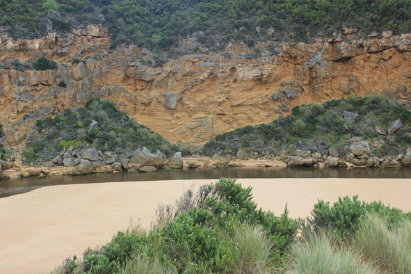
| #9686
|
20 Jun 2015
|
Approved |
Notes:
- Flow was out at start of monitoring but salt water (green)had reached tunnel entrance & flow upstream at G2 was noted at 12:10
- Water level very low at start, seagrass/sandbar exposed & steep side(1m.+) along channel to mouth
- High sand build up around mouth, higher & projecting out to sea slightly further east
- Beach very wide.
- Waves in all directions along whole of beachfront, strong longshore drift across mouth.
- Salt water entering & sending high wave 'clusters' up channel in front of salt/fresh divide
- Large amount of sand visible in turbulent water around rocks
|
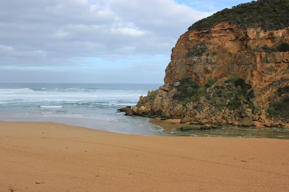
| #9668
|
12 Jun 2015
|
Approved |
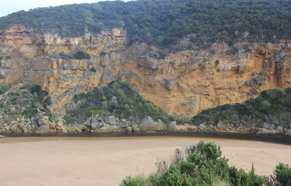
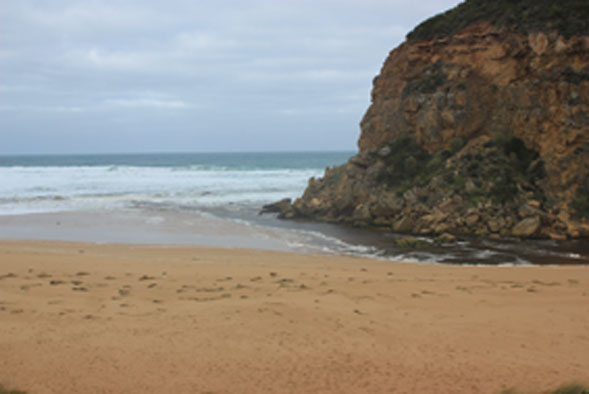
Notes:
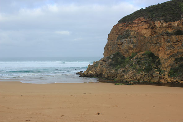
- Flowing out after natural opening (mouth barred 11/06/15 after hi to very rough seas)
- Some darker discharge around mouth & toward east
- Mouth wide but flowing down over very shallow area in front of rocks
- Channel narrow/shallow with sheer sides
- Many small close waves going upstream against the outflow (usually observed at times of very recent opening)
- Large amount of sand in water & out to sea
- Longshore drift active
- Small active flathead in swash line returned to water successfully
- Red Necked Avocet on ocean beach
- Water over low track & area near car park but only to edge of top track
- Water to edge of OOR (road crown recently raised) near flood markers.2 Bitterns in this area
- All flats upstream flooded but water well away from bridge deck at G4
- AHD @ G6 1.58 @10:10 (Platypus observed there)
|
| #9650
|
5 Jun 2015
|
Approved |
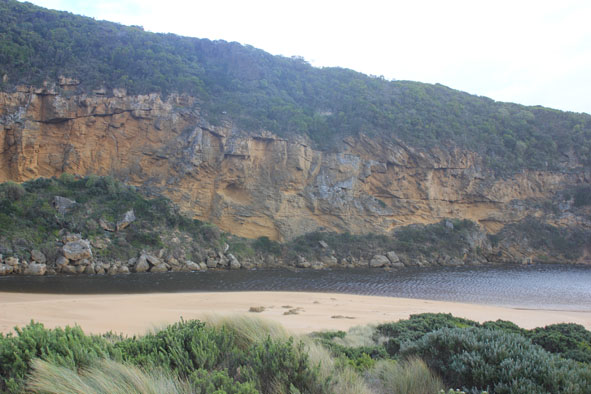
Notes:
- salt water entering, meeting fresh between rocks & tunnel entrance
- Waves sometimes high up over sand build up near mouth
- Wave swell from W/SW still impacting on dunes at east end of beach
- Longshore drift crossing over mouth to cliff dragging /rolling sand into channel in front of rocks & also taking it up stream
- East side of channel has steep side -scoured out by release on 2/6/15 & 3/6/15
|
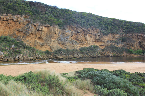
| #9696
|
4 Jun 2015
|
Approved |
Notes:
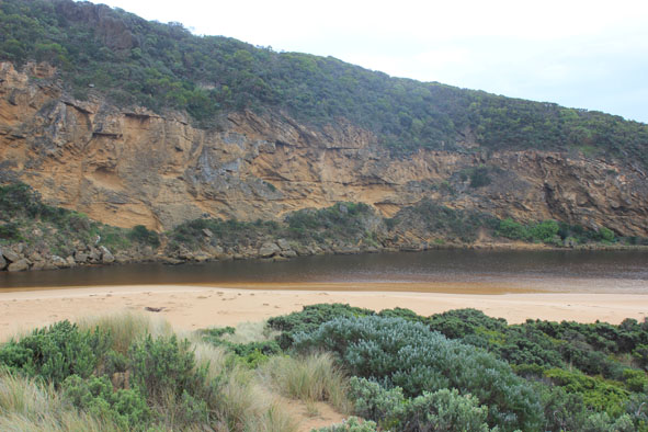
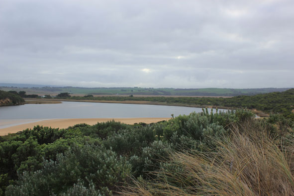
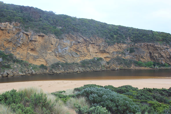
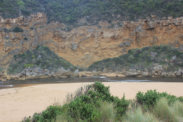
- Flow our through very narrow, shallow channel against cliff face over large sand build up at mouth
- Previous steep sides to channel have been smoothed out by longshore drift moving west along the beach, across mouth, around rocks & entering channel over a wide area closer to estuary
- Beach is much higher just east of mouth & projects out to sea at mid beach
- East end of beach continually scouring out & much lower
- Waves in all directions along whole beach area
- Large amount of sand visible in waves especially where sand projection occurs.
|
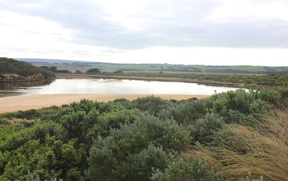
| #9645
|
30 May 2015
|
Approved |
Notes:
- Outflow reducing & channel width decreasing
- Rough sea, small waves entering estuary
- Large amount of sand build up in front of rocks & along channel
- Sand & debris being carried to mouth by strong longshore drift from erosion occurring at east end of beach
- Waves in all directions at east end of beach creating a sand projection out to sea at mid beach
- Strong longshore drift to mouth crossing over outflow & incoming waves
- Strong north wind blowing sand into channel and area around rocks
- Low track underwater with waves from north wind increasing depth
- Large mounds of dead sea grass along beach at south side of estuary
|
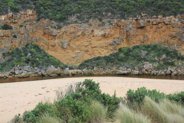
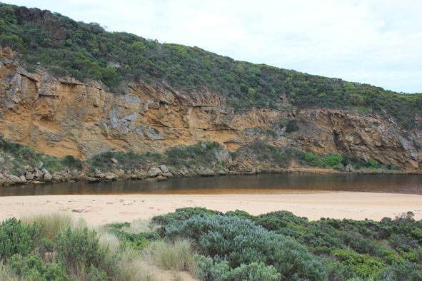
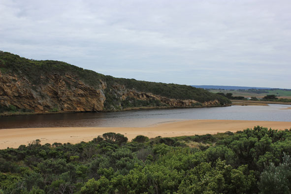
| #9618
|
22 May 2015
|
Approved |
Notes:
- Flowing out but some waves entering up into estuary
- Water very dark flowing along channel with steep/sheer east side & close to cliff at mouth.
- Sand build up in front of rocks & east of flow
- Strong longshore drift across mouth with waves in all directions at rocks
- SW swell has scoured out east end of beach leaving sheer side to dunes & removing previous sand cliff
- Previous projection mid beach has gone
- Large amount of Marram grass & Euphorbia clumps from front of impacted dune is scattered along beach to mouth
- Large amount of silt & rotting veg. remains along the low track & is also over exposed sea grass area
- 2 Bitterns observed on roadside OOR
|
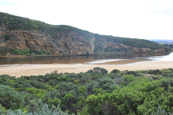
| #9617
|
16 May 2015
|
Approved |
Notes:
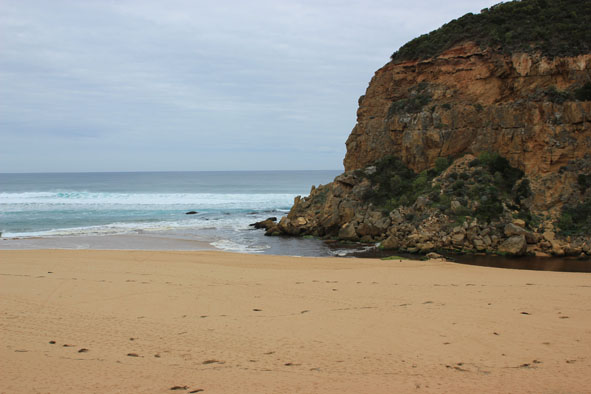
- Natural opening 14/05/15 has now created a very wide opening (30-40m).
- Large amount of dark discharge travelling both to south & east along foreshore
- Channel to estuary is also wide with steep sheer edge 2-3m above present water level
- Sudden & rapid discharge overnight has revealed sand bar & large expanses of sand extending north into estuary at the south side
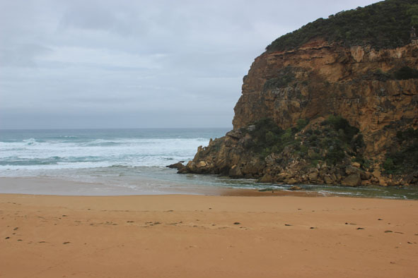
- Beach front is projecting out to sea at centre. Large waves scouring out 3m. high sand cliff below dunes at east end of beach
- Strong rip & longshore drift
- Some sand build up in front of rocks at entrance
- Waves at mouth in all directions. Very large amount of sand visible in current
- Low track fully exposed covered with dark silt, slime & debris. This is also over ocean beach
- No sign of any dead fish or invertebrates
- No water over any roads, camp ground still has water in very low areas on south, flats are draining
|