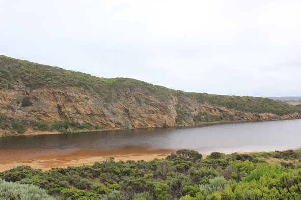
| #9398
|
4 Feb 2015
|
Approved |
Notes:
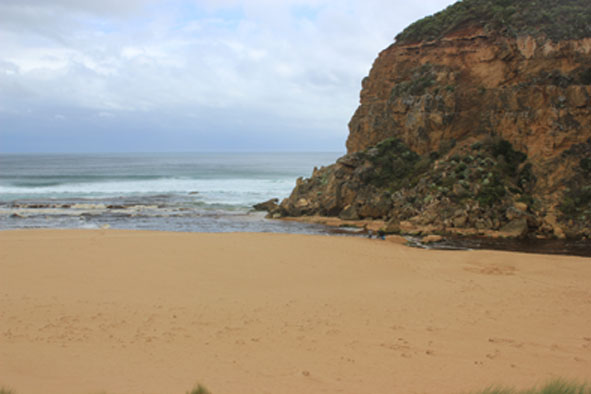
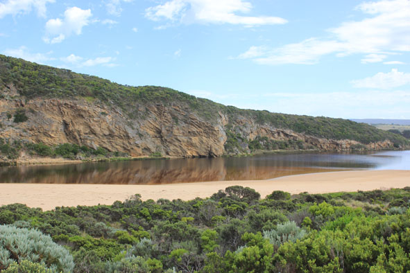
- Mouth appears to be closed but a slight flow of water is travelling under rocks & out to sea against the west cliff
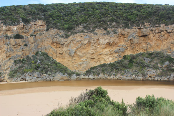
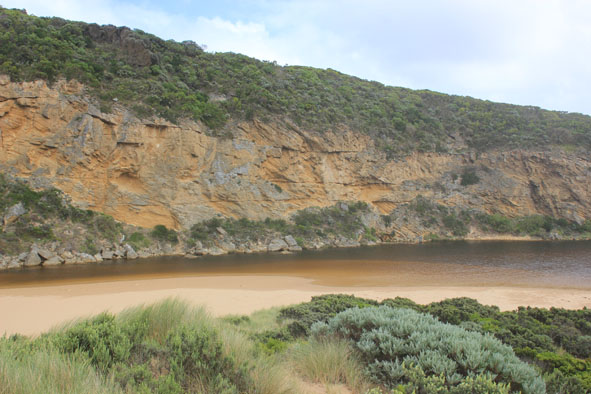
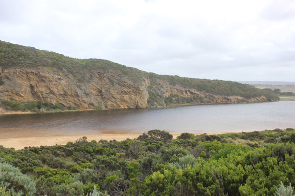
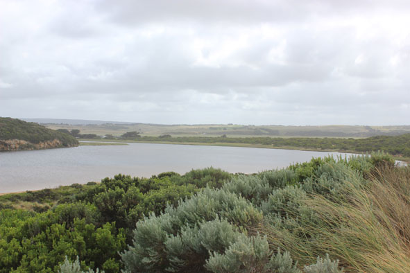
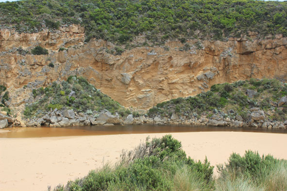
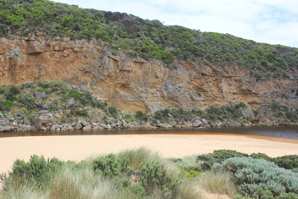
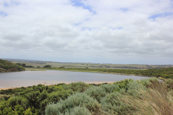
- Front of estuary is very wide & shallow , channel is also shallow
- High sand build up on beach Just east of mouth
- Front of berm has been washed away but remains about 0.50m above sea level. The dip at middle of berm between sea & estuary remains
|
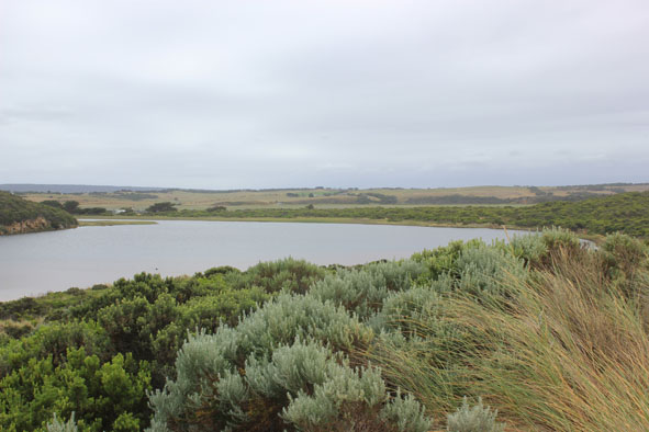
| #9364
|
29 Jan 2015
|
Approved |
Notes:
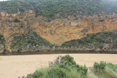
- River barred but signs of waves over berm on a wide front at last hi-tide
- observations taken at very low tide with moderate conditions
- Berm is higher & longer, 88m from swash line to river, more sand cover over rocks
- At about 40m from sea to the river there is a low depression in berm
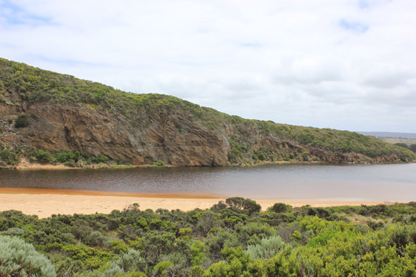
- Water level in estuary rising, small fish noted swimming in clear areas between vegetation along low track
|
| #9346
|
26 Jan 2015
|
Approved |
Notes:
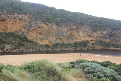
- Mouth barred 24.01.15 (rough seas ongoing from 23.01.15)
- Waves over berm & into estuary at high tide. Squid carapaces in swash line
- berm height measurement from ocean side not undertaken because of intermittent wave surge
well exposed
- Water level higher in estuary, low track partially under water. Some of these areas have large amounts of scum & algae floating on the surface
- Snipe noted on property above G5
|
| #9339
|
16 Jan 2015
|
Approved |
Notes:
- Dark discharge along foreshore to east
- Wind in all directions around Gp1, north wind flattening out the waves, & wind coming from s/e bringing blown sand into channel & across mouth
- Longshore drift active
- Water level low in estuary , sandbar exposed & low track mostly clear of water
- Drying skeins of algae (some rotten) cover some areas of vegetation where water has receded- a couple of very small dead fish in deep remaining pools smothered by rotting algae
- New sea grass (about (10cm.) actively growing near waters edge
- Many black cocatoos
|
| #9332
|
13 Jan 2015
|
Approved |
Notes:
- Mouth permit opening 12/01/16 4:00 pm
- Strong outflow with very dark discharge around mouth, along shore line to east then out to sea.
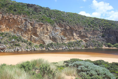
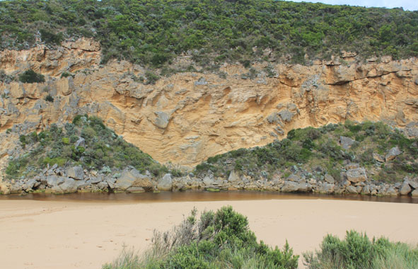
- Out flow along channel passing over cataract between rocks & cliff
- Sheer sides to channel(1.50m) at highest point near rocks, after that the height decreases & swings slightly to east
- Despite strong outflow some waves are entering & longshore drift is moving across area to cliff face
- Sand build up remains downstream rocks against cliff
- Strong north wind raising waves across estuary, foam along south sand area
|
| #9313
|
9 Jan 2015
|
Approved |
Notes:
- Mouth closed no waves over at last hi tide
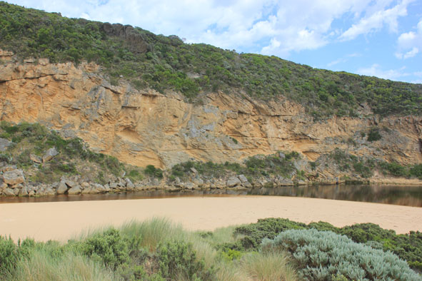
- Berm higher with more sand on ocean side
- Rock almost completely covered by sand
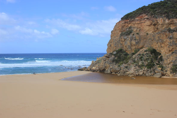
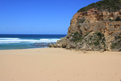
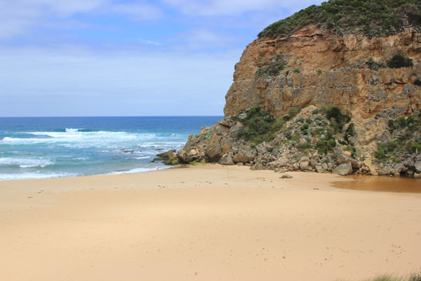
- Beach horseshoe shaped, very wide & gently sloping
- Deep water across low track ( shallow near car park) but only at edge of top track. Some puddles & damp areas in camp ground
- Bad smell noted from wetlands after hot/humid conditions (over 40c. temp. days)
|
| #9306
|
4 Jan 2015
|
Approved |
Notes:
- No flow , mouth barred but some waves over berm at last hi tide
- Berm increased in height
- Attempted illegal opening last night(?) but currently no out flow as waves have been over this area on a wide front infilling the dug out drain
- Beach horseshoe shaped, south west waves have strongly impacted mid beach with longshore drift travelling back to mouth. Sand is building up higher at both ends of beach
- Last 2 day about 40c.temp but strong se wind today has created turbulence & estuary surprisingly clear of algae, small fish noted along s side
- Water up to car park along low track but top track only damp
- Many Squid carapaces, dead moths & small blue jellyfish along swash line
- Dead Albatross found near mouth oxer past week
- Silver gulls (7) feeding along swash line
|
| #9287
|
27 Dec 2014
|
Approved |
Notes:
- Mouth closed, no flow but swash line indicates waves have been high on beach then travelled west behind berm into channel
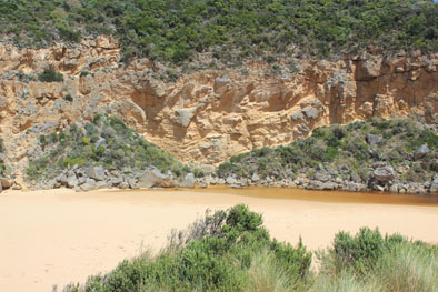
- Berm higher, highest point about 20-40m. east of mouth (lower across mouth)
- 2nd. rock in channel nearly covered with sand
- Beach horseshoe shaped lowest area mid beach
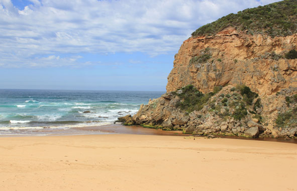
- Large slip has occurred along cliff at next beach to east, much sand being eroded
- Dead White faced Petrol
|
| #9284
|
20 Dec 2014
|
Approved |
Notes:
- Mouth barred 16th Dec. pm. but evidence of waves over berm during last night - no out flow
- AHD nearly the same level at G6 (1.02) & G2 (1.01)
- almost no flow at G6
- Waves going high up on beach with longshore drift taking flow west to mouth
- large rafts of algae forming along side riparian vegetation at sides of estuary
|
| #9274
|
14 Dec 2014
|
Approved |
Notes:
- Slight pale discharge out around mouth & about 40m. to left, mouth extremely shallow
- Greatly reduced flow (low tide) with more sand at entrance & in channel
- Flow only between rocks & cliff face
- High sand build up immediately east of rocks
- Beach horseshoe shaped
- Active longshore drift
- No of small fish along east side of estuary has increased
- More algae forming along east side of estuary
|