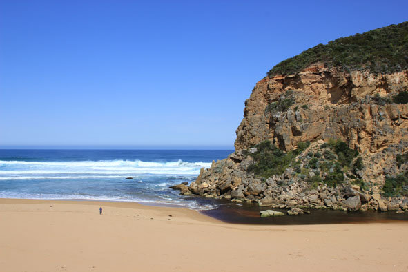
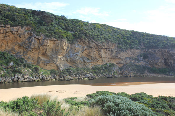
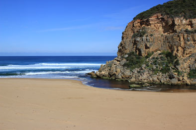
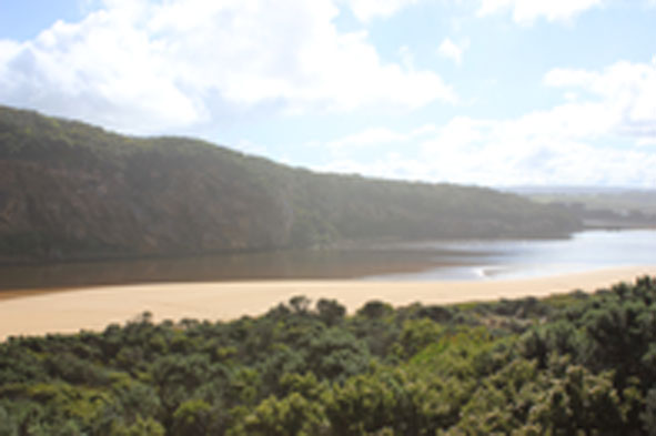
| #9868
|
2 Oct 2015
|
Approved |
Notes:
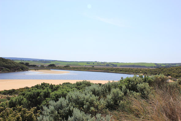
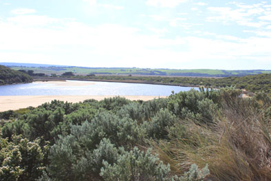
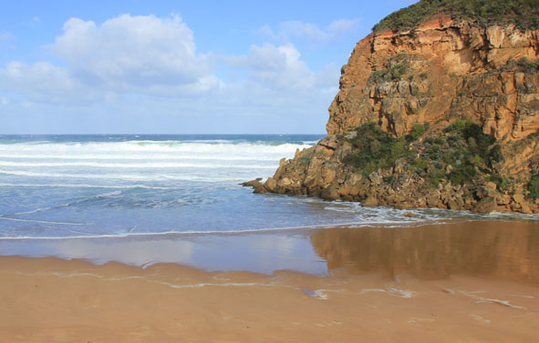
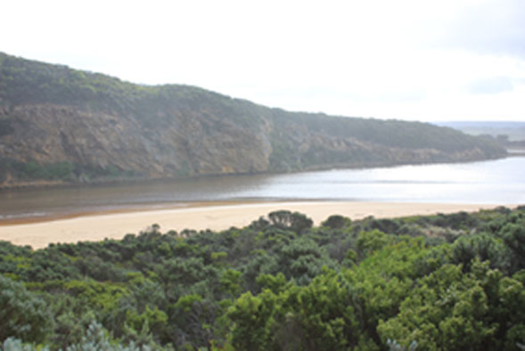
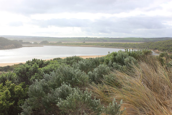
- Only small area of slight discoloured discharge around mouth & along foreshore to east
- Increased sand build up around mouth with only very shallow outflow. Sand on beach still high near mouth
- Small waves entering into estuary
- Strong longshore drift across mouth rolling more sand into outflow
- Sand visible in large breakers out to sea
- Many people fishing from ocean beach (holiday)
- Low tide & sandbar & sides of estuary uncovered revealing dead silt covered sea grass where scum & algae are forming
- Day of extreme tide heights
- Some shrimp in swash line on ocean beach
|
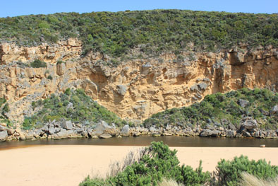
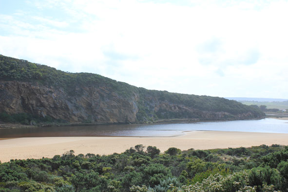
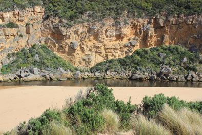
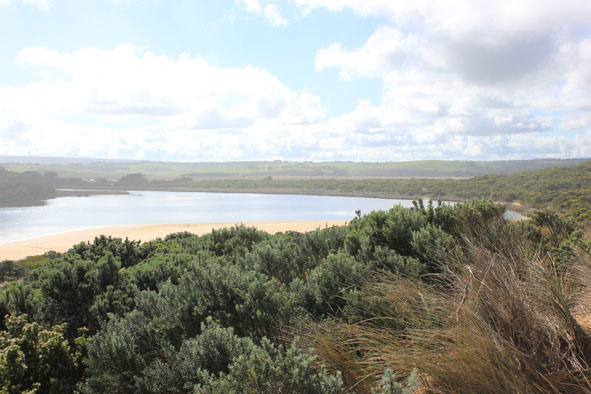
| #9856
|
28 Sep 2015
|
Approved |
Notes:
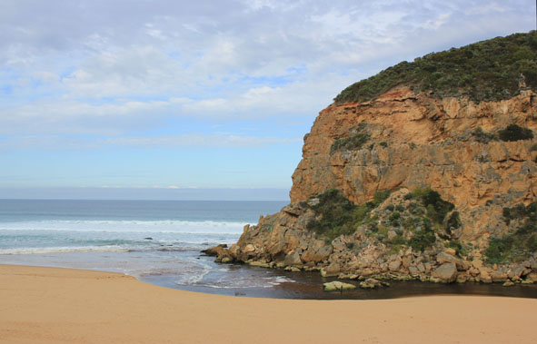
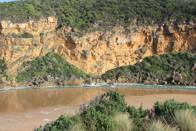
- Dark discharge out along shoreline to east
- Out flow reducing, actual entrance about 5m. wide up against cliff face, much wider & larger area of water around rocks
- Small waves entering into estuary
- Sand building up in front (downstream rocks)
- Strong longshore drift rolling sand into channel mouth
- Beach horseshoe shaped, widest beside mouth & highest just east of mouth
- Low tide level -sandbar & sides of estuary well exposed revealing large areas of dead silt covered rotting sea grass
|
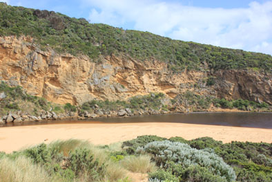
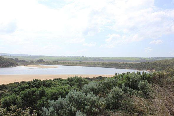
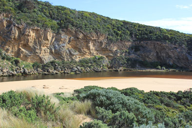
| #9851
|
19 Sep 2015
|
Approved |
Notes:
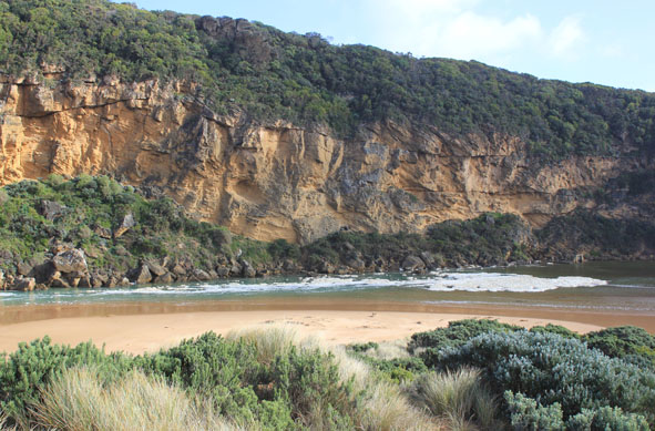
- Dark discharge out along foreshore to east & heading out to sea at east end of beach
- Small waves entering into estuary
- Dark silt along swash line near mouth
- Strong longshore drift across mouth
- Sand highest near mouth, east end of beach lower & more curved
- Sand projecting out to sea east side of mouth
- Sandbar & east & south sides have large areas of exposed sand - on the east side, sea grass has been exposed heavily covered with silt
|
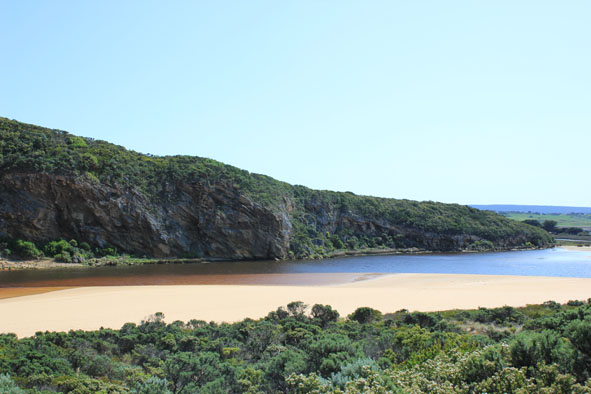
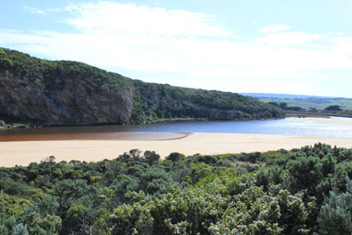
| #9833
|
10 Sep 2015
|
Approved |
Notes:
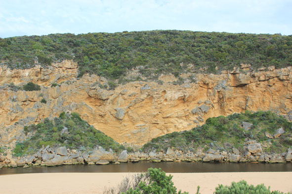
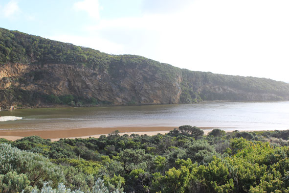
- Strong flowing dark discharge out along foreshore to east, high turbidity throughout the estuary increasing at G2
- Sheer sides to channel & entrance from recent release due to heavy rainfall, especially in the catchment
- Small waves entering, strong longshore drift across mouth
|
| #9830
|
1 Sep 2015
|
Approved |
Notes:
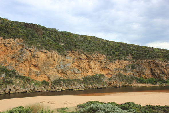
- Flow reducing channel & entrance shallow. Sand building up in front & behind rocks
- Small waves entering (green salt water up to rocks at 12:40) active longshore drift rolling sand into channel
- Beach very wide east side of entrance -highest at mid beach with steep drop to ocean. Much lower & smooth at east end
- Large areas of sand exposed in estuary because of low tide - exposing dead & rotting seagrass
- Beach starting to undulate (North/South direction) -
- A shallow /wide depression starting to form E/W mid beach, between high front & rising sand further back to dunes carrying water west to mouth
|
| #9783
|
15 Aug 2015
|
Approved |
Notes:
- Out flow reducing, dark discharge out & along foreshore to east
- Strong longshore drift
- Sand projecting out to sea beside mouth(east side)
- Waves high up at east end of beach which is the lowest part
- Dead Wallaby at waters edge on low track
- Water level at AHD board G2 rising & falling
|
| #9781
|
9 Aug 2015
|
Approved |
Notes:
- Recent rainfall has increased out flow, dark dirty discharge out along foreshore to east.
- Steep sheer side to channel & small waves entering up to rocks
- Sand at entrance building up & projecting out to sea
- Sand bar exposed (10 Cormorants /Black & Pied. 1 White egret,2 Shell duck)
- Very small fish in scour holes remaining filled with water amongst streamside vegetation on low track, fine granular looking algae in these areas also
- Iridescent scum/algae? in small area along low track
- Small seal near mouth reported 06/08/09
|
| #9769
|
31 Jul 2015
|
Approved |
Notes:
- Dark discharge flowing strongly out from mouth & to east all along beach. Debris & dark silt in swash line -Large amount of sand seen in breakers
- Recent release caused by heavy rainfall event increased flow
- Mouth wide & channel sheer sided - being modified by incoming waves
- Waves in all directions along beach with longshore drift across mouth
- Waves high up to dunes at east end
|
| #9747
|
26 Jul 2015
|
Approved |
Notes:
- Near Gale force winds & high sea driving waves over sand build up, covering area across from the mouth to sand dunes -only salt return back down narrow channel
- Very strong longshore drift across mouth. Waves in all directions around rocks & continuing strongly down channel into estuary, large areas of foam swirling
- Waves up to base of dunes at east end of beach removing more vegetation, former sand projection into ocean (mid beach) has been completely removed & beach flattened out.
- Near gale winds from S.E. at Gp1, S. slightly further east, & S.W. closer to east end of beach
- Air temp 5-7C. & 5cm. hail in some areas (covering G.O.R near Lower Gellibrand)
- Rainfall 44.5ml since 24th July.( G6 AHD 2.05)
|
| #9745
|
18 Jul 2015
|
Approved |
Notes:
- Flow out through wide mouth (heavy rainfall during the week) slight discharge around mouth & to east
- Waves entering channel & estuary, flowing upstream at G2 with strong pulsing action causing fluctuation from AHD 0.92 to 0.86 within 60sec. Flow at Lt.1 also going upstream.
- Very strong long shore drift across mouth with waves in all directions
- High sand build up at mid beach is being eroded by long shore drift & ssw / sw swell
- large no. cuttlefish in swash lines
|