Gellibrand River Estuary

Download

770 results found (Displaying 361 - 370)
ID Date Status Details
#8315 31 May 2013 Approved Notes:
  • Pale discharge out over shallow entrance
  • Strong longshore drift towards entrance
  • Sand build up at mid beach has increased to east & out to sea. - now highest point on beach
  • East end of beach has steep drop with sheer sand cliff below dunes(1.5m+)
  • Sand bar & large area south side of estuary exposed
  • Low track has been reformed by recent wave action
  • Large no. dog & fox prints in all areas
#8325 7 Jun 2013 Approved Notes:
  • Salt water entering channel & estuary
  • Large sand build up at entrance, waves & strong south wind bringing more sand into channel
  • Rough sea -waves up to base of dunes on ocean beach & entering estuary impacting on east side, surge also reaching G2.
  • Waves in all directions at mouth, longshore drift active & whirl pool in front of rocks
  • Shoreline more even but waves carving out steep sand cliff at east end
  • Dead Penguin on beach
  • Many Coots, 2 White Egrets & White Goshawk around estuary in estuary
#8347 14 Jun 2013 Approved Notes:
  • Dark discharge out around mouth & slightly to east
  • Flow has increased since recent rain (29.5ml)
  • Beach very windswept & sign of last hi tide up nearly to dunes
  • Waves from s/w -longshore drift active
  • More sand building up mid beach & projecting out to sea
#8357 21 Jun 2013 Approved Notes:
  • Air temp 3 C.
  • Flow out through wide shallow entrance.
  • East side of channel sheer (50cm -1m.)
  • Waves from south west turning back to entrance
  • Ocean beach still in 2 distinct bays, east end scoured out to foot of dunes & sand building up on west side of central projection
  • Sand bar exposed in estuary & low track (east) scoured out into new formation
#8360 27 Jun 2013 Approved Notes:
  • Waves entering with some salt return
  • Very low river & estuary water levels
  • Sand bar & sand south side of estuary well exposed
  • Salt water (green) nearly to tunnel entrance
  • Ocean beach still in 2 distinct curves with eastern end continuing to scour out at base of dunes
#8366 5 Jul 2013 Approved Notes:
  • Salt water entering over wide area along narrow channel. Salt to near tunnel entrance
  • More sand at entrance & along channel from V.rough seas & strong s/e winds
  • Wind driven waves from west impacting on east side of estuary
  • Wind across estuary from West but at Photo point from s/e along ocean beach
#8373 12 Jul 2013 Approved Notes:
  • Dark discharge out only around mouth
  • Signs of recent release -sheer side(1-1.5m.) to east side of channel
  • low water level in estuary & river - sand bar & east side well exposed
  • Waves entering mouth & channel -long shore drift active along shore line to mouth
  • Increased erosion east side of estuary from recent rough seas - waves up to dunes on ocean beach
#8412 19 Jul 2013 Approved Notes:
  • Dark discharge out around mouth, small waves occasionally entering channel & estuary
  • Channel east side sheer (70cm)
  • Ocean Beach wide & sloping, westerly waves impacting east end
  • Long shore drift toward mouth
  • Wind (north) driven waves in estuary impacting s/e corner
#8426 3 Aug 2013 Approved Notes:
  • Flow mainly out with discharge only around mouth
  • Very rough sea- waves entering over shallow entrance & travelling along east side of channel into estuary (Salt/green water upstream rocks intermittently)
  • Sand has built up around entrance & rocks -channel narrow & shallow
  • Sand high east end of beach, highest mid beach then sloping down to entrance -Waves high up on beach
  • Water level in estuary high, low track well under water
  • Dead penguin (!) near mouth
#8439 10 Aug 2013 Approved Notes:
  • Very strong out flow, dark & dirty around mouth & to west but main flow to east
  • Mouth & channel much wider & deeper, sheer east side to channel (over 1m.)indicates recent strong release
  • Longshore drift active
  • Beach no longer curved, higher at east end sloping down toward entrance
  • Sea has been up to base of dunes during recent rough seas
  • Wind in all directions in estuary
  • Turbidity at G2 NTUs 60 pH 6.4
Creative Commons CC BY
All content, files, data and images provided by the EstuaryWatch Data Portal
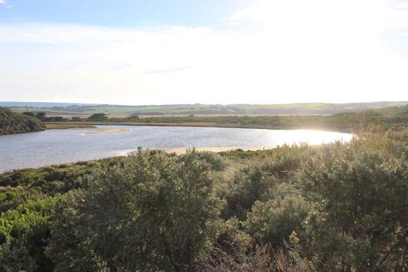
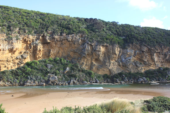
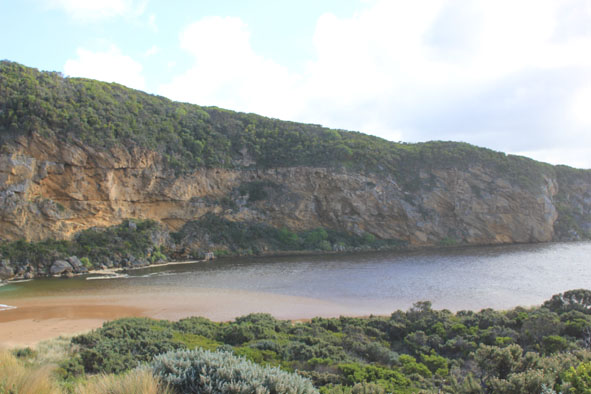
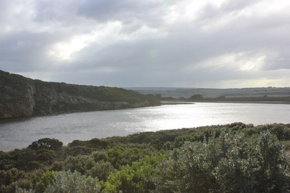
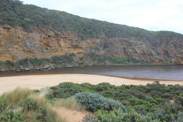
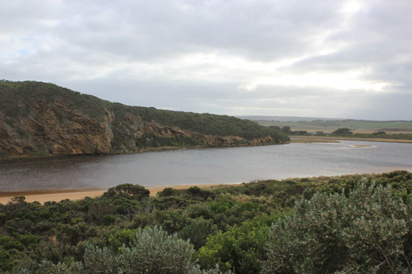
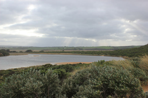
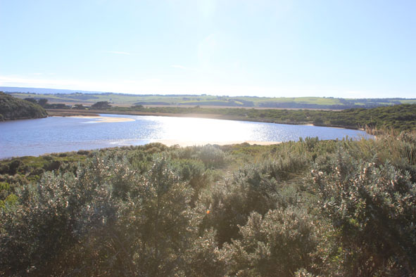
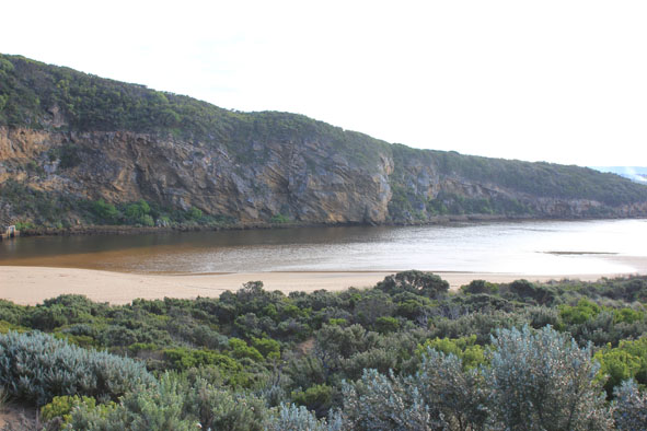
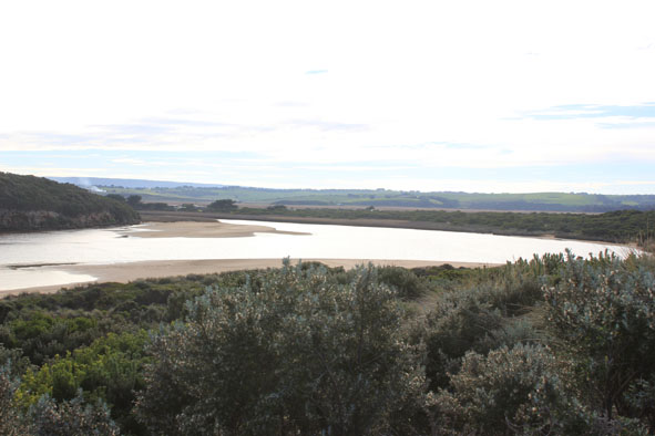
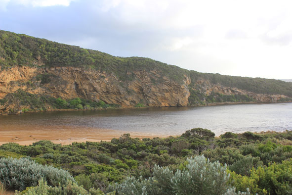
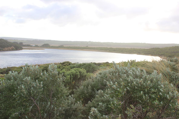
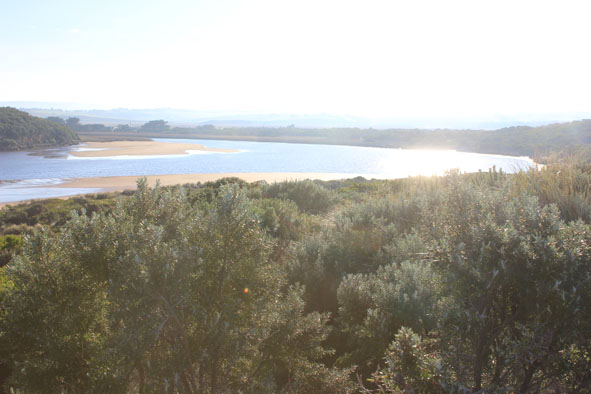
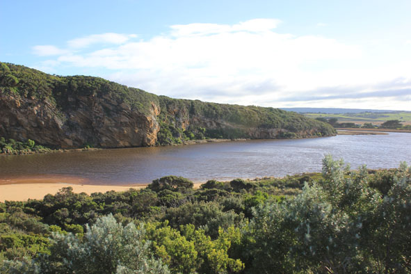
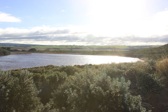
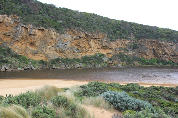
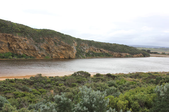
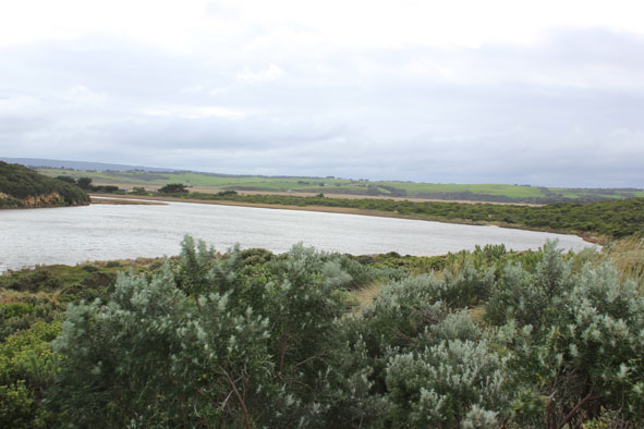
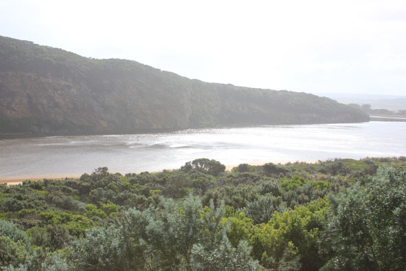
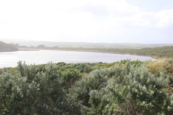
 and Gallery are subject to a Creative Commons Attribution License

Content is made available to be used in any way, and should always attribute EstuaryWatch and www.estuarywatch.org.au