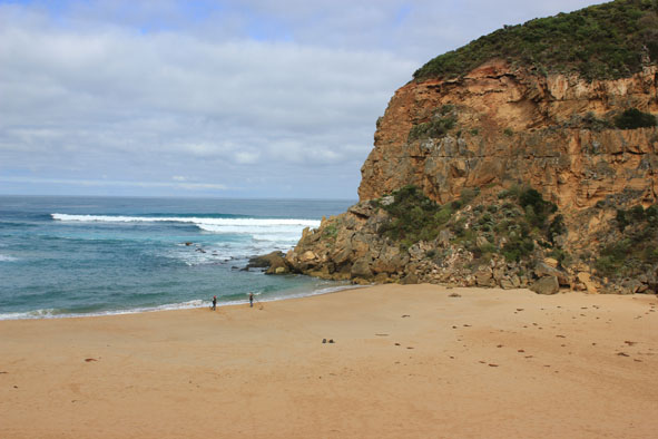
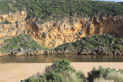
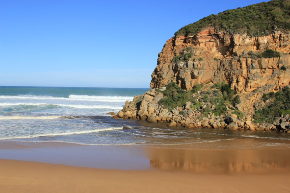
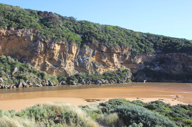
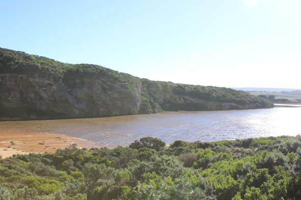
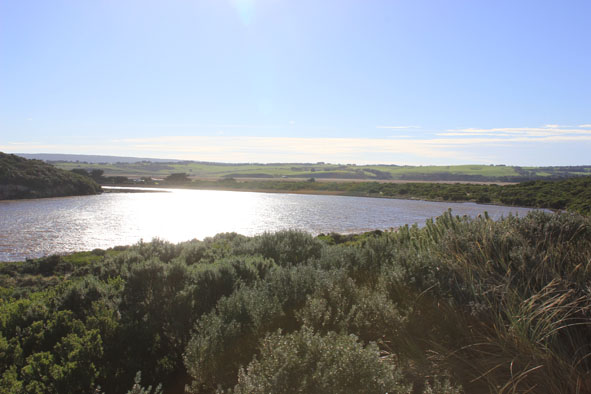
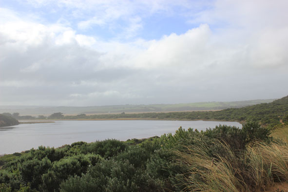
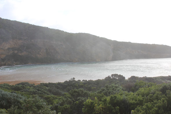
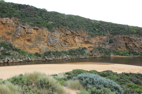
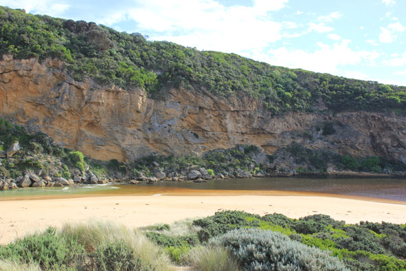
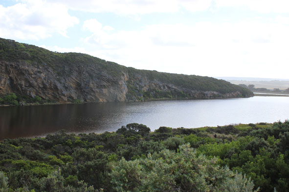
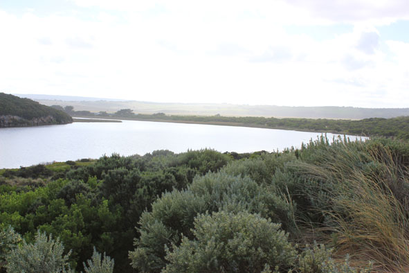
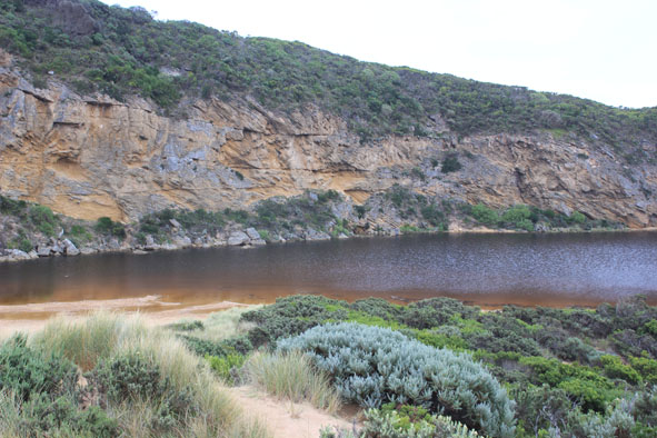
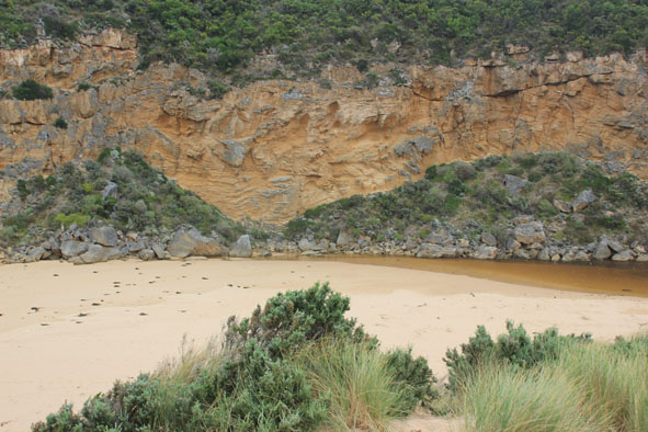
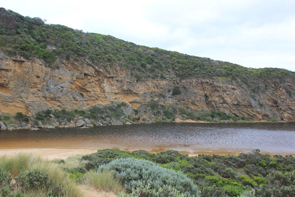
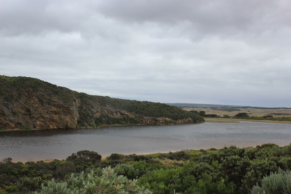
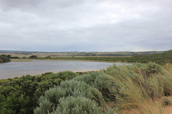
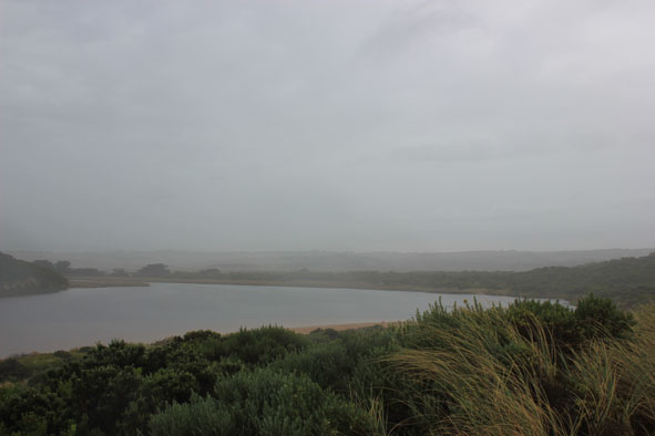
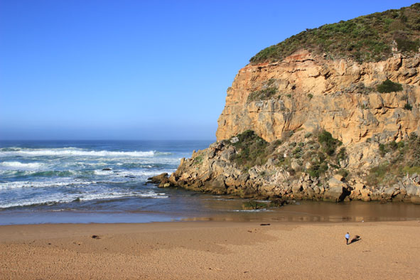
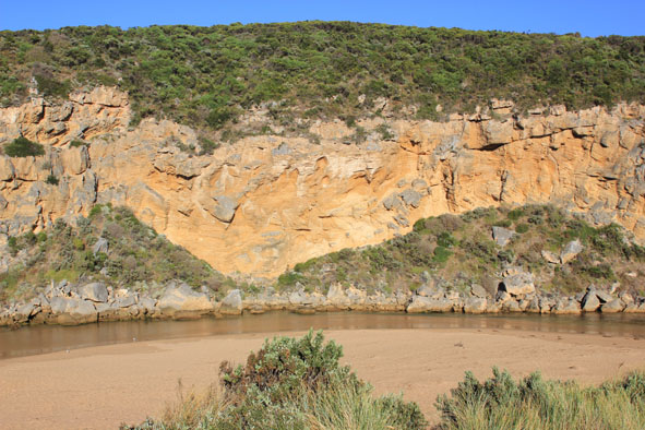
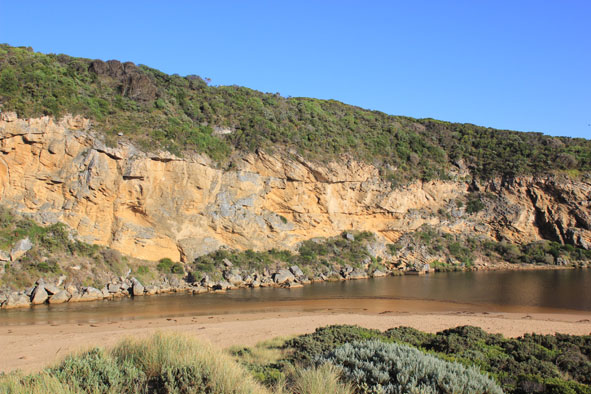
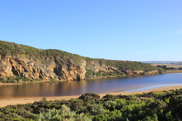
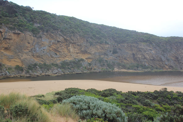
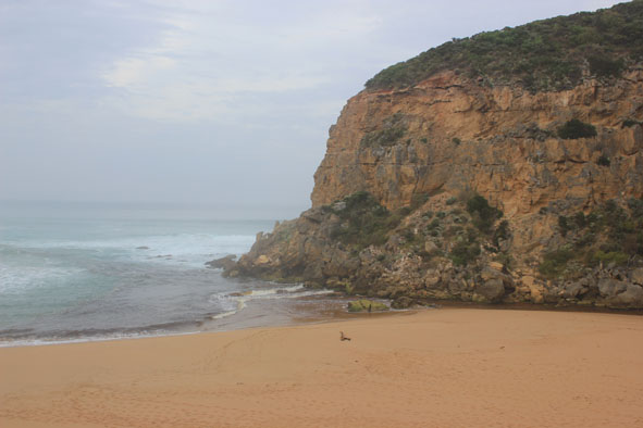
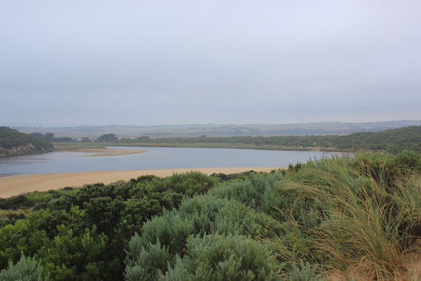
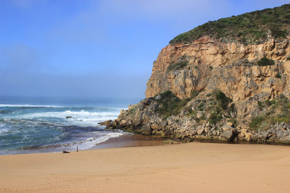
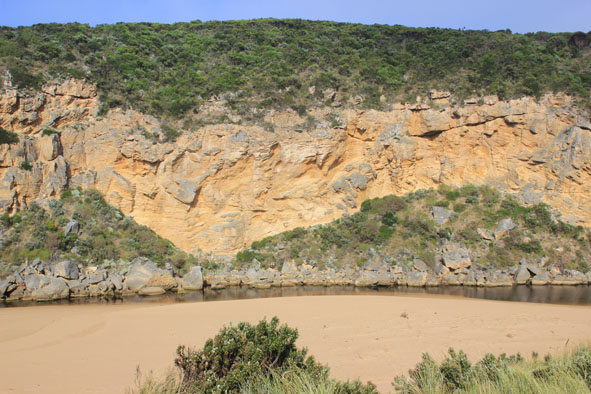
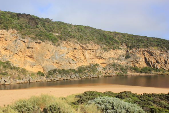
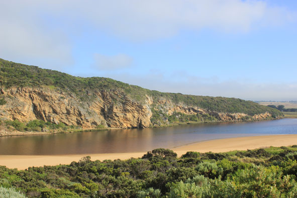
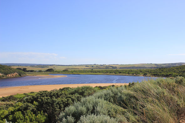
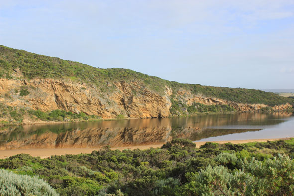
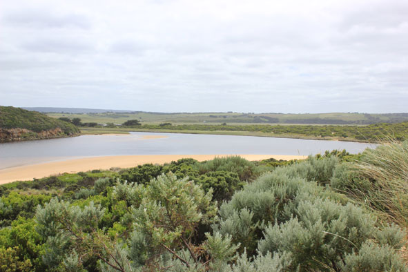
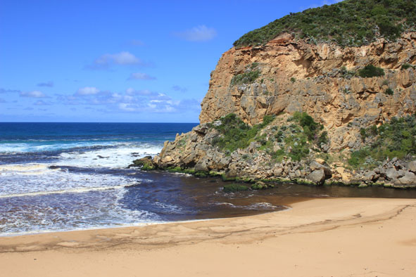
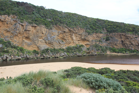
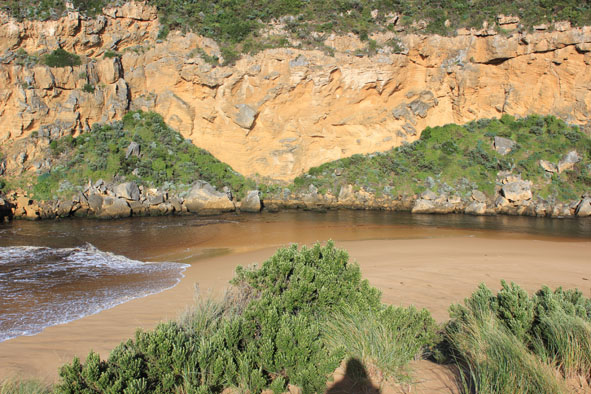
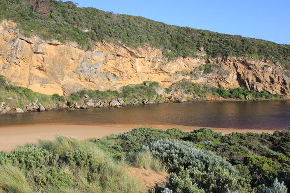
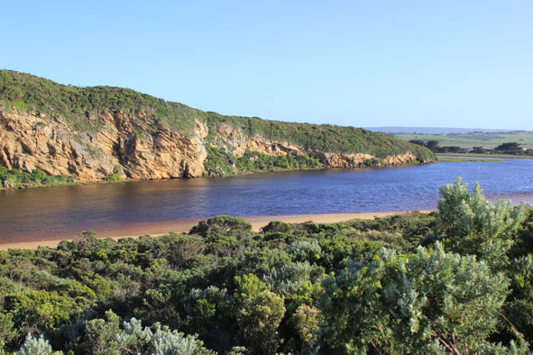
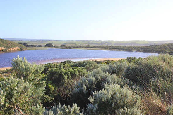
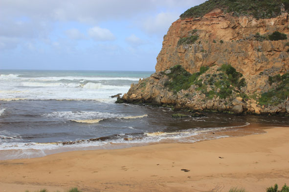
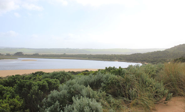
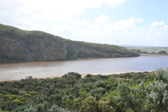
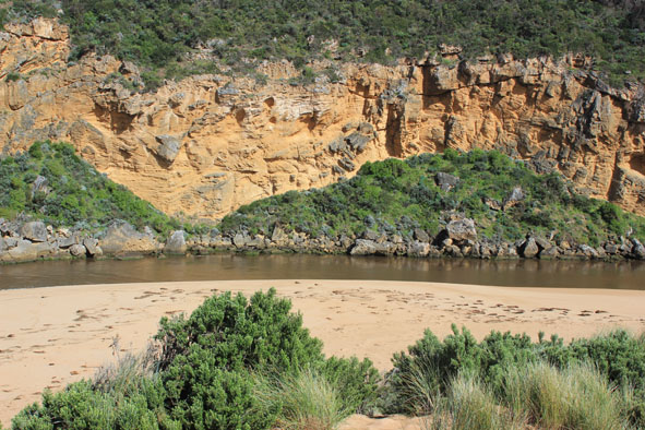
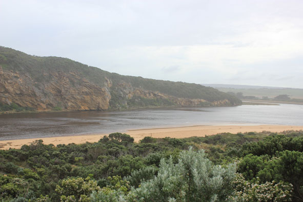
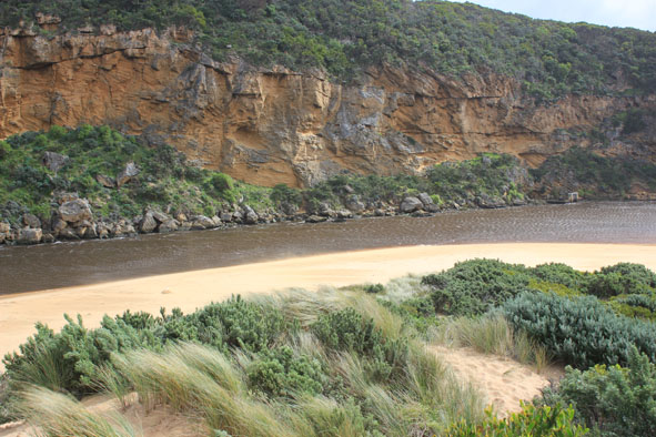
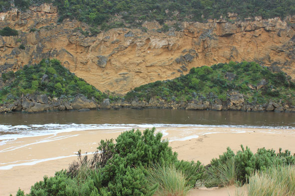
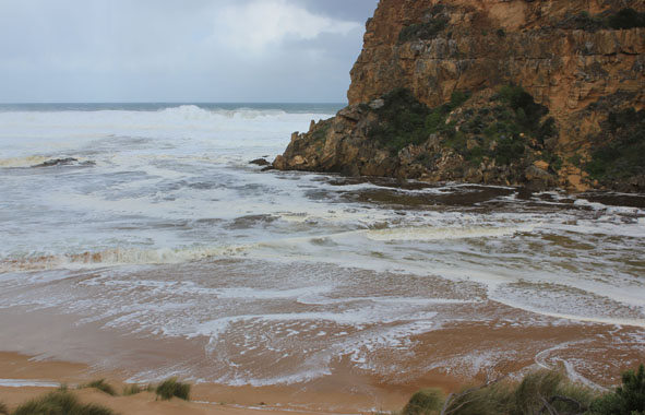
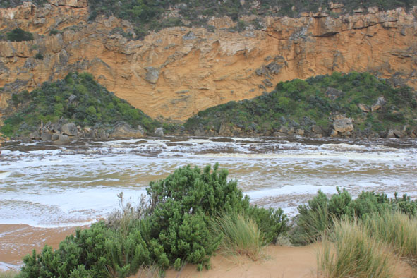
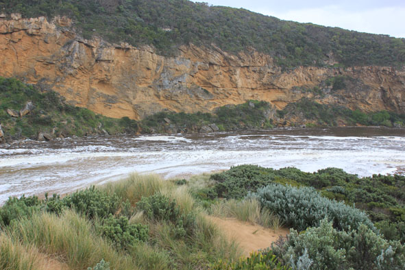
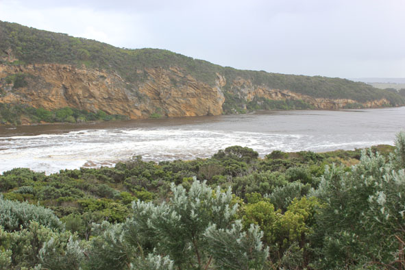
| #9015
|
19 Jul 2014
|
Approved |
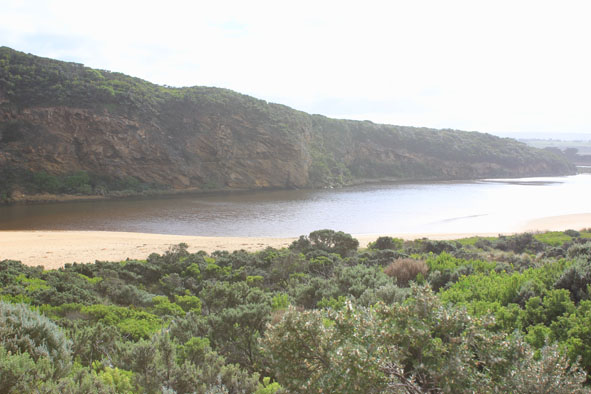
Notes:
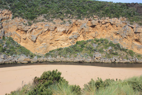
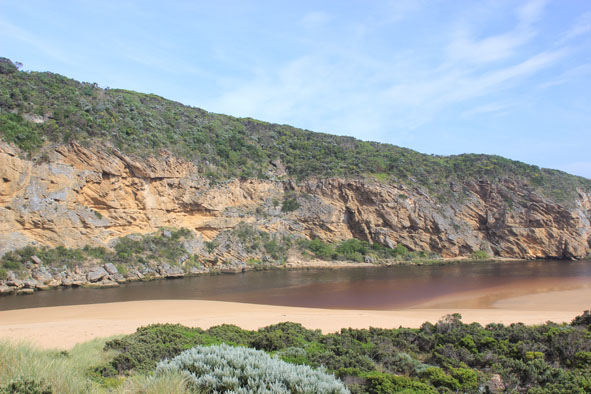
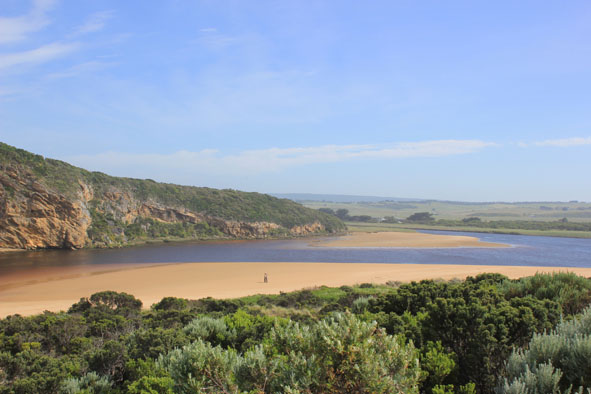
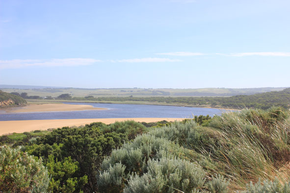
- Strong flowing dark discharge out over wide entrance, mainly around entrance but difficult to tell because of waves & foam
- Strong longshore drift, occasional small waves entering channel & estuary
- Ocean beach wide, level & covered with silt & foam (especially at east end
- Waves have been up to base of dunes during recent storm/rough sea (17/07/14)
- Sand spit at north end of channel has further extended into estuary
- Sand bar exposed & low track clear of water
|
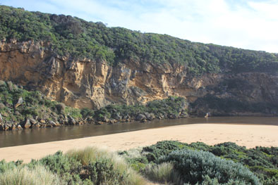
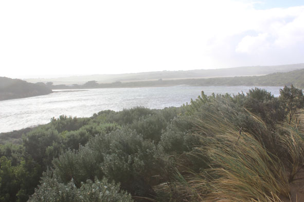
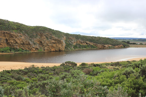
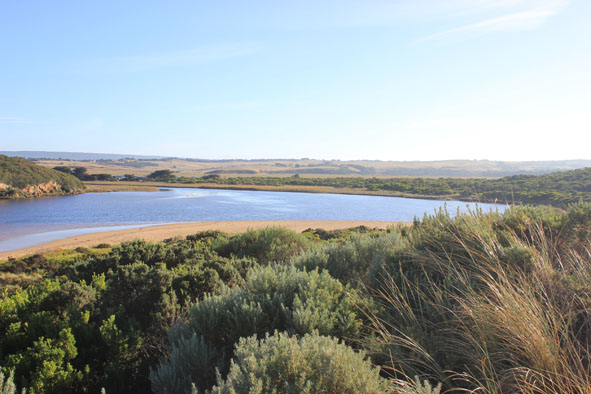
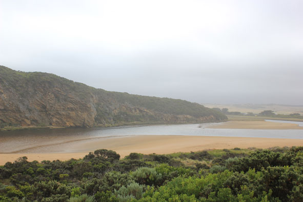
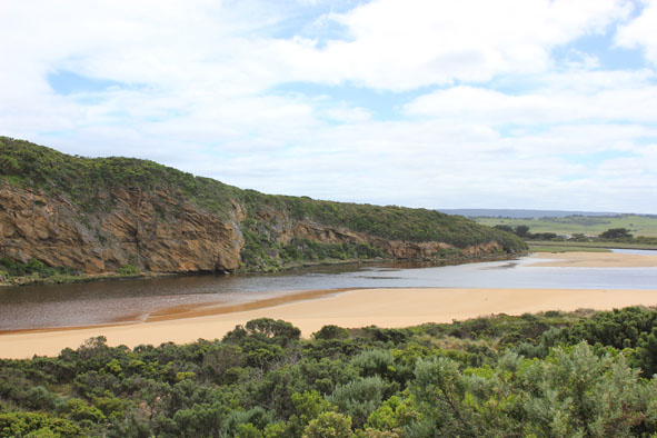
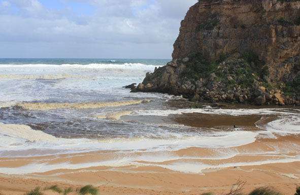
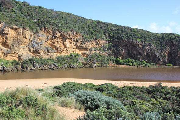
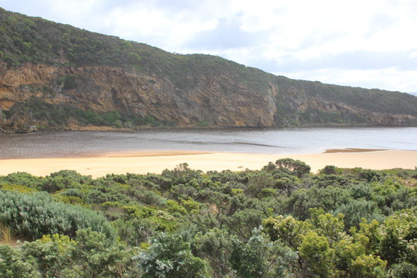
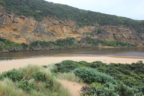
| #8995
|
11 Jul 2014
|
Approved |
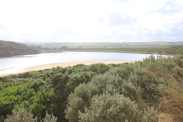
Notes:
- Strong wide dark outflow out around mouth & long way to east, also to west. Dark water about 60m+ out to sea around mouth
- Waves entering mouth across a wide area, some travelling up along the channel into the estuary & turning to east despite strong out flow
- Waves occasionally up to base of dunes on ocean beach which is covered with increased dark silt & foam. Beach is levelled out with only slight rise
- Strong north wind bringing waves (10-30cm high) to south side of estuary
- High flood levels upstream but no water over any road
|
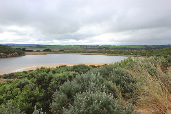
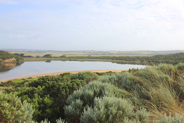
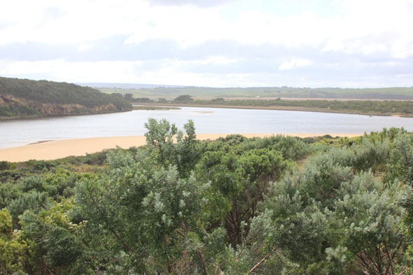
| #8992
|
5 Jul 2014
|
Approved |
Notes:
- Strong outflow -dark discharge around mouth & along foreshore to east
- Some waves entering travelling along channel into estuary where some go north over covered sandbar & others go to east along south side of estuary
- Signs of recent strong release of flood water, steep east side of channel & foam all along ocean beach with dark silt deposit at east end
- Ocean beach near mouth & east side of channel levelled out by recent rough seas
- Sand spit at north end of channel is protruding further into estuary
- Waves in all directions at mouth with whirlpool around rocks & active longshore drift
|
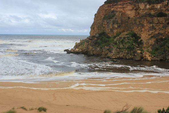
| #8973
|
27 Jun 2014
|
Approved |
Notes:
- Dark outflow around mouth
- Sand visible in breakers
- Longshore drift active
- Some waves completely across entrance & up to dunes on ocean beach but unable to travel up channel because of strong north wind producing waves over 30cm.high
- Extensive flooding of wetlands & flats but no water over any roads
- Water levels in estuary high, low track under water to car park -some water at edge of top track
- Very large, high mounds of debris along low track
- Hoary headed Grebes (2) in estuary
|
| #8965
|
25 Jun 2014
|
Approved |
Notes:
- Dark discharge out around mouth & east along foreshore(difficult to estimate because of waves & foam
- Longshore drift active
- Base of dunes at GP1 has been eroded (cut 1-2m.)
- Sand has built up around mouth & at northern end of channel (site of whirlpool 20140624) long spit extends north to near tunnel entrance
- Latrobe creek flooded as are wetlands up to G4 where water is just under the bridge decking
- Flooding upstream G4 with water over bank midway between G5&G4
- South side of channel at G5 under water but flats on north side have water only in lower areas
- Flooding starting from G5 to G6
|
| #8964
|
24 Jun 2014
|
Approved |
Notes:
-Waves over 1-2m. high along the channel & into the estuary where they turn to east & impact east side of estuary & reach car park
- Waves in all directions in channel with huge whirlpool near tunnel entrance -some over top of structure
- Flooding west end of camp ground & wetlands west & north, water forming on side of OCR
- Fishing platform under water
- Green water under bridge (G2) & upstream well past township
- Extreme winds have up rooted many very large trees & closed GOR
- Flood water just starting to come across OOR
|
| #8956
|
21 Jun 2014
|
Approved |
Notes:
- Dark discharge out but only around mouth
- Waves entering channel & north across nearly covered sand bar mid estuary
& sand visible in large waves out to sea
- Sand highest at west end of ocean beach with high steep front to sea, further back there is a depressed lower area running down to ward mouth & channel
- Sandbar in estuary just under water, seaweed deposited along south side of estuary
- Very few signs of small fish in remaining shallow pools along low track
|
| #8953
|
13 Jun 2014
|
Approved |
Notes:
- Waves entering over wide area then travelling down channel, green water to near tunnel
- Rough sea, waves high up on beach, longshore drift across mouth
- Sand high at front of beach but drops lower further back into slight channel where water is travelling west back toward mouth
- Waves in estuary going north over covered sand bar but also swinging around to east, sand is building up in this area with increased projection into estuary
- Shell ducks 2. on south bank of estuary
|
| #8898
|
30 May 2014
|
Approved |
Notes:
- Waves entering channel across a wide area
- Waves in all directions at mouth-strong longshore drift across mouth & into channel upstream rocks
- Dark silt in swash line (also many Squid carapaces) along ocean beach & around mouth
- Last hi tide well up on beach & in estuary
- Sand highest near mouth but several depressed channels running back to the sea have occurred
- Longshore drift in both directions at east end of beach
- By 12:15 green water had moved up channel to near tunnel entrance
- Wide fluctuations on AHD board noted over 5 min. period
|
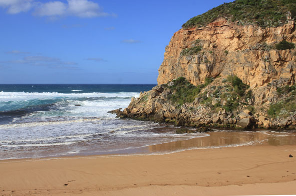
| #8881
|
23 May 2014
|
Approved |
Notes:
- Weak outflow around mouth & to east
- Waves entering channel & longshore drift active across that area
- More sand build up around mouth & along channel which is narrow & shallow
- Sand bar in estuary visible
- Flats upstream starting to become waterlogged with visible water cover in low areas & around drains
- 13 ml. rain at G6 22/05/14
|
| #8876
|
17 May 2014
|
Approved |
Notes:
- Salt water only entering mouth, travelling down channel into estuary. Entering darker water near tunnel entrance
- Wave surge strong down channel continuing north over sand bar
- Wind driven waves from north travelling toward mouth along east side of estuary
- Waves in all directions at mouth around rocks
- Strong long shore drift
- Waves on angle along beach
- Hoary headed grebe(1), Swamp harriers (2) Peregrine falcon (1)
|
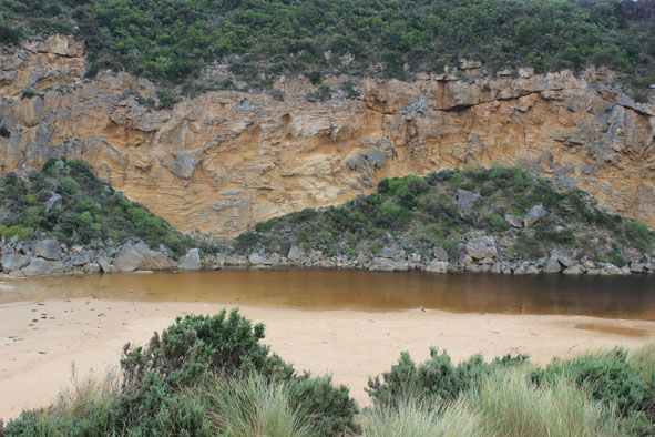
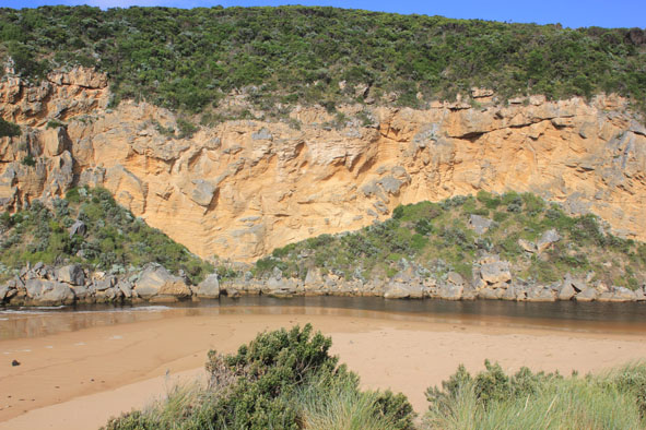
| #8854
|
9 May 2014
|
Approved |
Notes:
- Dark discharge out between rocks & cliff over shallow area, turning to east
- Channel very wide forming a pool with steep east bank directly upstream rocks, but starts cascading down through shallow area between rocks & cliff
- More erosion to east side of estuary, many large mounds of seaweed & scattered shells from ocean beach along channel to near car park. Sandbar exposed
- many small fish in shallow water(east side of est.)
- Shoreline on Ocean beach is becoming straighter, east end scoured out & sand highest near mouth
- Longshore drift both to east & to west, also meeting return waves at east end of beach
- Strong north wind flattening out sea
|
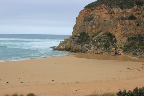
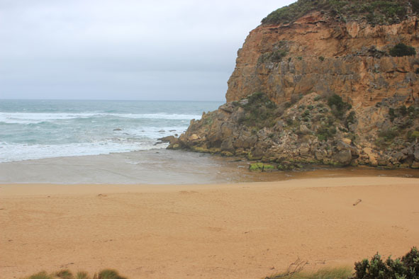
| #8879
|
12 Apr 2014
|
Approved |
Notes:
- Artificial opening 11/14/2014 ( Early AM.)
- strong dark discharge from mouth to east & west
- water level dropped about 1m. since opening
- mouth about 40m. wide but channel narrowing upstream rocks to about 15m.Flow on both sides of rocks
- steep 1.30 m/ sides to channel at mouth
- waves in all directions at mouth with strong rip & longshore drift
- sandbar exposed & wide expanse of sand south side of estuary
- water only in deep areas of low track
- couple of dead salt water fish but many small fish swimming near surface
|
| #8878
|
9 Apr 2014
|
Approved |
Notes:
- Mouth barred
- no waves over berm at last hi tide
- water levels have risen but no water over roads except for some along the edge of O.O.R. near flood markers (above 0.2)
- very small amount of water in extremely low areas in camp. ground
- water increased in low area of top track to beach
- Floodwater starting (waterlogging) downstream, midway between G5&G4
- water in drains & very low areas around G5 & upstream to G6
|
| #8822
|
6 Apr 2014
|
Approved |
Notes:
- Mouth barred but waves have been over berm at hi tide
- Berm highest along beach east of the mouth but toward cliff ( going west) it gradually slopes down
- Ocean beach horseshoe shaped - waves up to base of dunes at last hi tide
- swell from s/w with strong rip & longshore drift to west across mouth
- Estuary is much wider near sea
- Water levels in estuary increased, water in dip & across track to river south of camp ground -no flooding in camp ground or across roads (water to edge of O.O.R. in low areas near flood markers)
- Water still beneath deck of fishing platform near G2
|
| #8818
|
2 Apr 2014
|
Approved |
Notes:
- Waves over berm entering estuary from rough sea across a wide area
- Water level in estuary high
- Waves also up to base of dunes, longshore drift active travelling behind berm
- Water over low track & visible in vegetation beside car park, also in dip on road south side of camp. ground where the track to the river is also covered. Water visible in wetland west of camp ground boundary
- Flats around Princetown up to G4 have water cover but no flooding around G5 & upstream
|
| #8803
|
28 Mar 2014
|
Approved |
Notes:
- Mouth barred but some waves over at hi tide (wave patterns in sand toward estuary)
- Waves have been up to base of sand dunes at west end of ocean beach which is still horse shoe shaped with sand highest near mouth
- Berm is highest close to sea but a depression has formed between top of berm & estuary
- Water over low track & into vegetation near car park
- Flooding in all wetlands around township but not upstream of G4
|
| #8802
|
23 Mar 2014
|
Approved |
Notes:
- Mouth barred but waves over at last hi tide
- Rough sea & strong wing have increased the length of the berm
- More sand over rocks at entrance
- Ocean beach highest near mouth
- Water over low track increased in height & closer to carpark
|
| #8789
|
21 Mar 2014
|
Approved |
Notes:
- Mouth closed 20/03/14 but sea has been over berm during rough sea & hi tide
- Rocks at entrance are not yet covered with sand
- Large mounds of seaweed along side of channel from end of estuary to near tunnel entrance
- Low track on east side of estuary covered with areas of deep water
|
| #8778
|
14 Mar 2014
|
Approved |
Notes:
- Water level on AHD board rising as watched
- Rough sea entering mouth over a wide area, longshore drift active
- Waves going over high sand build up & on into estuary where sand bar is covered
- Only very slight outflow of returning salt water
- Water & salt levels rising upstream
- Beach still horseshoe shaped - higher near mouth
- Swans &, Black duck 7 in estuary
|
| #8770
|
7 Mar 2014
|
Approved |
Notes:
- Very slight outflow both sides of rocks
- Waves entering over wide shallow area
- Strong longshore drift across mouth impacting on west cliff
- Sand in estuary well exposed (low tide 0.14)
- Waves pulsing toward east side of estuary -sea weed on sand near car park east side of estuary
- Ocean beach still horse shoe shaped with sand high at east end & even higher near mouth
|
| #8756
|
28 Feb 2014
|
Approved |
Notes:
- Slight dark discharge around mouth, flowing both sides of rocks
- Rough sea pushing occasional waves over rocks up into channel/ estuary
- More sand into channel from longshore drift, sand can be seen in breakers about 50m out to sea
- Large sand build up at west end of beach where small sand cliffs have formed . Beach still horse shoe shaped
- Hoary headed Grebes (4) east side of estuary
- Large Mullet caught in shallow water ocean beach
|
| #8749
|
22 Feb 2014
|
Approved |
Notes:
- Slight pale discharge out over high sand build up between rocks & also upside of rocks. Discharge only around mouth
- Out flow is travelling east over sand build up
- Weak longshore drift over sand build up east of mouth
- Sand is high at western end of beach near mouth (1.5-2.5m above sea)
- Last hi tide up to base of dunes on ocean beach
- Beach still horseshoe shaped
- Fairy prion found on beach 04.02.14- successfully released
- last hi tide & rough sea have increased sand height at mouth & along channel to estuary
- Broken shells along swash line east side of estuary(close to car park)
|
| #8723
|
14 Feb 2014
|
Approved |
Notes:
- Slight discharge out around mouth but waves entering channel
- Slight longshore drift present
- Sand build up at mouth increased
- Waves have been up to base of dunes at last hi tide , also high swash line along channel littered with broken bits of sea grass (feeding swans)
- Sea mist
- mulloway caught near the end of salt wedge upstream of Princetown
|
| #8711
|
7 Feb 2014
|
Approved |
Notes:
- Dark discharge out around mouth over very shallow area in front of rocks
- Channel narrow & also very shallow in certain areas
- Ocean beach high near mouth but waves over at hi tide travelling west toward channel
- 40 Swans feeding on sea grass near sandbar, small pieces of sea grass along swash line south side of estuary & east side of channel
- Many Ravens in surrounding vegetation, 3 Spoon bills, 1 White egret, 1 White ibis
|
| #8701
|
1 Feb 2014
|
Approved |
Notes:
- Slight discharge only around mouth, out over sand build up in front of rocks
- Flow only between rocks & cliff face
- Sand cliffs formed (1-1.5m high) close to ocean along western end of beach. East end very wide with formerly exposed rocks now covered with sand
- Sea has been up to base of dunes at last hi tide
- Longshore drift bringing more sand to entrance
- Dead Albatross at east end of beach
- Swans 28 feeding on seagrass in estuary, Silver gulls 4, Peregrine falcon 1, Musk duck 1 near G2
|
| #8695
|
24 Jan 2014
|
Approved |
Notes:
- Slight discharge only around mouth
- Sand building up in front of rocks & starting to block channel about 30-40m upstream rocks
- Sand higher on ocean beach near mouth, 'sand cliffs' more rounded.
- Movement of large saw log from further east to near mouth indicates strength of long shore drift
- Rotting algae along swash line east & south sides of estuary, 'skeins forming on deeper water
- Large healthy seal fishing about 50m out to sea (large no's salmon being caught in that area)
- Large dead Hawk moth & wings of smaller moths in swash line(bats feeding)
- Small fish 1-4 cm along east & south sides of estuary
- Letter winged kite 1, Black cockatoos 15, many Ravens around estuary
|
| #8674
|
18 Jan 2014
|
Approved |
Notes:
- Dark discharge difficult to see because of light & waves but seems to be only directly around mouth
- Channel narrow & shallow flow only over cataract between rocks & cliff face
- Beach wide with slight sand cliffs forming close to high tide line
- Beach undulating (north south) depressions
- Sandbar in estuary well exposed
- Blackened algae scattered on sand east & south sides of estuary
- Regrowth including Sea Kale noted in recently eroded area east of channel
- Salmon being caught off ocean beach
|
| #8661
|
10 Jan 2014
|
Approved |
Notes:
- Dark discharge mainly around mouth & slightly to east
- Wave direction from west impacting east end of beach resulting in strong longshore drift toward mouth
- More sand visible around entrance
- Beach very wide & horseshoe shaped
- Out flow only between rocks & cliff face
- Reducing flow from upstream
|
| #8652
|
3 Jan 2014
|
Approved |
Notes:
- Very dark dirty discharge out around mouth
- Outflow only between rocks & cliff face but waves entering over a wider area- long shore drift active
- Channel narrow & sand build up increased in front of rocks
_Sea has recently been up to base of dunes with strong long shore drift entering channel & estuary up stream of rocks
- Large amount of seaweed, algae, silt & broken pieces of dead vegetation on swash line south east side of estuary & ocean beach
- Hi tide & rough seas have covered sand bar
- Pelican (!) in estuary
|
| #8644
|
29 Dec 2013
|
Approved |
Notes:
- Dark discharge only around mouth & to east
- Increasing sand build up at mouth
- Channel only flowing between rocks & cliff face but waves entering across a wider area, strong longshore drift to mouth & entering channel upstream rocks
- Recent hi sea has been up to base od dunes on ocean beach
- Sand bar nearly covered
|
| #8642
|
20 Dec 2013
|
Approved |
Notes:
- Dark discharge only around mouth
- Sandbar & areas south & east sides of estuary well exposed
- Large masses of bright green algae draped along east side of estuary
|
| #8615
|
14 Dec 2013
|
Approved |
Notes:
- Dark discharge only around mouth & to west
- Increased sand build up around mouth & around rocks
- Dark silt line along Ocean beach- up to base of dunes
- Despite being close to hi tide the sandbar is still partially exposed
- 58 cm. Trout caught in river about 15m. upstream rocks
- Large increase of Melilotus indica along side low track, also sand at south side of estuary is being re-colonised by Cakile maritima
|
| #8602
|
6 Dec 2013
|
Approved |
Notes:
- Dark discharge around mouth & to west
- Sand building up in front of rocks
- Sea has been up to base of dunes at last hi tide with longshore drift actively sweeping around into the estuary & channel
- Saw logs have moved from east end of beach to mouth & into estuary
- Many shells washed up on exposed sand mid low track in estuary
- Sand areas & sandbar exposed
|
| #8585
|
29 Nov 2013
|
Approved |
Notes:
- Very dark & dirty discharge around mouth & to east, dark silt covers the beach to high tide mark
- Small waves entering into estuary
- Large areas of sand exposed on bar & south & east sides of estuary
- Seagrass exposed along east side of estuary
- Black sand patterns beside channel
- Solitary Tern fishing the estuary
|
| #8575
|
22 Nov 2013
|
Approved |
Notes:
- Dark discharge out around mouth & to east
- Waves entering channel & continuing into estuary
- Small (1m.) dead seal (Pale coloured) near mouth
- !0 new dead Shearwaters
Also platypus have been sighted in river about 1.2km upstream of township
|
| #8568
|
15 Nov 2013
|
Approved |
Notes:
- Dark discharge around mouth & to east along foreshore, some visible to west
- Sand build up around rocks increasing
- Water level low in estuary, sandbar & sand areas well exposed
- Outflow increased from recent rainfall (45ml since 07/11/13 at G6)
|
| #8548
|
10 Nov 2013
|
Approved |
Notes:
- Dark reddish discharge around mouth, slightly to east & west. (Flats upstream are draining) Flow is reducing
- Channel narrow (low tide)but sand has built up on beach at mouth & around into estuary. Sand is also building up around rocks
- 88 recently dead Shearwaters on beach under eroded dunes, near mouth & alongside channel, 7 more at east end of beach.
- Sand bar, low track and south side of estuary are very well exposed (low tide)
- Tern fishing along foreshore & reef
|
| #8543
|
31 Oct 2013
|
Approved |
Notes:
- Dark discharge around mouth, along foreshore, slightly out to sea & west
- Water levels in estuary very low, sand bar, south side & low track well exposed
- Waves entering channel
- Sand dunes on ocean beach more severely eroded, . steep face now about 3-5m. high, sand,shrubs & vegetation have been driven toward mouth and around into estuary
- 2nd (30-70 cm. high) small sand cliff forming below dune face
- 13 dead black shearwaters & many small purple shells along beach.
- Flood waters upstream are receding but all flats around G5 are still underwater
- Strong flow under bridge G4
|
| #8529
|
18 Oct 2013
|
Approved |
Notes:
- Outflow reducing, dark discharge only around mouth
- V.rough sea, waves curving around across mouth, longshore drift active & strong rip out to sea.
- Waves travelling down channel into estuary
- Strong gale force wind & high sea on 17/10/13 have created more erosion to dunes on ocean beach & in estuary
- Sand has built up around rocks & channel only about4m. wide upstream
|
| #8526
|
11 Oct 2013
|
Approved |
Notes:
- Dark reducing discharge around mouth & to east & west
- Waves entering channel & estuary
- Damage to dunes on ocean beach continues, vegetation being swept around into estuary where damage to low track has increased
- 2 dead black Shearwaters along ocean beach
|
| #8513
|
3 Oct 2013
|
Approved |
Notes:
- Strong dark out flow despite rough seas
- High seas & wind gusts to 10 on 02/10/13 resulting to considerable damage to dunes both near ocean & in estuary. Low track covered with debris & seaweed
- Mouth very wide, waves up to base of dune have created a sheer face over 2m high. This continues to east where it is even higher
dark shearwater
|
| #8508
|
27 Sep 2013
|
Pending |
Notes:
- Dark discharge out around mouth & to the east
- Gale force winds & very rough seas (26/09/13) have severely impacted the sand dunes all along the ocean beach- high sheer face to dunes (from 2.5m to 4m. high)
- East end of ocean beach 'carved out' & still covered with silt & foam
- Large waves have entered the estuary causing more damage to low track (unusually very soft sand in area)
- Large area of exposed sand south side of estuary & sand dunes further reduced
- Peregrine falcon in estuary
|
| #8504
|
22 Sep 2013
|
Approved |
Notes:
- Strong outflow from recent rainfall, dark discharge around mouth, out to sea, to west and to east
Waves in all directions at the mouth, strong longshore drift
- Side of channel near mouth has 1m. high sheer side on east
- many broken shells in previously high wave impacted area east side of estuary(low Track)
- Stick caddis (5) south east side of estuary
|
| #8490
|
13 Sep 2013
|
Approved |
Notes:
- Out flow reducing, dark discharge only around mouth & slightly to east
- Ocean beach is horseshoe shaped with sand higher & wider at east end, sand cliff at base of dunes remains about mid beach (about 2.5-3m high)
- Sand bar well exposed in estuary (low tide)
|
| #8475
|
6 Sep 2013
|
Approved |
Notes:
- Dark discharge only out around mouth. Water very reddish brown in colour
- Flow reducing & sand building up from very rough seas around mouth & along channel
- Waves in all directions, including in channel. Strong longshore drift
- Waves severely impacting sand dunes on ocean beach near mouth
- Ocean beach is higher & wider at east end
|
| #8469
|
30 Aug 2013
|
Approved |
Notes:
- Mouth wide, strong flowing dark discharge around entrance, out to sea & to east. Waves in all directions, longshore drift active
( but many changes in direction in the estuary)
- East end of beach is wider with increased height
- Flood waters reducing, water no longer over bridge deck at G4
|
| #8467
|
24 Aug 2013
|
Approved |
Notes:
- Strong dark outflow well out to sea
- Mouth very wide with waves in all directions (some small ones entering down left side of channel) Longshore drift very active
- Waves up to base of dunes with sheer sand cliffs cut
- Ocean beach covered with foam & east end covered by dark silt & debris
- Severe erosion in areas along low track & debris piled up to 1m.high in places
- Recent high seas have further reduced sand dunes east of channel & south side of estuary
|
| #8461
|
19 Aug 2013
|
Approved |
Notes:
- High sea entering & very strong outflow completely across entrance, waves in all directions in channel then turning east into estuary where they impacting on south & south east sides where much damage has occurred from recent even higher sea & tides
- Dunes east side of channel & south side of estuary greatly reduced
- Waves up to dunes on ocean beach which is covered with foam
- Water very deep over low track & up to car park
- No water over roads but some run off from heavy rain is running in 2 channels cut across the OOR previously
but levels at G4 are lower than at17/08/13
|
| #8456
|
17 Aug 2013
|
Approved |
Notes:
- Strong flowing dark discharge out around mouth & west but mainly to east
- Waves from very rough sea high up on beach & entering channel then travelling down channel to estuary where they are met by wind driven waves from the strong north wind
- Strong longshore drift toward mouth
- East end of ocean beach has increased in height & width, sand now sloping down toward mouth
- Waves in all directions at mouth, also dramatic change in wind direction -especially in the estuary
- Flooding in all areas but no water over roads.
|