| #10750
|
20 Jan 2017
|
Approved |
Notes:
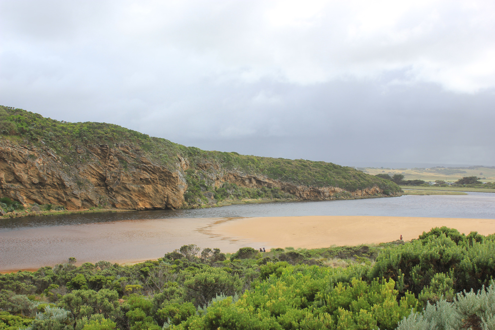
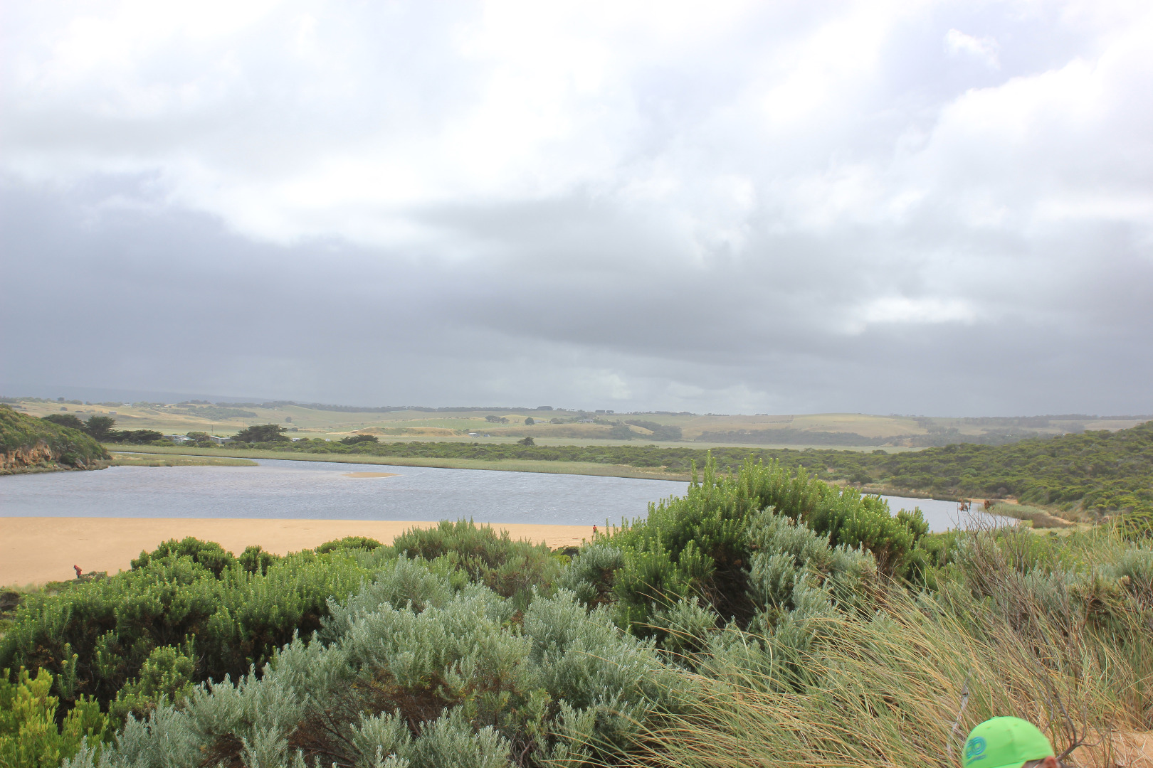
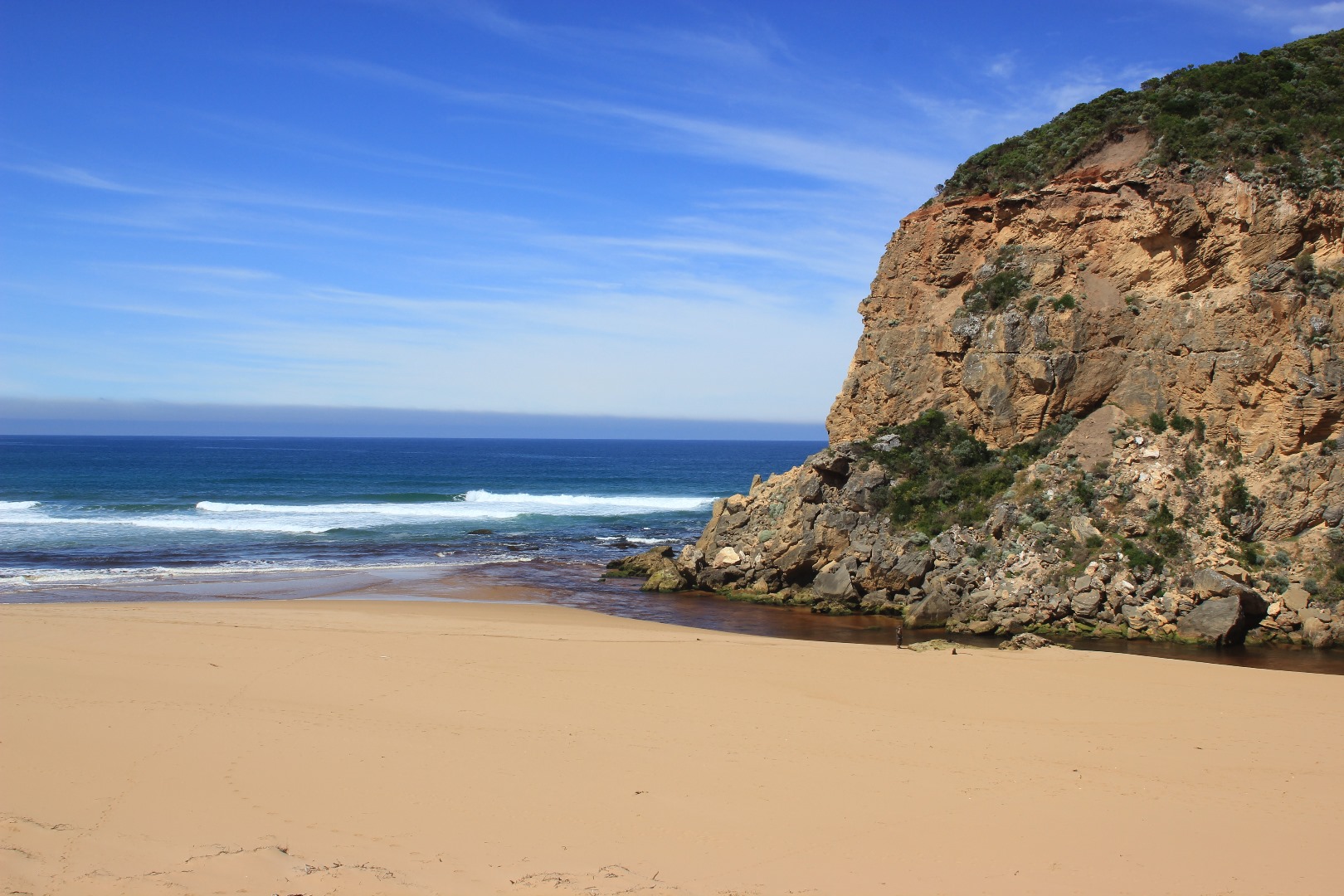
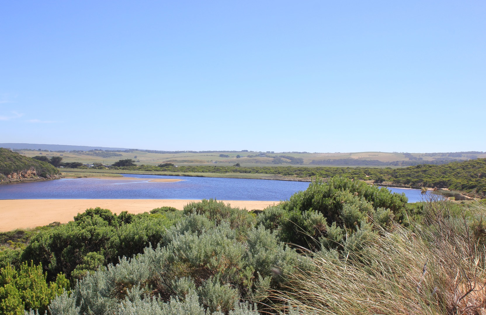
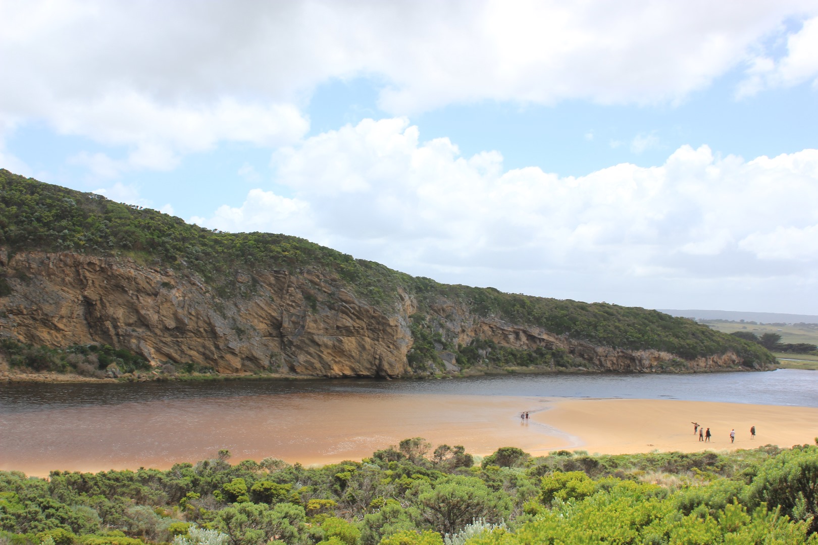
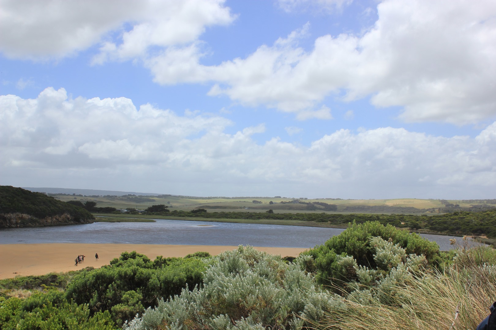
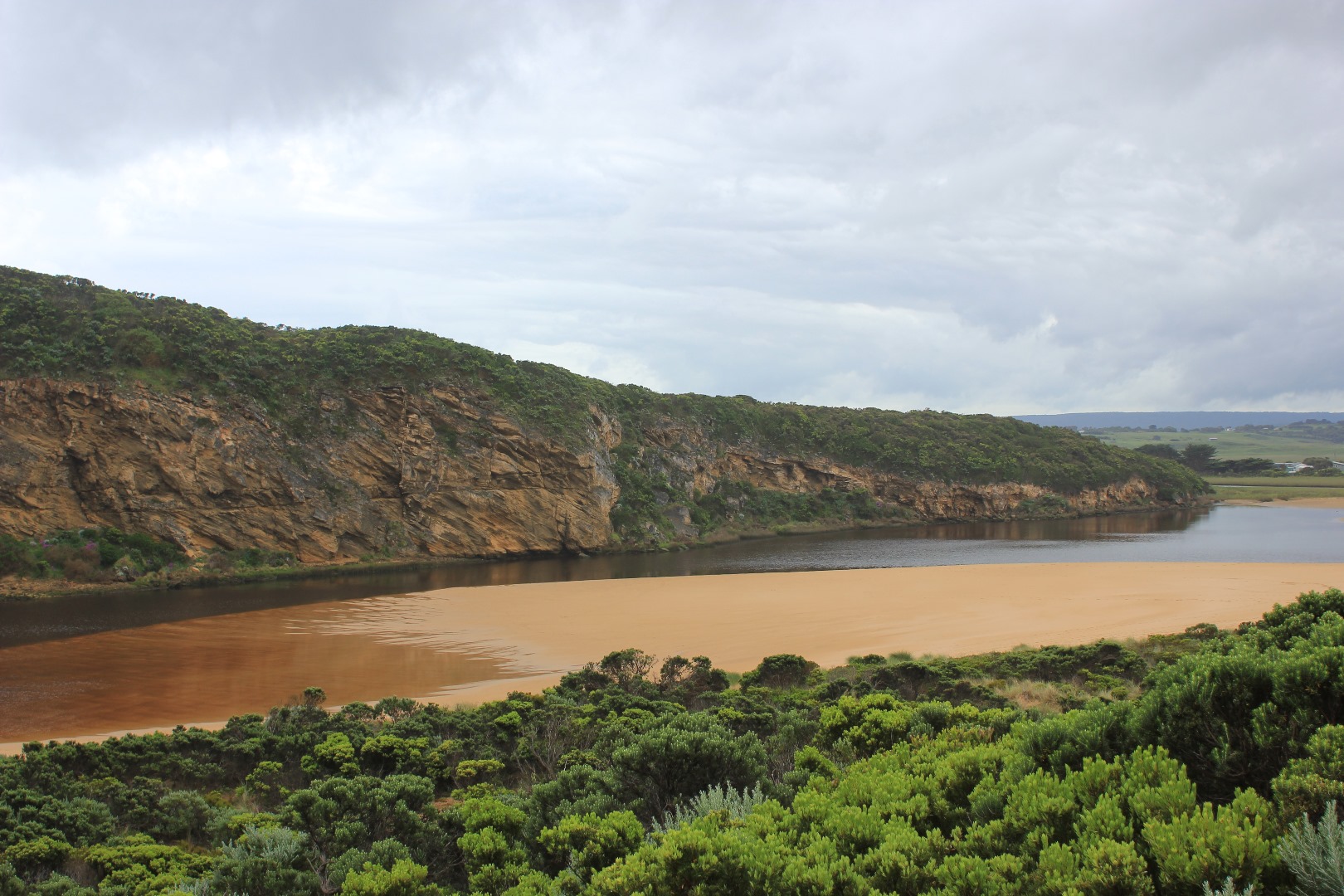
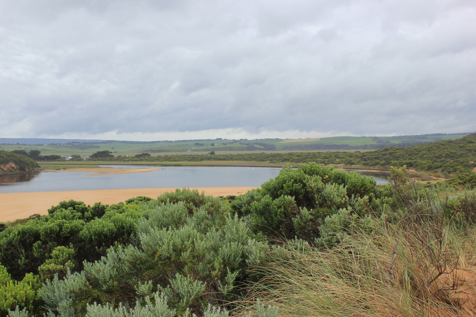
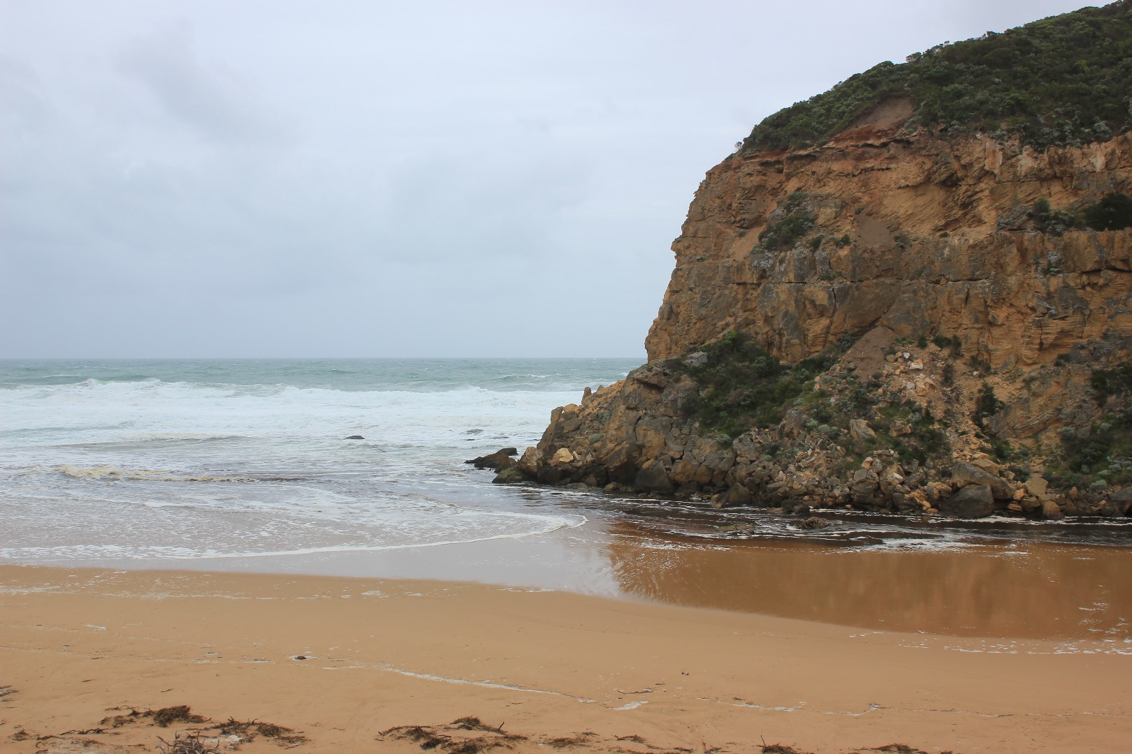
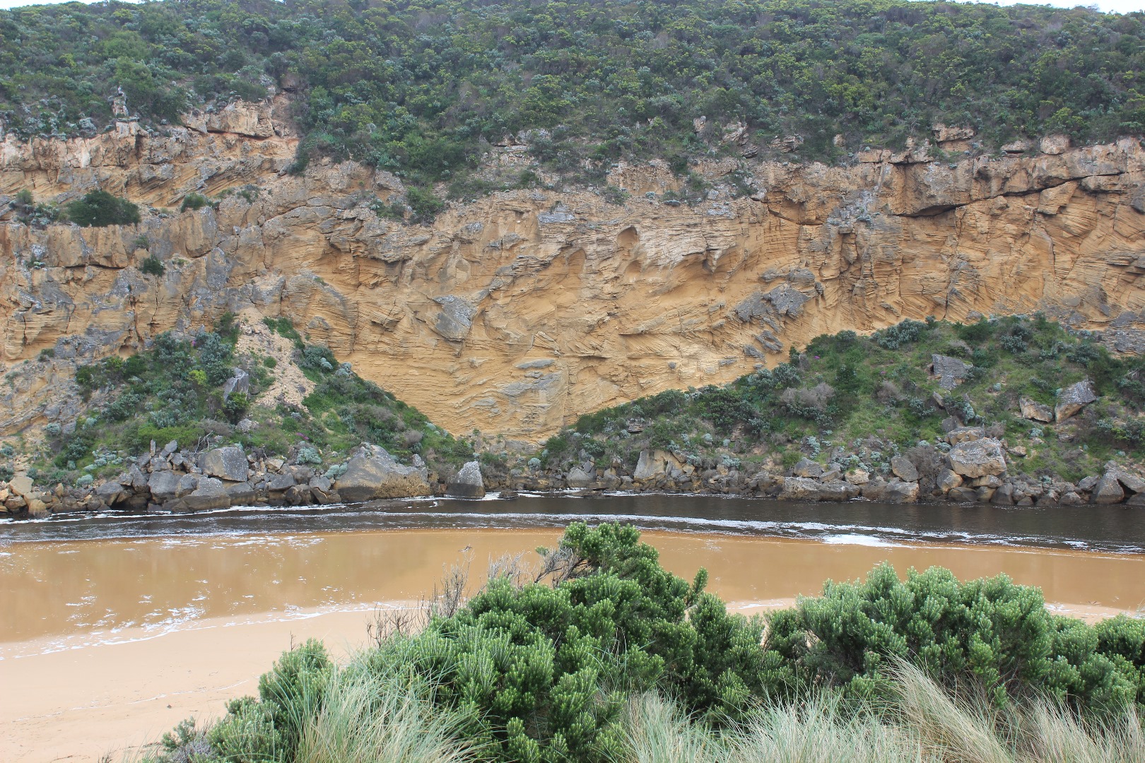
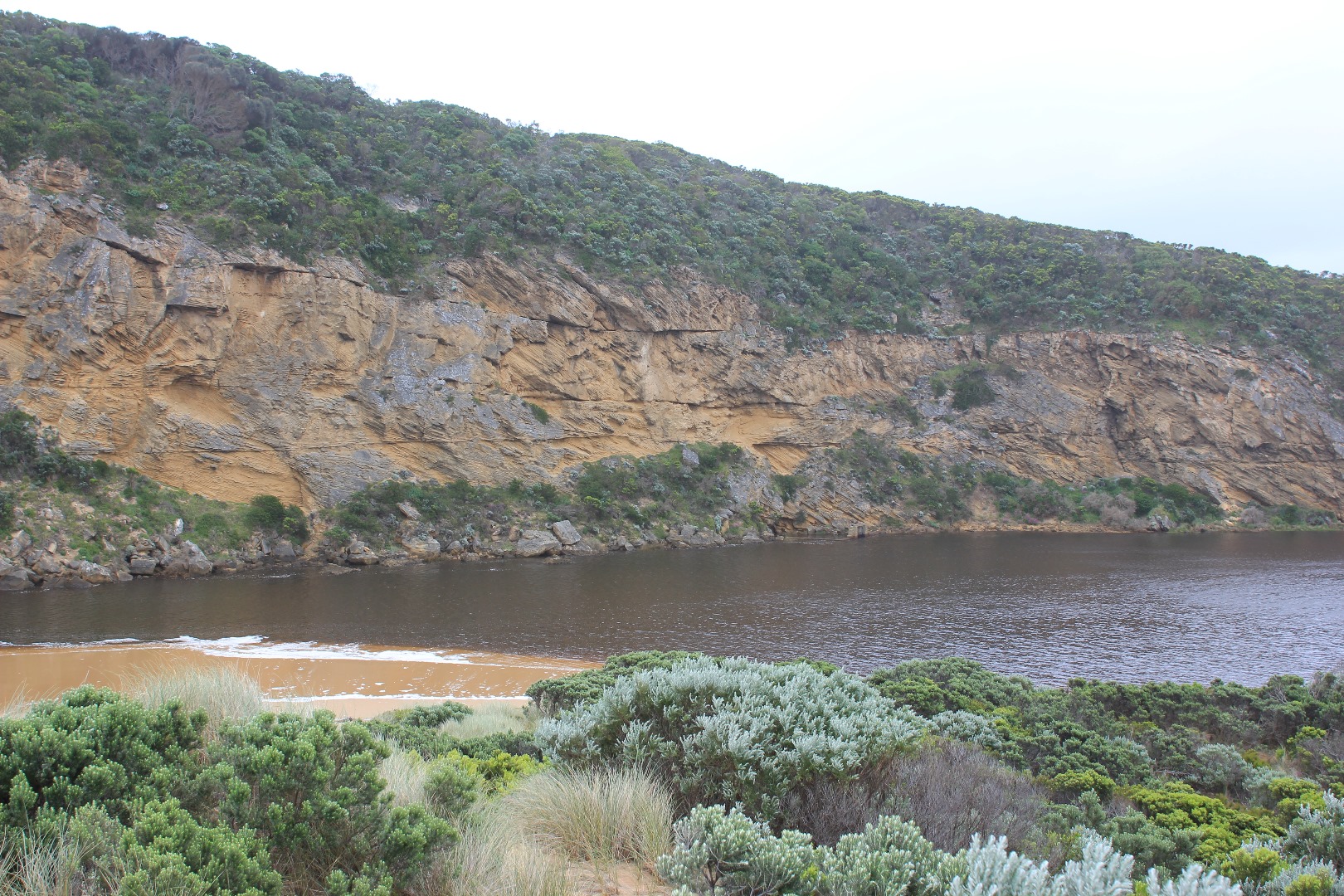
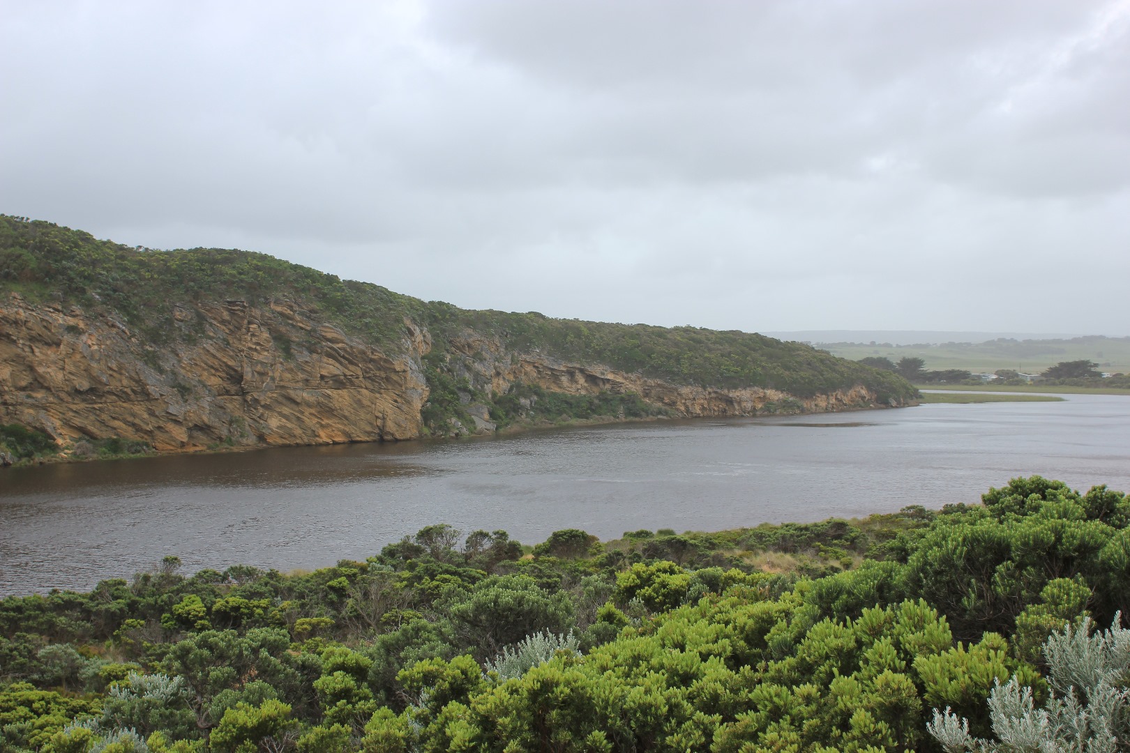
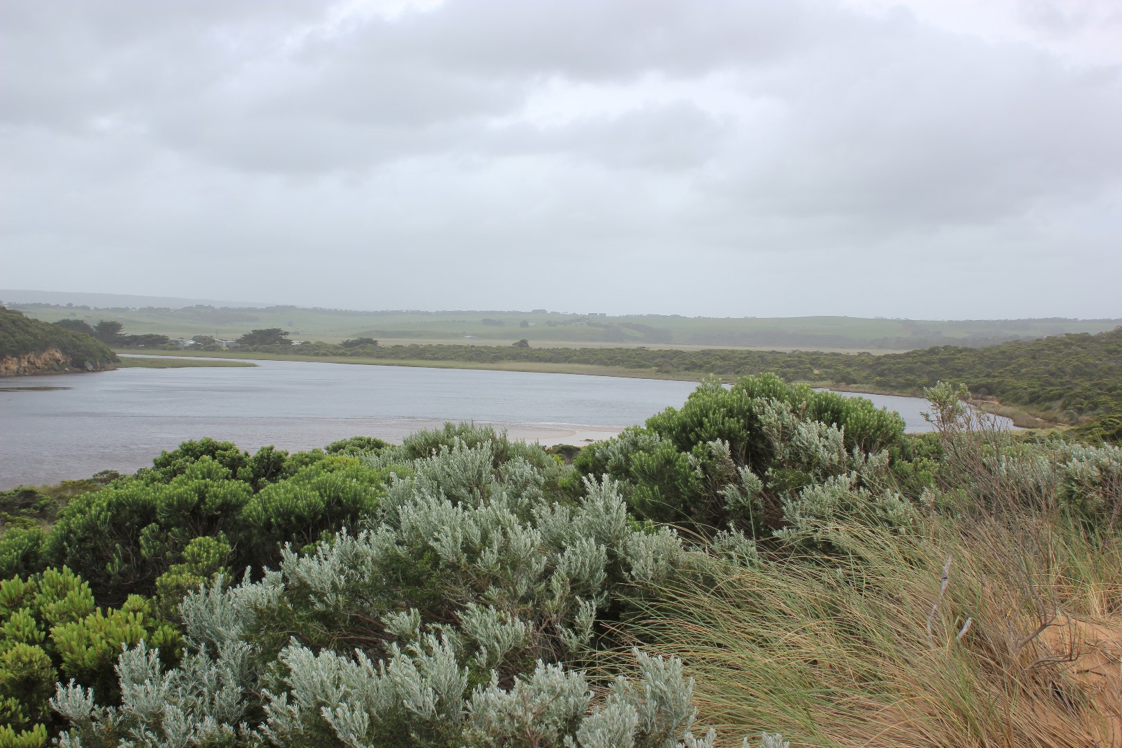
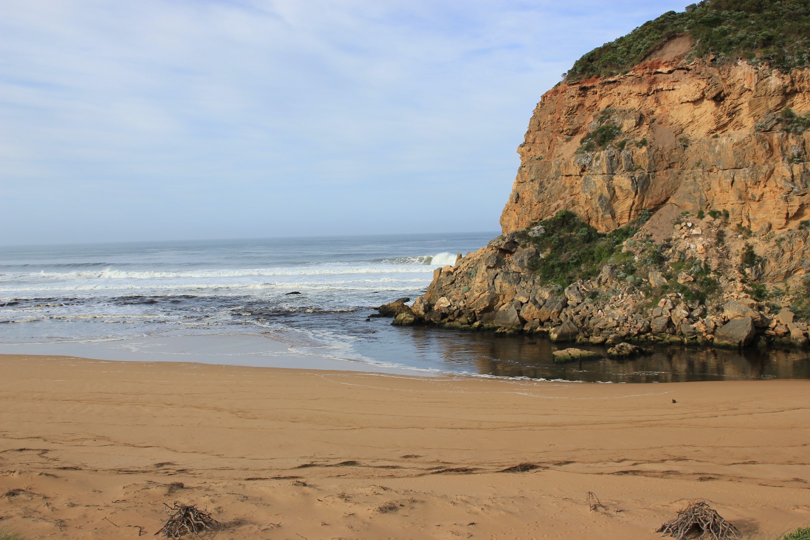
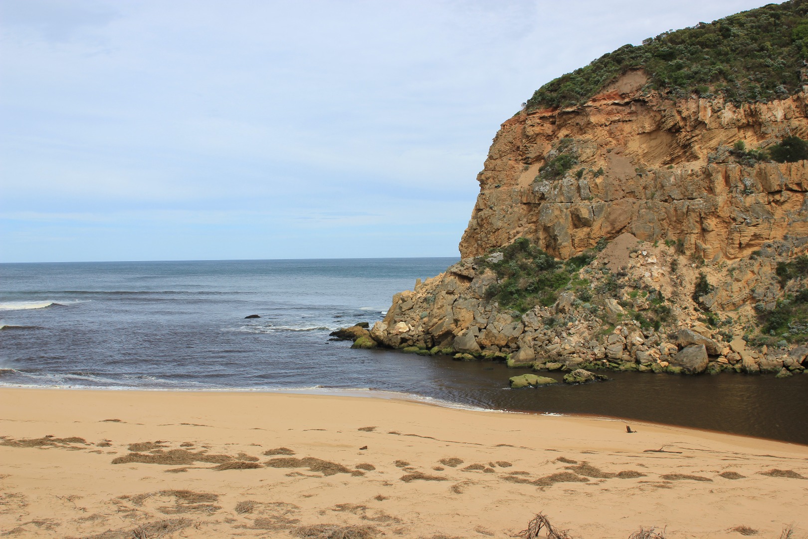
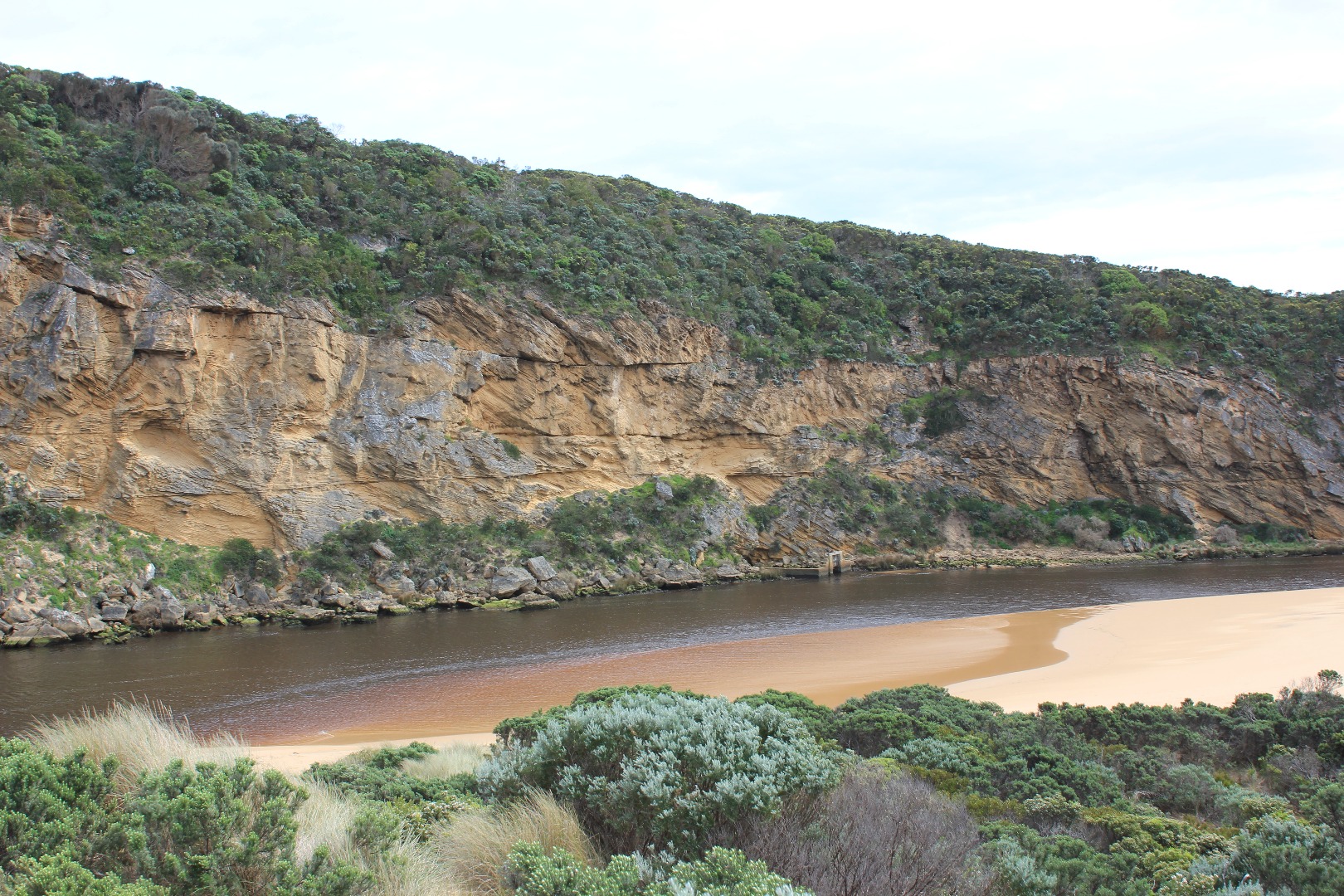
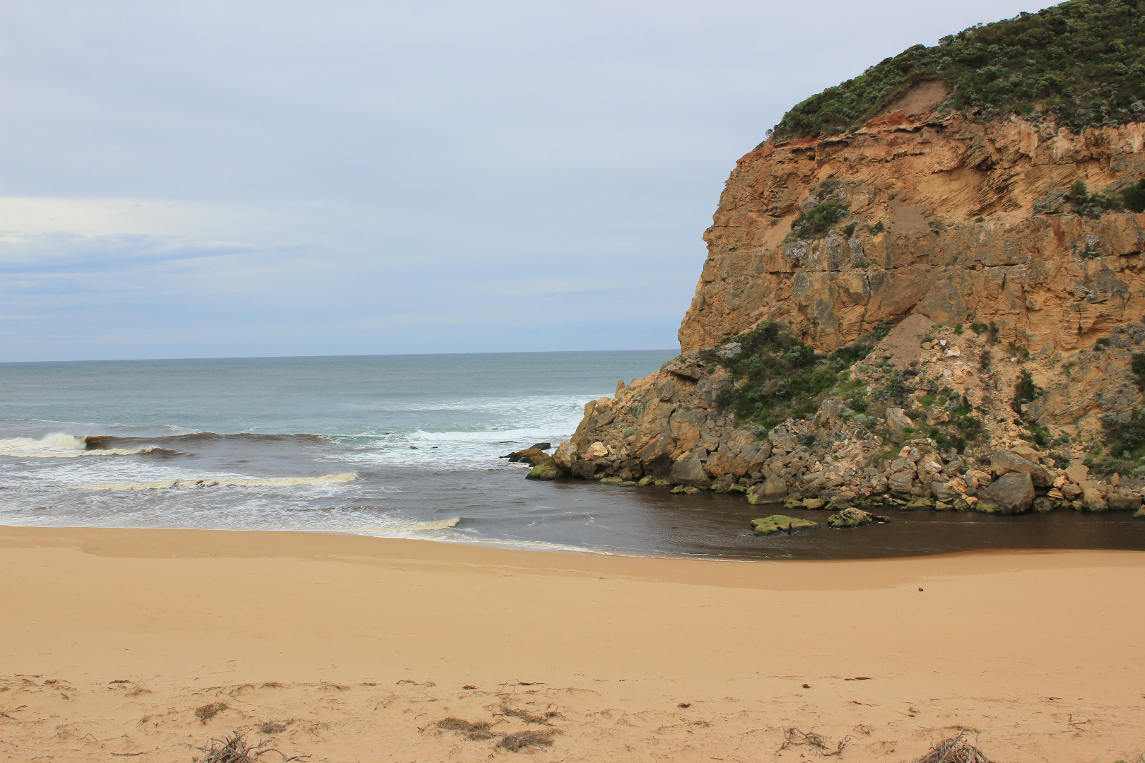
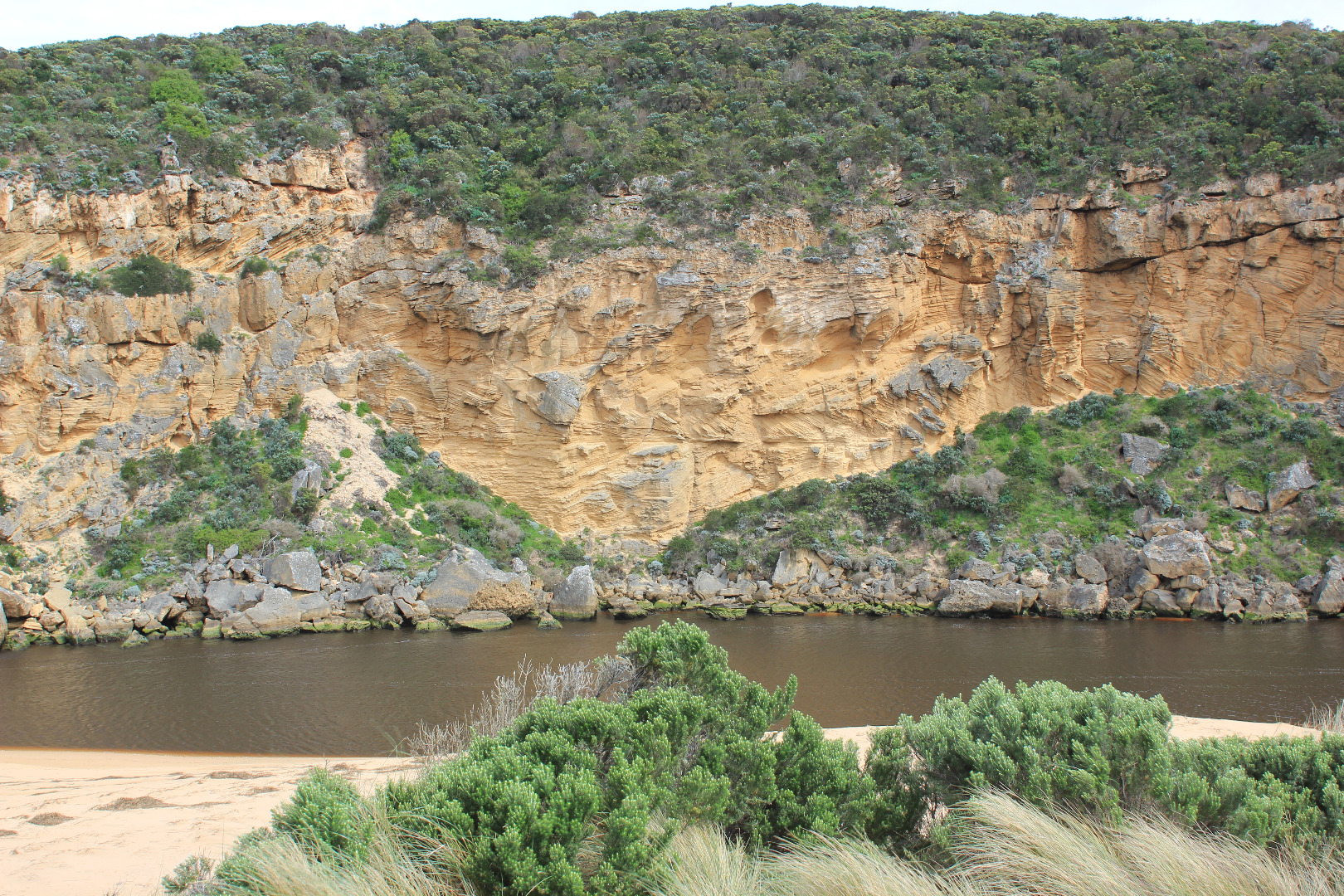
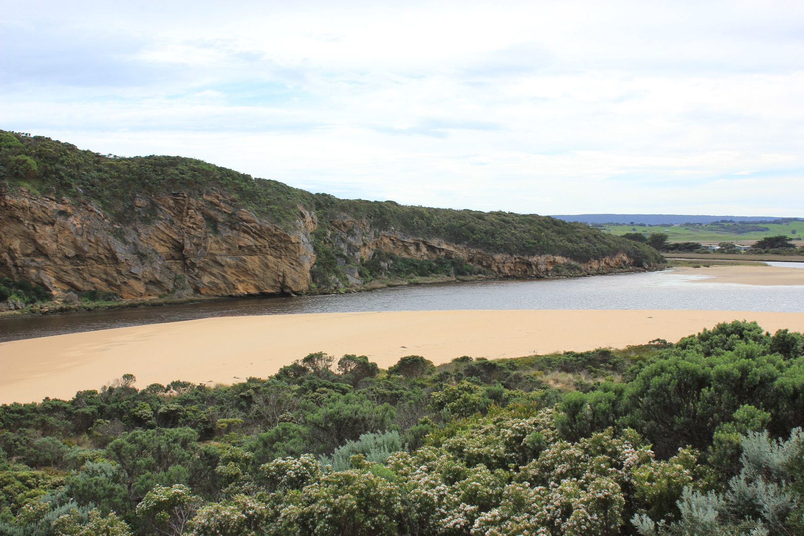
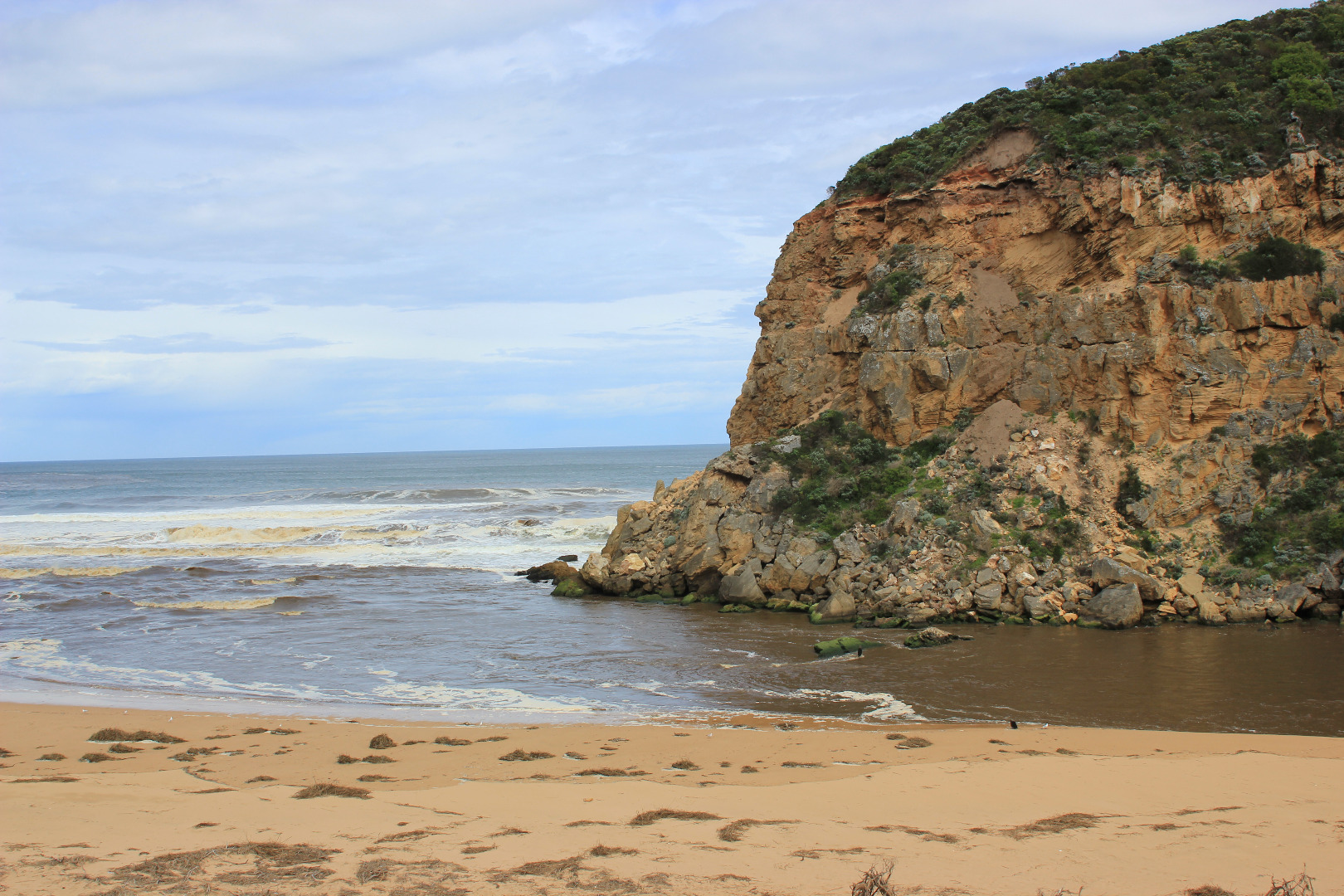
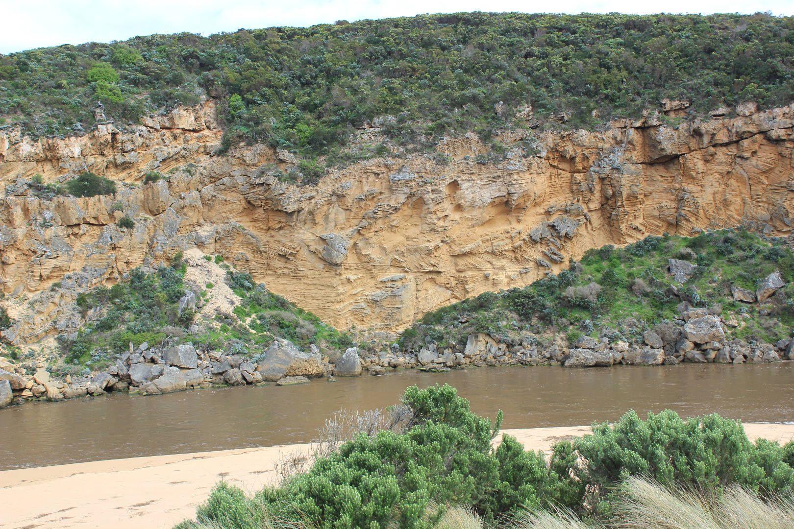
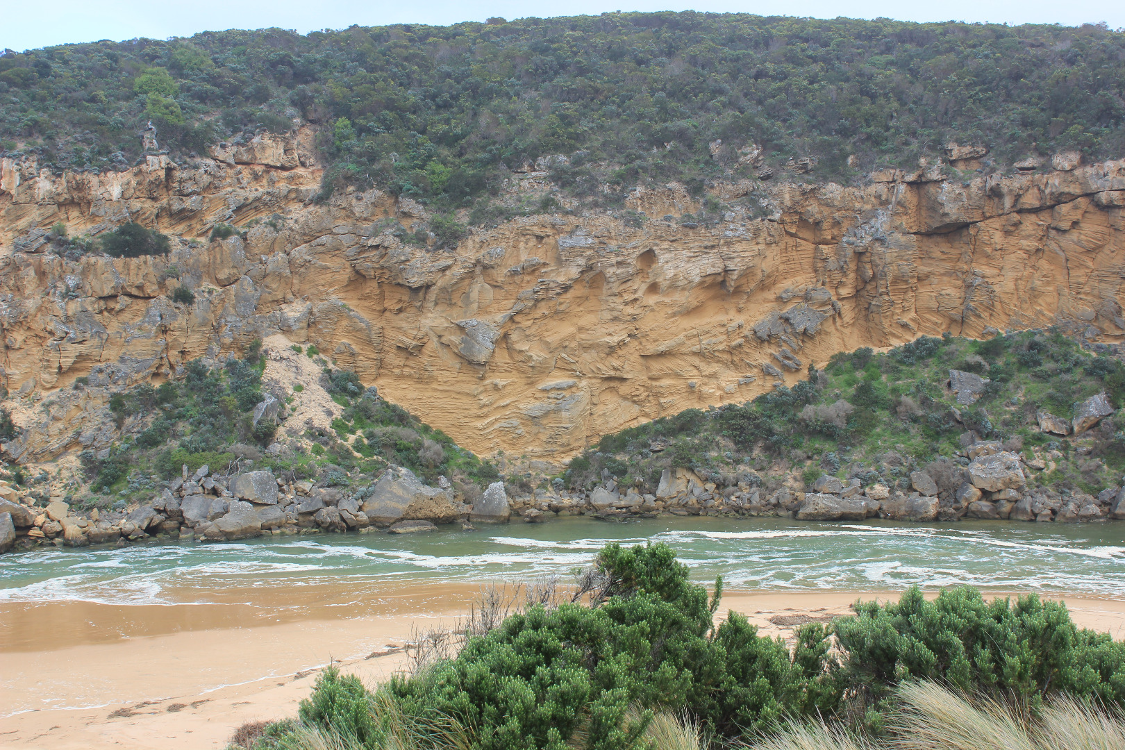
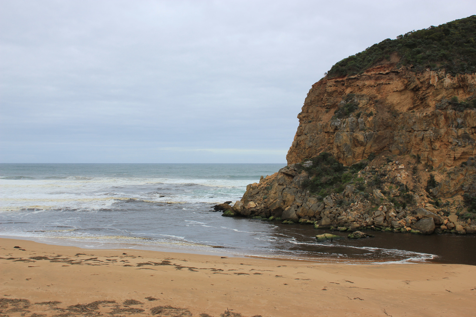
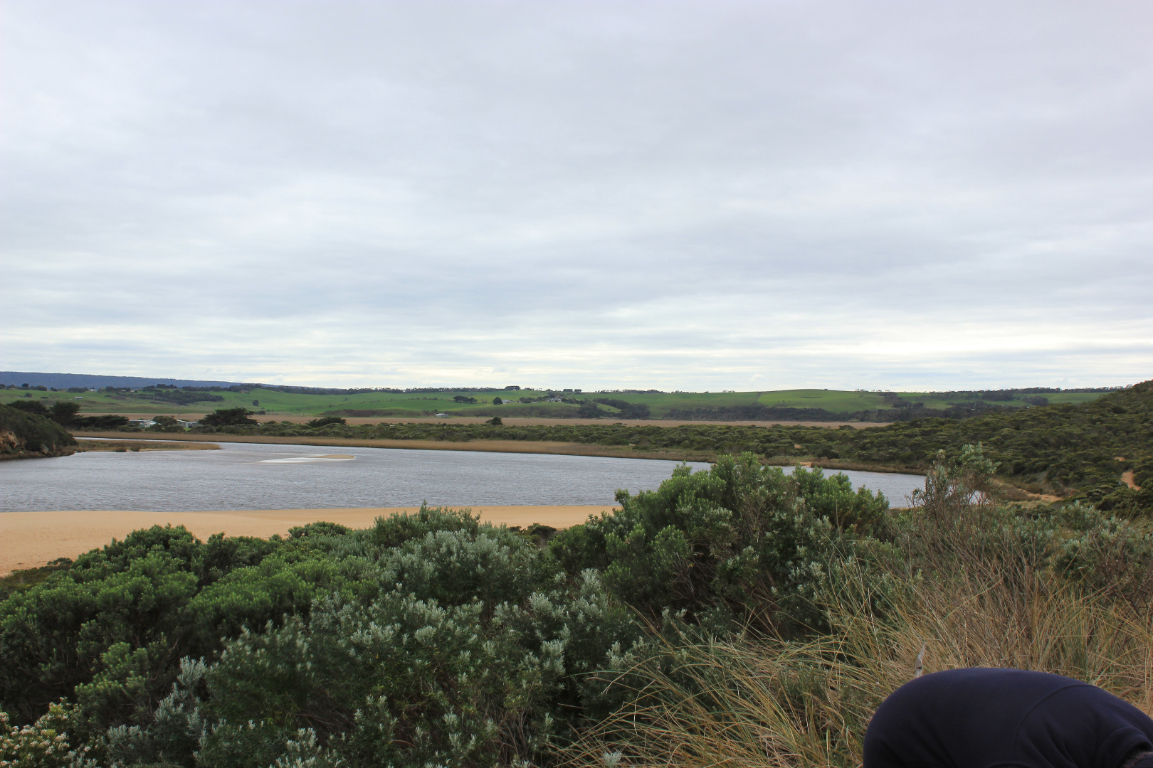
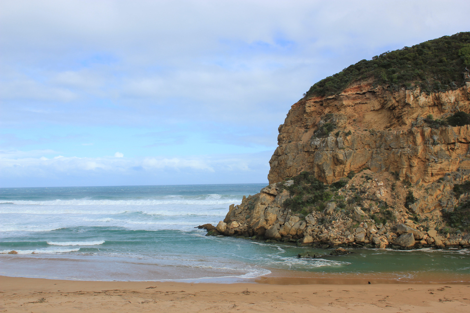
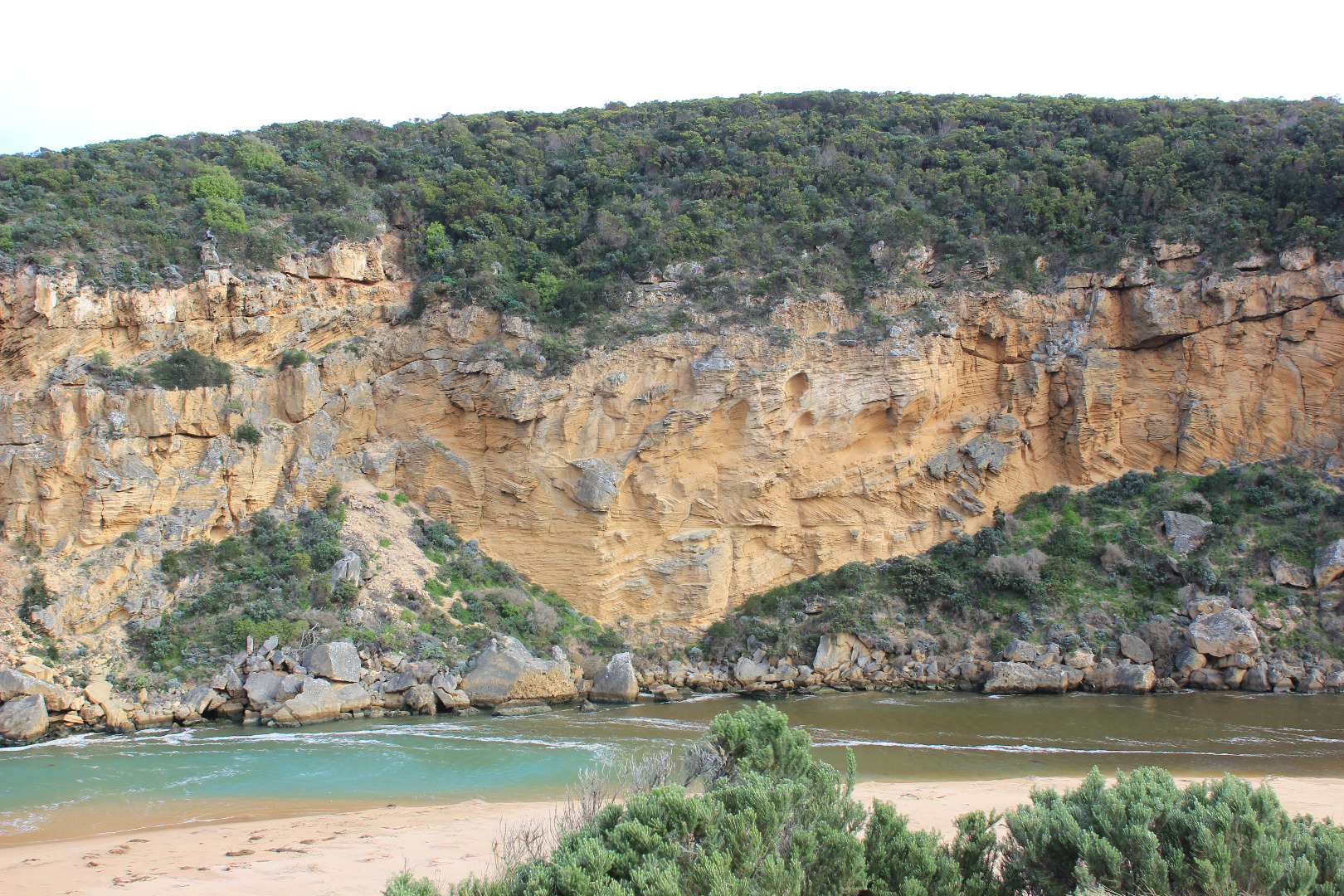
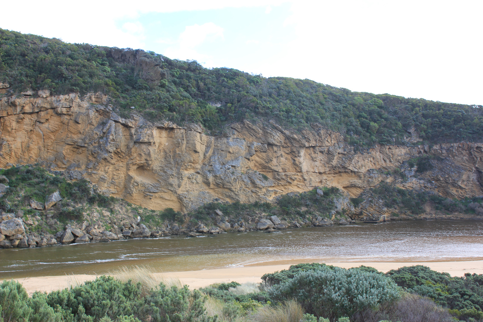
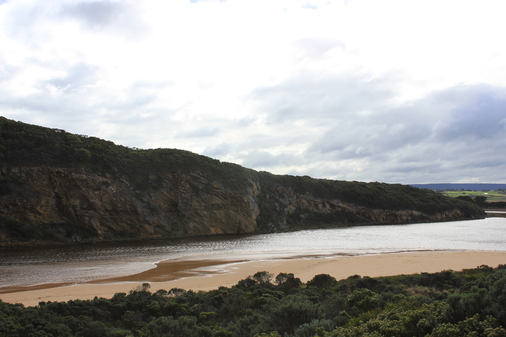
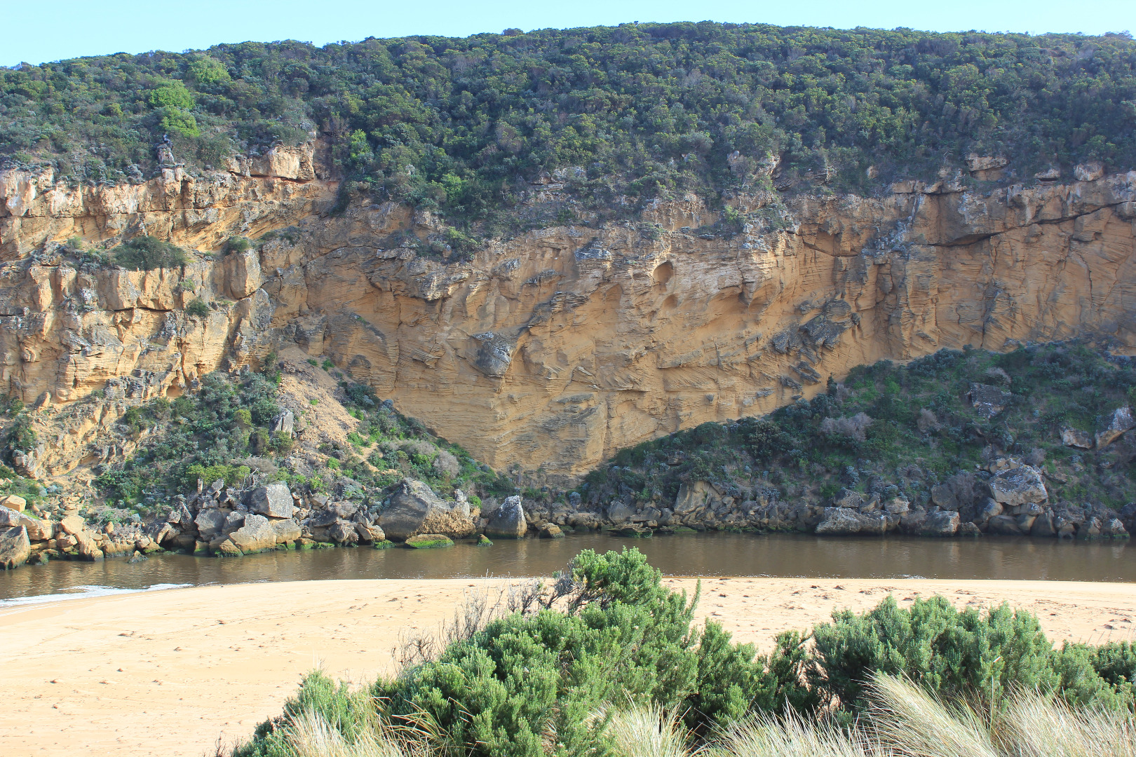
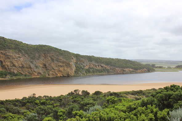
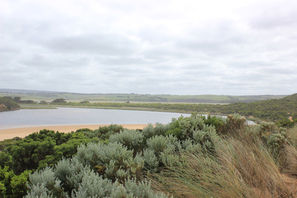
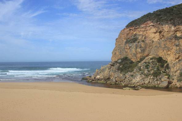
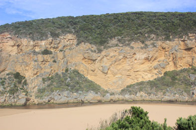
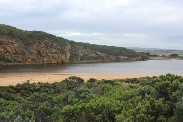
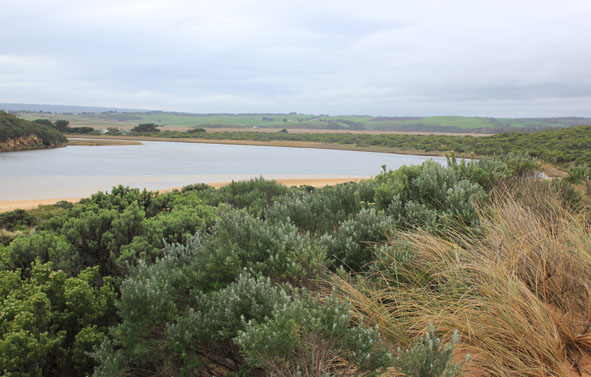
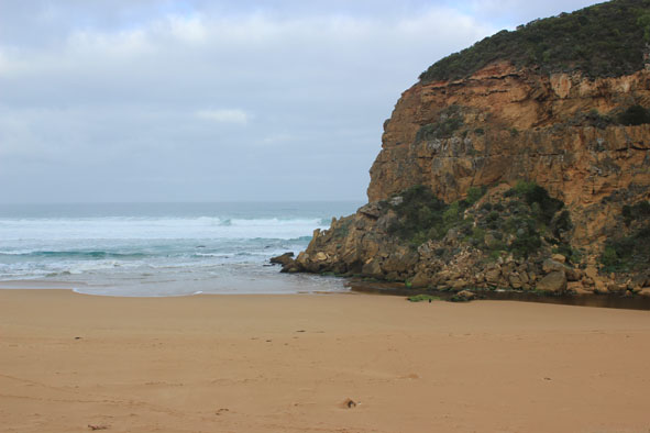
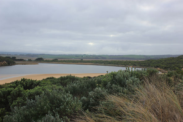
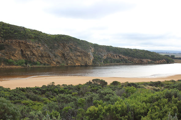
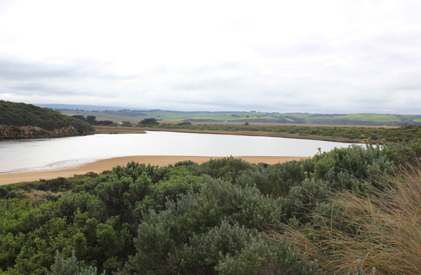
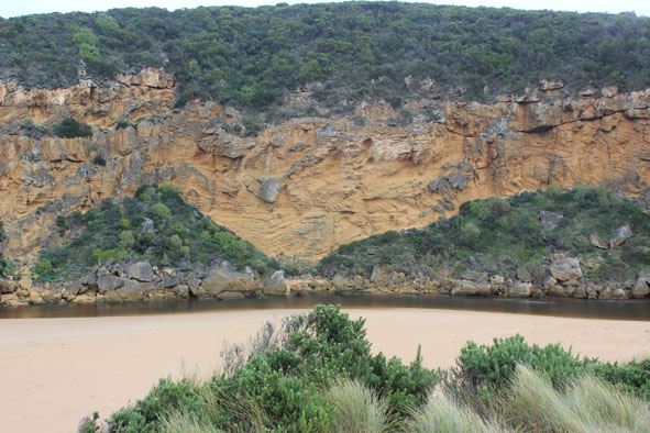
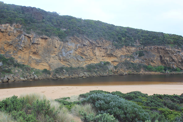
Pale discharge out along beach face to east. Entrance very shallow & channel narrow with sheer side to channel close to rocks, water only between rock & cliff. More sand around rocks & side of cliff downstream of rocks (entrance). Long shore drift across mouth. Dark silt in swash line
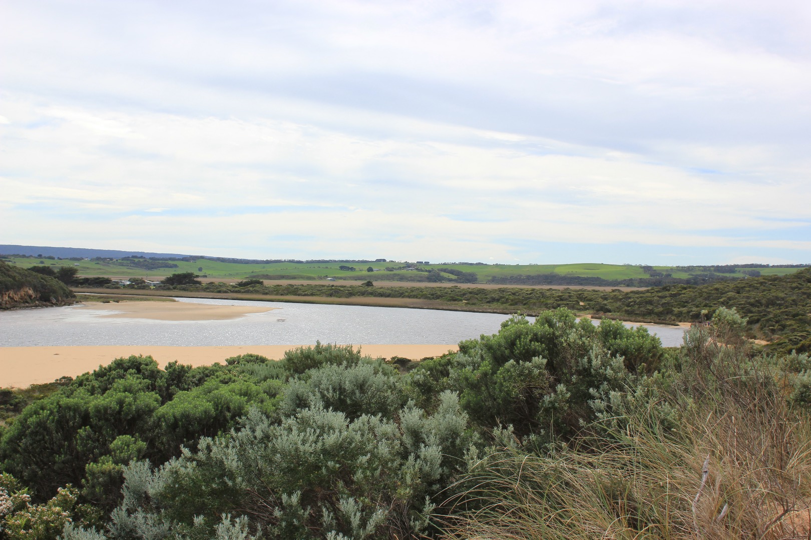
Sand height increasing at east end of beach
Very strong south wind blowing large amount of sand along side channel into estuary, but despite this waves in estuary are travelling to S/E corner of estuary. Waves flattened by strong gusts from south
Unusually high number of Silver Gulls around wetlands , estuary & beach
|
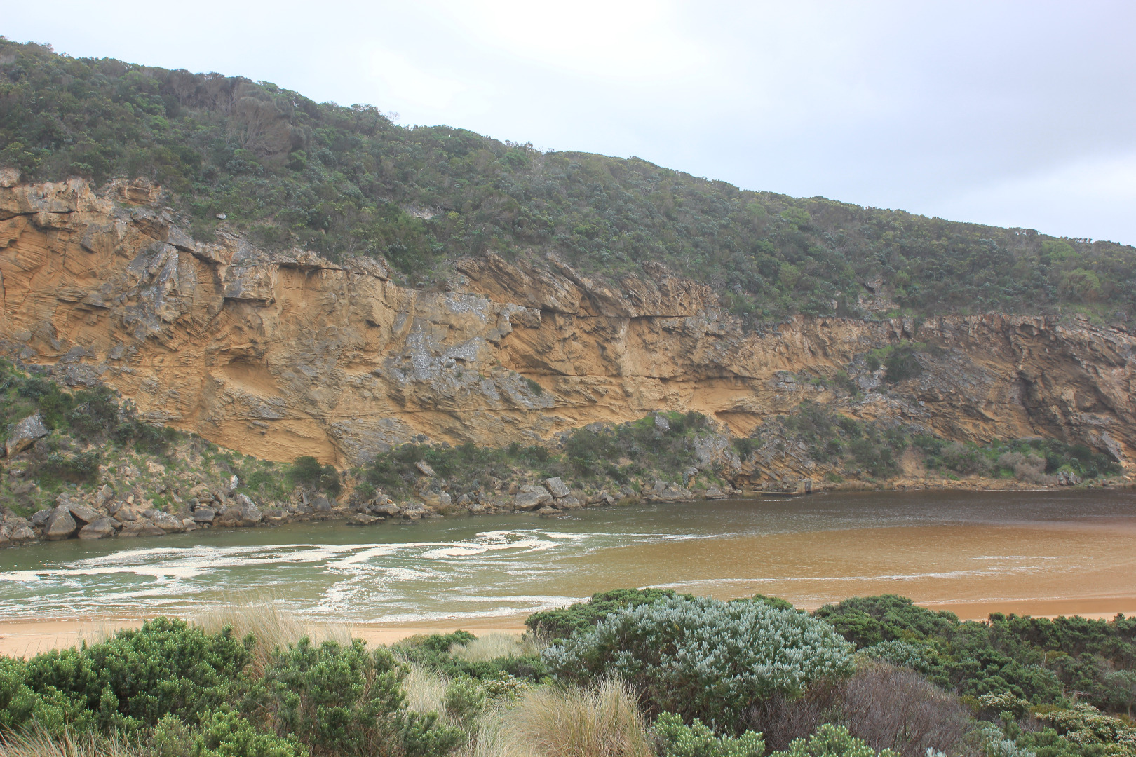
| #10749
|
16 Jan 2017
|
Approved |
Notes:
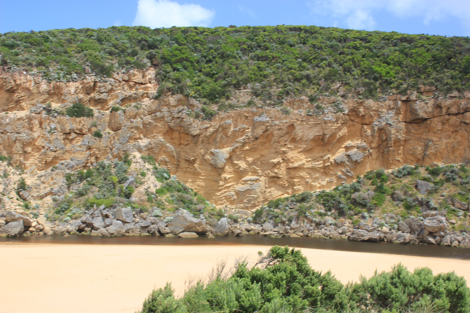
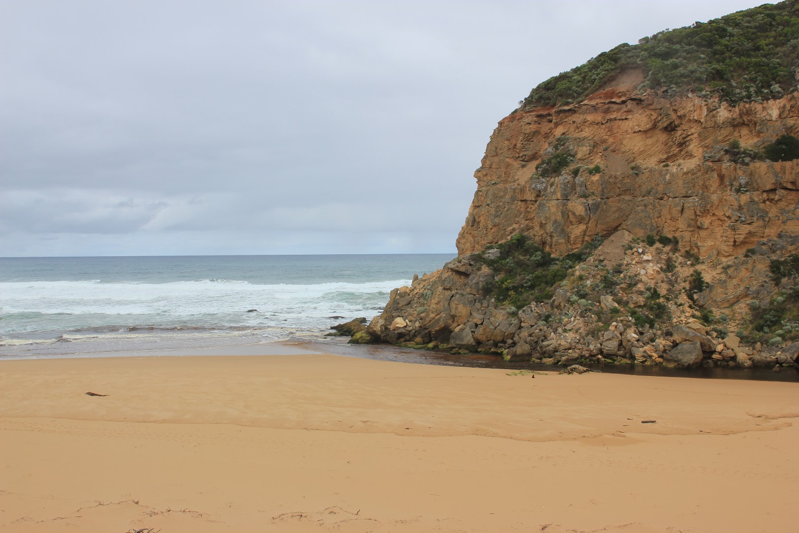
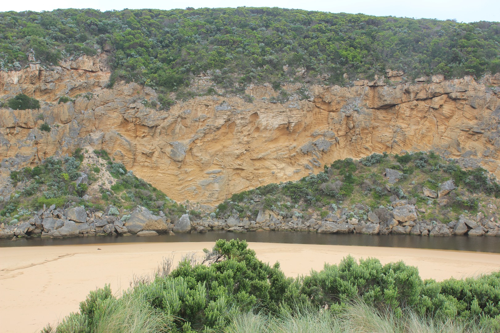
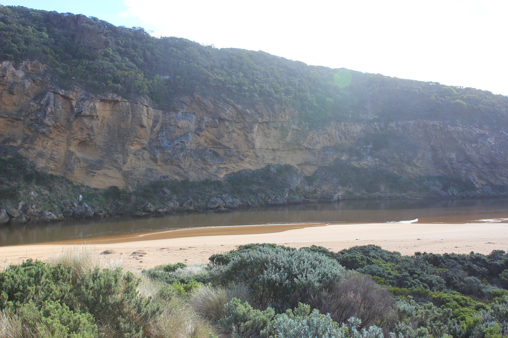
Pale discharge out to east, shallow flow out over high sand build up both along channel & entrance - east side of channel just upstream of rocks sheer to 15 cm. above water level
Water level in estuary high (possibly because of inflow from recent high seas)
Waves reducing in height, sea moderate with occasional high set. Slight but constant long shore drift across mouth
Beach front not as high as previously, now sloping . Waves have been high up on beach
Red scum along sand south side of estuary
|
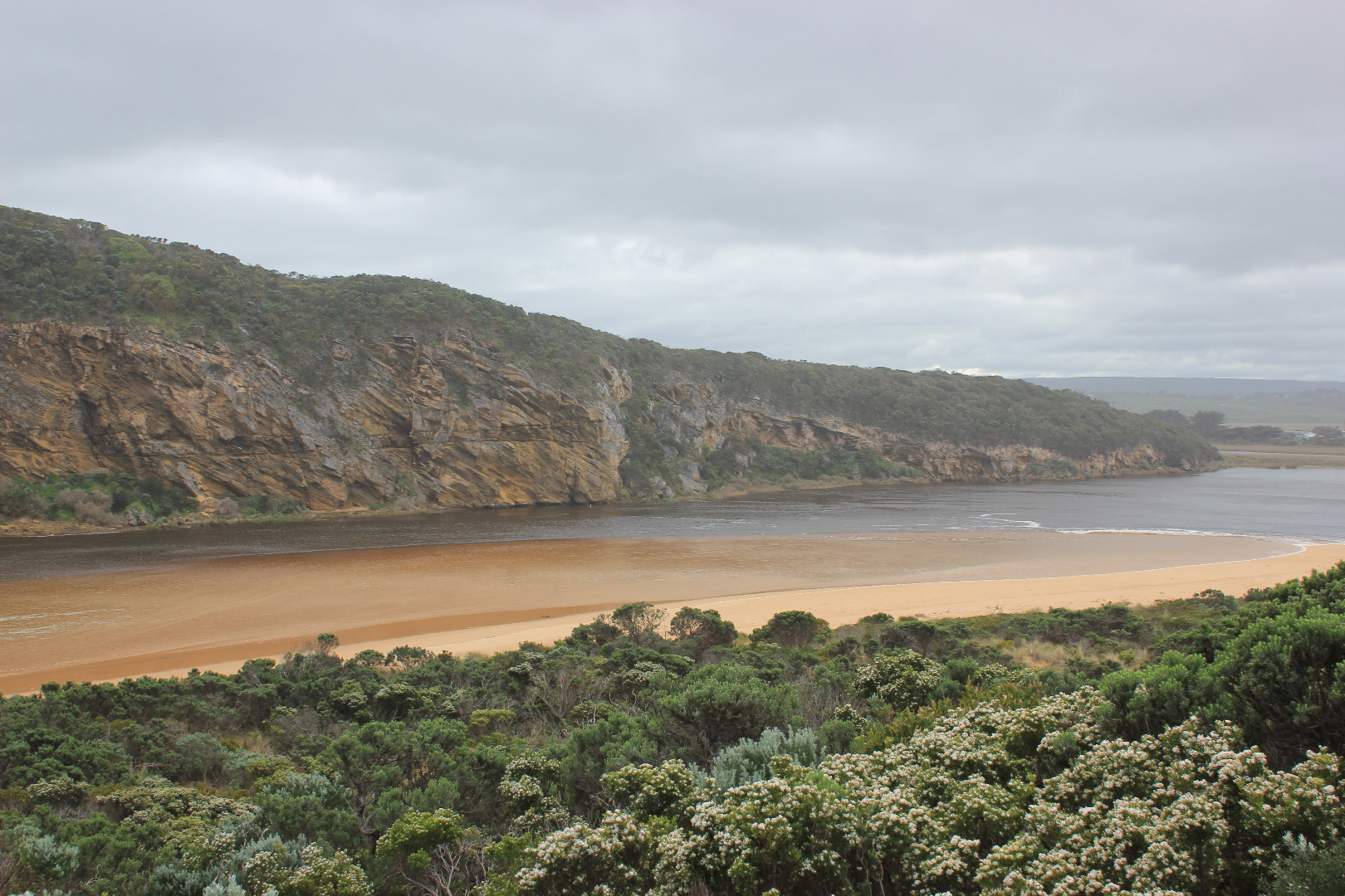
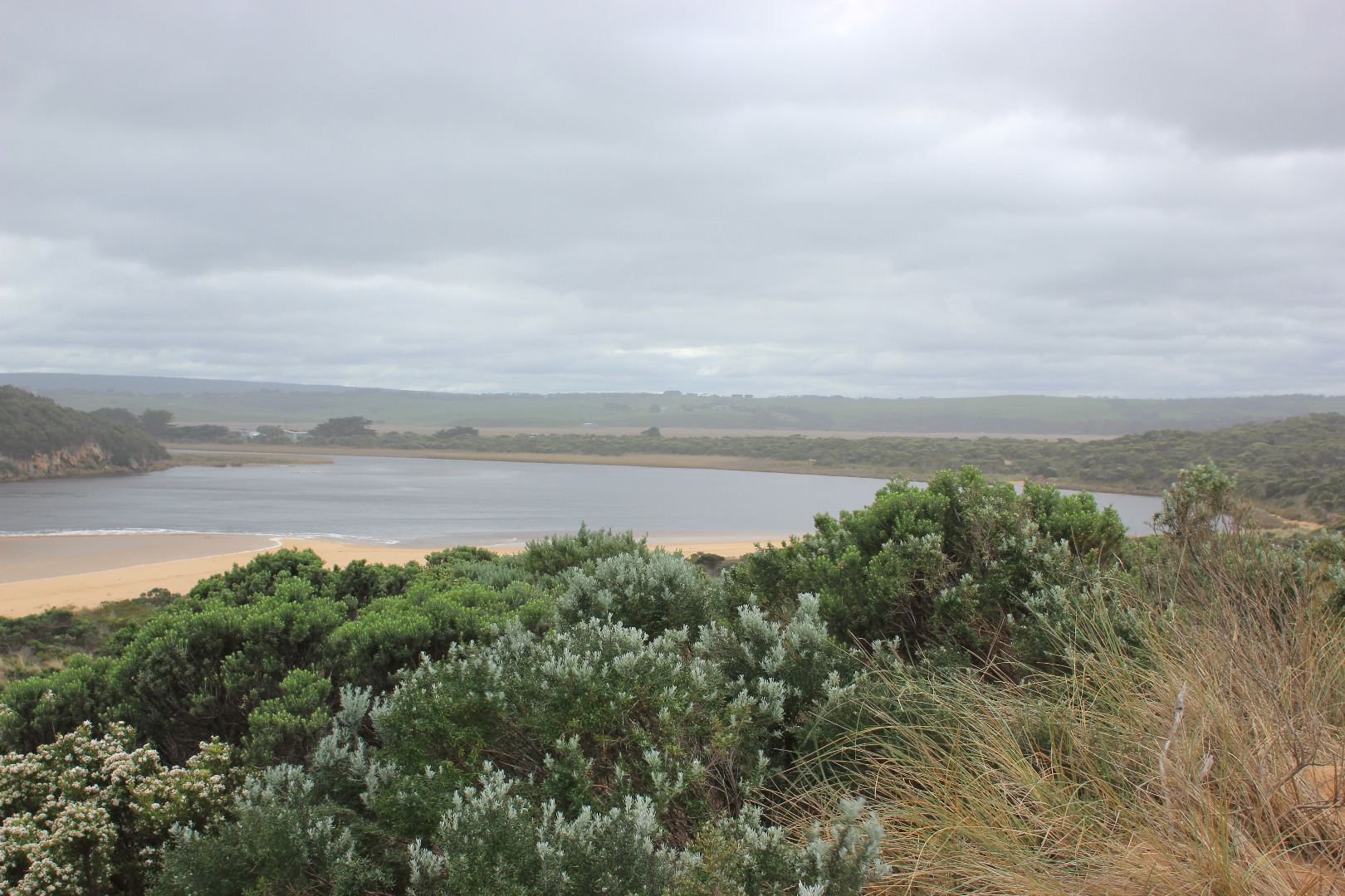
| #10713
|
13 Jan 2017
|
Approved |
Notes:
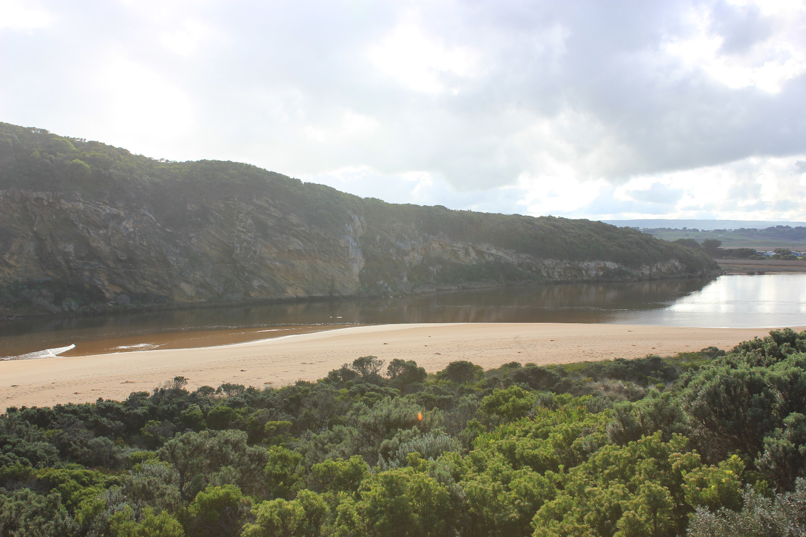
Observations taken from beach not Gp1 because of wind & very heavy rain
Mouth open with flow between rock & cliff. Intermittent waves entering from very rough sea over a much wider area. Strong long shore drift across mouth
Last hi tide has travelled well up on beach over steep high beach front and flow has turned to travel west in depression behind rise to enter mouth & channel.
Tides have wide range - Low tide @ 18:58 = 0.2 Hi tide @ 02:18 = 1.14.
Sand area at south side of estuary is being re formed into new rises & inlets
Many small fish in shallow water beside low track near car park
Waves across estuary to south east cr. from north west wind
Good catches of Black Bream & Mullet continue to be caught
|
| #10678
|
6 Jan 2017
|
Approved |
Notes:
Observations taken nearing low tide
Flow reducing. Pale discharge out around mouth & along shoreline to east, also some to west.
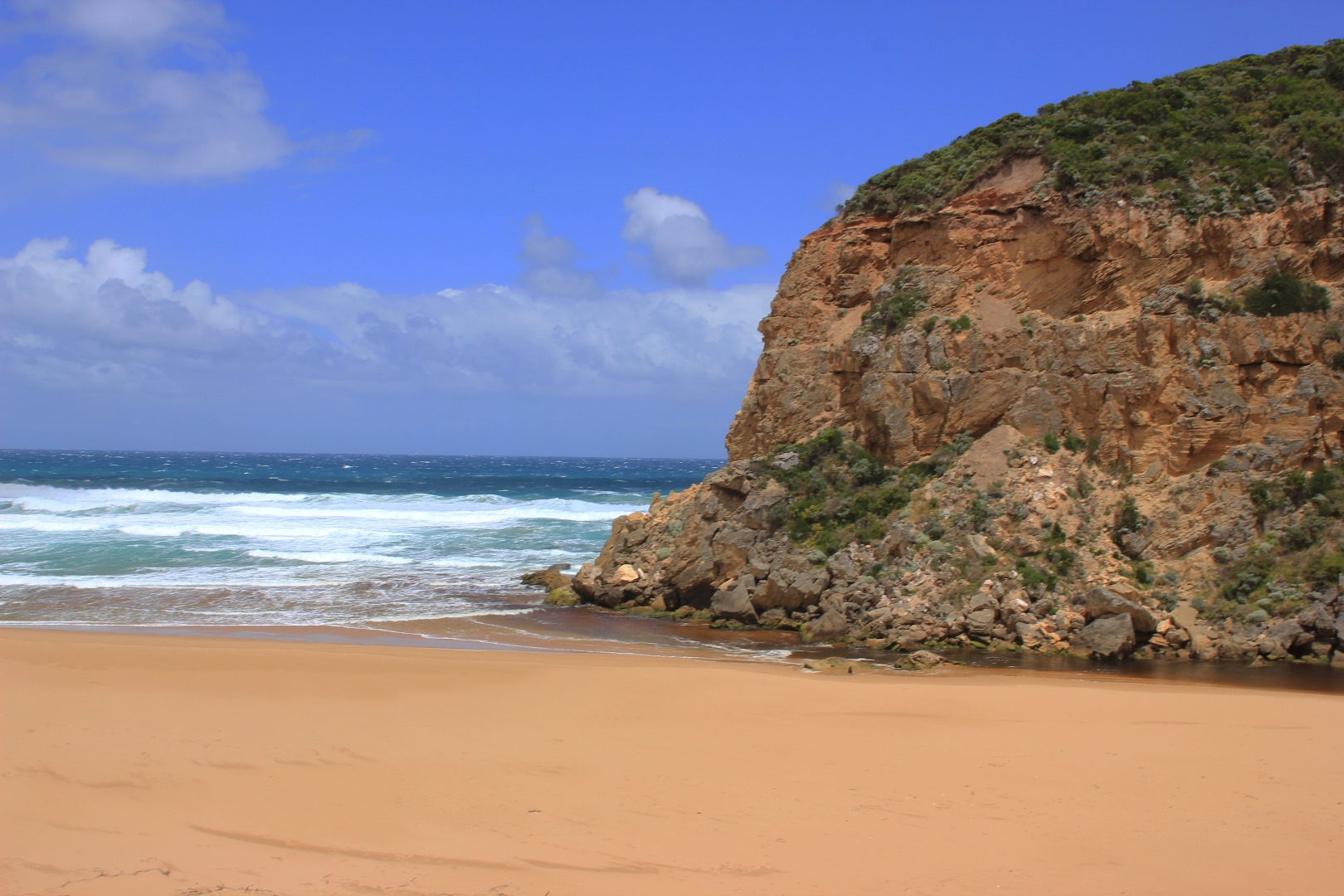
Beach curved with highest area near mouth
Channel shallow sand has built up at mid channel & at entrance. Flow only between rock & cliff face through shallow rapids. Edge of channel has steep bank .50m above water level
Very large no. small fish in shallow water beside low track close to stream side veg. 5 turquoise dragonflies in that area
|
| #10657
|
30 Dec 2016
|
Approved |
Notes:
Dark discharge out around mouth, to east & also to west, slight longshore drift across mouth
Beach horseshoe shaped, with high sand along beach face, highest close to mouth. Beach very wide
Small area of sand bar in estuary exposed & large expanse of sand south side of estuary. Many small fish in water beside low track close to car park
Dead Black Bream SE side of estuary where scum has accumulated
|
| #10650
|
23 Dec 2016
|
Approved |
Notes:
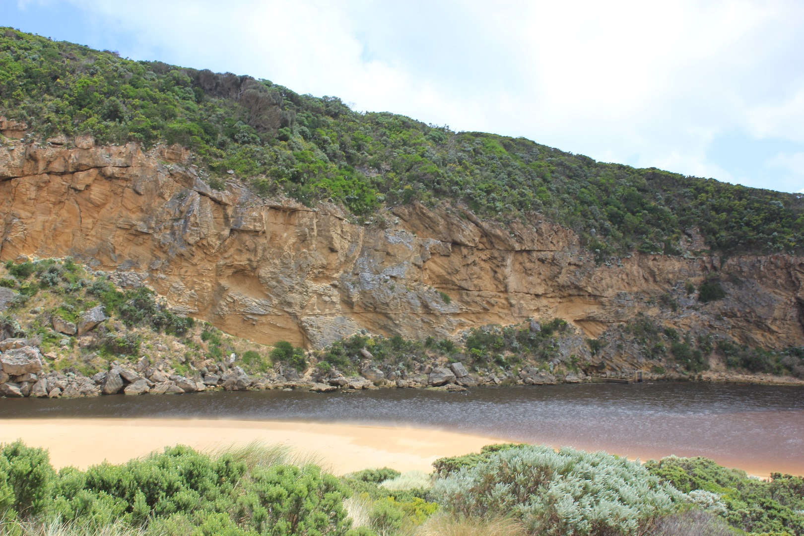
Observations taken near low tide. Humidity high. Swell time 11-10 sec
Reduced dark brown reddish discharge around mouth & alongside beach face to east
Mouth shallow, occasional long shore drift across mouth. Greatly increased sand build up. Flow only between rock & cliff. Side of channel has sheer side suggesting a strong release as sea level dropped at last low tide
Beach face high with lower area between face & dunes
Sandbar well uncovered also side of low track where algae is forming on stream side veg & sea-grass. Mosquito larvae, mosquitoes & flies in areas nearer car park but many small fish observed at south side of estuary
Turquoise dragonflies (3) & red Damselfly (1) amongst stream side veg east side of estuary
|
| #10647
|
17 Dec 2016
|
Approved |
Notes:
Reddish brown discharge out over increased sand build up only immediately around the mouth
Rough sea assisted by south wind sending some waves up over steep beach front into dip then turning west & proceeding toward mouth & channel at last hi tide
South wind blowing a large amount of sand down beside channel into the estuary
Black silt pattern on sand south side of estuary & channel entrance area
Algae forming on stream side veg.especially at Lt1.
Dead female kangaroo on sand near channel entrance to estuary
|
| #10624
|
10 Dec 2016
|
Approved |
Notes:
- Reduced outflow out shallow over large sand build up at mouth. Travelling east along foreshore. Long shore drift across mouth
- Swash line up high on beach with 1000's+ Velella at all stages of development
- Strong wind gusts (8) on 07/12/16 have reshaped the dunes especially next to Gp1 & E end of beach
- Steep rise from sea at E end of beach but rocky area has been scoured out (depth to sea about 5 - 8m)
- Steep rise in height of sand at E end beach then dips down at mid beach where waves impact then rises even higher close to mouth
- More rock falls on west cliff face
- Area where channel meets estuary has changed - much wider, large areas of black sand are have been deposited in this area
- Only mosquito lava seen in scour holes along low track, but closer to car park small fish were present in confined areas
- Pacific gull observed at E end of beach
|
| #10598
|
4 Dec 2016
|
Approved |
Notes:
- Observations taken at low tide
- Flow out -reducing dark discharge out over sand build up at mouth. Travelling east along foreshore & going out to sea about 2/3 rds' along beach
- Sand visible in breakers out to sea
- Hi tide has been well up on beach & estuary
- Eastern end of beach has larger curve & sand is highest closer to mouth
- Dark silt in swash line along beach & in estuary. This pattern clearly shows how storm surge 12/11/16 deposited sand along south side of estuary
- Mouth affected by long shore drift sending some small waves into channel
- Very large no small fish in shallow water along south side of estuary
- 1 dead Shear water (foxed) near mouth
|
| #10579
|
26 Nov 2016
|
Approved |
Notes:
Flow out to east but reduced since 20/1/16. Long shore drift across mouth with small waves entering channel
Beach very wide with high front, some waves up & over. Also very large expanse of sand south side of estuary. Swash line on ocean beach has 1000's of 'by the wind sailors' & large amount of dark silt.
Sand bar exposed showing channel in mid section
Wind SW at south side of estuary, S along channel & SE along beach to mouth. Sand blowing down channel into estuary. Some wind gusts above 7
More rock falls from cliff face
|
| #10578
|
12 Nov 2016
|
Approved |
Notes:
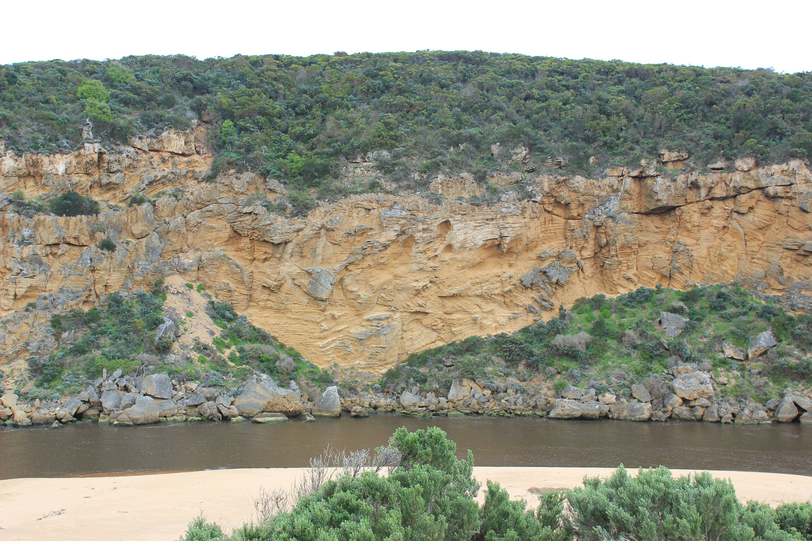
Dark discharge from draining flats up stream.( water drained from below G4 but is still draining upstream to G6. ( cape pond weed is flowering) Land slips along OOR between G5&G6
Flow out along foreshore to east
Foreshore is now undulating and beach very wide. Large areas of sand exposed in on south side of estuary. Sand extends north into estuary as well.The 'flow' of sand recently deposited by storm surge shows distinct levels (about .50m from present water level at edge) with about 30 - 40 cm. difference across area.Sand bar now has channel through middle.
Juvenile Nankeen Kestrel on debris near mouth
Sand has built up along parts of low track where new scour holes occur near previous two that currently contain small Flathead gudgeon & juvenile Tupong)
|
| #10580
|
5 Nov 2016
|
Approved |
Notes:
Dark discharge strong flow out along foreshore to east , going out to sea about 2/3 to east
Gale force winds overnight 7-8 & 5.8m seas currently sending waves up to base of dunes all along the beach. East end continues to be impacted creating long shore drift to mouth. Some waves entering channel over a wide area(from sand dune to cliff) then turning east & impacting on low track which is completely under water
water up to bearer just below deck on fishing platform at G2
Wind gusts 7 at Gp1 -wind from NE at Gp1 but from WNW across the estuary
|
| #10462
|
29 Oct 2016
|
Approved |
Notes:
Dark discharge out along foreshore
Strong outflow but small waves entering & travelling north across the sandbar
Sea rough with occasional very high set of waves -SW swell continues to impact east end of beach causing long-shore drift to mouth. Previously high sand near east end has been reduced in height by wave action. Swash-line high up on beach (many purple shells)
Recent storm surges have deposited more sand into the estuary extending sand at south side further north into the estuary(observation taken near low tide).Sand bar visable with channel partly cut into middle. The deep scour areas along low track have been filled in and new ones created. Areas of black sand at start of channel from estuary
Maram grass regeneration along base of dunes closer to mouth. Increase of Euphorbia paralais & senecio elegans along dunes
Thousands of small eels(?)/ fish making their way upstream observed at G4. moving along vev at side of channel away from strong flow
Rivernook flats have no visable water cover but all areas up stream to G6 are under water- no flood water below G4
|
| #10459
|
24 Oct 2016
|
Pending |
|
| #10458
|
20 Oct 2016
|
Pending |
|
| #10717
|
15 Oct 2016
|
Approved |
Notes:
- very dark dirty discharge out directly to east only
- no waves entering / longshore drift present, SW swell continues to impat east end of beach
- beach very high near east end
- very low tide sand bar exposed
- huge expanse of sand S side of esturay exposed extending into estuary well beyond tunnel (distance from sand near tunnel 30m)
- low track has been built up by sand in ,any areas
- sea grass exposed and coveres with silt
- change in shape of sandbar
|
| #10716
|
24 Sep 2016
|
Approved |
Notes:
- very dark discharge out around mouth and pale discharge to east and out to sea
- intermittent waves entering mouth
- channel has steep sides in 3 stages 1-1.5m above water
- beach very wide and sloping (low tide) highest near east end
- SW swell continues to impact and erode dunes at east end
- waves going over high beach front near E and and travelling along beach in slight depression to west
- large area of sand exposed S side of estuary
- sandbar nearly completely exposed at low tide
- sand along side of low track exposed showing large areas of sea grass
- no visible flood waters at G4 (rivernook waterlogged but no visible water)
- area upstream still extremely flooded
|
| #10715
|
17 Sep 2016
|
Approved |
Notes:
- longshore drift active meeting outflow and incoming S/W swell. waves in all directions, backwash along beach rolling sand
- extremely fast dark dirty flow around mouth to east west and going out to sea about mid beach
- some waves entering over top of out flow and travelling into estuary
- 2 hooded plovers and 1 young ?
- 2 surfers on jetskis
- 2 canoe paddles found east end of beach
- more erosion to cliff face
- beach very wide
- wavs continue to erode east end of beach to sand dunes (height over 2m)
- beach much higher about 40 m west and extends out to sea
- debris from flood water along beach
- channel has 60cm high sheer sides
- large deposits of frog spawn in debris at side of channel
- Burrupa peaked on 16/9/16
- G6 peaked about 12:40 17/9/16
- water receding all areas 18/9/16
|
| #10714
|
5 Sep 2016
|
Approved |
Notes:
- salt water entering channel up to tunnel entrance at times
- sand building up at enterance (visible up to and around rocks under shallow waves)
- main flow between rocks and cliff
- waves high up on beach (very wide area and highest at mid beach) dragging and rolling sand being tossed by LSD from SW swell impact at east end as it travels to mouth
- east end of beach carves out
- waves travelling N across sand bar in estuary
- 1 hooded plover feeding along coast line
- road excavation at flood marks OOR, water very dark and smells bad
- flood water around G$ water logged
- water still retained around G5 - Cape pondweed prolific
|
| #10712
|
27 Aug 2016
|
Approved |
Notes:
- strong dark outflow around mouth and along shoreline to the east
- despite strong outflow, small waves entering
- channel east side 1m+ sheers sides
- NW wind bring waves to S/SE side of estuary
- N wind blowing down channel taking sand into flow
- E end of beach continue to scour out dunes but sand area at mid beach extending further out to sea
- white egret on sand bar. Peregrine falcon along cliff top and over estuary
|
| #10711
|
10 Aug 2016
|
Approved |
Notes:
- waves moving up estuary S-N visible from carpark
- waves from north moving down eastern side
- sandbank visible below water
- winds on path NNW. wind lifting and blowing sand
- top of second post visible
- wide entrance, waves going in and no brown discolouration - outflow being help back. salt entering upstream
- S-W swell impacting east end of beach carving out dunes
- strong long shore drift
- new rock fall at mouth
|
| #10709
|
16 Jul 2016
|
Approved |
Notes:
- water levels were much higher on the 13/7/16 AHD 1.43 at 13:43
- very strong dark discharge out around mouth and to east
- dark water out to pas 2nd sand bar form east west and along beach front
- entrance is wide and fast flowing amd dirty. large amount of debris on beach
- a .6 - .8m sheer face to edge of channel
- east end of beach continues to scour out because of swell impact - reaching up into dunes
- all of the beach is covered in silt and broken veg
- low track partly uncovered - receding water levels have left a large circular "drainage" funnels
- rotting seaweed along SE estuary and low track
- some puddles covered with bubbles (photo)
- 5 stranded elvers, S side of estuary near start of channel
|
| #10707
|
9 Jul 2016
|
Approved |
Notes:
water level in estuary low
- 3 stick caddis on s side of estuary
- water gauge ebbing and flowing in and along low track from waves
- SW swell impacting at east end of beach (sand drift has gone further back toward dunes and towards entrance)
- slight LSD across mouth
- waves entering channel and east into estuary
- water level at G6 2.55AHD - flooding from G6 midway between G5 and G6, reducing from flat point
- very slight cover at drain
|
| #10402
|
3 Jul 2016
|
Approved |
Notes:
- AHD @ G6 2.41@09:00
- Dark discharge around mouth being held back by V.rough SW Swell
- SW swell impacting on E end of beach has created a continuous sand cliff from mid beach to rocks at east end (1-2m.) Some waves going over the top.
- Very strong rip going out at east end, meeting incoming waves then travelling fast parallel to foreshore toward mouth(west). The resulting longshore drift on reaching the mouth turns N entering the channel and then turns east into the estuary
- Waves in all direction at mouth with backwash rolling more sand into channel (back wash stirring up sand all along the beach)
- Sand build up at mouth visible under water. Sand stir visible in ocean
- Water has covered all of low track at last hi tide
- Strong N wind across estuary
- OOR water visible at edge of road near flood markers, water across causeway @ G4 & flats upstream underwater but level lower than 25/6/16
- 4 dead Kangaroos found NW end of camp ground
|
| #10399
|
25 Jun 2016
|
Pending |
Notes:
- Strong dark outflow out around mouth being held back by SW swell & longshore drift
- Strong rip at mid beach
- Longshore drift entering channel & turning east into estuary
- Waves in all directions at mouth scouring sand into channel
- Sand cliffs to 1.5m high formed from mid beach to east end, but beach from mid way to mouth is gradual wide slope
- Waves from strong SW swell travelling up to base of dunes & scouring out area next to rocks
- Wave erosion along side of low track
- White sea Eagle (immature ) near top of cliff near channel/ estuary start
|
| #10372
|
18 Jun 2016
|
Approved |
Notes:
- Dark discharge out across mouth only
- Waves entering & travelling up channel into estuary
- Flow out over sand build up, deeper channel against cliff
- Steep front forming at mid beach but long gradual slope down to ocean at entrance
- Large number of Coots in middle of estuary
|
| #10349
|
2 Jun 2016
|
Approved |
Notes:
- Dark discharge out but only directly around the mouth
- Small waves entering over outflow & continuing up channel turning east at start of estuary
- Sand continues to build up at mouth around rocks but out flow has increased
- Gradual slope down to sea at mouth, waves entering over a wide area
- Sand has built up higher at eastern end of beach covering rocks
- Small area at centre of beach has been scoured out, surrounding sides higher -strong backwash in front of this area
- Small 'Jellies' in swash line
- Seaweed drying out & starting to smell bad in remaining damp area. It remains alongside channel & south side of estuary but has formed very large mounds (2) on foreshore. Some is even on low track close to ocean car park
- Red swash line along s/side of estuary
- Masses of small flying insects along low track (close to vegetation. Phragmities in that area has bad Aphis infestation
|
| #10337
|
26 May 2016
|
Approved |
Notes:
- AHD G6 1.19 @1:21
- Waves entering across a wide area, salt water up to tunnel entrance. Small waves entering estuary & travelling directly north toward camp ground
- Channel very shallow with deeper narrow section against cliff
- Sand being rolled into channel by backwash
- blowing sand along beach into channel
- Seaweed has been spread out but very large mound remains on foreshore
- Small fish in pools alongside low track
|
| #10338
|
21 May 2016
|
Approved |
Notes:
- Salt entering over a wide area, only small waves up channel
- Waves going high up on beach -backwash rolling sand back to ocean & into channel
- Large amount of seaweed including 1 very large mound on beach -seaweed extends down channel & alongside the south side of estuary
- Floodwater reducing upstream
- Bittern near OOR in north wetlands
|
| #10365
|
19 May 2016
|
Approved |
Notes:
- Mouth open, small waves entering into estuary. Only salt return along narrow channel against cliff face over large sans build up both along channel & mouth
- Wind from NE blowing sand into channel
- Waves high up on beach -backwash rolling sand especially at mid beach
- Very large amount of sea weed washed alongside channel & around onto S side of estuary
- wind from N at Gp1, from NW across estuary, NE along channel.(Gusts up to 6)
|
| #10364
|
15 May 2016
|
Approved |
Notes:
- Mouth open strong dark discharge flowing along foreshore & out to sea at east end of beach
- Rip near mouth & slight longshore drift getting covered by incoming SW swell. Some small waves entering the estuary
- Sand from N/E (gust 5-6) wind along channel blowing very large amount of sand into water
- Very large area of sand exposed on south side of estuary
- Water level much lower in estuary but sea grass area still covered. Only small area of sandbar exposed
- Immature White sea eagle over estuary
|
| #10363
|
14 May 2016
|
Approved |
Notes:
- Mouth very wide with fast flow. Dark discharge to east along foreshore & slight amount to west along cliffs
- waves high up on beach at east end, large amount of foam & silt in that area
- Channel turns east along beach, steep sides along channel 1.5-2m high
- High sand turbidity in out flow, water very dark & reddish in colour
- Beach higher at east end and at mouth
- Black silt under decomposing seaweed & iridescent 'skeins' forming on still water along low track
|
| #10359
|
13 May 2016
|
Approved |
Notes:
- Despite mouth being open (P.O. 12/5/16) flood levels have risen overnight. Water is now completely over to the other side of the GOR
- OCR/wetlands area also has increased flooding(very large no of small fish observed in flood waters in this area)
- Dark discharge flowing out very strongly over a shallow area at entrance, east side of channel has sheer 1-2.5m high sides that are gradually collapsing into the strong out flow. Estuary front is still straight across from cliff to sand dunes
- Beach projects out to sea at both east & west ends, highest at centre with gentle slope down to ocean at mouth
- N wind blowing large amount of sand into channel
- Peregrine falcon at entrance
- no sequential photos were taken
|
| #10358
|
12 May 2016
|
Approved |
Notes:
- Opening attempt 11/5/16 failed as very rough seas over night filled in the channel with sand
- More sand on berm, the largest rock is now almost completely covered
- 3rd P.O. commenced 09:00 in deep water (berm extended a long way into the estuary under water)
- Observations made at low tide
- Beach higher at midway with gentle slope down to ocean in front of estuary
- Wind from south on beach & from north across estuary & down channel
- 10:30 water strongly flowing out of new excavated channel
- OCR completely covered east of G2 bridge
- GOR water over to opposite side white line
- OOR road underwater to GOR
- Extensive flooding upstream on both sides of river channel
|
| #10357
|
11 May 2016
|
Approved |
Notes:
- Channel completely filled in by high seas @ 08:30
- 2nd attempt at P.O. started @ 14:42 - this was abandoned because of dangerous conditions at about 15:30
- Channel dug nearly to swash line & sea entered along partly excavated deep channel into estuary, eels were going out to sea in this flow
- N wind creating strong waves in estuary travelling toward ocean.
- Increased flooding in all areas
- No sequential photos because of extreme conditions
|
| #10356
|
10 May 2016
|
Approved |
Notes:
- Mouth closed, channel from P.O. 20160509 has nearly completely filled with sand, but shallow narrow area beside cliff remains with return to ocean from waves entering across a wide area, some small fish going out in flow
- Winds from 5-7 everything getting sand blasted with strong gusts, sea V.rough, going high up all along beach & entering estuary. Beach 1/3 from estuary is slightly higher. Gradual slope down to ocean at mouth
- Wind from SE at Gp1, from S on beach at entrance, from N down estuary
- Longshore drift across mouth is being crossed over by SW swell, then meeting returning water creating surges in all directions
- Large build up of sand visible under water extending into estuary.
- Water is straight across channel & deep up against sand dunes below Gp1..Sand very soft & deep at entrance
- Boardwalk deck is partially under water, large no. small fish in water
- More rock falls at S end of cliff
- Water 2/3 over GOR
|
| #10355
|
9 May 2016
|
Approved |
Notes:
- Mouth closed
- Wave going high up on beach
- More rock falls with large rocks smashed
- Many small fish swimming near surface around G2
- 13:07 Attempted P.O. Narrow shallow channel dug with water flowing out to sea by13:41
- Flood water about 1/2 way across GOR
- Increased flood levels in all areas, water over road in camp ground
|
| #10354
|
7 May 2016
|
Approved |
Notes:
- Mouth barred, estuary almost straight across from cliff to dune (below Gp1 site). Waves going over but not reaching estuary
- Erosion occurring at southern end of cliff - small rock falls
- Flood levels increasing upstream & in wetlands. Many waterbirds in flooded areas also small fish
- OCR- water at sides of road but not across, west end of campground & adjoining property entrance under water. Picnic area & boardwalk wetland area flooded
- GOR -water about 1/3 across
- OOR -increased flood level at flood markers & water at sides of road further west toward GOR
|
| #10352
|
5 May 2016
|
Approved |
Notes:
- Mouth barred but waves over on very wide front, travelling up into estuary. Only salt return
- Waves up to dunes at east end from SW swell and high all along beach. Mid beach is higher with reduced wave cover
- Large amount of sand rolling back to ocean with backwash
- Waves tending to sweep around end of dunes below Gp1 and up into estuary. Large 'ripples' left from backwash
- Large amount of sand visible in breakers
- Less distance from estuary to sea, part of largest rock still above sand
- Weak longshore drift across mouth
- 2 Bitterns observed near flooded area OOR (early am.)Flood water depth increasing near flood markers and along sides of the road
- GOR -flood water at side of road
- Fishing platform under water with large no. Ibis in that area. Water only at sides of OCR but west end of camp ground well under
- Water through causeway almost to concrete bridge deck at G4
|
| #10350
|
4 May 2016
|
Approved |
Notes:
- Mouth closed but waves from V.rough/high sea over, some reaching estuary across a very wide front
- Backwash from waves rolling large amount of sand back to ocean leaving deep channels
- Waves very high up on beach at east end
- Dead mackerel at base of Gp1
- Low track under water up to car park, large amount of water on top track, deep water at west end of camp ground and at sides of OCR
- Water commencing to cross over OOR at flood markers
- Extensive flooding from Princetown to G4 and along south side of channel to G5
- Galaxias commencing to spawn in flooded areas.
|
| #10277
|
30 Apr 2016
|
Approved |
Notes:
- Observations made near low tide
- Berm increased in length. More sand at ocean exposed & more build up out to sea
- Some waves have topped the berm but not gone far up the beach
- Beach, wide & curved. At east end, sand projection extending out to sea creating 2nd smaller bay
- WSW swell impacting strongly at east end with longshore drift travelling to projection but not much beyond that area
- Sand build up along berm higher near mouth, reducing in height as it nears western cliff
- Large amount of sand in waves in sea near mouth
- More erosion along southern end of cliff
- Peregrine falcon along cliff
- Top track has more water cover & water is over the low track up to ocean car park
- Run off in camp ground but no water over OCR. Water only along side of OOR at flood markers
- Princetown wetlands flooded up to G4
- Very large number of water birds in flood waters
- Many o/s tourists photographing birds on wetlands north of Township
- Hooded plover(3) sighted on Rivernook beach
- N wind strengthening throughout monitoring
|
| #10260
|
23 Apr 2016
|
Approved |
Notes:
- Mouth closed, some occasional waves from rough sea travelling about 20m. over the berm near the cliff face but not reaching the estuary
- Length of berm greatly reduced but large area of sand under very shallow water extends from channel into a large area of the estuary
- Waves from south directly impacting area near cliff
- Beach front has straightened out
- Large amount of sand visible in breakers out to sea, especially near western part of beach
- Water starting to come onto low area of top track, none on OCR & only in small areas near the flood markers on OOR (road has recently been reformed)
- Flats flooded from Princetown to G4. Also further upstream on south side only. Some water in all drains from recent run off
- Berm length 34.2m.
|
| #10250
|
16 Apr 2016
|
Approved |
Notes:
- Mouth barred -no flow
- Low track under water, small fish noted
- Sand cliff forming to east on Ocean beach
- Seaweed clumps near mouth & around into the estuary
- Sub surface sand at end of channel extending toward tunnel
- Berm length 84.2m
|
| #10236
|
5 Apr 2016
|
Approved |
Notes:
- Mouth closed between 03/4/16 & 04/04/16. very shallow before that but waves from rough sea going over berm into estuary. Waves over at last hi tide 05/04/16
- Very long bar 82.5 m. but starting just around rocks and extending further into the estuary -channel completely filled in
- Berm not high, gradually slopping to ocean. Current swash line around rocks but some waves going further toward estuary
- Extremely large amount of seaweed along ocean beach, continuing around into the estuary & along low track. Also large clumps in water
- Ocean beach -horseshoe in shape with highest area about 1/3rd from west cliff
- Red scum/algae along waterline south side of estuary(blown by N wind)
|
| #10230
|
29 Mar 2016
|
Pending |
Notes:
- Narrow shallow flow along channel, between rocks & out over high sand build up. Channel very shallow from start (close to tunnel)
- Sheer 0.40m. side to channel close to rocks
- Previous high area of beach front east of outflow has been greatly reduced by waves from rough seas
- Waves have been high up to sand dunes on beach and around into estuary. Seaweed clumps all along beach and estuary extending along low track to near car park
- Sea rough, sand visible in breakers out from mouth.
- Strong longshore drift crossing over outflow & meeting SW swell resulting in waves in all directions in front of rocks
- Dark swash line along beach intensifying at east end.
- Low tide, possible to walk around to 2nd. beach(east) where large areas of cliff erosion & areas of deeply scoured sand have occurred. 2 Hooded Plovers in this area feeding along swash line
- 16 Silver gulls, 6 Terns on Princetown beach also 2 Pelicans on sand bar in estuary
|
| #10222
|
19 Mar 2016
|
Approved |
Notes:
- large amount of sand filling in the entrance from rough seas and strong wind.
- longshore drift travelling west across outflow being met by strong south west swell.
- some waves entering channel.
- pale discharge around mouth, practically obscured by waves.
- large amount of sand in breakers out to sea.
- beach sand cliff (small) at centre, rocks at east end exposed.
- sand bar and low track well exposed.
- some areas of exposed seagrass bleaching.
- brown algae scum on sand area on low track.
- iridescent algae left in water depression areas.
- large number of cabbage butterflies on sea kale at start of the low track.
- man small fish on the S/E section of estuary.
|
| #10220
|
16 Mar 2016
|
Approved |
Notes:
- discharge from the estuary was a pale colour.
- water levels in estuary are extremely low.
- large areas of seagrass are exposed.
- increase in seagrass distribution along the side of the lower track and in front of the fishing platform.
- about seven large dead fish in water from G2 to the mouth.
- small pipi shells stranded on drying seagrass.
- large no. of dead and dying small fish in depression with remaining water along the low track. Identified as gudgeons, tupong, galaxias and estuary perch.
|
| #10217
|
14 Mar 2016
|
Approved |
Notes:
- Steep sides of channel near mouth reduced in height (not ones near ocean)
- Sea rough, waves s/w swell with rip east of mouth meeting strong out flow all of which is being crossed by longshore drift ¿waves in all directions with some entering & traveling up channel.
- Sand bar well exposed with green algae on edges , especially on west side
- Seagrass well exposed along east side has recovered from exposure to drying out & new growth evident.
- Unfortunately many shrimp etc. and small fish have been stranded in this area.
- Further south near an isolated patch of Phragmities there is an extremely large fish kill of small fish- mainly Estuary Perch, flat head etc.
- Also at fishing area on river bank south of camp ground & around auto monitoring station many small shrimp are stranded.
|
| #10214
|
13 Mar 2016
|
Approved |
Notes:
- estuary mouth very wide.
- large amount of foam and sand in the sea and along the beach.
- some longshore drift across the mouth meeting south west swell.
- some waves entering and going upstream.
- many small fish stranded in pools now cut off from flow (estuary perch, flounder, flat head, mullet about 2-4cm)
- thousands of small fish in water and larger schools of tommy rough.
|
| #10211
|
12 Mar 2016
|
Approved |
Notes:
- estuary artificially opened at 13:00
- swash high up on beach.
- river very dark.
- more sand pushed into estuary around rocks.
- foam and algae removed by waves over berm during past few days.
- waves creating curved scoured area on the ocean side of the berm.
- excavation channel started at east side of estuary and curved toward the west. The channel is wide and shallow.
- flow after opening was steady. By 16:40 waves were travelling upstream.
- extremely large number of fish in shallow water near the start of the excavation channel.
|
| #10194
|
9 Mar 2016
|
Approved |
Notes:
- Mouth barred-no exchange but waves have been over at last hi tide into estuary and high up all along the beach
- Berm lowest near the cliff
- Sw swell very high out from 2nd beach
- Waves out from mouth carrying very large amount of sand-waves over berm have pushed more sand into estuary around rocks
- Many small fish in estuary near berm. 1 dead Mullet on edge slightly up stream
- water up to car park on low track and increased about 8m. along top track
- no water over OCR or west end of camp ground
- Water only to edge of OOR near flood markers
|
| #10205
|
6 Mar 2016
|
Approved |
Notes:
- Mouth barred, no waves over. Previous swash line high up on berm but not entering the estuary
- Area of estuary where water meets the berm is still dark & starting to smell. Many small fish (2-5cm) in shallow water near this area
- Bad smelling sheet like concentrated foam in swash line -more concentrated amounts near cliff
- A rise in height of berm nearest sea has started to form, berm then dips down lower before the highest part closer to the estuary
- 3 dead (long time dead)Trevally in shallow water at start of channel
- Water cover slightly increased on top track
- Water only along side of OOR at flood markers
|
| #10189
|
2 Mar 2016
|
Approved |
Notes:
- Mouth barred but estuary closer to sea (observations made at low tide showing wider area closer to sea)
- Waves have been over berm & reduced height at entry point (no waves over at this time)
- Beach horseshoe shaped with waves high up especially at east end
- Water in slighter deeper channel against rocks at start of estuary very dark brown with 'skeins' of algae on surface, some small fish swimming in that area
- I dead Mullet in shallow water near berm(11cm.) -bleeding from gills & anus
- Small tiger snake (very aggressive) close to waves on sand between swash lines, about 5-6 m. away from cliff/rocks
- some fish in shallow water along low track
- Water in small area on top track
- No water over any roads apart from some along the side of OOR near flood markers
- berm length 39.6 metres.
|
| #10171
|
26 Feb 2016
|
Approved |
Notes:
- Mouth barred but intermittent waves over into estuary from very rough seas- but no return
- waves traveling high up gradual steep rise along foreshore
- Wide sand projection about mid beach
- Very large amount of sand visible in breakers on submerged sandbar about 50m. out to sea from mouth
- Amount of water over berm increases slightly with action of occasional longshore drift
- Dead Mullet 14cm. at edge of shallow water near berm- some broken blood vessels around gills & anus
- Hundreds of very small fish in shallow water along low track-
- Top track only damp on one side & no water over any roads (slight amount at edge of road near flood markers on OOR)
- Flats flooded from Princetown to around G4. Some water cover on south flats u/s G4
- berm length 21 metres.
|
| #10160
|
20 Feb 2016
|
Pending |
Notes:
- Mouth barred but some waves over into estuary at hi tide/rough sea
- Slight longshore drift across mouth
- Berm higher & more sand in estuary from rough seas during week
- Large mullet & about 20 smaller paler fish swimming in the channel in shallow water near bar
- 1st rock now completely covered by sand
- Beach changed, steeper and straighter. Sand spit further reduced & moving further to west cliff face
- Massive sand stir in breakers all along beach & out to sea
- Large sand build up under water along last 1/4 of beach (eastern end )
- Large no. small fish 3-6cm in shallow water along side low track
- Small waves in estuary, only 1 small patch of algae in sheltered area
- Low track near car park starting to get damp but no water over any roads or tracks
|
| #10143
|
12 Feb 2016
|
Approved |
Notes:
- Narrow berm , estuary has very slightly advanced toward sea
- Estuary along channel narrow & shallow
- Berm much lower near cliff, rising higher along the beach front
- Beach slightly undulating, height of sand spit reduced (waves over) but sand can be seen under water extending out to sea & moving closer toward west cliff
- Some part of rocks are above water at start of the estuary
- Dense amounts of sand visible in breakers out from mouth & near exposed reef at east end of beach
- Water over all of low track but nowhere else
- Reduced number of small fish swimming in shallow water near low track
- berm length 24 metres.
|
| #10144
|
5 Feb 2016
|
Approved |
Notes:
- Mouth barred, not much change since 02/02/16
Some very slight salt water incursion over berm at lowest part at last hi tide
- East end of beach very uneven, sand cliffs reduced
- Normally exposed rocks at east end of beach have been uncovered
- Crested Terns 38 at east end of beach
- Hooded plover feeding along the swash line
- Low visibility(intermittent fog) prevented photo recording at Gp1
|
| #10132
|
2 Feb 2016
|
Approved |
Notes:
- Mouth barred but some waves over during last hi tide at lowest point
- Berm narrow (26.3 m in length) but much higher further east
- Sand spit dividing beach is much wider & moving toward mouth.
- Longshore drift bring sand to spit from east
- Large amount of sand in ocean all along the beach
- Dead Mullet at start of estuary
- Fish with parasites caught recently
- Many small fish seen along waters edge
|
| #10120
|
27 Jan 2016
|
Approved |
Notes:
- Mouth barred but small amount of water over at last hi tide (close to west cliff face)
- Sand spit extending further out to sea, tending to spread toward entrance
- Beach divided into two distinct bays - sand cliffs on beach in eastern area
- Longshore drift bringing sand to spit from east end of beach
- Sand is visible in breakers both close to shore & out to sea all along the each. Also visible travelling west past entrance
- 22 Crested terns on sand spit
- Many small fish swimming in shallow water along side of low track, several larger fish seen jumping in water just upstream G2
|
| #10100
|
21 Jan 2016
|
Approved |
Notes:
- Mouth barred but infrequent waves over into channel, some slight salt return
- Berm length 25m.
- Projection into sea 40m. from cliff has almost gone
- Swash line from last high tide indicates wide area over berm & up into channel nearly to estuary
- Channel very shallow
- Large amount of sand visible in breakers about 50 m. out to sea
- Very large no. small fish in shallow water along side low track
- Sandbar covered
|
| #10094
|
16 Jan 2016
|
Approved |
Notes:
- Weak outflow across hi sand build up. Pale discharge only around mouth
- Increased sand build up at mouth & along channel
- Low tide -flow cutting steep side to channel (20cm. high
- Sand projection into ocean approx. 40m. from mouth has created 2 distinct horseshoe shapes along beach front
- Sand stir visible in breakers
- Last hi tide left swash line high up on beach & along channel
- Reef at eastern end of beach uncovered
- Pied cormorants 2 on sandbar which is well exposed
- Very large no. small fish in shallow water along side of low track
|
| #10056
|
10 Jan 2016
|
Approved |
Notes:
- Waves across a wide area of entrance at hi tide travelling into estuary
- Beach front high with gradual slope to ocean
- Longshore drift across mouth
- Entrance & channel has more sand, sand stir visible in breakers out to sea
- Silver gulls continue to feed on Leucopogon berries
- Much rotten veg along east side of estuary
|
| #10054
|
6 Jan 2016
|
Approved |
Notes:
- Slight pale discharge out to east -about 30m.
- Mouth & channel very shallow
- Waves entering strongly over outflow
- Longshore drift across entrance
- Beach front high & sloping
- Over 50 Silver gulls along exposed seagrass area, also eating Leucopogon berries
- 4 pelicans feeding in deeper water near sandbar
- Phragmities extending further into water & along side of low track
- Cold wind from SE
|
| #10045
|
1 Jan 2016
|
Approved |
Notes:
- Slight outflow over increasing sand build up between rocks & sea
- Cold S wind after 39C. on 31.12.15
- Longshore drift active across entrance/ outflow, waves in all directions at mouth,
- Flow only between rocks & cliff
- Many small fish (different shapes & sizes) in area S/E side of estuary (also some larger sized Bream/Estuary Perch 5 )
- Many bright blue dragon flies amongst streamside vegetation
|
| #10040
|
28 Dec 2015
|
Approved |
Notes:
- Dark discharge out around mouth, to east along shoreline, South & west
_ High tide well up on beach -indicated by dark sediment along swash line
- Flow in channel cut steep sides near mouth (1.5m )
- Sand build up between sea & rocks, flow on both sides but main channel close to cliff
- Sandbar in estuary well exposed -Silver gulls, ibis & 4 pelicans feeding along channel against cliff
- Dead Albatross in swash line south side of estuary (one leg removed - possibly band taken) Wing span over 2.5m.
- Drying algae 'blankets' over some stream side veg.
- Shrimp have been caught in this
- 1 dead eel
- Seagrass growing profusely along east side of estuary has been uncovered by drop in water level
- extreme variation in tide levels for past few days
|
| #10034
|
27 Dec 2015
|
Approved |
Notes:
- Strong dark outflow around mouth, to SW, S & east along foreshore
- Flow has cut sheer side to channel at mouth (1-2m) which is collapsing into flow
- Both rocks well exposed but main volume of water is on east side over cascade, sand build up immediately d/s rocks
- Strong longshore drift across mouth crossing out flow & turning into channel & up into estuary
- Waves in all directions at mouth
- Waves have been high up on beach & over remaining part of berm (dark swash line)
- Beach has gradual steep slope-highest near mouth
- No water in campground. Dip in causeway G4 is clear of water
|
| #10032
|
26 Dec 2015
|
Approved |
Notes:
- Waves have been over unopened berm at last hi tide (indicated by swash line & debris)
- Small rocks continue to fall from cliff
- Top of one of the rocks still visible
- Mouth artificially opened 10:05
- 10:55 channel 2-3m wide , west edge .40m high
- Waves entering opening, travelling upstream about 30m
- 11:00 Increase in out flow but affected by longshore drift across mouth
- Very strong south wind gusts
- 38ml rain at G6 overnight
- water only at side of OOR, no water on OCR, water in camp ground & more along top track
- Gannet travelling west along shore line
|
| #10031
|
24 Dec 2015
|
Approved |
Notes:
- mouth barred
- Length of berm reduced to 33.6m . Steep front to ocean
- Beach curved -projection near mid beach reduced
- Slight longshore drift across to cliff
- Sand stir in water close to shore and extending out to sea about 50m (between beach & sand bar)
- Water over in small patches on top track but no water over OCR or in camp. ground
- Water to edge of OOR near flood markers
- D.O. levels in salt wedge very low
- 'Skeins' on surface of water.
|
| #10020
|
16 Dec 2015
|
Approved |
Notes:
- Mouth barred no waves over
- Beach very wide with steep slope. Horseshoe shaped with increased projection 1/3rd from entrance
- Water to edge of top track in lowest area. No water over any roads or in camp. ground
- berm length 51.9m
|
| #9988
|
12 Dec 2015
|
Approved |
Notes:
- Mouth barred but waves over at hi tide (1.17) & rough sea
- Waves over berm & have travelled west along beach to river. This area is very wet & soft
- Sand on beach projecting out to sea about 1/3rd east of cliff where erosion continues
- Water in estuary higher but no water over roads (to edge of road at flood markers OOR) Only low track has deep water
|
| #9977
|
4 Dec 2015
|
Approved |
Notes:
- Mouth barred but waves have entered at hi tide/rough sea
- Waves have been hi up on beach with some water travelling west to mouth behind shoreline into estuary & around mouth
- Berm measurements taken at lowest point of entry, sand much higher further east
- Water level higher in estuary -low track under water but no other tracks or roads have water cover
- Flooding up to G4
|
| #9963
|
27 Nov 2015
|
Approved |
Notes:
- Mouth barred but intermittent waves from rough sea over reaching the river mouth (no berm measurement taken)
- Sand build up almost covering rocks
- Sand stir in breakers out to sea, also to west
- Long shore drift across mouth
- Waves going high up on beach. Beach wide with gradual slope to ocean
- Cliff face near rocks is eroding from top (noted after 14/11/15)
|
| #9960
|
25 Nov 2015
|
Approved |
Notes:
- Entrance open -waves entering over a wide area from rough sea, slight return down very narrow/shallow channel
- Waves going well up on beach all along foreshore including intermittently over highest part just east of entrance
- Longshore drift across mouth over sand build up.
- Most of one of the rocks buried under sand
- Some of the remaining fish eggs have been carried around to side of channel
- Water level higher in estuary, parts of low track flooded, this is increased by very strong N wind driving waves to the area
|
| #9959
|
21 Nov 2015
|
Approved |
Notes:
- Slight very pale discharge out over shallow entrance, channel very narrow but waves are entering over a much wider area.
- Discharge travelling short distance east along foreshore but some also going out to south
- Longshore drift across mouth
- Ocean beach changing drastically-sand cliffs at east end have almost gone but high area just east of entrance now has steep front. The rest of the beach east of this area is now a series of wide rises & depressions
- Last hi tide has been a long way up on the beach & over the high area
- Thousands of small fish(?) eggs along the swash line also small lumps of jelly. Silver gulls feeding along the swash line
- 3 Hooded Plover at far end of beach
- Algae in the estuary & river around G2 is now clustered along the vegetation at the sides driven by strong wind & wave action
|
| #9941
|
14 Nov 2015
|
Approved |
Notes:
- Slow shallow outflow. Small waves entering over wide area. Strong longshore drift across mouth meeting rough SW swell
- Large amount of sand visible in breakers out from mouth
- Ocean beach almost straight from mouth to east end. Highest point still just east of mouth
- Waves have been high up on beach & travelled back to mouth
- Water level higher in estuary where large 'floats' of algae are occurring
- Very large no of small fish in above area
- Black winged Stilts 10,Black billed spoonbill 1,Pelican 1, White egret, Swans 2 +4 young, Shell duck 2, Coots 10, on northern wetland
|
| #9938
|
7 Nov 2015
|
Pending |
Notes:
- Slight pale coloured discharge only around mouth & part way along foreshore, strong longshore drift across mouth. Sand visible in breakers directly out from mouth
- Increased sand build up in channel & entrance (low flow)
- Last hi tide well up on beach & over high front at mid beach
- Water level in estuary higher, some water over small areas on low track where there are many small fish(3-5cm.)
- Large 'floats' of algae have been forced into lower narrow restricted areas also across shallow submerged sand bar & along south side of estuary where it has been partly buried by sand
- East end of beach has more sand & sand cliffs increased in length
- 1000's of millipedes on sand south side of estuary
- Many battered dead moths in swash line along ocean beach(some had 'ladybirds' attached to abdomen under wings)
- 7 Straw necked Ibis, 14 WN Herons, 20WH Herons, 3 Black winged Stilts. Also numerous Swans with young & ducks on wetlands
- Whiskered Terns, Glossy Ibis also observed over past weeks
- Rainfall to 08Nov. 16ml.
- AHD G6 0.84 @ 09:19 (Higher total rain recorded up stream)
|
| #9923
|
30 Oct 2015
|
Approved |
Notes:
- Slight discharge (very pale) out around mouth & a short way along foreshore to east (mainly return from waves entering)
- Small waves entering across sand build up, area very shallow. Channel also more narrow & shallow
- Beach still horseshoe shaped at east end but small sheer sand cliffs are forming in that area
- Sand highest closer to mouth but area undulating and at different levels
- Water low in estuary -large no. green clumps of algae forming in shallow areas especially along east side where many small fish are swimming
- 12 Swans feeding (on sea grass?) close to sandbar where 1 White egret & 3 Cormorants were resting
- Wetlands have reduced water cover & also on north wetland a more yellowish algae is forming (7 sandpipers(?) in that area)
- Some water remains in very low areas around & upstream G5 where many White necked & White faced Herons were feeding
- Springs along OOR discharging very red sediment
|
| #9921
|
23 Oct 2015
|
Approved |
Notes:
- Pale discharge along shoreline
- Sand visible in breakers around mouth & out to sea
- Flow further reduced & entrance very shallow
- Longshore drift across mouth
AHD - G6 0.74@ 10:10
|
| #9895
|
16 Oct 2015
|
Approved |
Notes:
- Reduced outflow only very slight exchange at mouth- mainly returning salt water from small waves entering
- Strong longshore drift across mouth
- large amount of sand visible in breakers
- Beach horseshoe shaped at east end but highest just east of mouth then projecting out to sea on east side of channel
- large amount of sand around rocks -flow only against cliff face
- Channel very shallow & narrow
|
| #9876
|
10 Oct 2015
|
Approved |
Notes:
- Slight dark discharge out around mouth & some to east along shore line.
- Reduced outflow affecting channel width & depth
- Strong longshore drift across mouth
- Small waves entering. Some occasional very high waves
- Large amount of sand visible in breakers directly out from mouth
- Beach horseshoe shaped with sand still highest near mouth
- Low water level, small 1-2cm fish seen in channels & pools throughout waterside vegetation east side of estuary
- Heliotrope moths & moths wings along swash line south side of estuary
|
| #9868
|
2 Oct 2015
|
Approved |
Notes:
- Only small area of slight discoloured discharge around mouth & along foreshore to east
- Increased sand build up around mouth with only very shallow outflow. Sand on beach still high near mouth
- Small waves entering into estuary
- Strong longshore drift across mouth rolling more sand into outflow
- Sand visible in large breakers out to sea
- Many people fishing from ocean beach (holiday)
- Low tide & sandbar & sides of estuary uncovered revealing dead silt covered sea grass where scum & algae are forming
- Day of extreme tide heights
- Some shrimp in swash line on ocean beach
|
| #9856
|
28 Sep 2015
|
Approved |
Notes:
- Dark discharge out along shoreline to east
- Out flow reducing, actual entrance about 5m. wide up against cliff face, much wider & larger area of water around rocks
- Small waves entering into estuary
- Sand building up in front (downstream rocks)
- Strong longshore drift rolling sand into channel mouth
- Beach horseshoe shaped, widest beside mouth & highest just east of mouth
- Low tide level -sandbar & sides of estuary well exposed revealing large areas of dead silt covered rotting sea grass
|
| #9851
|
19 Sep 2015
|
Approved |
Notes:
- Dark discharge out along foreshore to east & heading out to sea at east end of beach
- Small waves entering into estuary
- Dark silt along swash line near mouth
- Strong longshore drift across mouth
- Sand highest near mouth, east end of beach lower & more curved
- Sand projecting out to sea east side of mouth
- Sandbar & east & south sides have large areas of exposed sand - on the east side, sea grass has been exposed heavily covered with silt
|
| #9833
|
10 Sep 2015
|
Approved |
Notes:
- Strong flowing dark discharge out along foreshore to east, high turbidity throughout the estuary increasing at G2
- Sheer sides to channel & entrance from recent release due to heavy rainfall, especially in the catchment
- Small waves entering, strong longshore drift across mouth
|
| #9830
|
1 Sep 2015
|
Approved |
Notes:
- Flow reducing channel & entrance shallow. Sand building up in front & behind rocks
- Small waves entering (green salt water up to rocks at 12:40) active longshore drift rolling sand into channel
- Beach very wide east side of entrance -highest at mid beach with steep drop to ocean. Much lower & smooth at east end
- Large areas of sand exposed in estuary because of low tide - exposing dead & rotting seagrass
- Beach starting to undulate (North/South direction) -
- A shallow /wide depression starting to form E/W mid beach, between high front & rising sand further back to dunes carrying water west to mouth
|
| #9783
|
15 Aug 2015
|
Approved |
Notes:
- Out flow reducing, dark discharge out & along foreshore to east
- Strong longshore drift
- Sand projecting out to sea beside mouth(east side)
- Waves high up at east end of beach which is the lowest part
- Dead Wallaby at waters edge on low track
- Water level at AHD board G2 rising & falling
|
| #9781
|
9 Aug 2015
|
Approved |
Notes:
- Recent rainfall has increased out flow, dark dirty discharge out along foreshore to east.
- Steep sheer side to channel & small waves entering up to rocks
- Sand at entrance building up & projecting out to sea
- Sand bar exposed (10 Cormorants /Black & Pied. 1 White egret,2 Shell duck)
- Very small fish in scour holes remaining filled with water amongst streamside vegetation on low track, fine granular looking algae in these areas also
- Iridescent scum/algae? in small area along low track
- Small seal near mouth reported 06/08/09
|
| #9769
|
31 Jul 2015
|
Approved |
Notes:
- Dark discharge flowing strongly out from mouth & to east all along beach. Debris & dark silt in swash line -Large amount of sand seen in breakers
- Recent release caused by heavy rainfall event increased flow
- Mouth wide & channel sheer sided - being modified by incoming waves
- Waves in all directions along beach with longshore drift across mouth
- Waves high up to dunes at east end
|
| #9747
|
26 Jul 2015
|
Approved |
Notes:
- Near Gale force winds & high sea driving waves over sand build up, covering area across from the mouth to sand dunes -only salt return back down narrow channel
- Very strong longshore drift across mouth. Waves in all directions around rocks & continuing strongly down channel into estuary, large areas of foam swirling
- Waves up to base of dunes at east end of beach removing more vegetation, former sand projection into ocean (mid beach) has been completely removed & beach flattened out.
- Near gale winds from S.E. at Gp1, S. slightly further east, & S.W. closer to east end of beach
- Air temp 5-7C. & 5cm. hail in some areas (covering G.O.R near Lower Gellibrand)
- Rainfall 44.5ml since 24th July.( G6 AHD 2.05)
|
| #9745
|
18 Jul 2015
|
Approved |
Notes:
- Flow out through wide mouth (heavy rainfall during the week) slight discharge around mouth & to east
- Waves entering channel & estuary, flowing upstream at G2 with strong pulsing action causing fluctuation from AHD 0.92 to 0.86 within 60sec. Flow at Lt.1 also going upstream.
- Very strong long shore drift across mouth with waves in all directions
- High sand build up at mid beach is being eroded by long shore drift & ssw / sw swell
- large no. cuttlefish in swash lines
|
| #9701
|
9 Jul 2015
|
Approved |
Notes:
- Dark discharge out around mouth with thin line along foreshore to east
- Steep curved side to channel near rocks (.70m) indicating recent release
- Strong longshore drift to mouth & reduced impact of swell at east end of beach. Now the front of the projection at mid beach has become steep fronted while the rest of the beach has gradual slope
- Sand bar & low track well exposed
|
| #9698
|
4 Jul 2015
|
Pending |
Notes:
- Salt water entering, rough sea with strong longshore drift across mouth over increasing sand build up around rocks & in channel
- East end of ocean beach- increased erosion of dunes, debris washing up over high sand build up mid beach & travelling west to mouth
- Small particles of pumice in swash line near mouth
|
| #9697
|
28 Jun 2015
|
Pending |
Notes:
- Flow out through very narrow shallow channel against cliff over large sand build up
- Previous sheer sides to channel have been smoothed out by waves from longshore drift travelling along beach, across mouth & entering channel over wide area
- Beach very much higher just east of mouth with sand extending out to sea at mid beach
- East end continues to scour out & is much lower
- Waves in all directions along beach with much sand visible in breakers, especially at mid beach
|
| #9686
|
20 Jun 2015
|
Approved |
Notes:
- Flow was out at start of monitoring but salt water (green)had reached tunnel entrance & flow upstream at G2 was noted at 12:10
- Water level very low at start, seagrass/sandbar exposed & steep side(1m.+) along channel to mouth
- High sand build up around mouth, higher & projecting out to sea slightly further east
- Beach very wide.
- Waves in all directions along whole of beachfront, strong longshore drift across mouth.
- Salt water entering & sending high wave 'clusters' up channel in front of salt/fresh divide
- Large amount of sand visible in turbulent water around rocks
|
| #9668
|
12 Jun 2015
|
Approved |
Notes:
- Flowing out after natural opening (mouth barred 11/06/15 after hi to very rough seas)
- Some darker discharge around mouth & toward east
- Mouth wide but flowing down over very shallow area in front of rocks
- Channel narrow/shallow with sheer sides
- Many small close waves going upstream against the outflow (usually observed at times of very recent opening)
- Large amount of sand in water & out to sea
- Longshore drift active
- Small active flathead in swash line returned to water successfully
- Red Necked Avocet on ocean beach
- Water over low track & area near car park but only to edge of top track
- Water to edge of OOR (road crown recently raised) near flood markers.2 Bitterns in this area
- All flats upstream flooded but water well away from bridge deck at G4
- AHD @ G6 1.58 @10:10 (Platypus observed there)
|
| #9650
|
5 Jun 2015
|
Approved |
Notes:
- salt water entering, meeting fresh between rocks & tunnel entrance
- Waves sometimes high up over sand build up near mouth
- Wave swell from W/SW still impacting on dunes at east end of beach
- Longshore drift crossing over mouth to cliff dragging /rolling sand into channel in front of rocks & also taking it up stream
- East side of channel has steep side -scoured out by release on 2/6/15 & 3/6/15
|
| #9696
|
4 Jun 2015
|
Approved |
Notes:
- Flow our through very narrow, shallow channel against cliff face over large sand build up at mouth
- Previous steep sides to channel have been smoothed out by longshore drift moving west along the beach, across mouth, around rocks & entering channel over a wide area closer to estuary
- Beach is much higher just east of mouth & projects out to sea at mid beach
- East end of beach continually scouring out & much lower
- Waves in all directions along whole beach area
- Large amount of sand visible in waves especially where sand projection occurs.
|
| #9645
|
30 May 2015
|
Approved |
Notes:
- Outflow reducing & channel width decreasing
- Rough sea, small waves entering estuary
- Large amount of sand build up in front of rocks & along channel
- Sand & debris being carried to mouth by strong longshore drift from erosion occurring at east end of beach
- Waves in all directions at east end of beach creating a sand projection out to sea at mid beach
- Strong longshore drift to mouth crossing over outflow & incoming waves
- Strong north wind blowing sand into channel and area around rocks
- Low track underwater with waves from north wind increasing depth
- Large mounds of dead sea grass along beach at south side of estuary
|
| #9618
|
22 May 2015
|
Approved |
Notes:
- Flowing out but some waves entering up into estuary
- Water very dark flowing along channel with steep/sheer east side & close to cliff at mouth.
- Sand build up in front of rocks & east of flow
- Strong longshore drift across mouth with waves in all directions at rocks
- SW swell has scoured out east end of beach leaving sheer side to dunes & removing previous sand cliff
- Previous projection mid beach has gone
- Large amount of Marram grass & Euphorbia clumps from front of impacted dune is scattered along beach to mouth
- Large amount of silt & rotting veg. remains along the low track & is also over exposed sea grass area
- 2 Bitterns observed on roadside OOR
|
| #9617
|
16 May 2015
|
Approved |
Notes:
- Natural opening 14/05/15 has now created a very wide opening (30-40m).
- Large amount of dark discharge travelling both to south & east along foreshore
- Channel to estuary is also wide with steep sheer edge 2-3m above present water level
- Sudden & rapid discharge overnight has revealed sand bar & large expanses of sand extending north into estuary at the south side
- Beach front is projecting out to sea at centre. Large waves scouring out 3m. high sand cliff below dunes at east end of beach
- Strong rip & longshore drift
- Some sand build up in front of rocks at entrance
- Waves at mouth in all directions. Very large amount of sand visible in current
- Low track fully exposed covered with dark silt, slime & debris. This is also over ocean beach
- No sign of any dead fish or invertebrates
- No water over any roads, camp ground still has water in very low areas on south, flats are draining
|