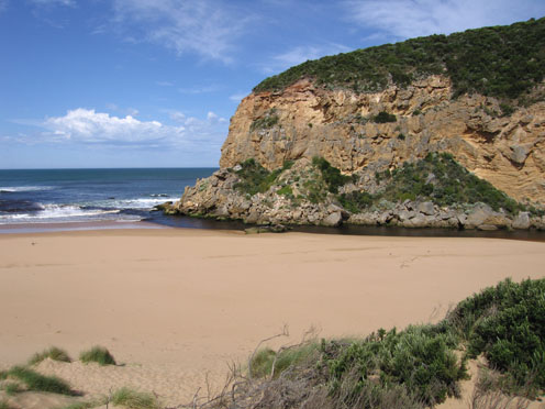
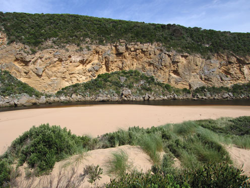
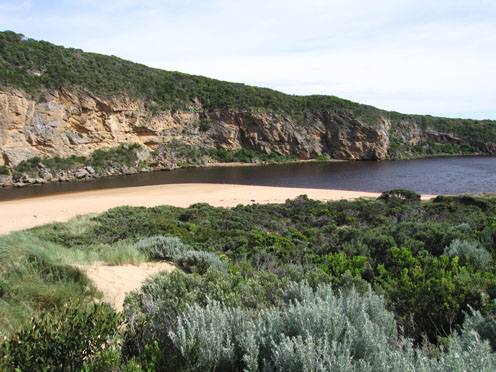
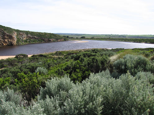
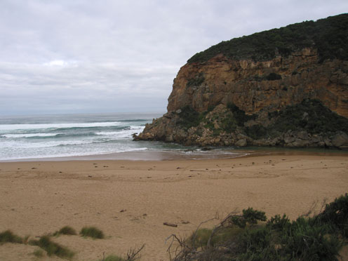
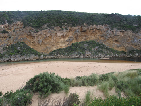
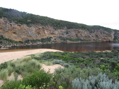
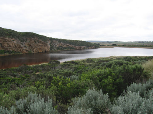
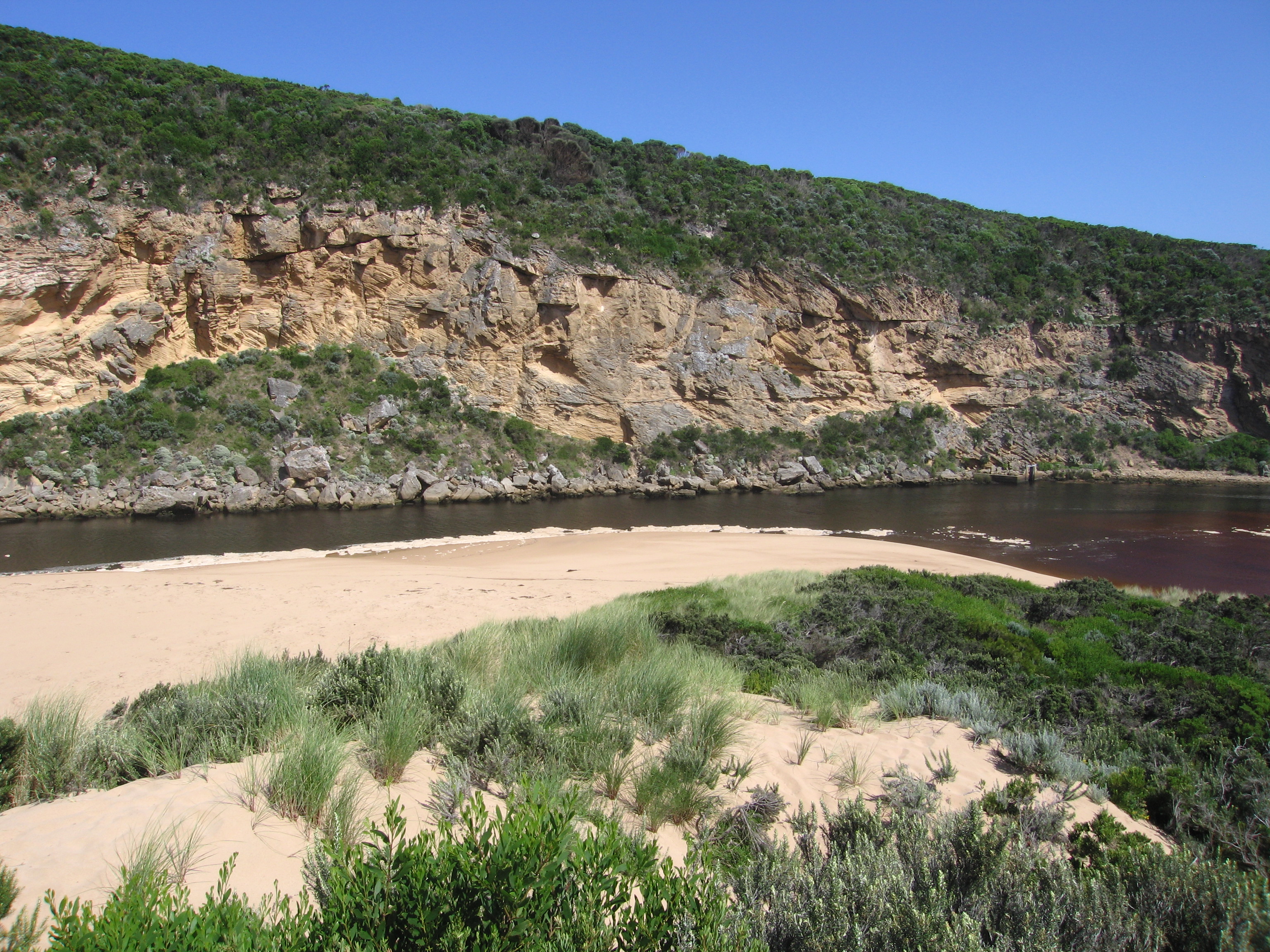
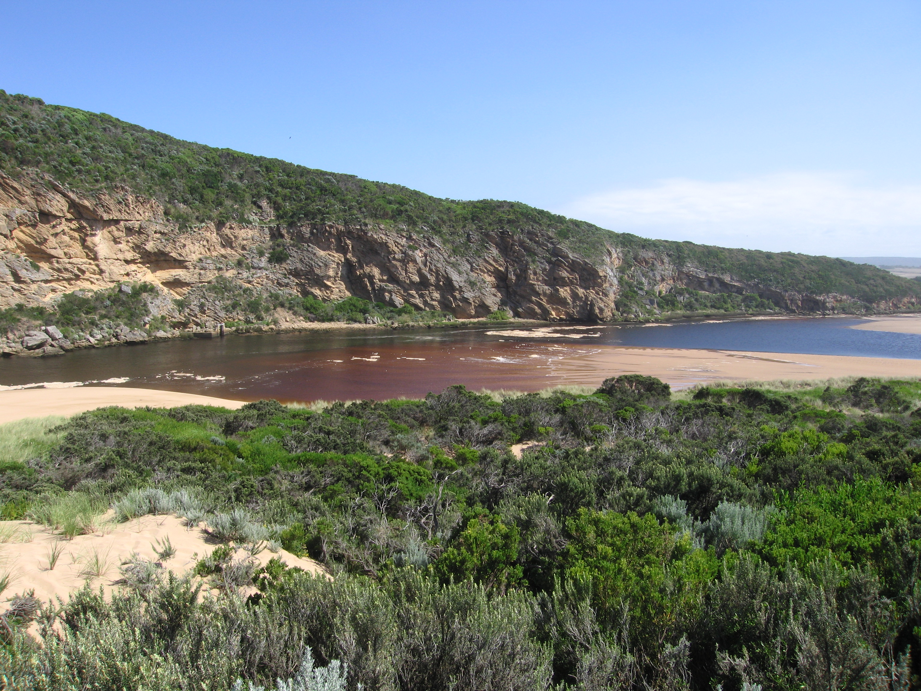
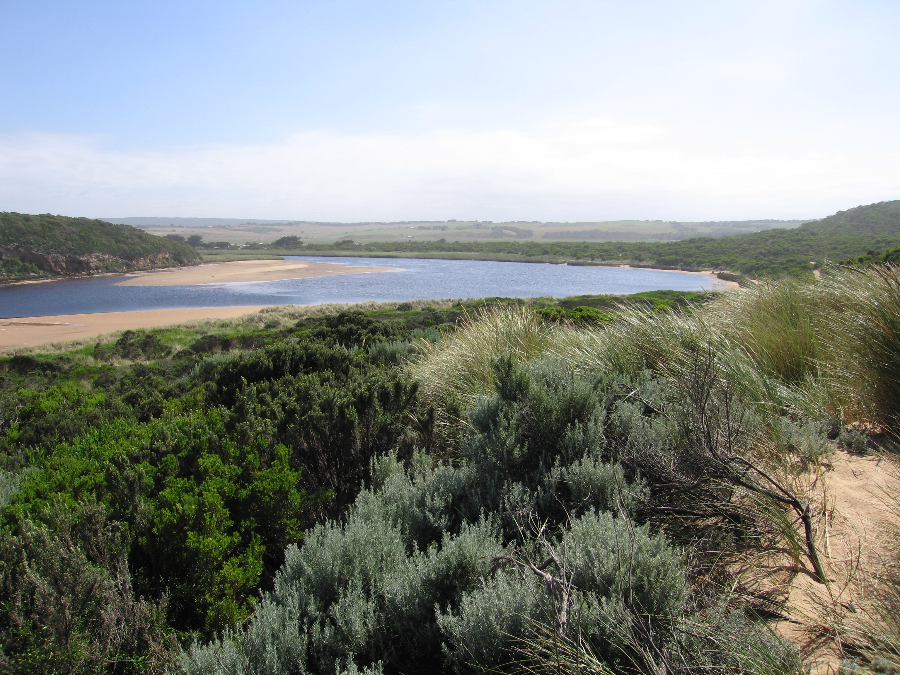
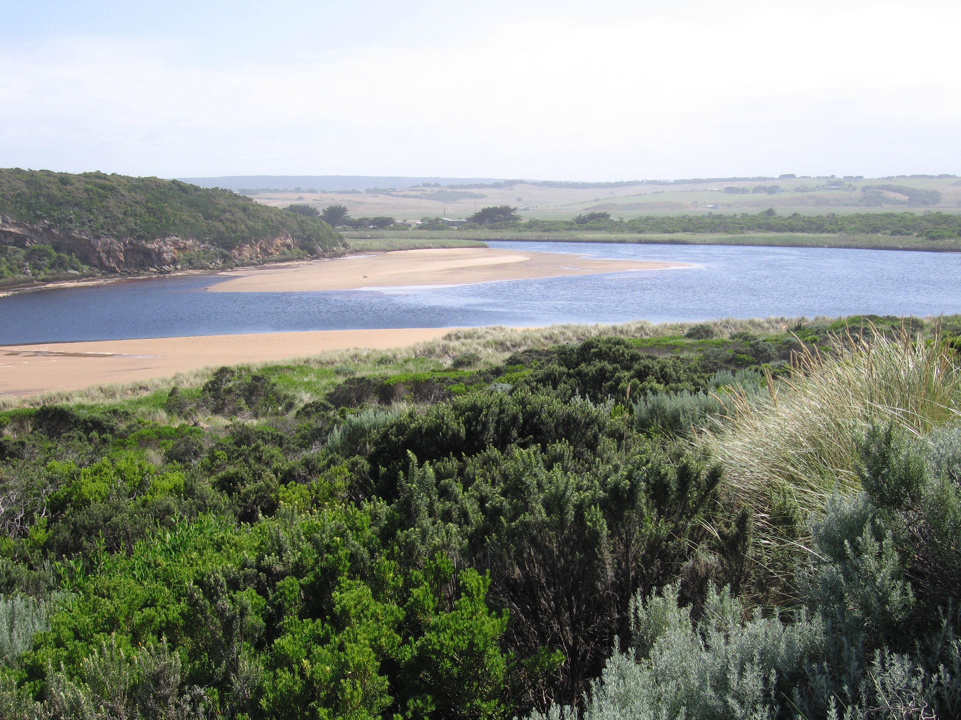
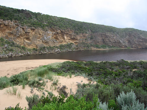
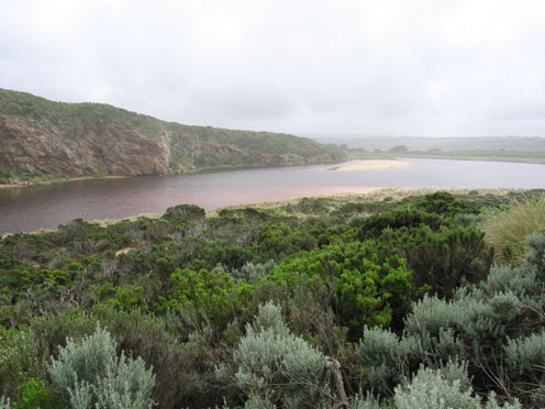
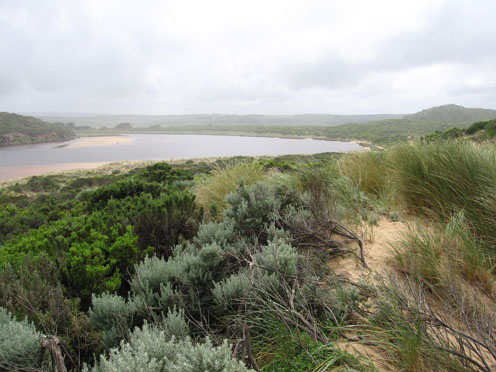
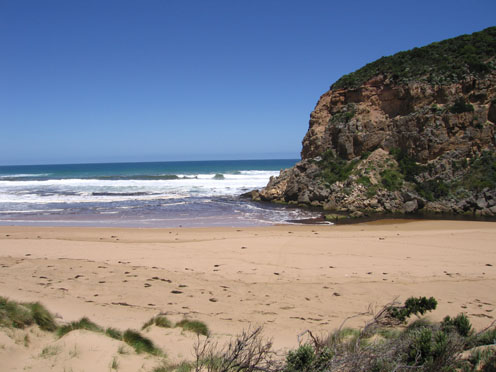
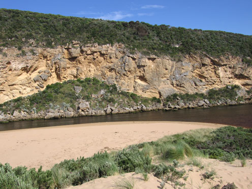
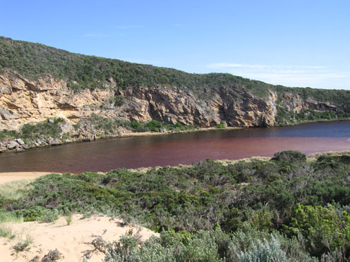
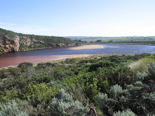
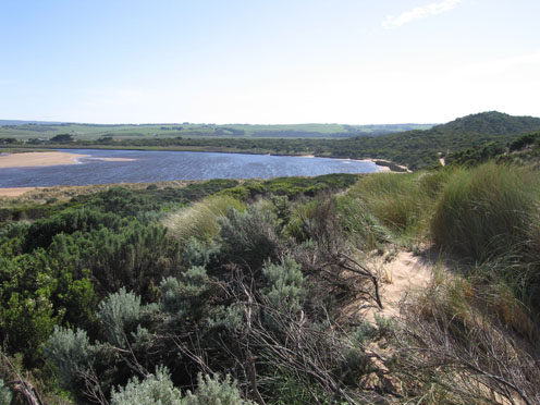
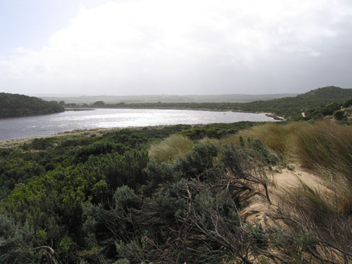
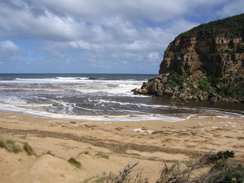
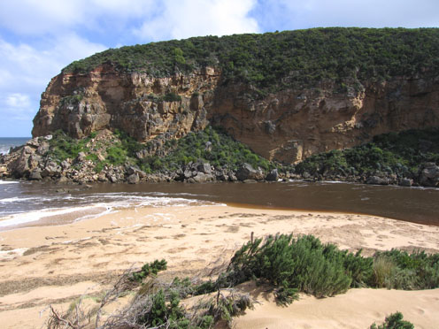
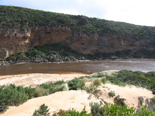
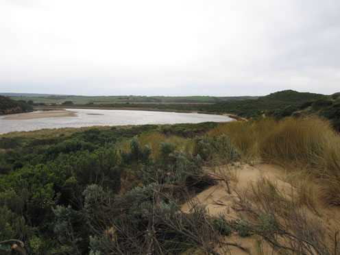
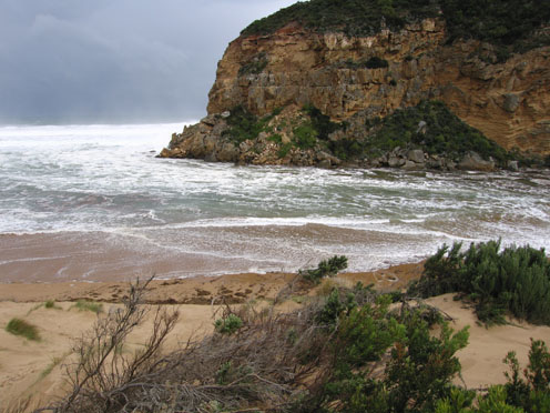
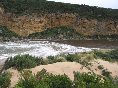
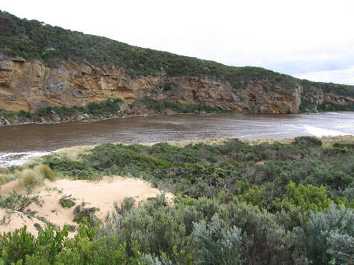
EstuaryWatch Data Portal
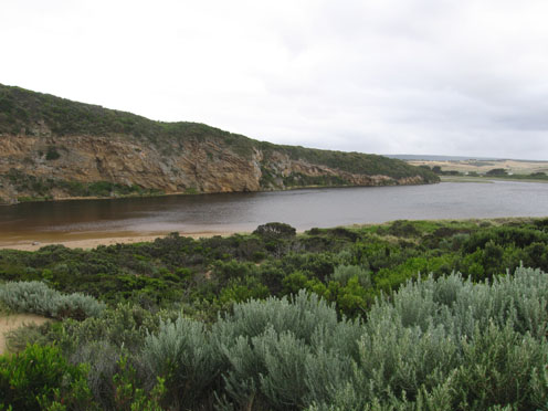
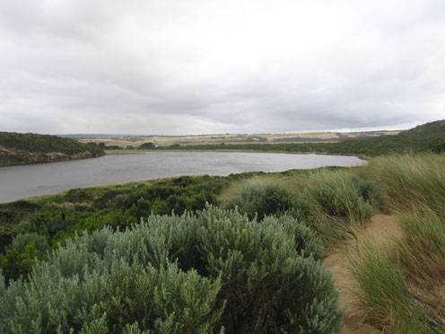
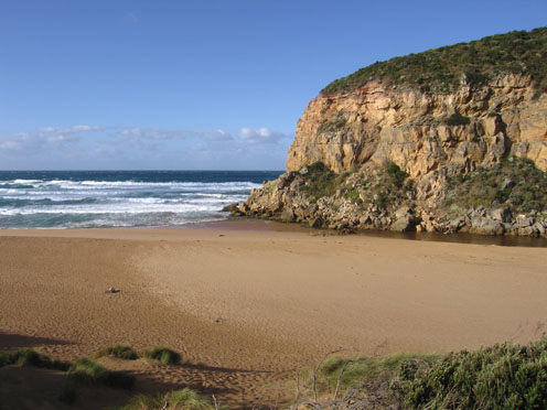
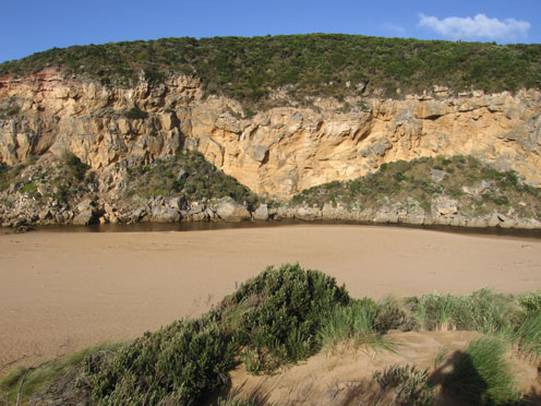
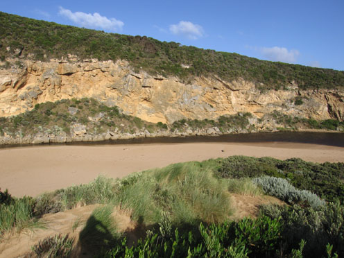
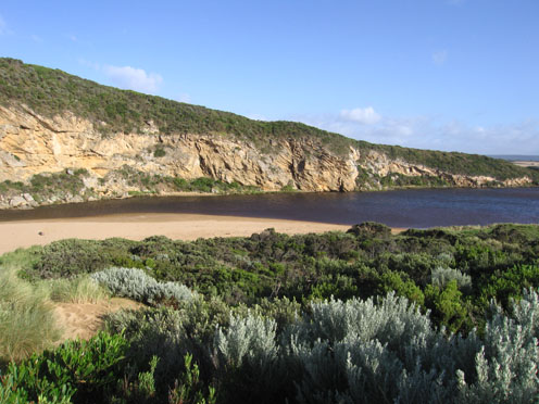
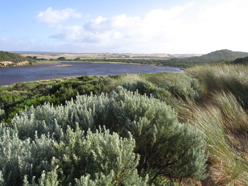
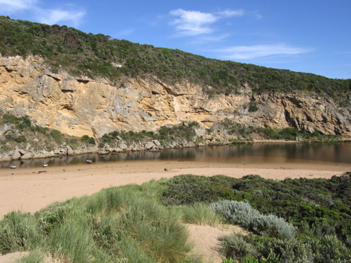
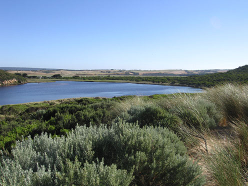
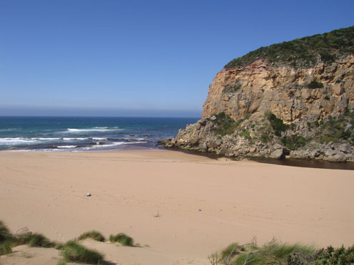
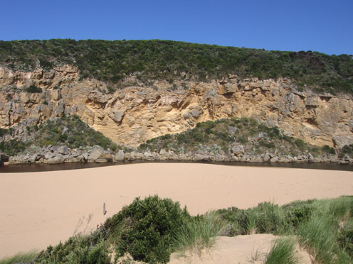
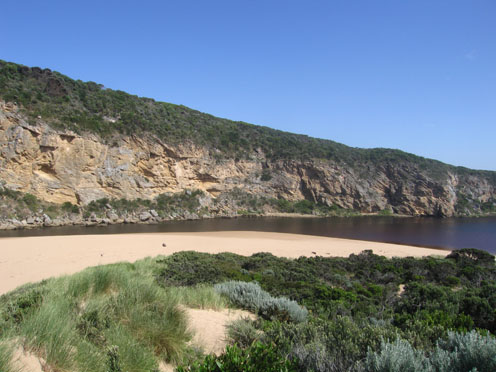
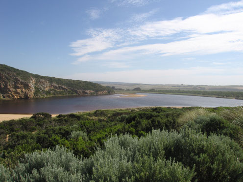
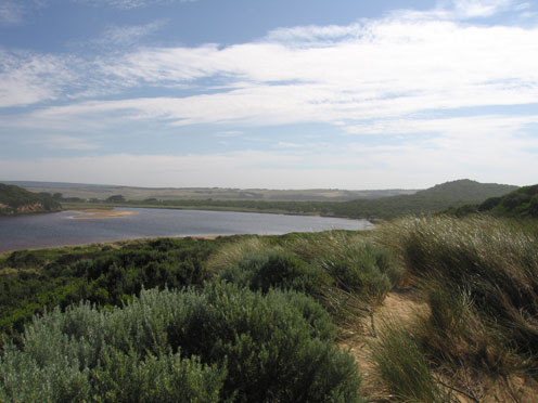
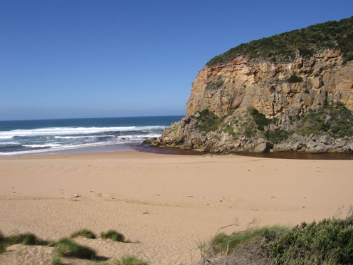
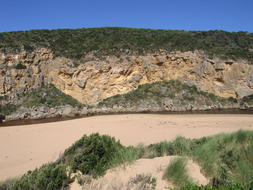
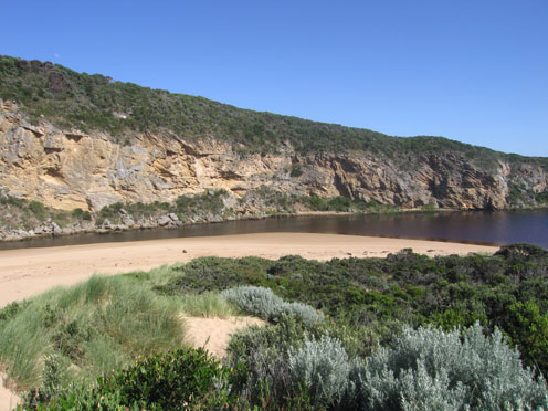
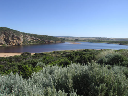
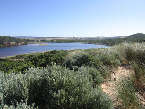
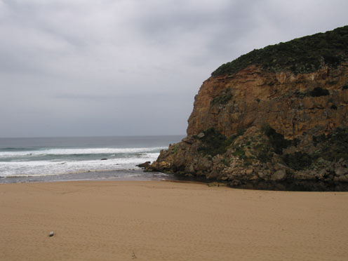
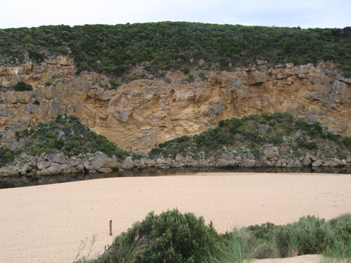
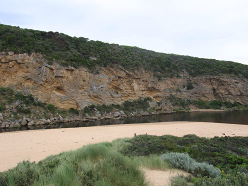
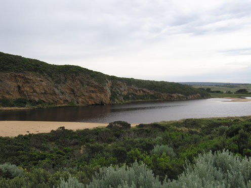
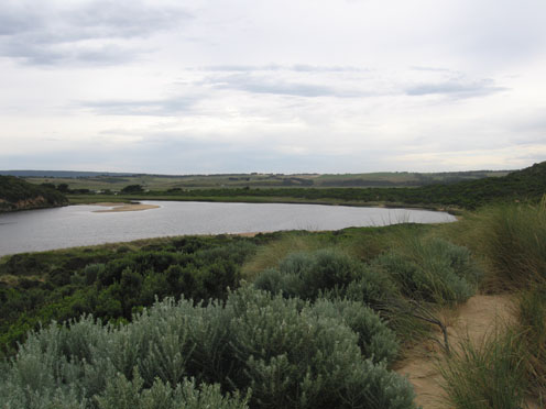
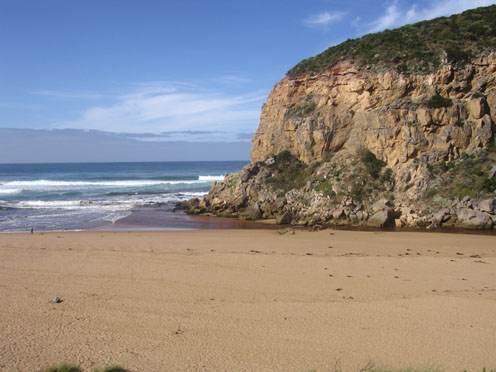
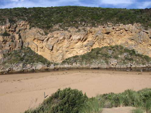
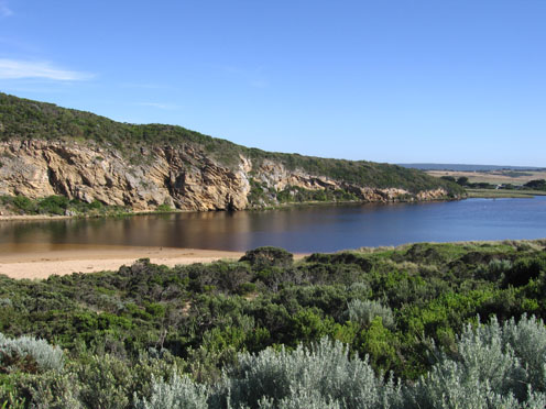
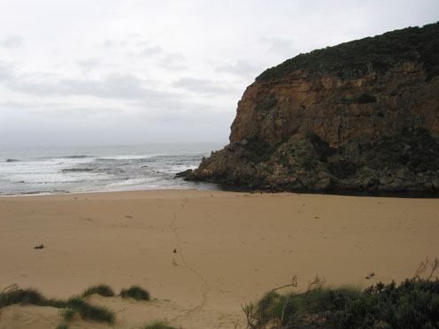
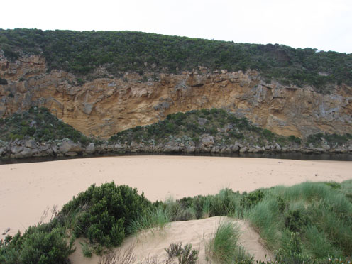
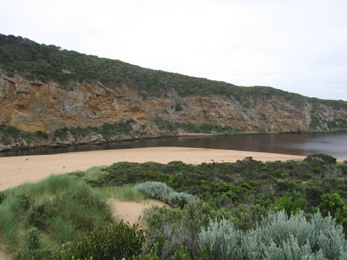
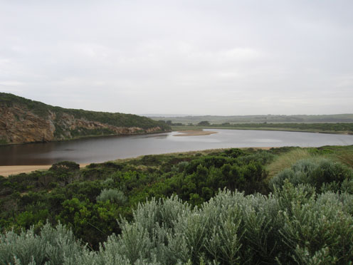
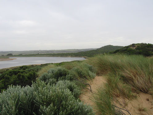
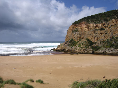
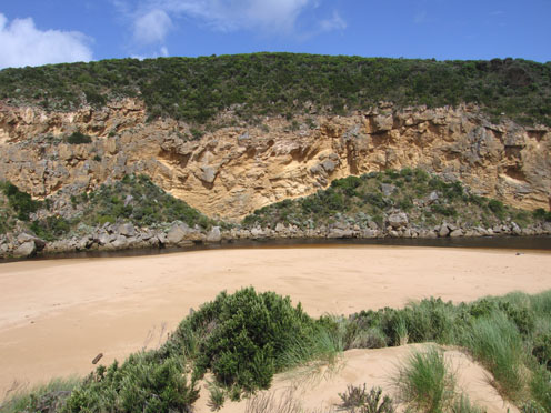
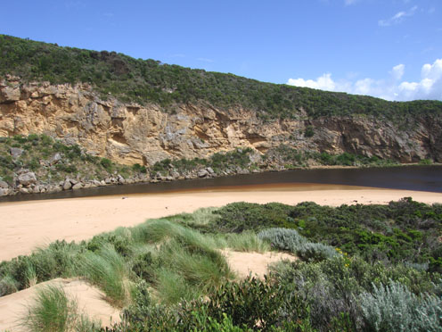
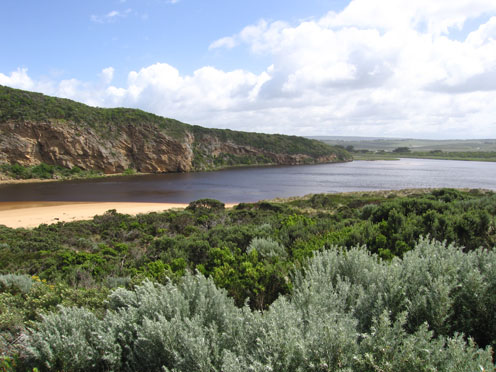
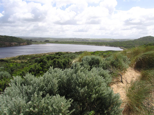
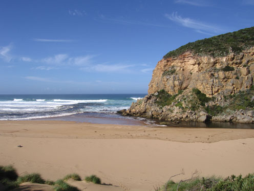
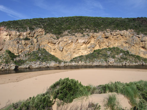
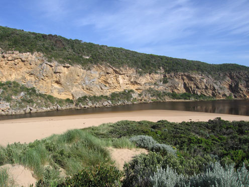
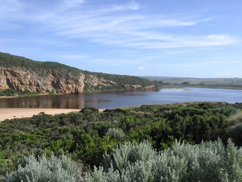
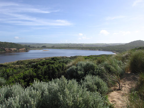
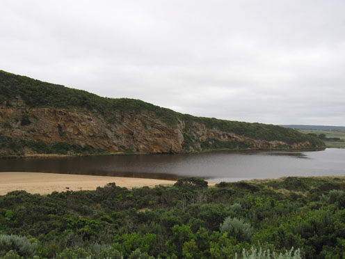
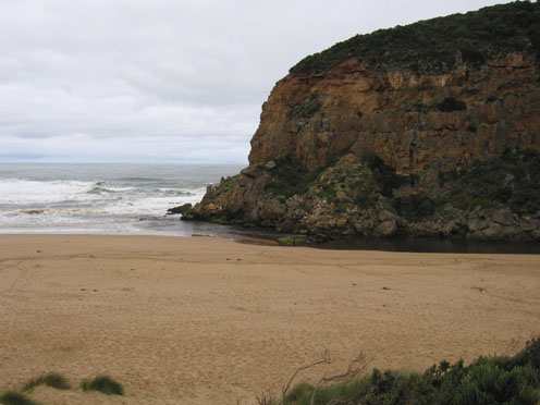
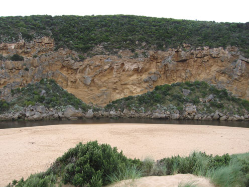
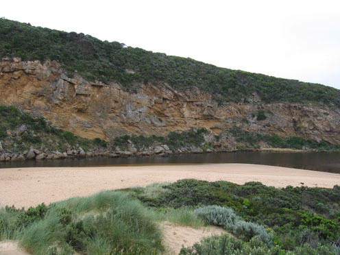
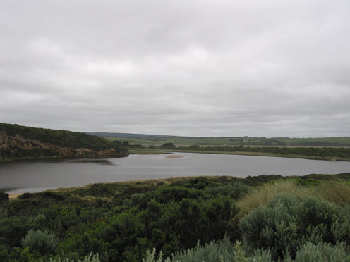
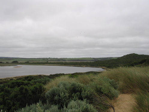
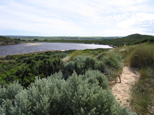
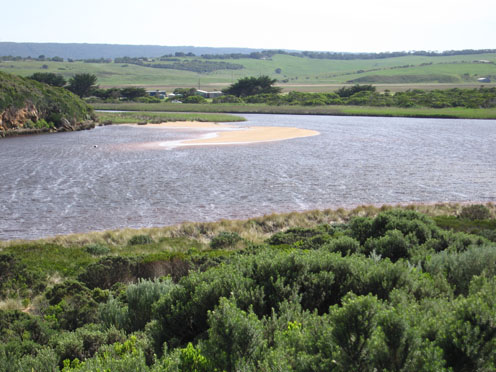
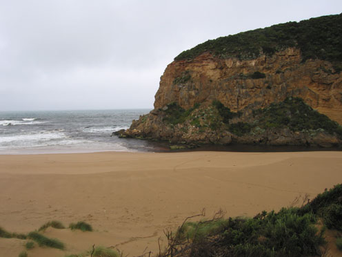
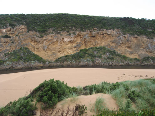
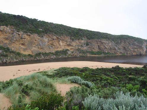
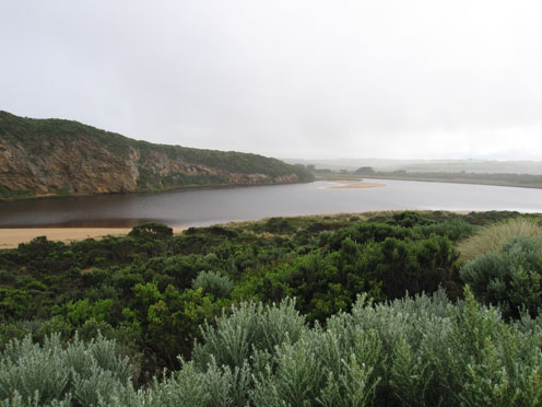
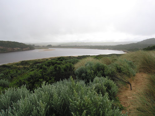
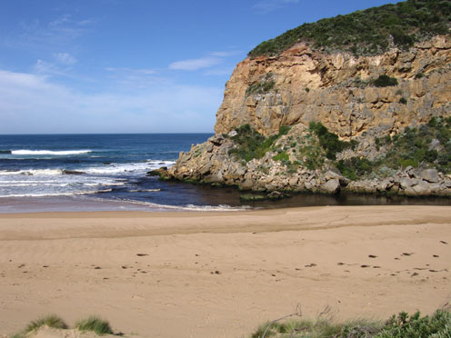
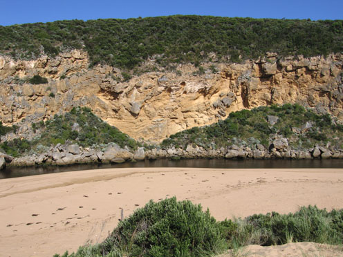
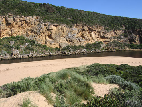
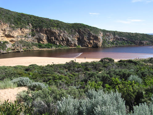
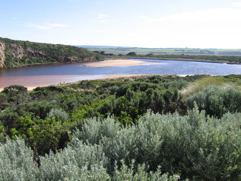
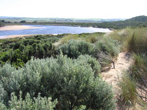
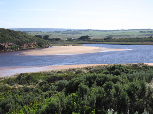
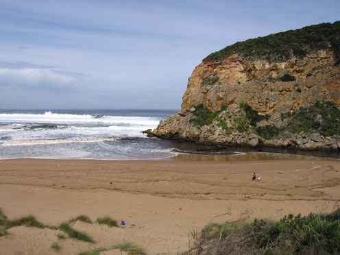
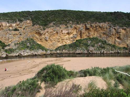
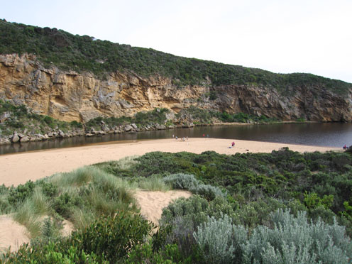
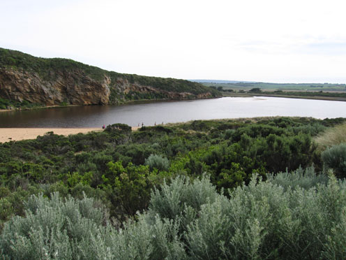
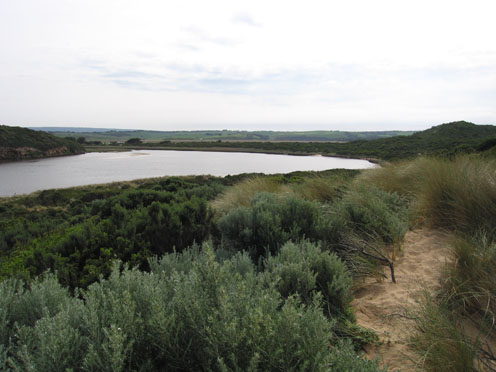
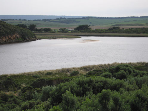
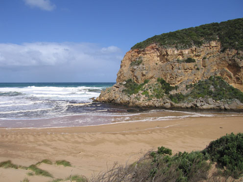
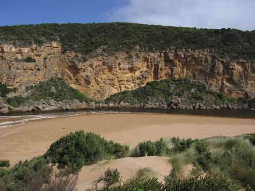
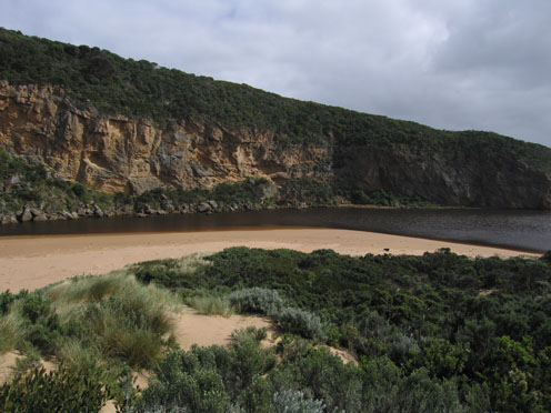
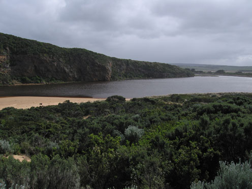
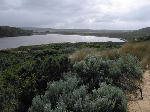
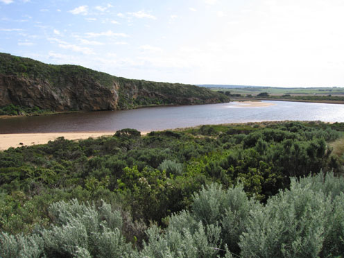
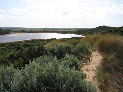
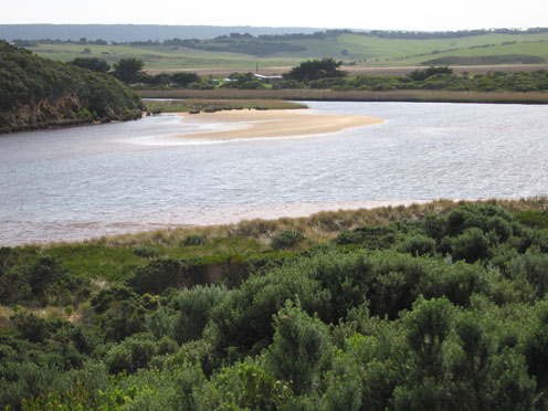
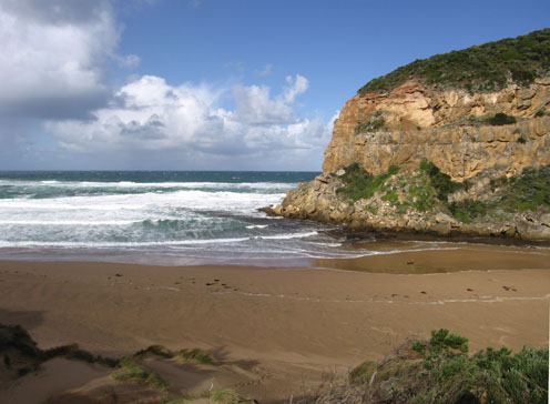
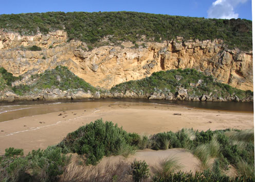
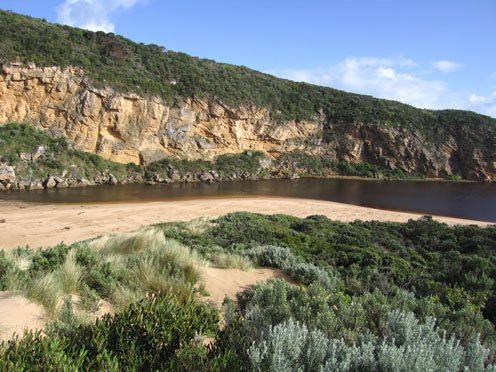
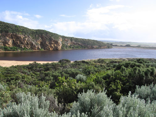
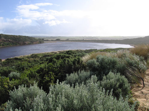
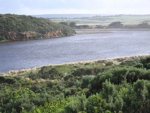
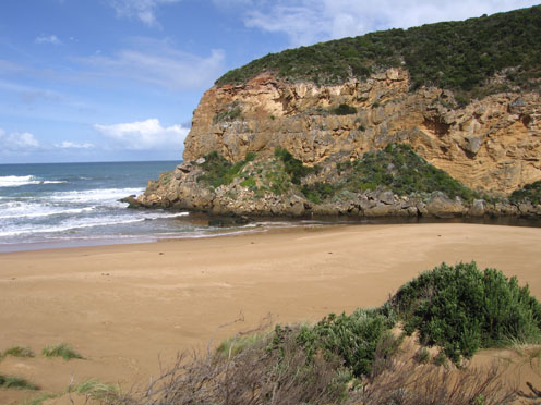
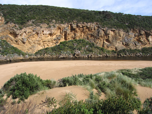
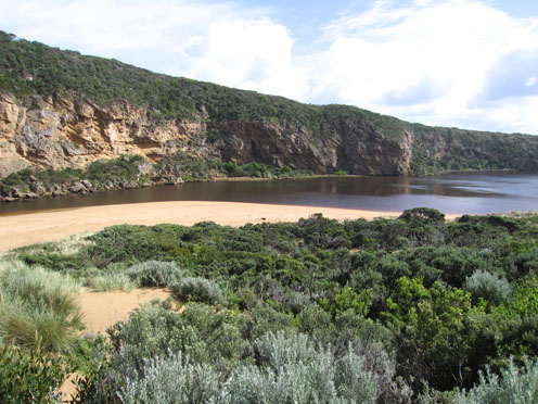
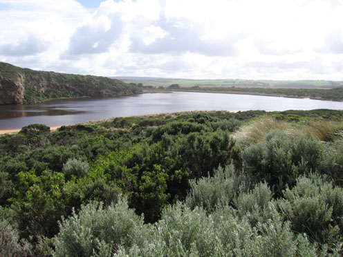
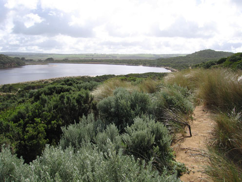
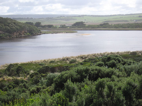
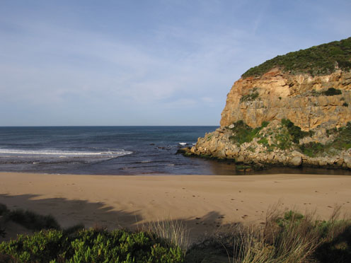
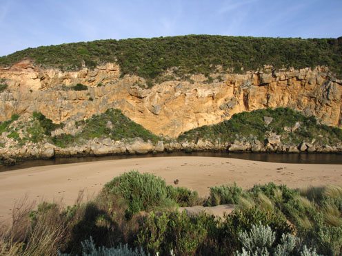
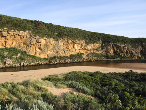
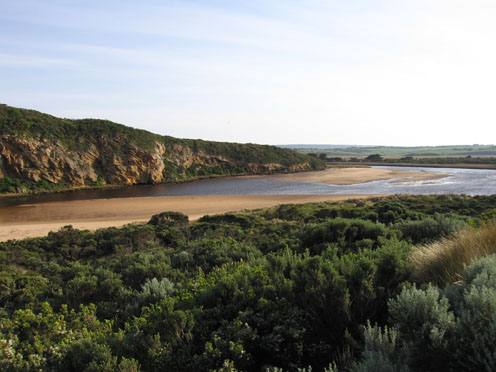
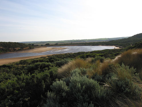
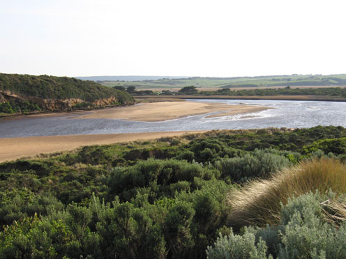
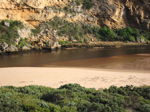
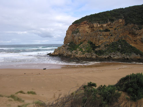
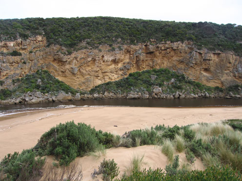
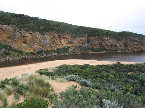
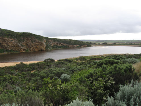
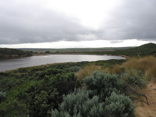
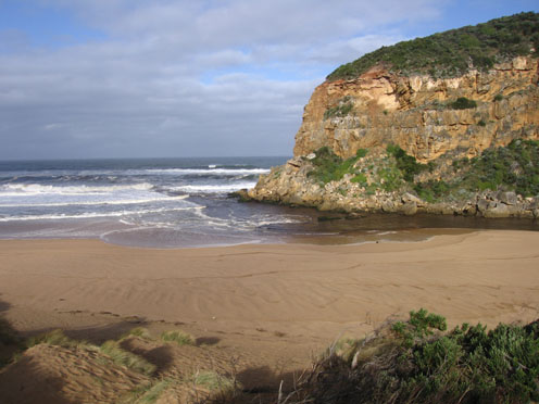
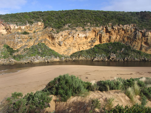
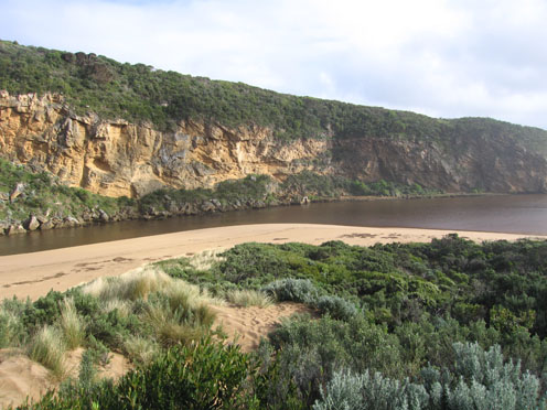
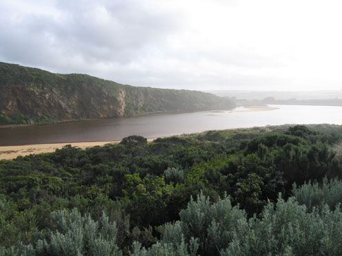
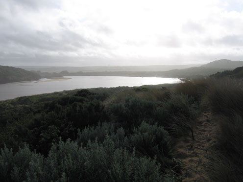
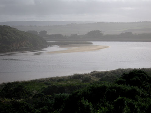
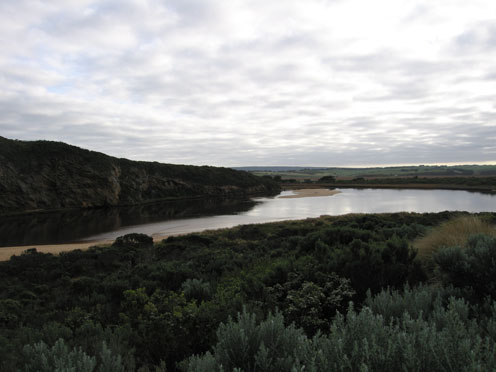
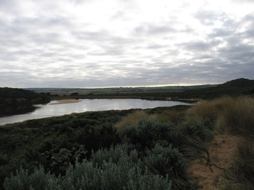
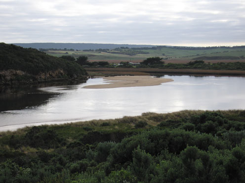
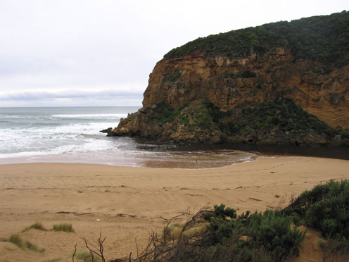
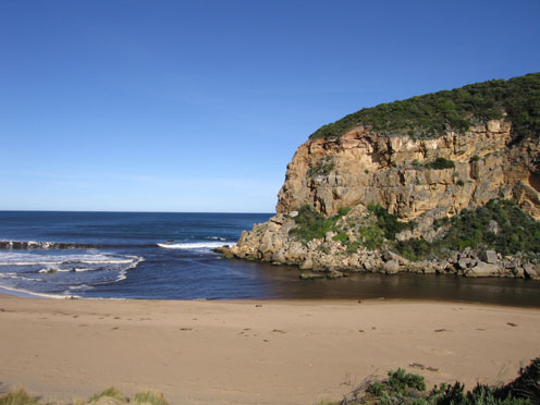
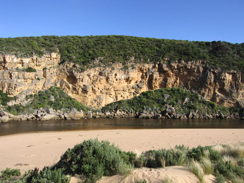
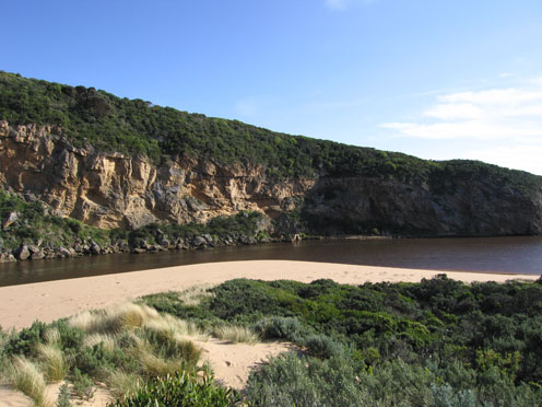
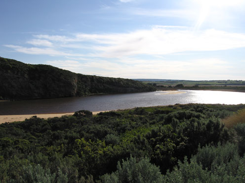
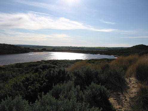
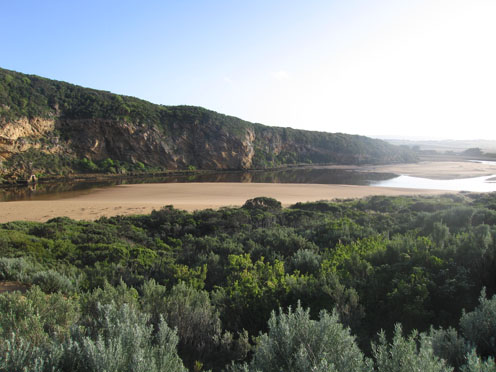
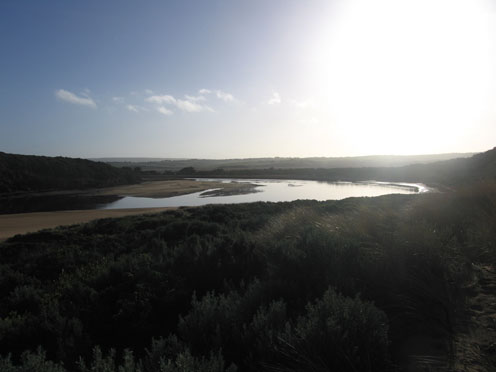
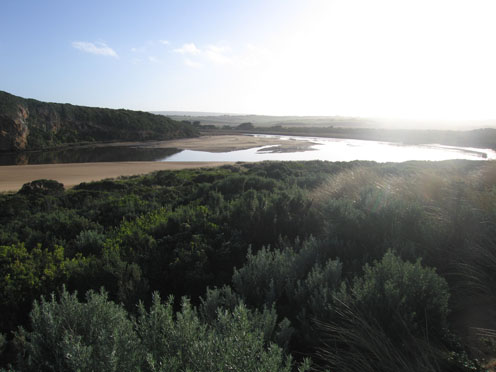
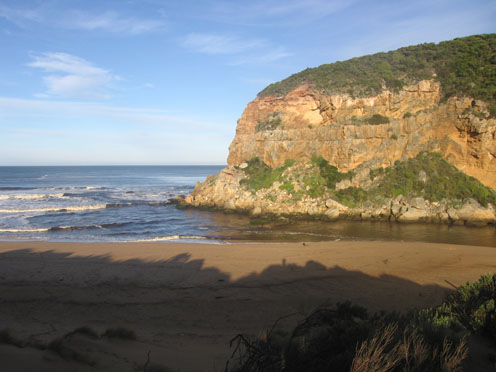
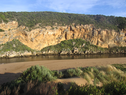
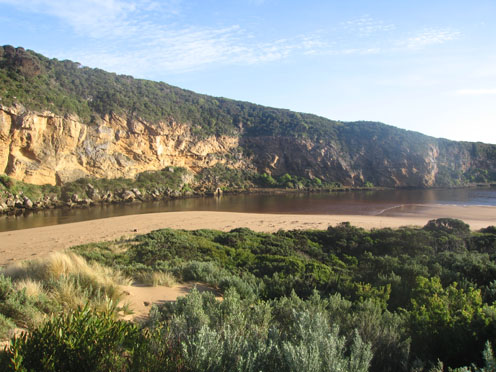
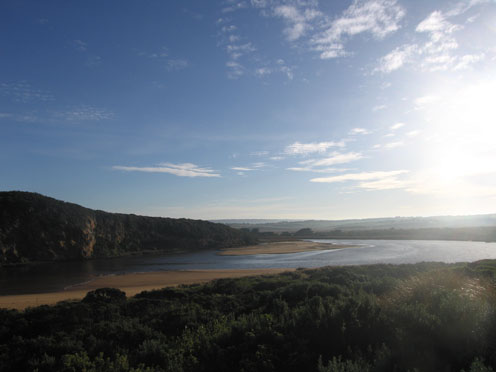
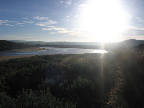
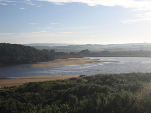
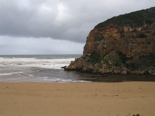
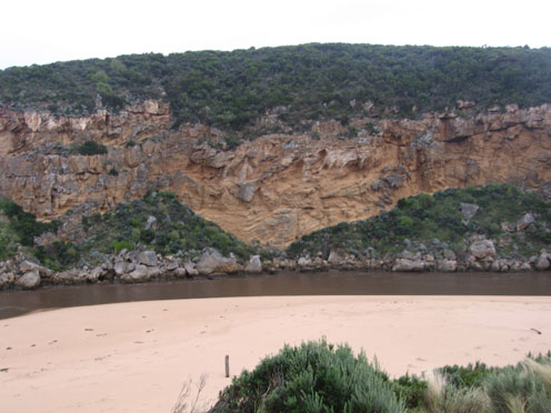
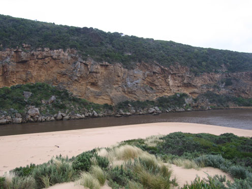
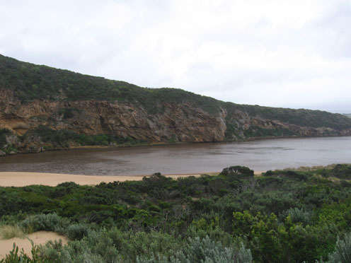
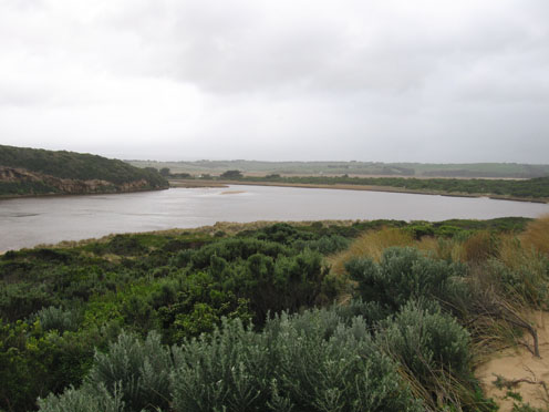
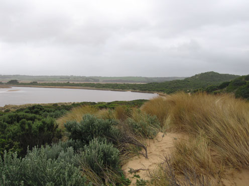
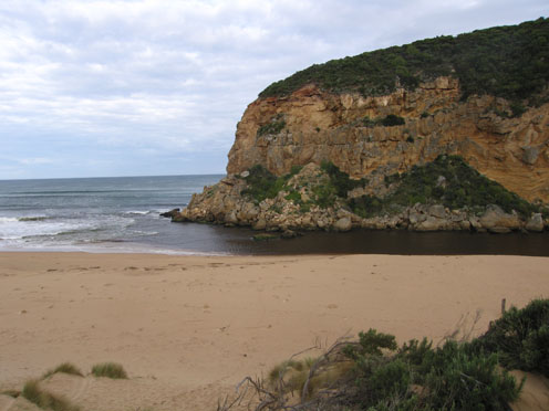
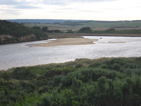
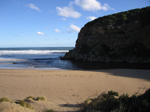
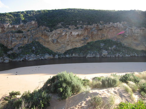
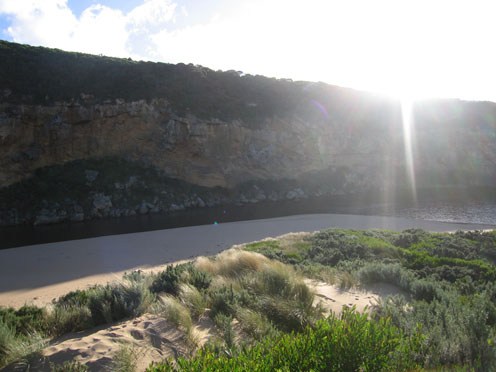
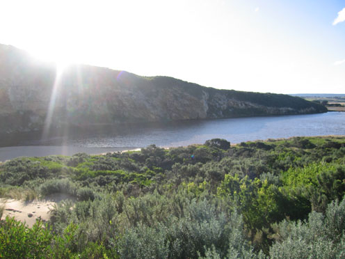
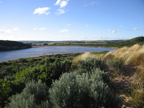
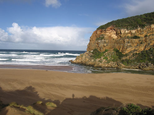
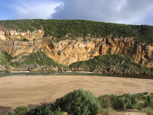
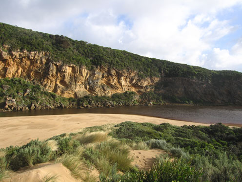
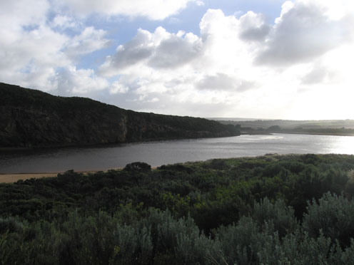
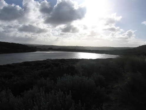
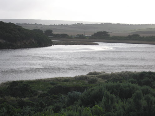
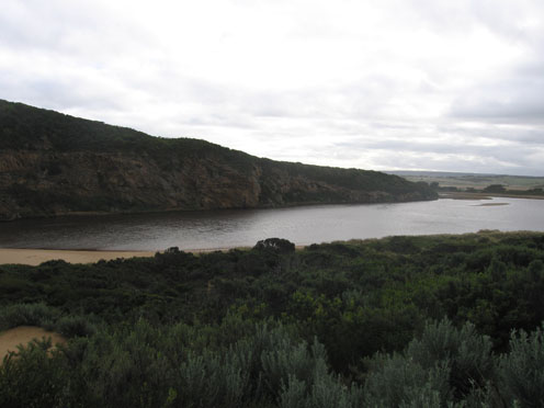
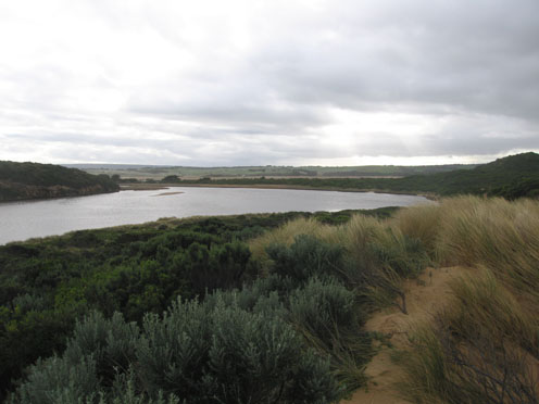
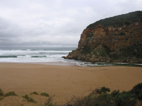
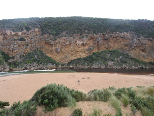
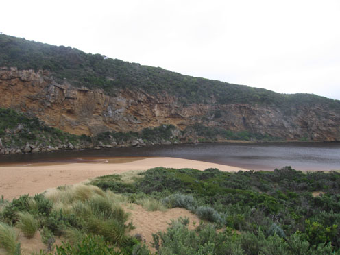
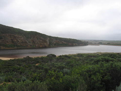
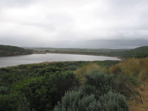
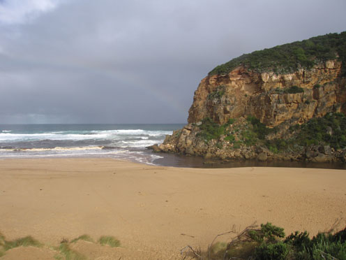
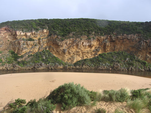
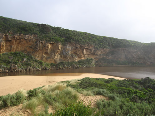
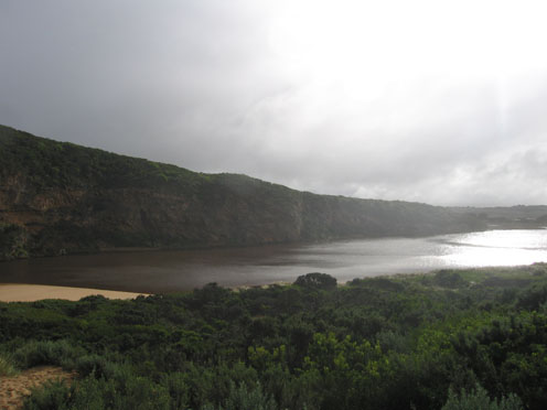
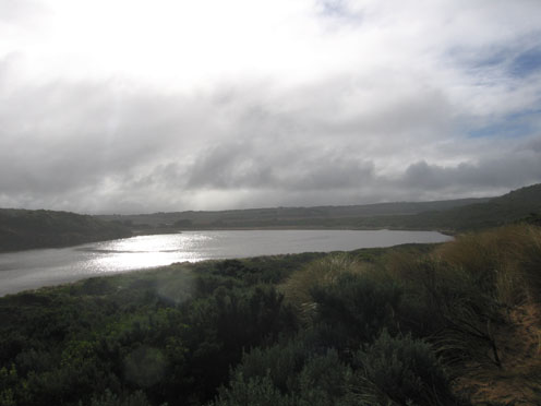
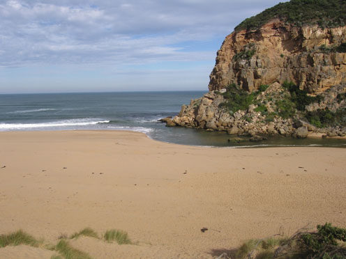
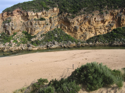
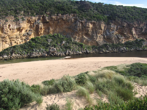
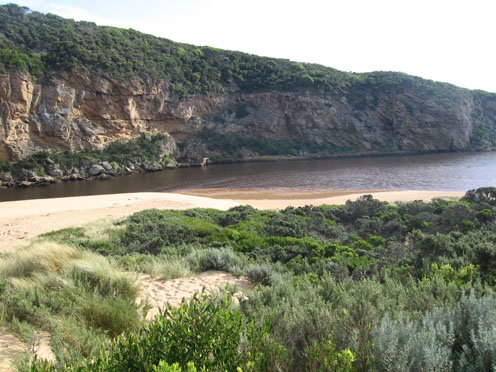
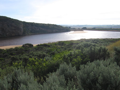
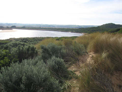
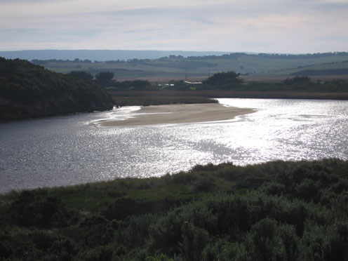
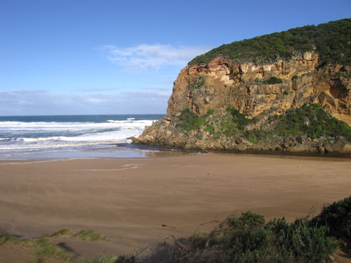
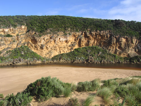
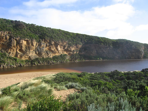
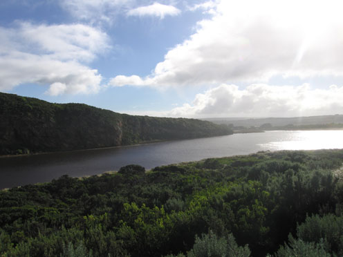
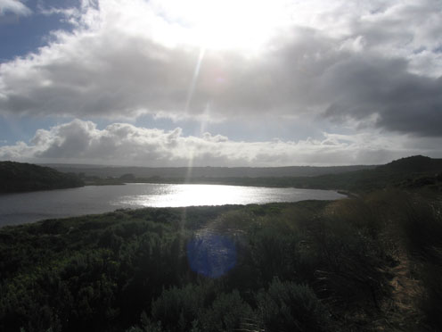
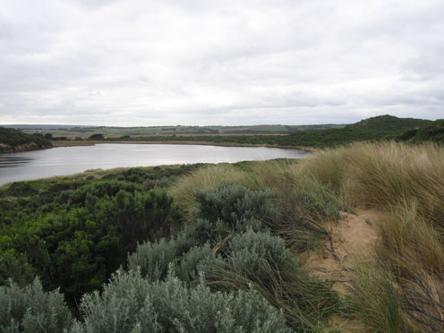
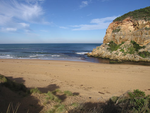
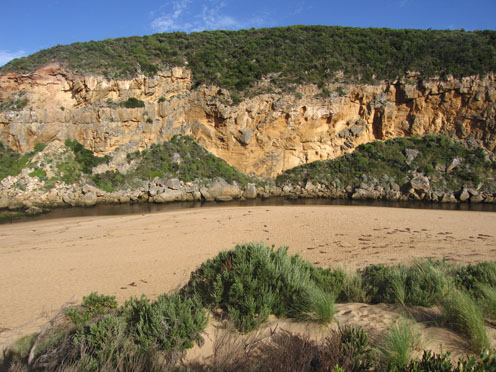
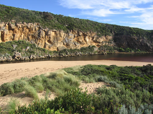
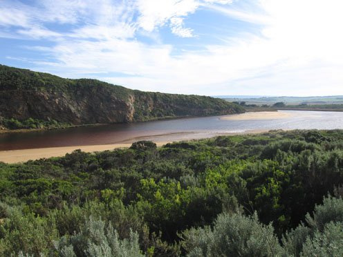
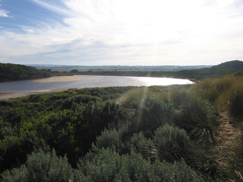
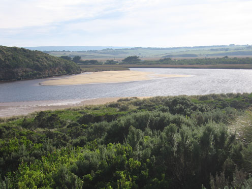
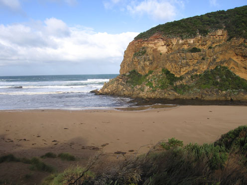
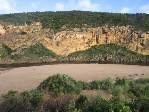
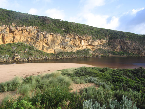
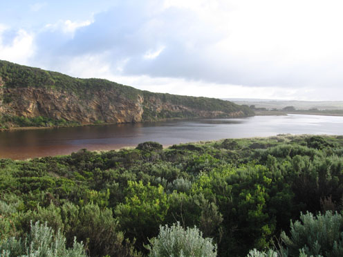
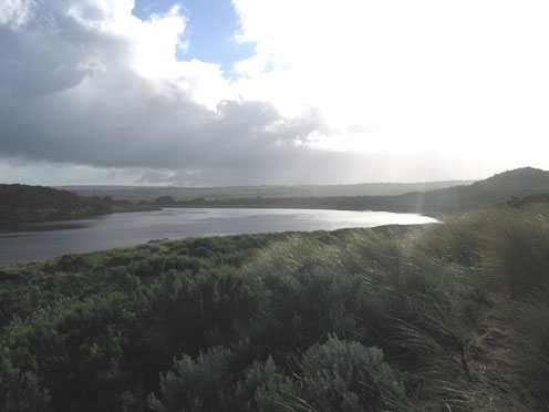
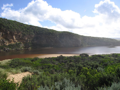
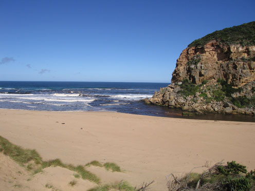
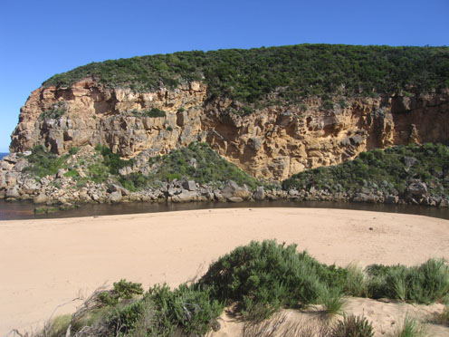
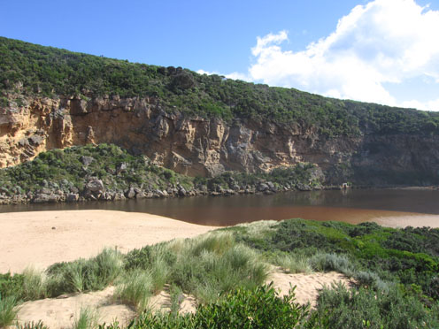
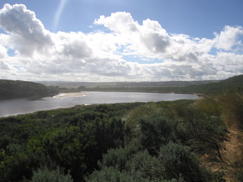
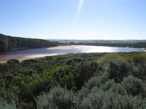
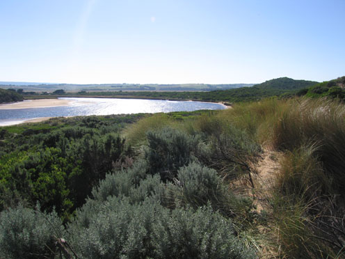
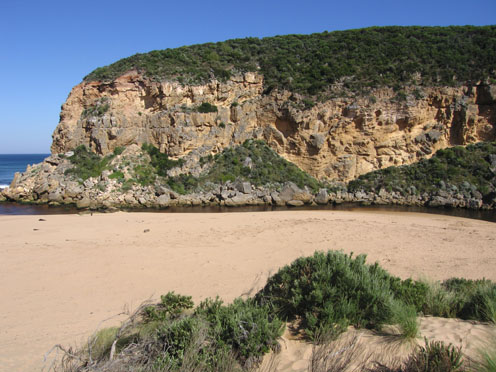
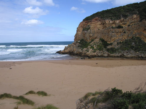
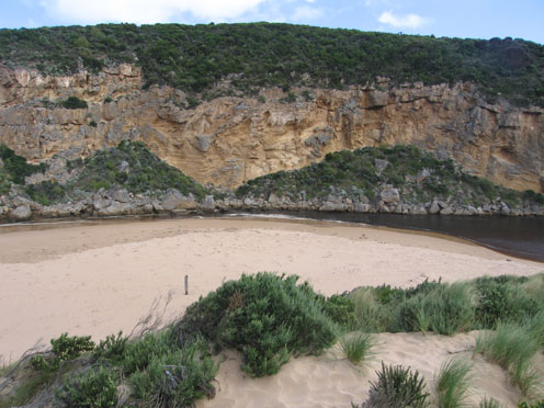
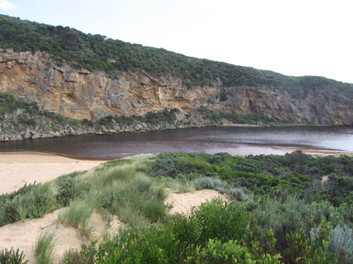
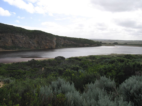
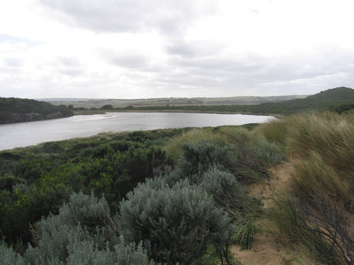
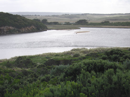
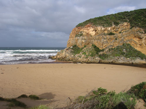
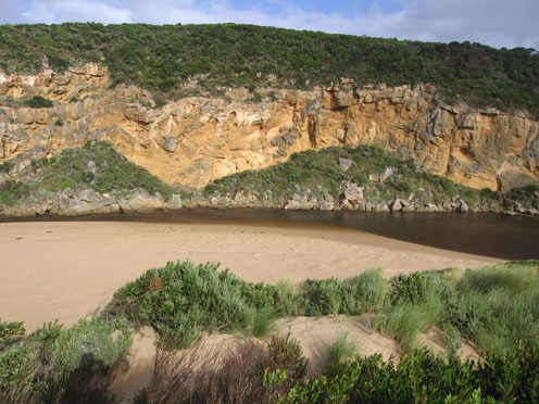
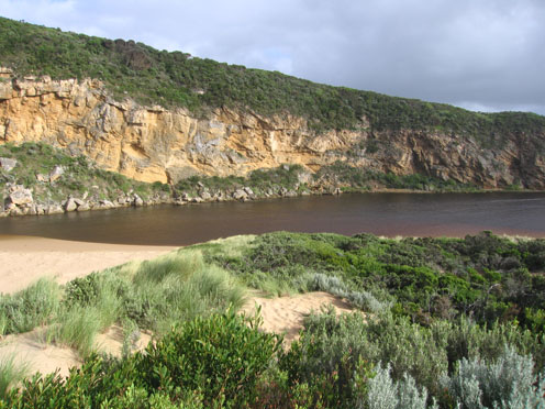
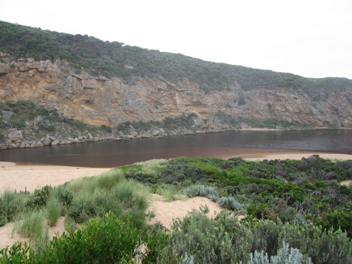
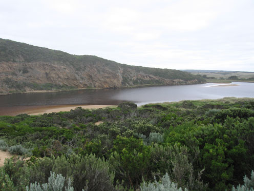
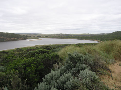
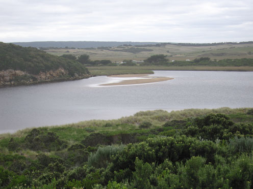
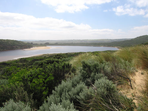
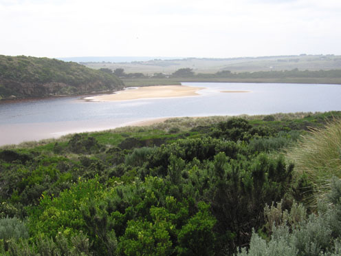
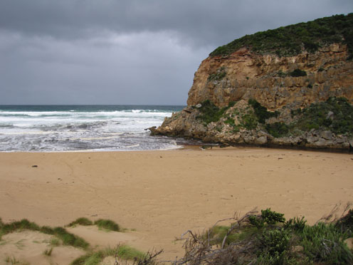
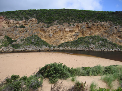
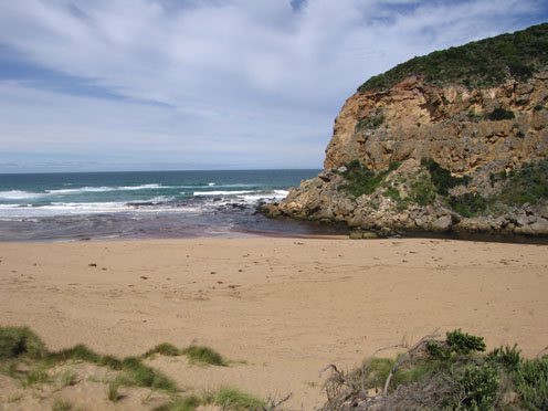
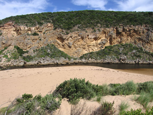
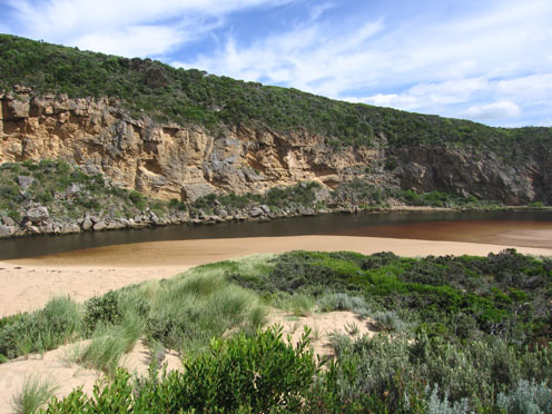
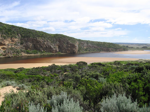
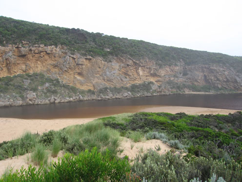
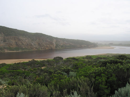
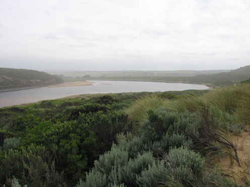
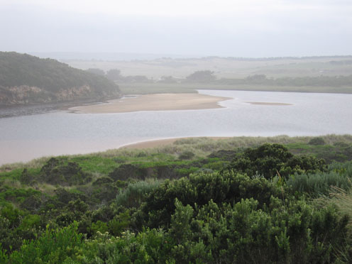
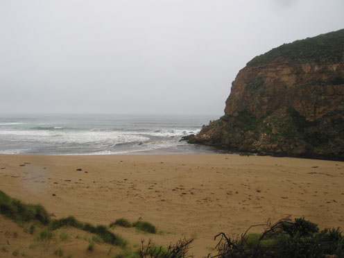
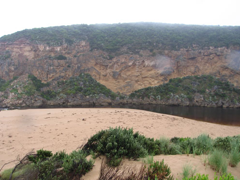
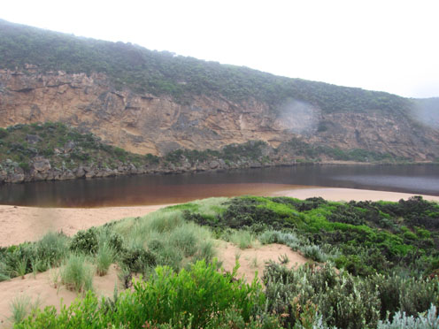
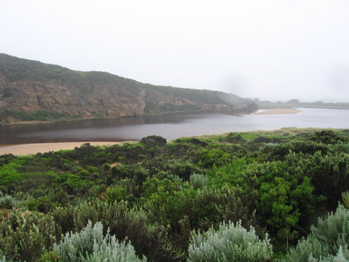
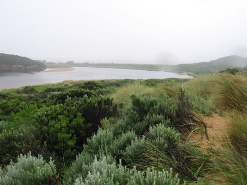
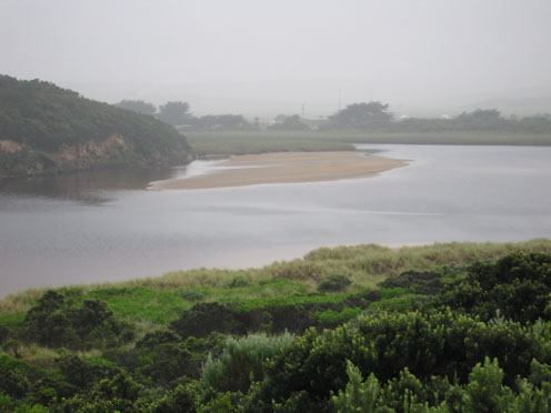
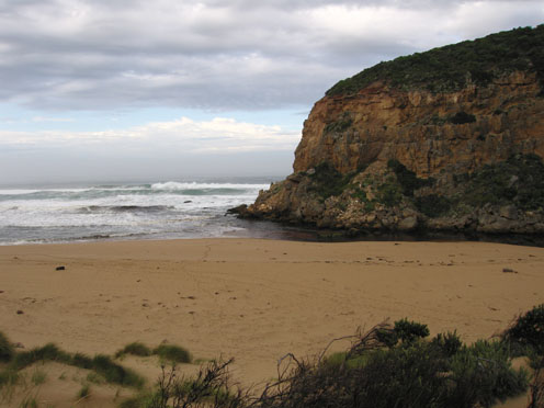
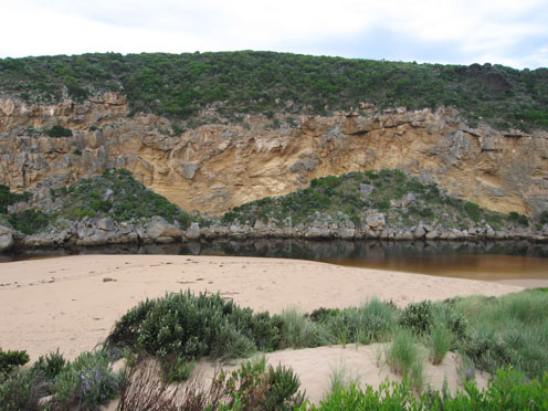
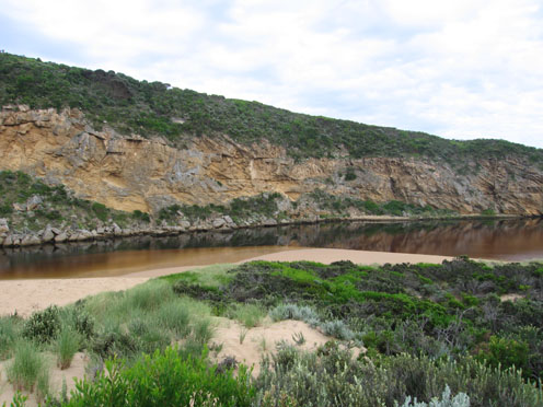
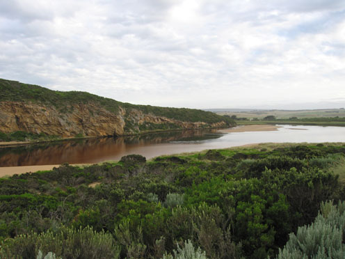
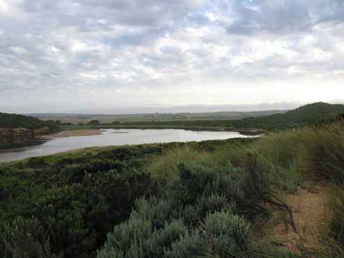
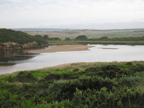
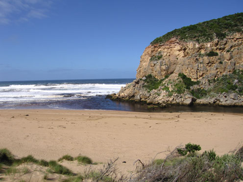
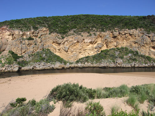
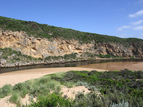
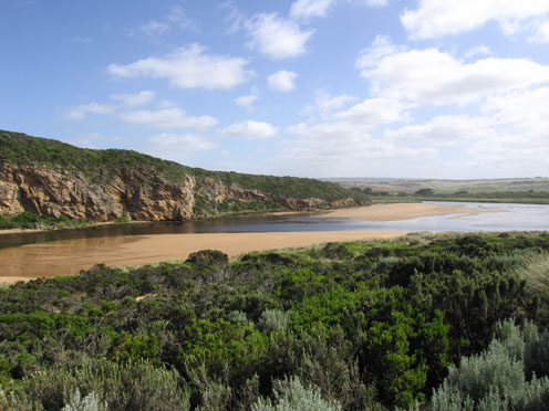
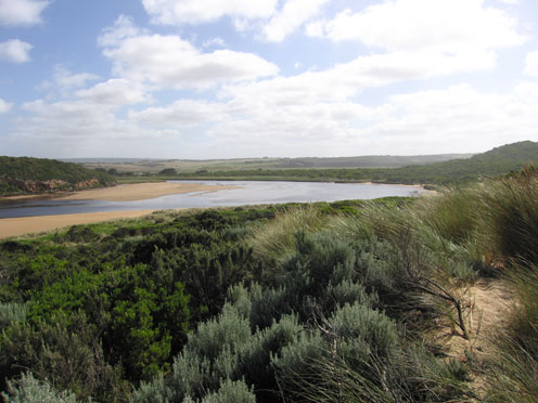
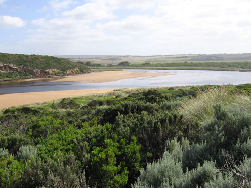
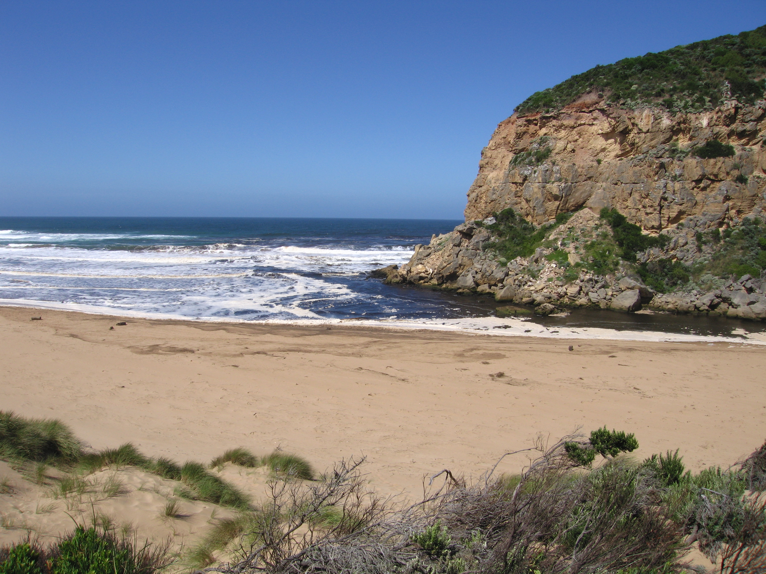
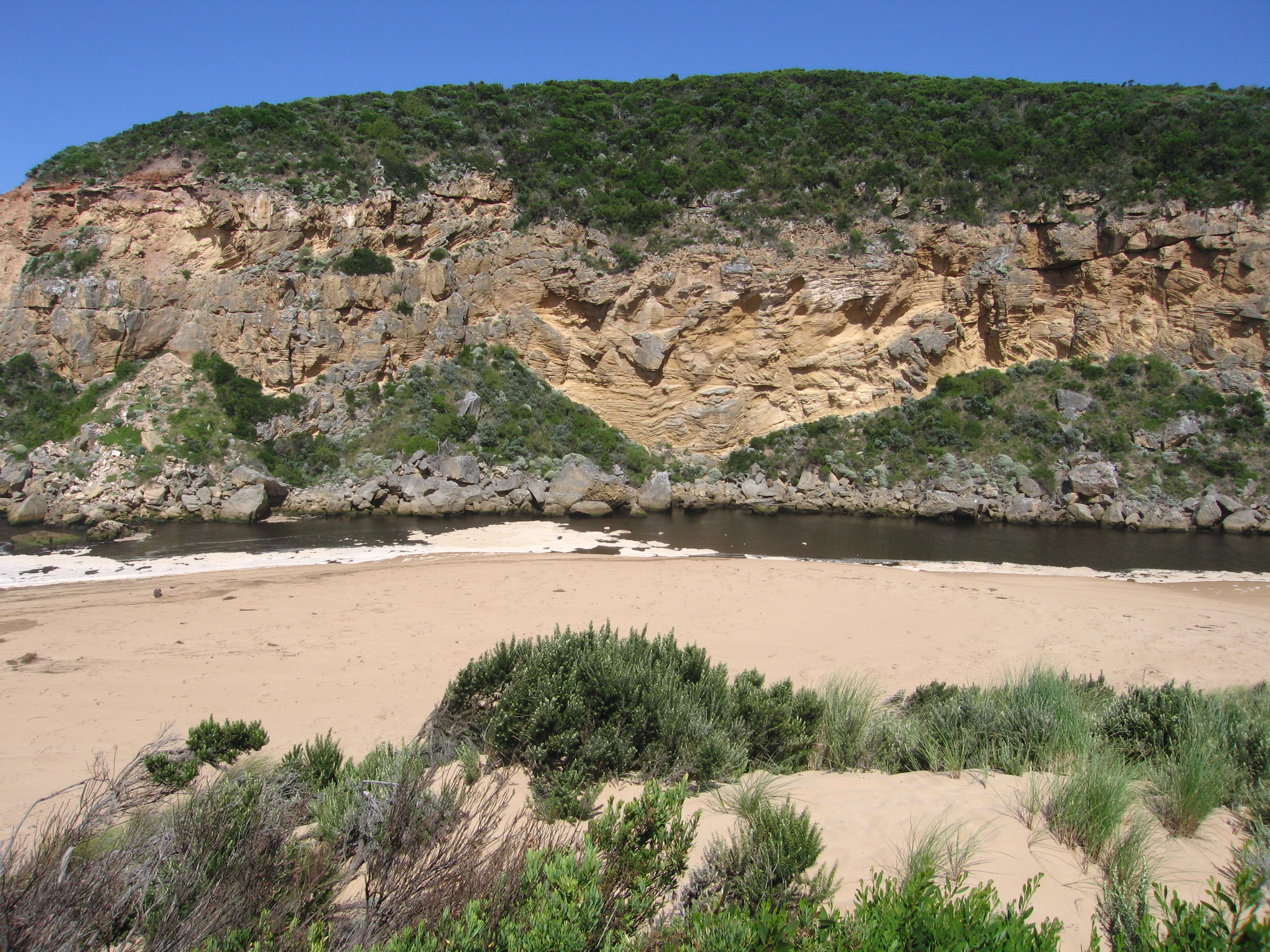
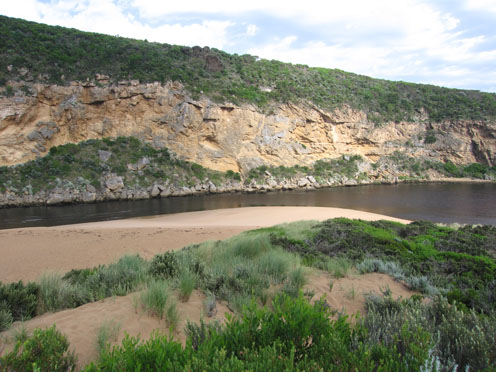
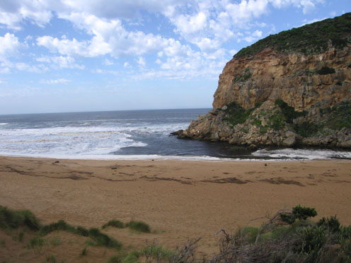
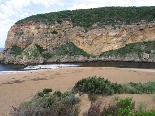
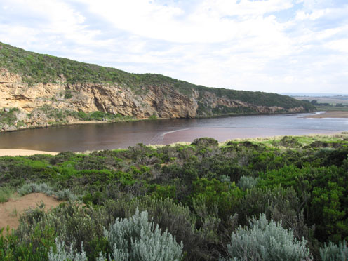
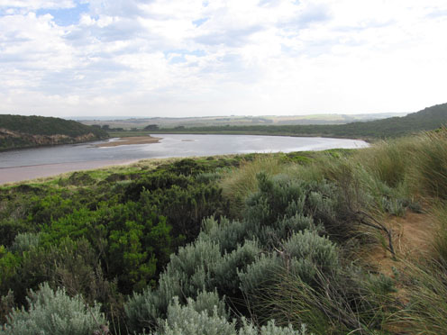
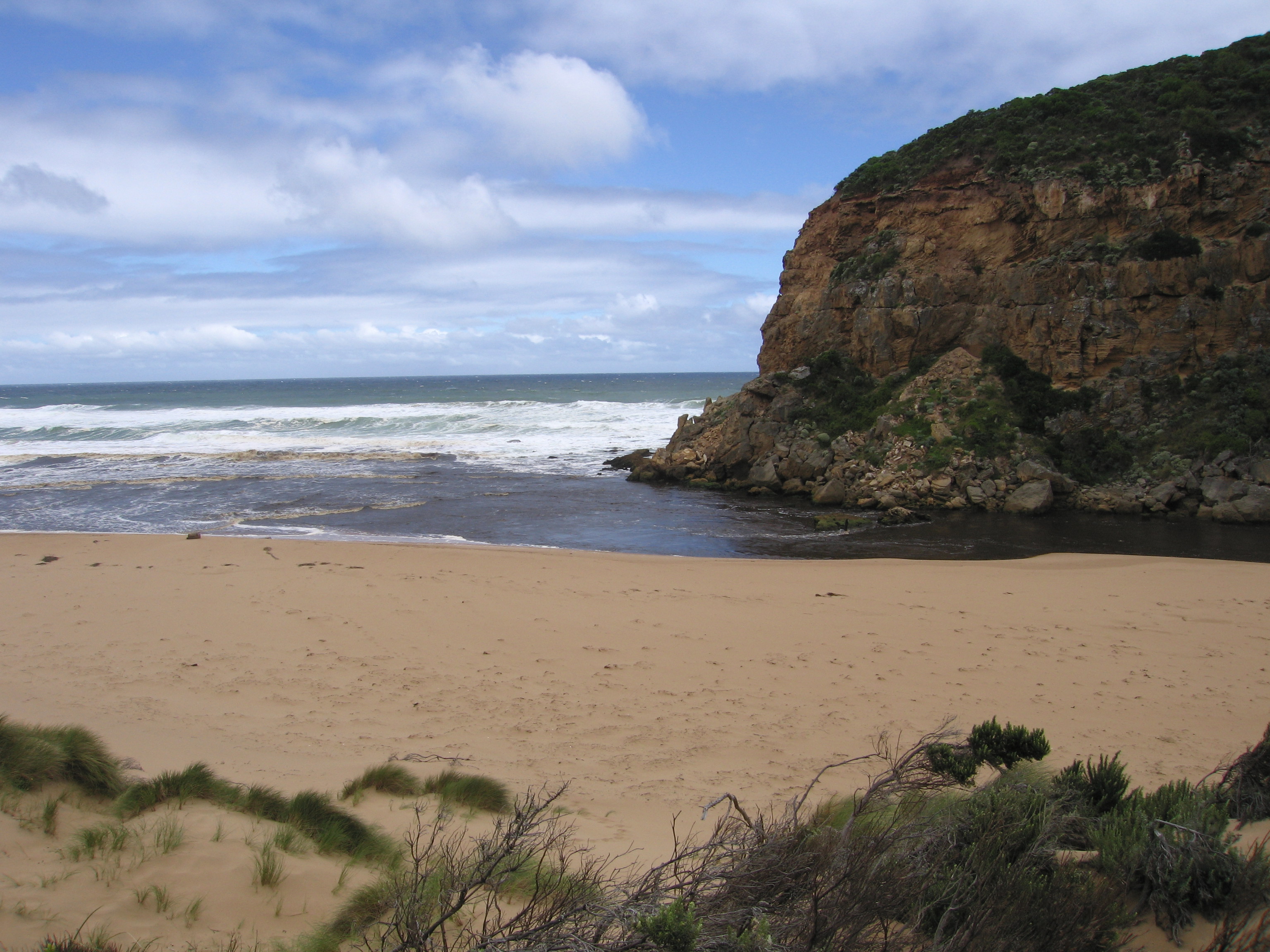
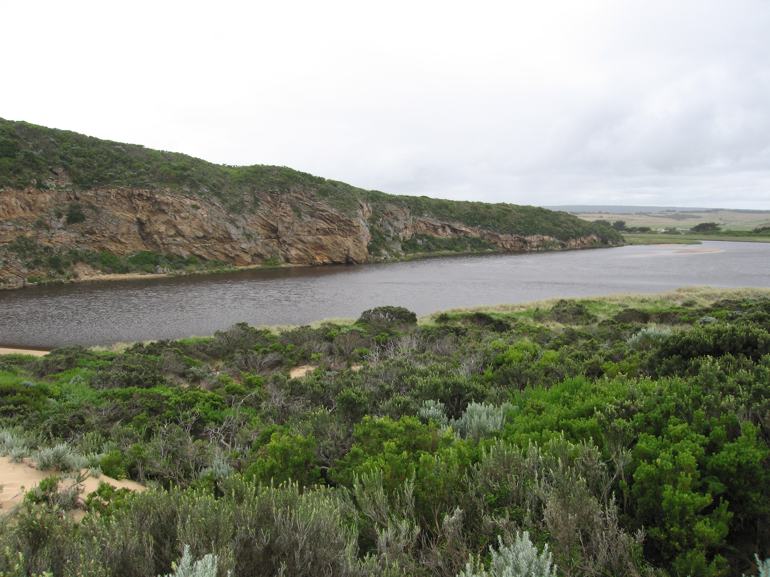
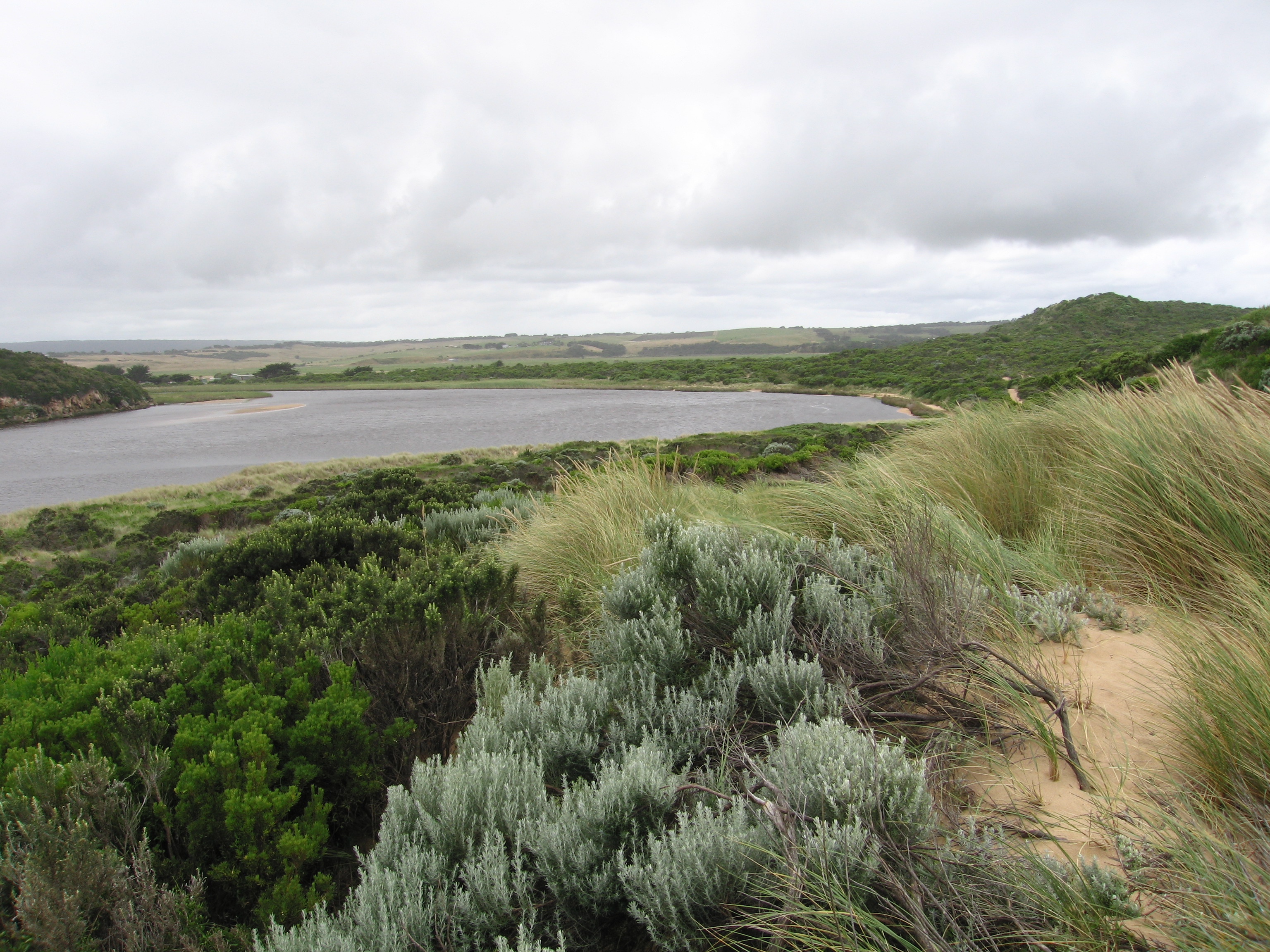
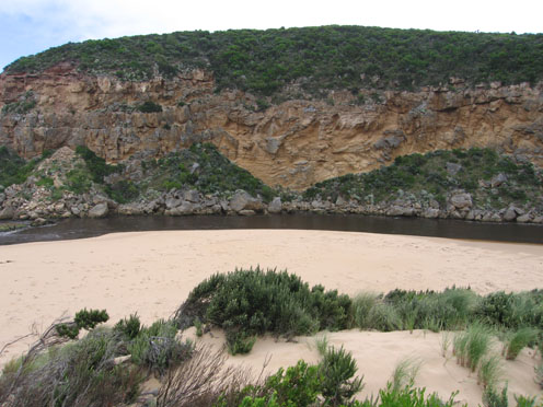
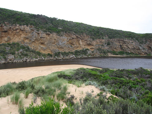
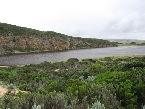
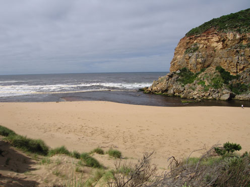
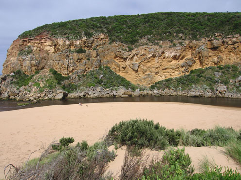
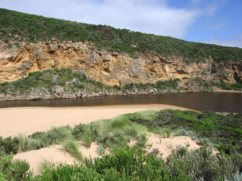
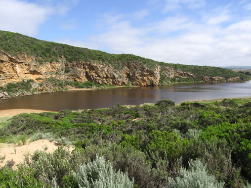
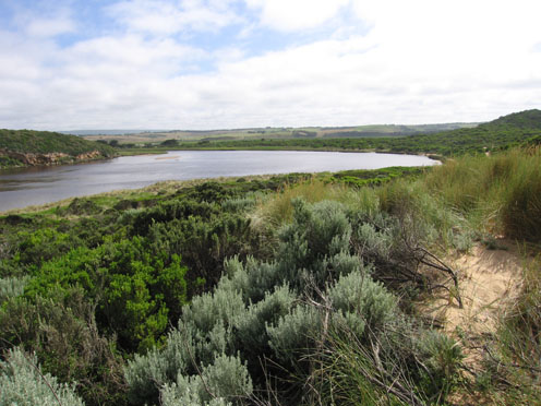
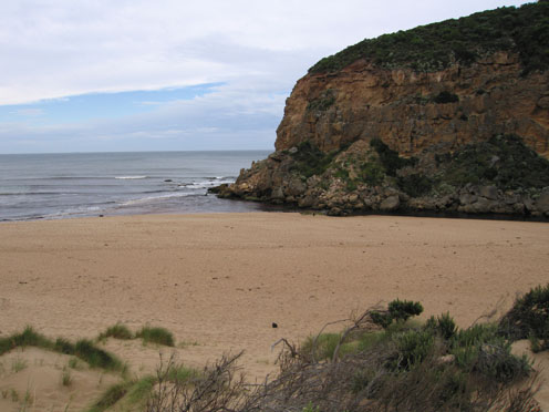
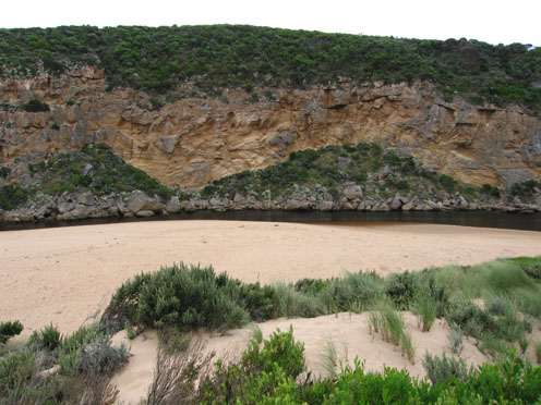
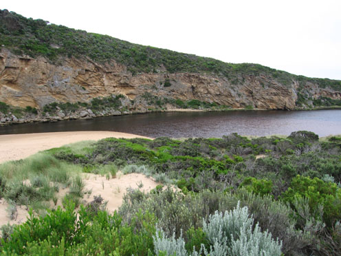
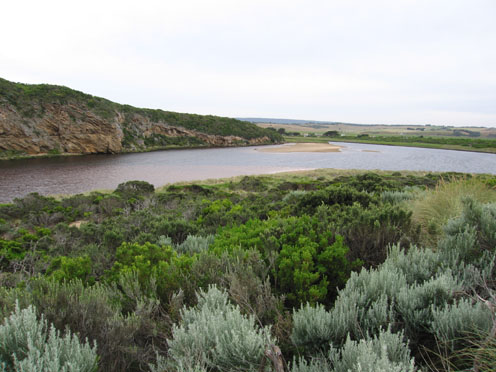
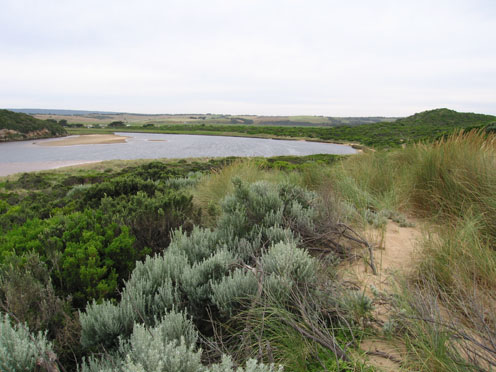
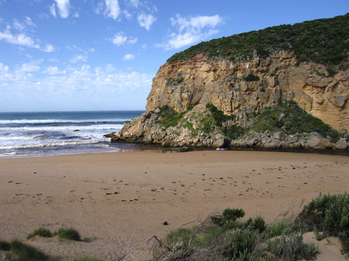
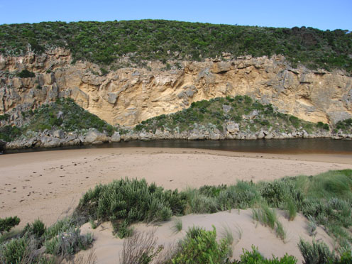
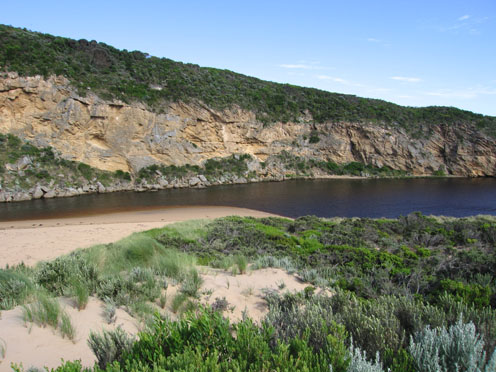
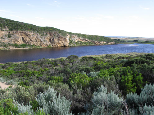
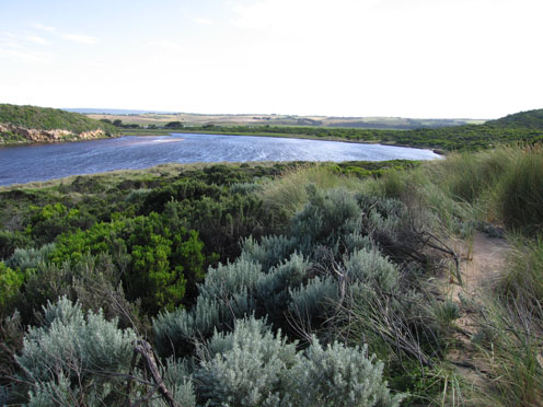
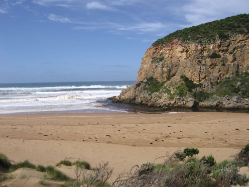
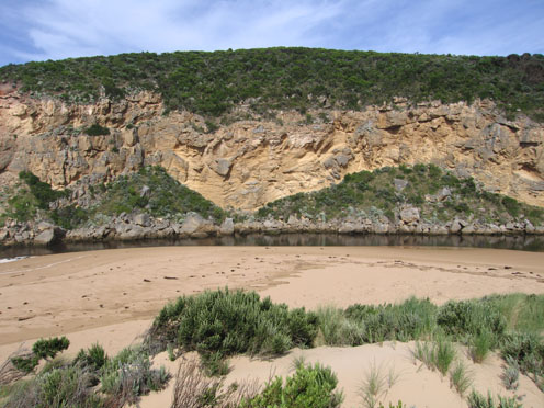
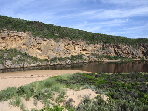
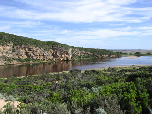
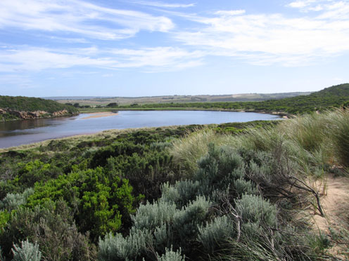
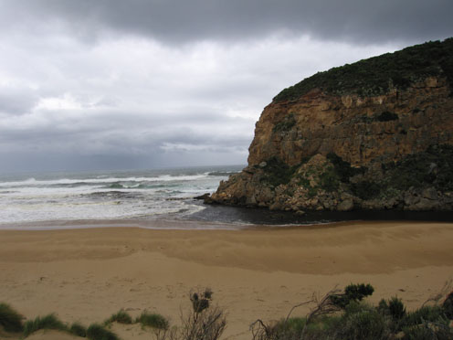
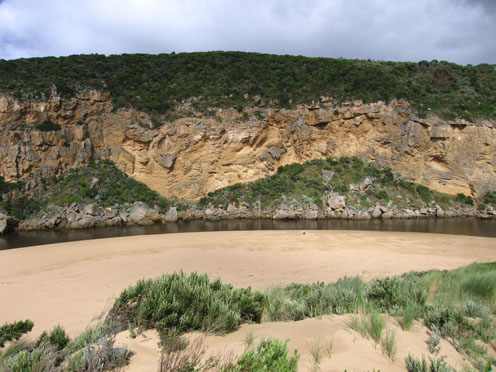
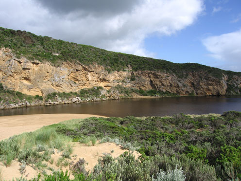
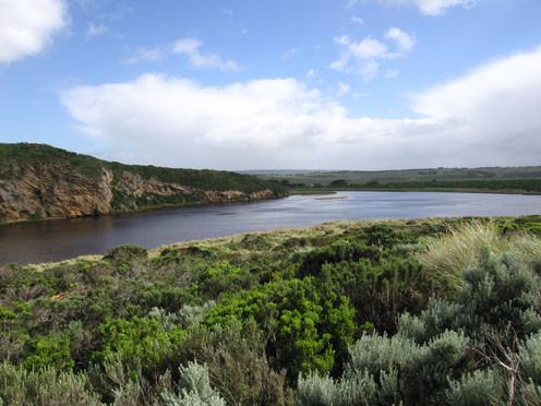
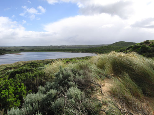
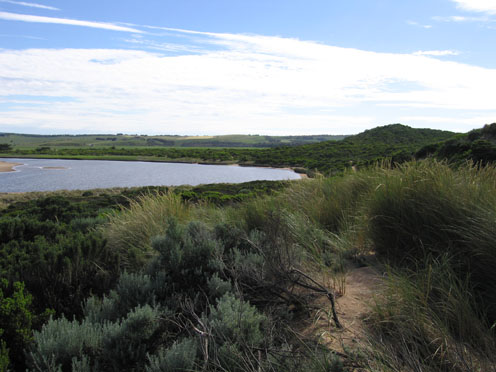
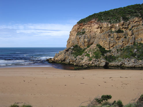
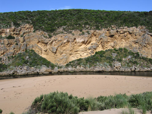
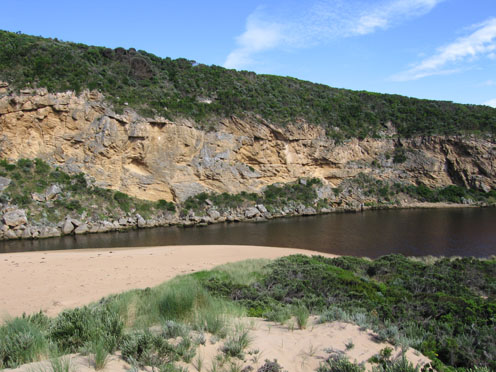
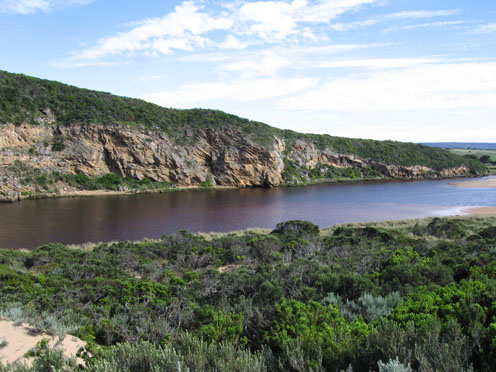
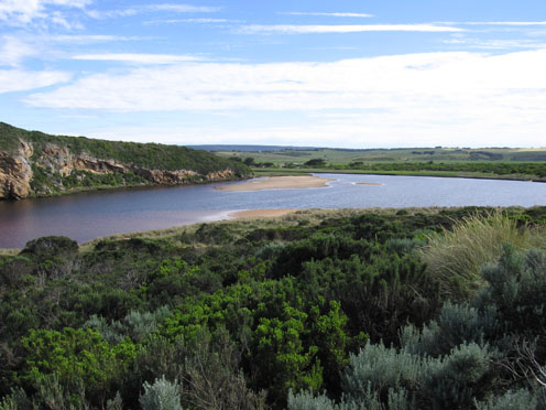
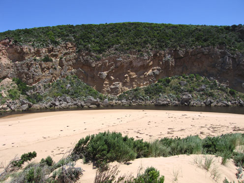
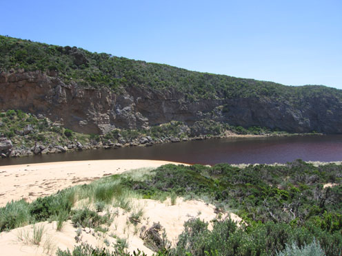
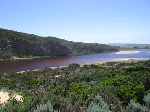
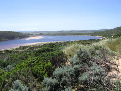
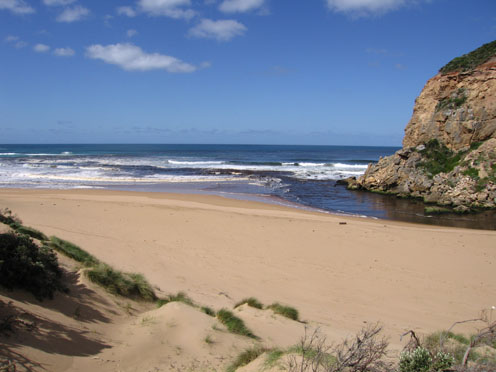
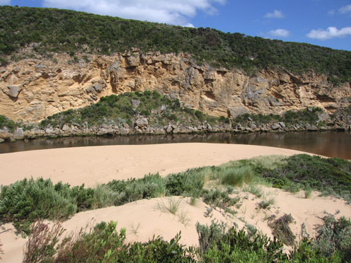
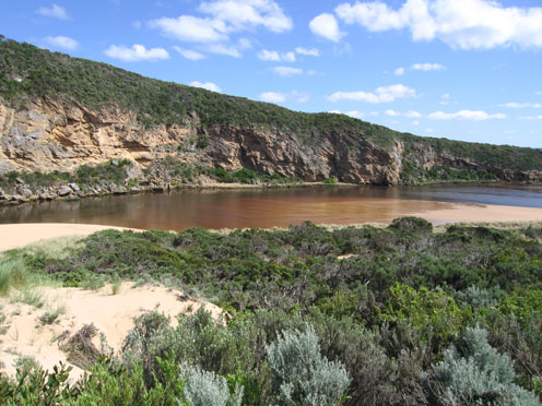
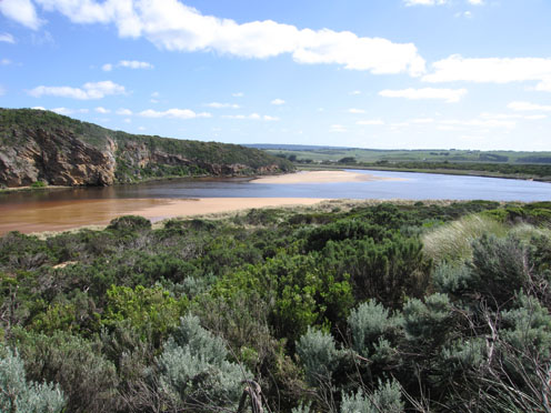
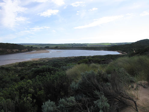
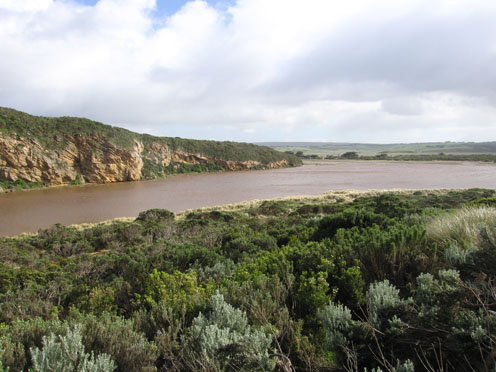
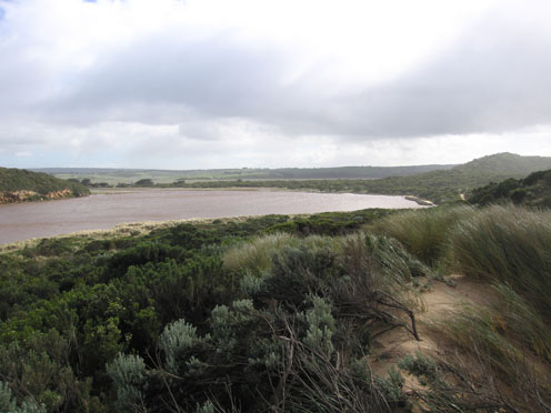
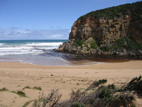
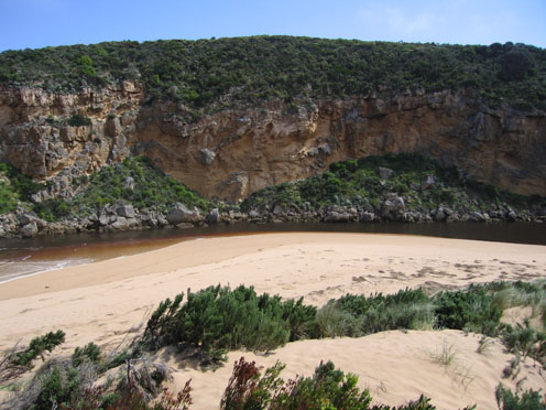
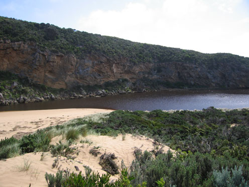
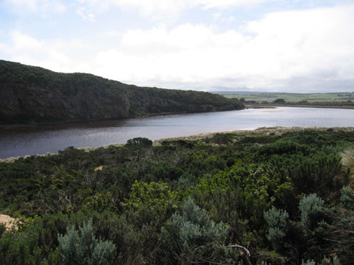
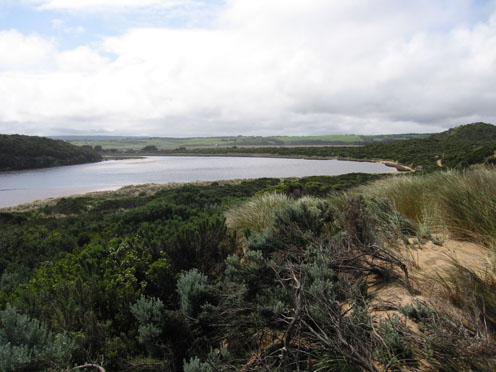
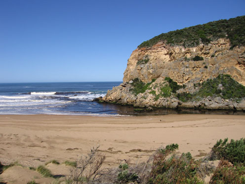
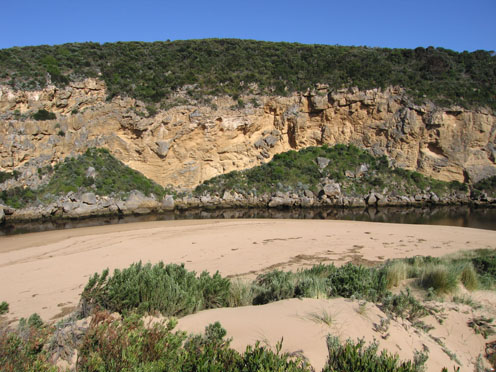
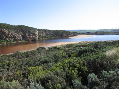
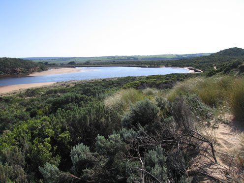
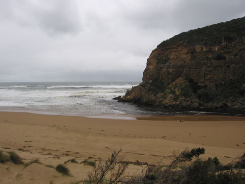
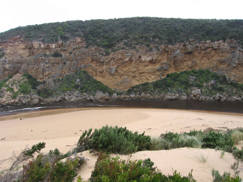
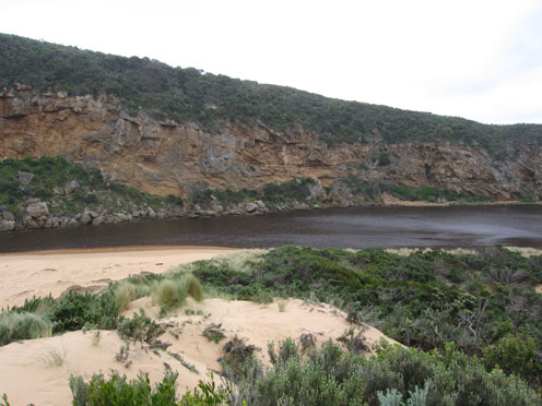
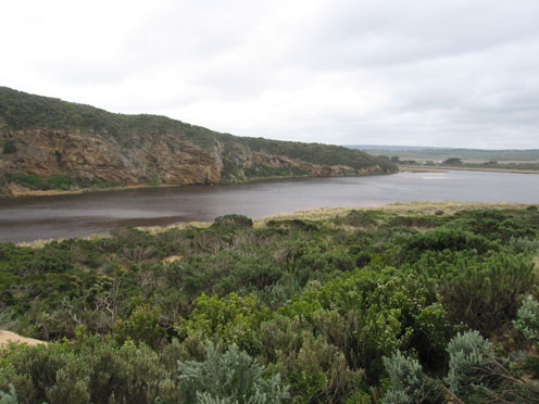
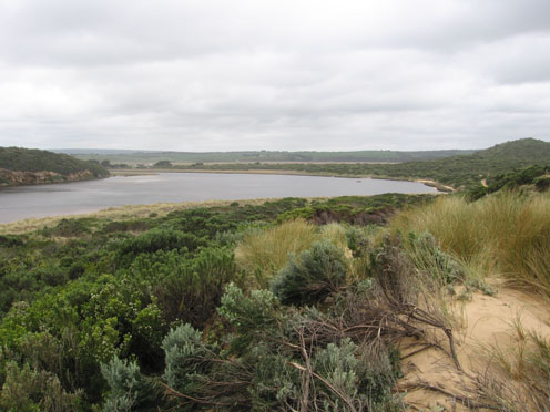
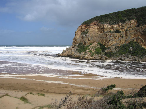
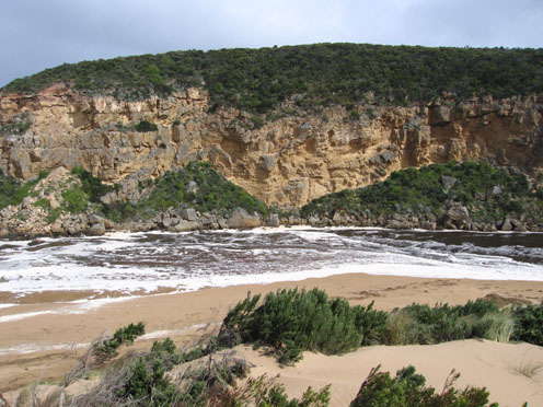
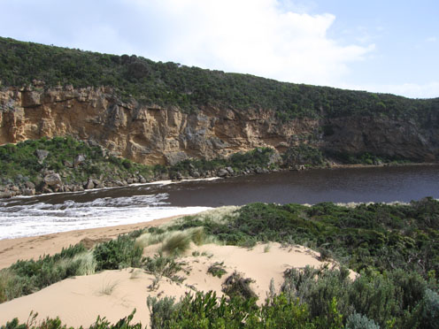
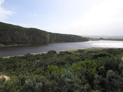
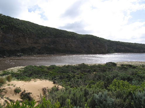
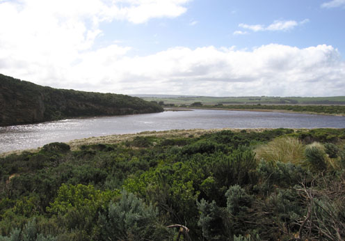
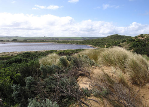
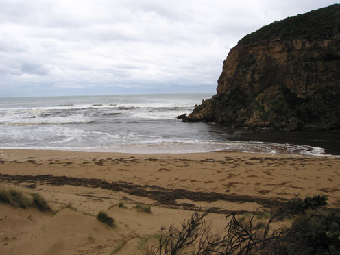
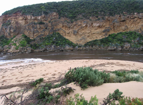
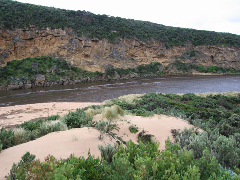
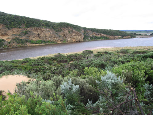
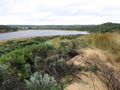
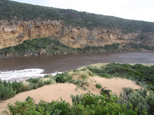
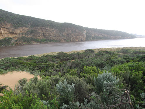
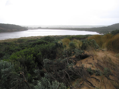
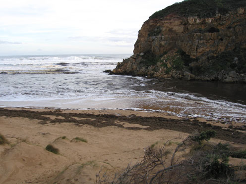
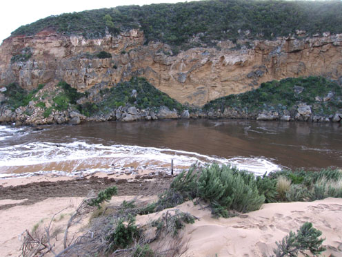
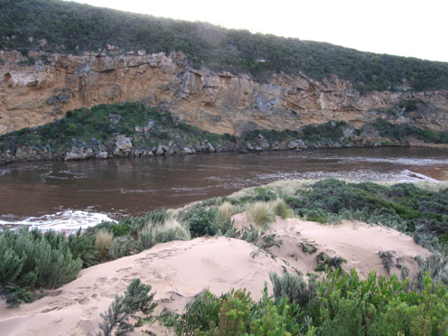
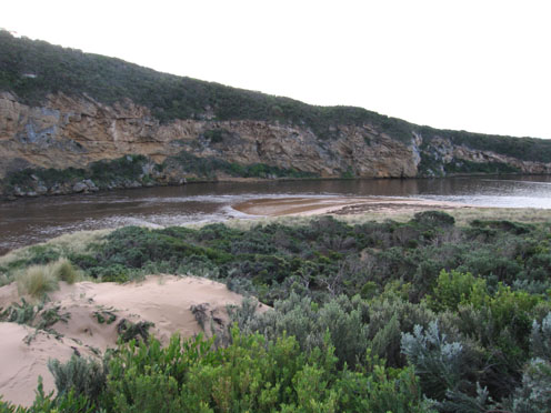
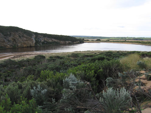
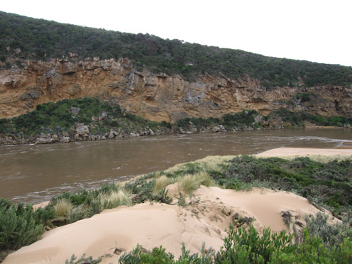
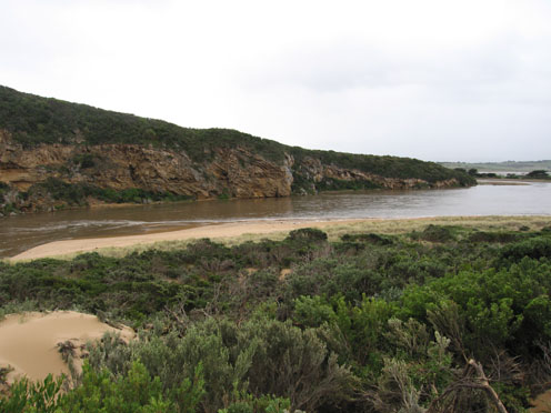
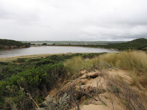
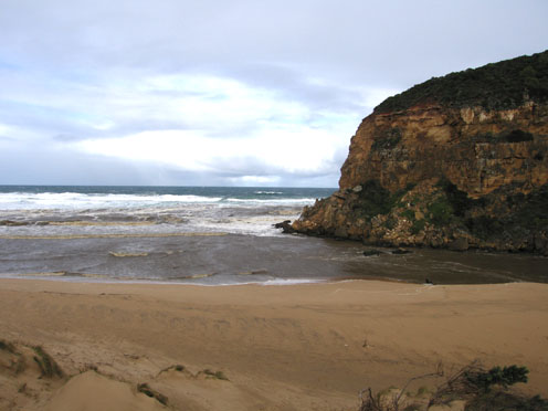
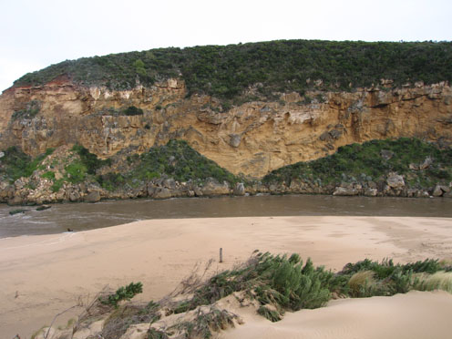
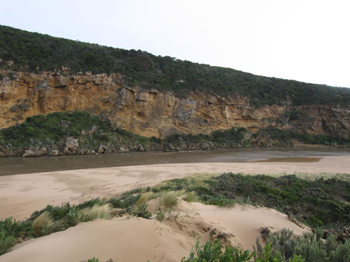
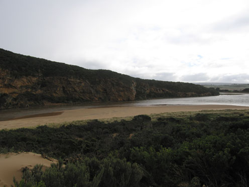
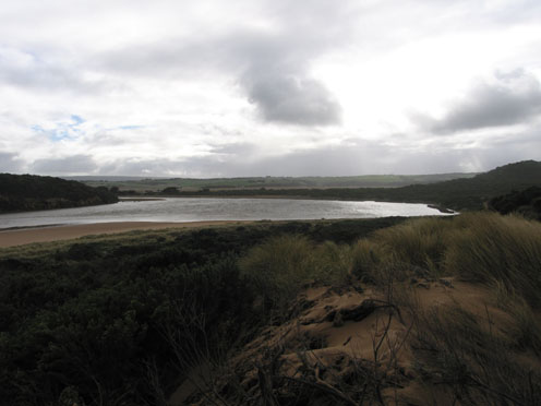
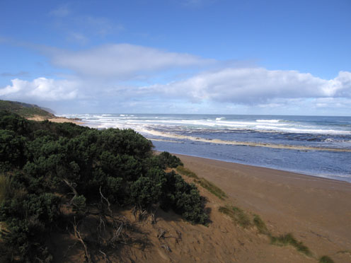
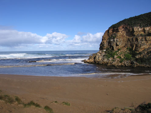
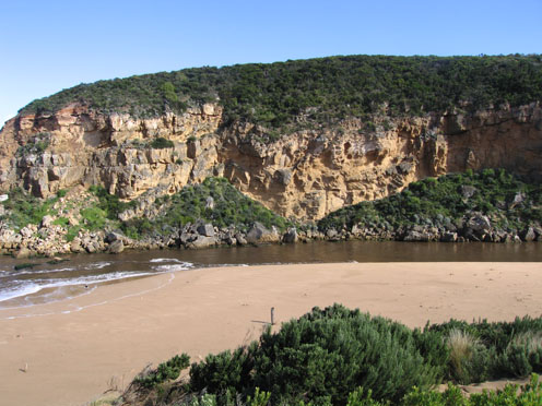
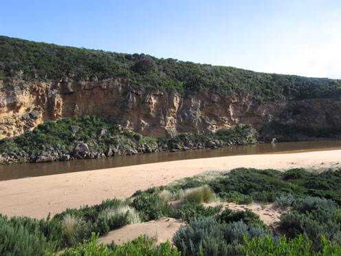
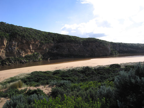
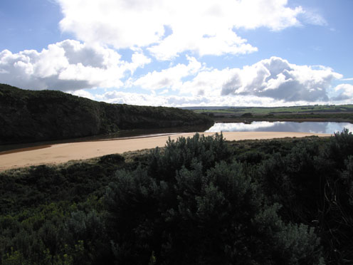
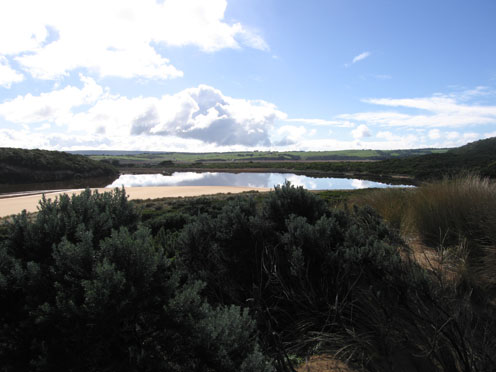
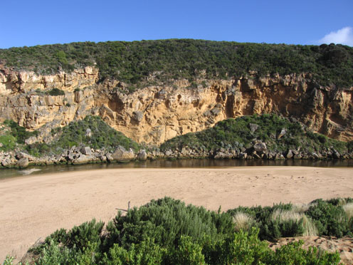
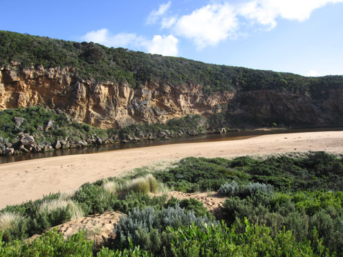
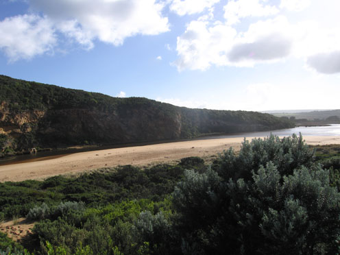
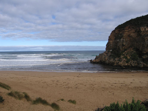
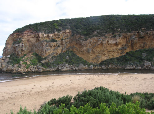
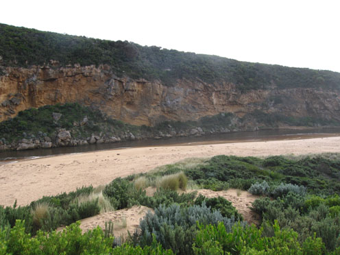
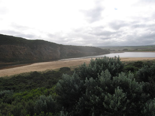
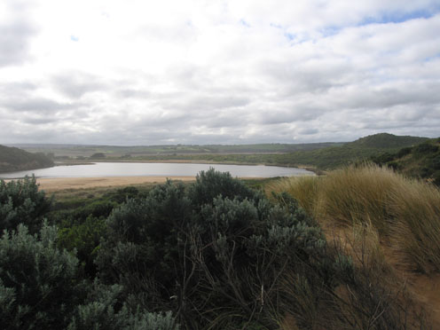
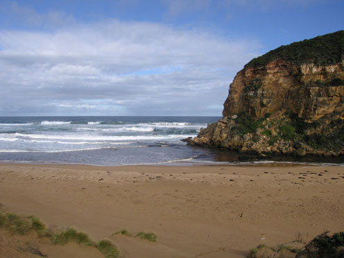
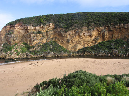
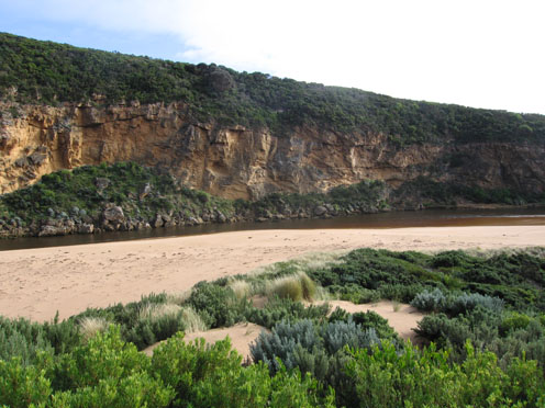
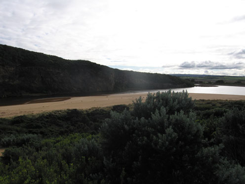
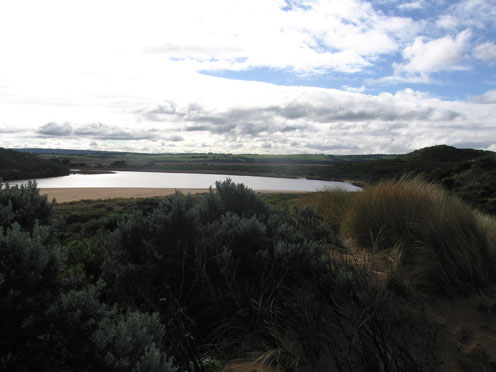
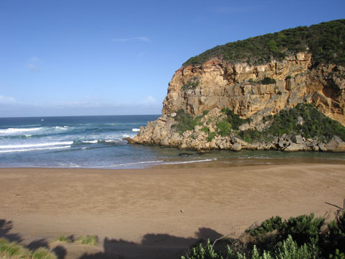
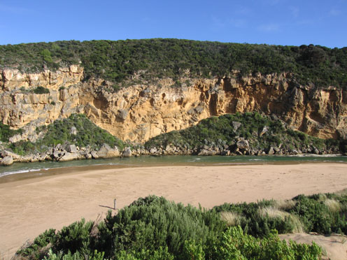
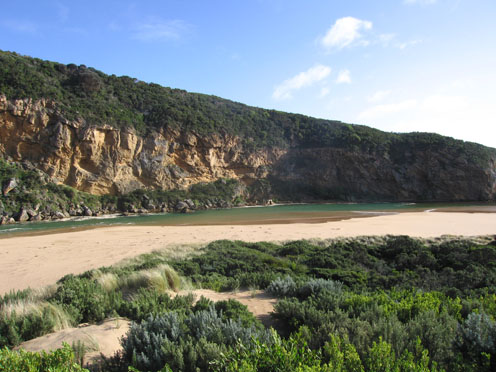
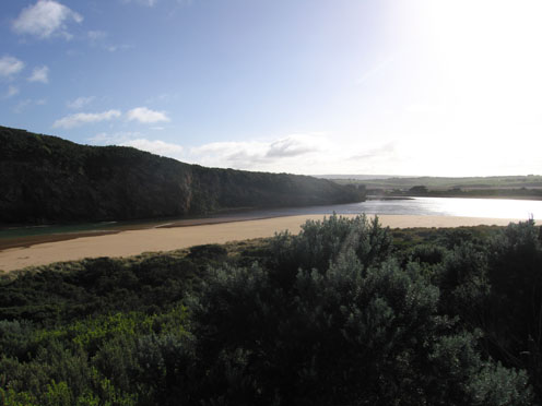
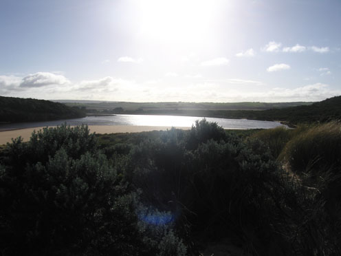
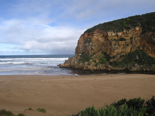
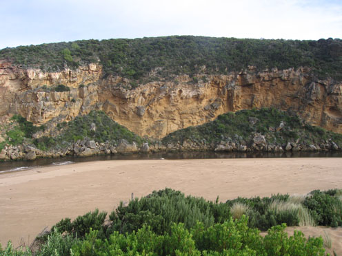
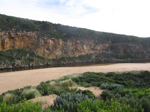
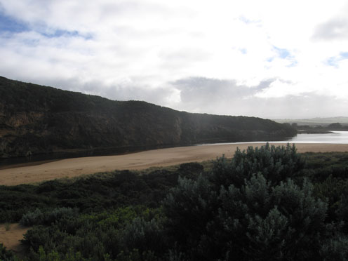
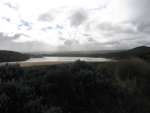
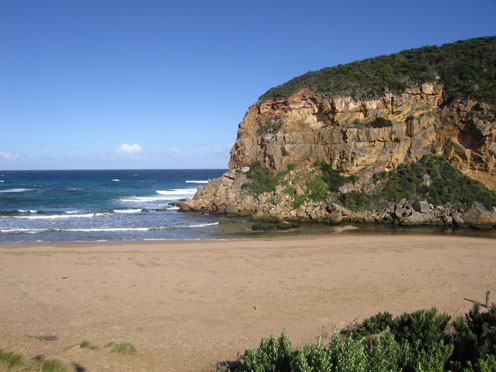
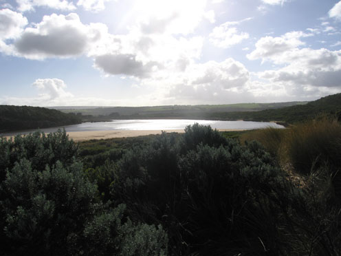
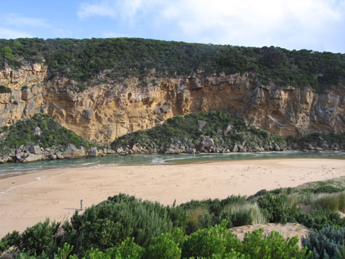
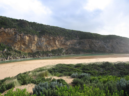
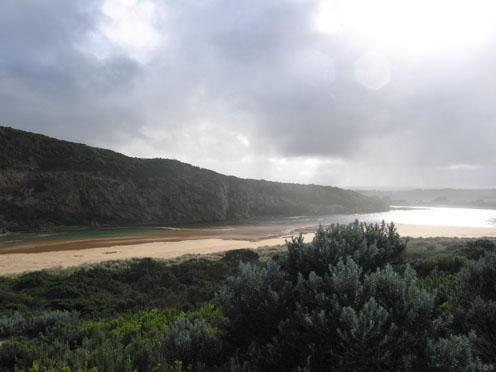
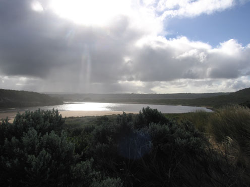
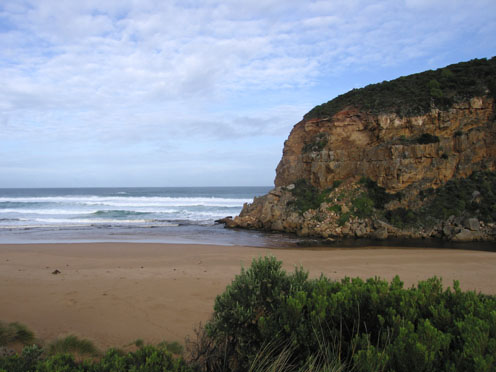
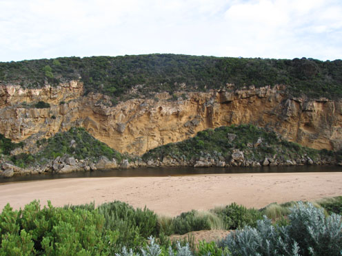
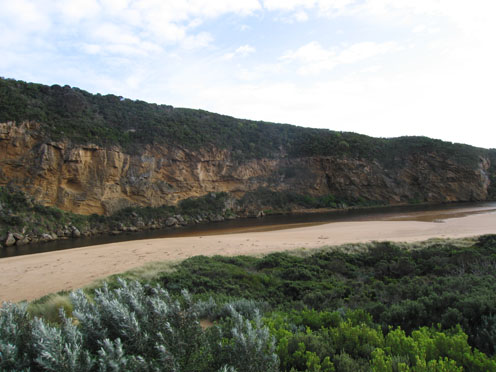
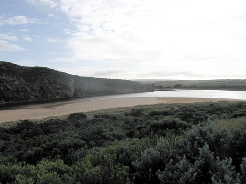
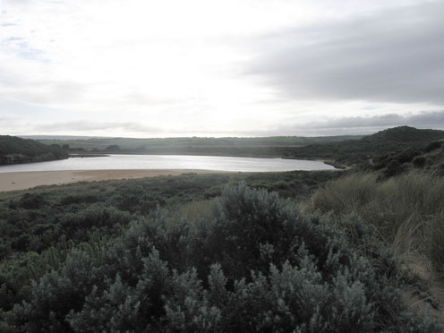
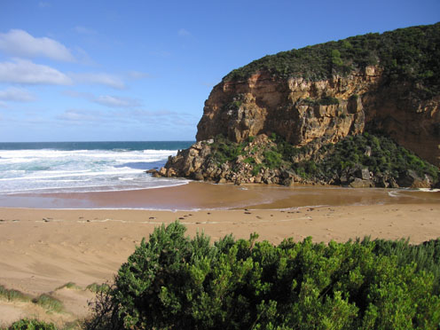
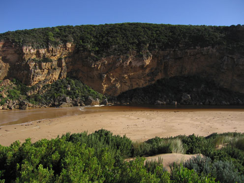
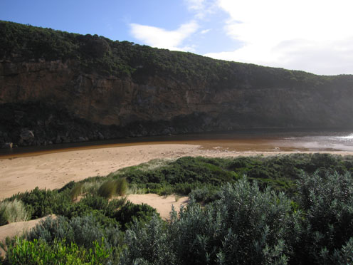
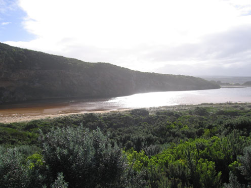
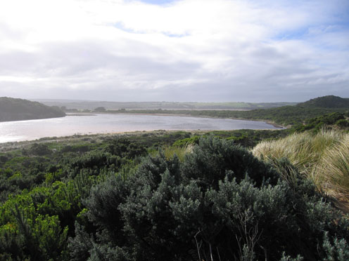
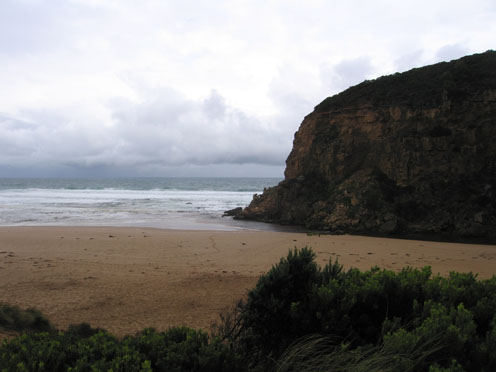
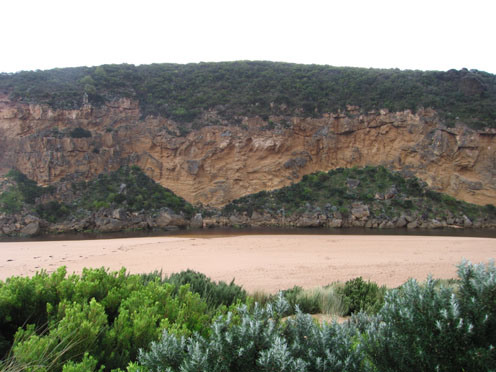
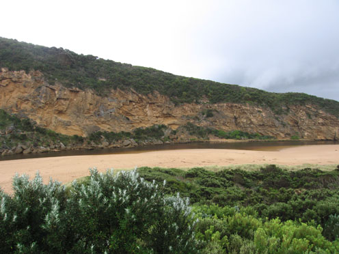
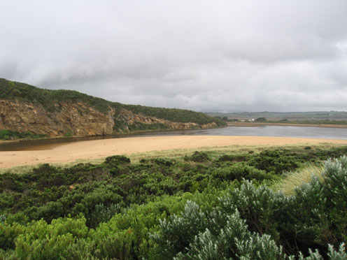
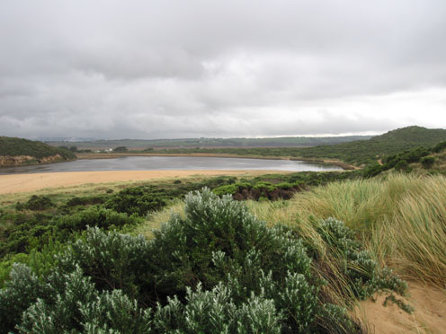
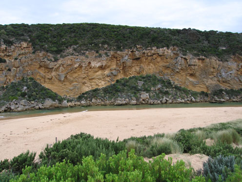
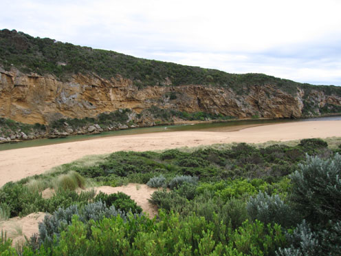
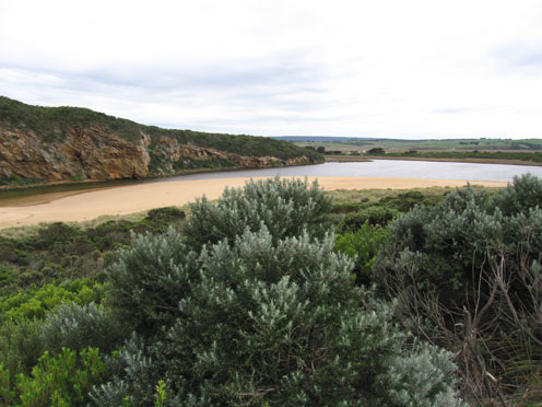
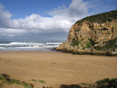
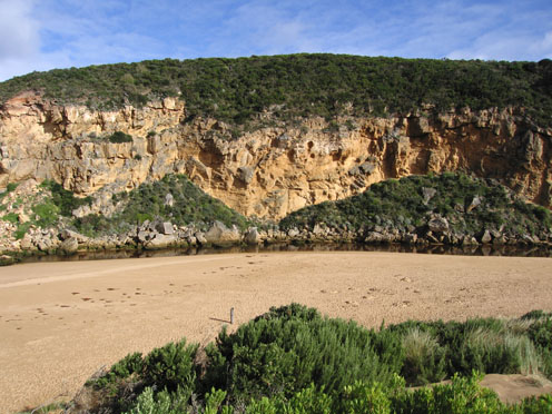
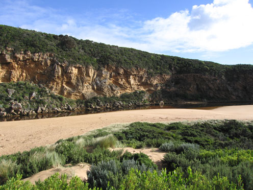
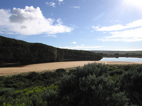
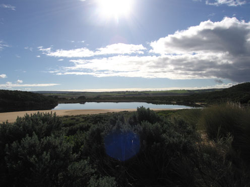
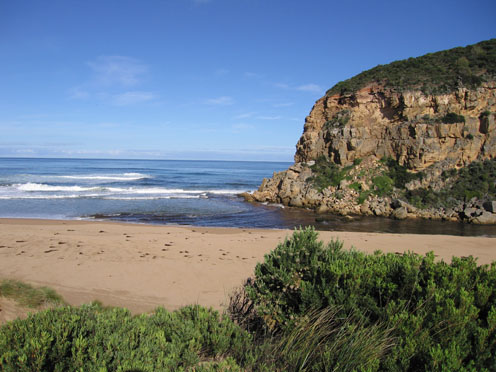
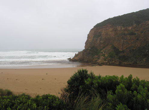
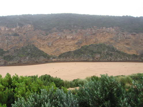
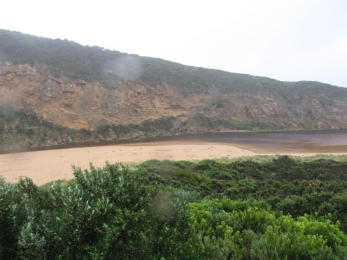
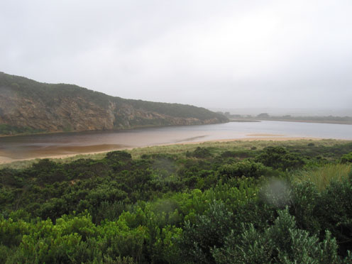
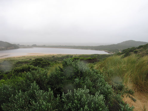
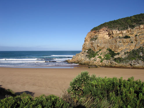
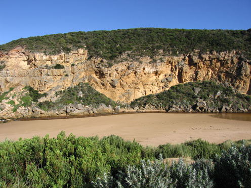
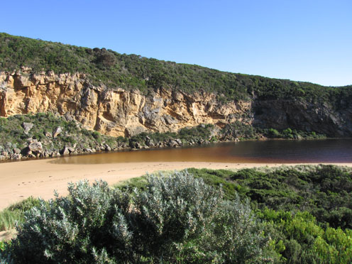
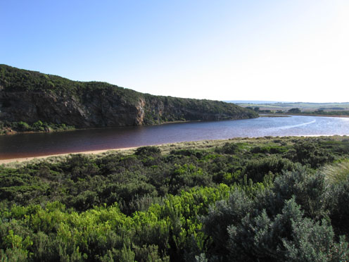
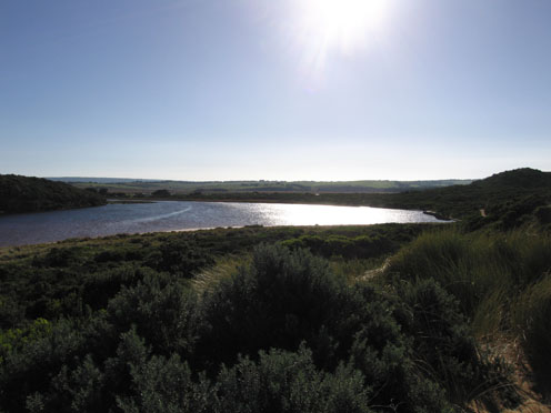
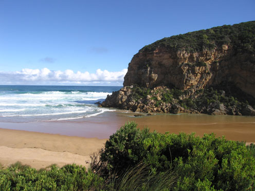
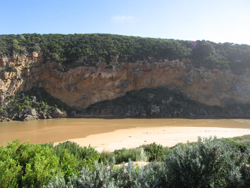
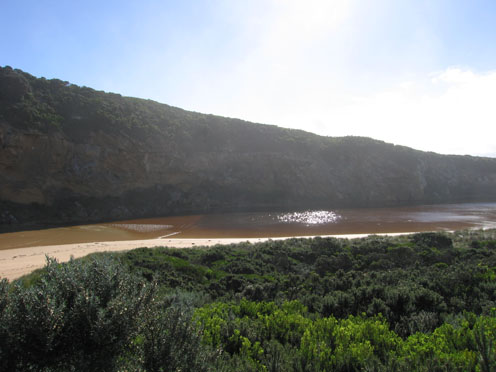
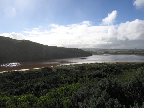
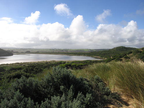
GMC Gellibrand River Estuary Mouth Observation Site
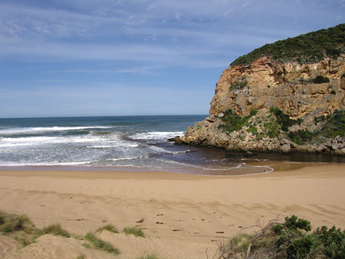
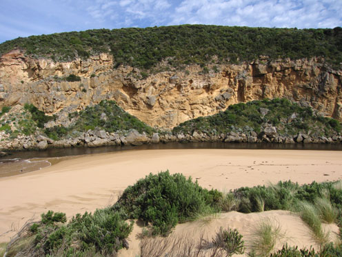
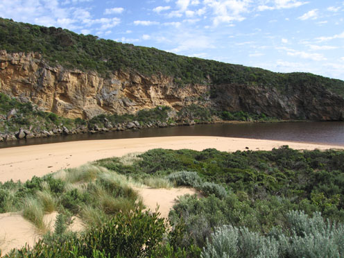
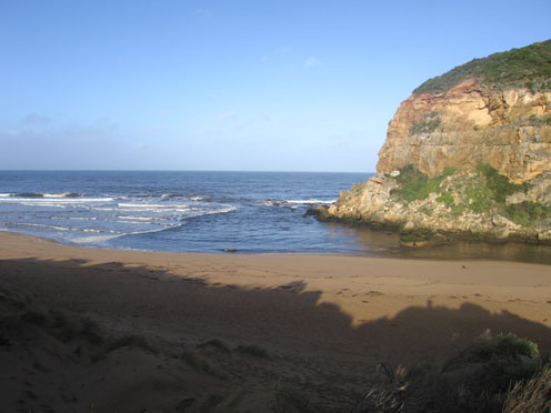
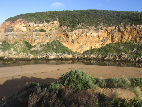
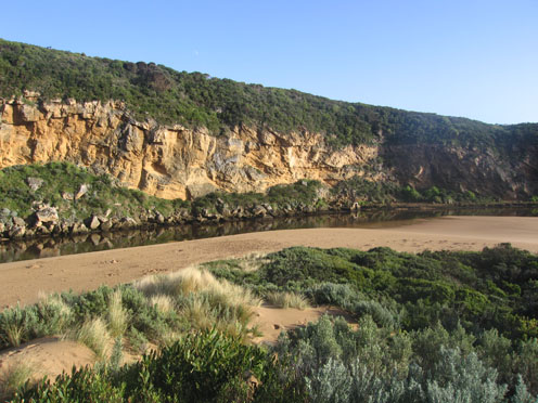
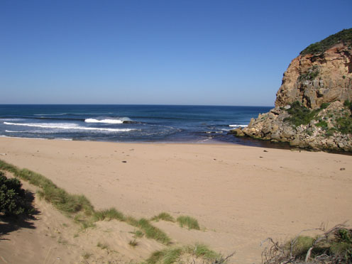
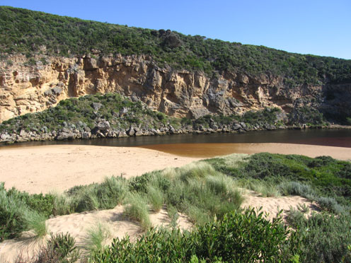
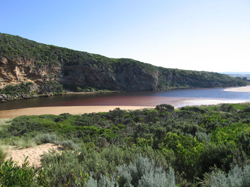
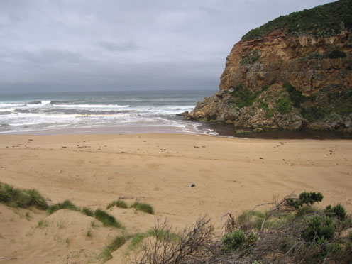
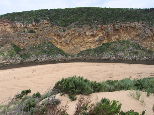
Active Mouth Condition 20-04-2007 - 19-04-2024Gellibrand River Estuary
770 results found (Displaying 501 - 600)
| ID | Date | Status | Details | |
|---|---|---|---|---|
| #6566 | 13 Jan 2012 | Approved |
Notes:
1. AHD at G6 1.41 at 07:17 2. Mouth closed on 12/01/12 . 3.Waves have been over at last hi tide, width of berm at present about 40m. River about 1m higher than sea level. Signs of waves entering channel up to 60m 4.Rocks just showing above sand. 5.Bouy barnicles 100's of them all along beach & some in river 6.Sand mid beach has been reduced by wave action 7.Small rock fall near rocka 8. Dead Albatross east end of beach |
|
| #6535 | 6 Jan 2012 | Approved |
Notes:
1.Entrance very shallow , waves over sand build up with small channel against cliff 2.Waves in all directions at mouth. Longshore drift bringing more sand 3. Sand around rocks higher 4.Reduced flow - no rain since 1.5ml since 26/12/11 5. Sand higher mid beach 6.Dead fish at entrance |
|
| #6532 | 30 Dec 2011 | Approved |
Notes:
1.Slight pale discharge around mouth & halfway along beach 2.Channel only about 3m. wide & shallow -lots of turbulance 3. Water high in estuary even at low tide 4.Ocean beach- scouring at e. end continues, sand increasing in height mid beach. |
|
| #6529 | 23 Dec 2011 | Approved |
Notes:
1. Reduced flow -only around mouth 2.Steep sand face at east end of beach has moved closer to dunes (height over 3m.) 3.Steep front to mid beach- sand higher at this point then sloping down west toward mouth -east end of beach much lower 4.Algae visiable in large sheets, bubbles rising & 'skeins' forming on surface - e. side of estuary 5.Many small 1-2cm fish in area e.side of estuary |
|
| #6528 | 16 Dec 2011 | Approved |
Notes:
1.slight coloured discharge around mouth, east & west 2.Channel very narrow at mouth, flow only against cliff. 3.Waves in all directions at mouth 4.East end of beach still has high sheer sand close to dunes 5. High tide has nearly reached dunes on ocean beach & water was about 1m higher than present level in estuary 6.Small fish 1-2cm in shallow water s/e side of estuary 7.Dead Wallaby wrapped in large amount of seaweed near channel (juvenile) |
|
| #6426 | 9 Dec 2011 | Approved |
Notes:
1.Dark discharge along beach to east 2.Despite large pool behind rocks(upstream) actual channel at mouth is only about 3-4m wide 3.Sand building up at mouth assisted by longshore drift 4.Dark sludge line along channel with small pieces of rotting vegetation 5.East end of ocean beach eroded nearly up to base of dunes,steep face about 3-4m high 6.Sand at south side of estuary changing shape 7. Sooty Oystercatchers 3, at east end of beach also Silver gulls 8, Rufus bristlebird 1, White egret 1, wallaby 1, around estuary |
|
| #6531 | 8 Dec 2011 | Approved |
Notes:
1.Slight pale discharge around mouth & halfway along beach 2.Channel only about 3m. wide & shallow 3.Lots of turbulance - water high in estuary even at low tide 4. Ocean beach -scouring east end continues 5. Sand increasing in height mid beach & sloping down to mouth |
|
| #6421 | 27 Nov 2011 | Approved |
Notes:
1. Dark discharge only around mouth 2..Out flow only against cliff, cascading over rocky area between rocks & cliff 3. Channel upstream of rocks- bank about 1m above water- steep sided 4.Increased erosion at east end of beach, high sand area mid beach. Sand continues to build up around mouth 5.Dead shearwater east side of channel 6. Many waterbirds on north wetlands. |
|
| #6361 | 20 Nov 2011 | Approved |
Notes:
1. Dark discharge around mouth & along shoreline to east 2.Waves in all directions at mouth. occasional wave over rocks & upstream 3.Channel only about 3-4m wide upstream of rocks 4.More sand build up east side of rocks & cliff face 5.High sand build up mid beach -sand cliff at east end of beach has increased height 6.Water level high east & south side of estuary |
|
| #6341 | 11 Nov 2011 | Approved |
Notes:
1. Sand build up continues to increase at mouth 2.Steep edge to sand at eastern end of ocean beach remains 3.Sea has been high up on beach at last hi tide, large amount of Squid carpaces in swash line 4.Shell duck 18 on sandbar in estuary also large black comorant 5. Woodduck 3 on fishing platform, large increase in Waterhens, Coots in north wetlands. Grebes 6, Swamp Harriers 2, Comorants 2, White egrets 2, Straw necked Ibis 18. |
|
| #6321 | 4 Nov 2011 | Approved |
Notes:
1.Water flowing both sides of rocks but increased sand build up at mouth 2.Sea has eroded eastern end of ocean beach leaving 3m high face to sand 3.Continuing erosion on east & south side of estuary 4.Hooded Plover tracks on beach but no sighting of birds 5 Birds Increaced no of Coots & Swamphens Hardhead ducks, Swans, Ibis, White egrets,W/h herons, W/n Herons, Comorants,Wood duck, Teal, Grebes, Swamp harriers3, large mob of masked Plover 10 at G4 |
|
| #6262 | 28 Oct 2011 | Approved |
Notes:
1.Dark discharge around mouth, also to east & west 2.Despite over 25ml rain during week flow seems to be decreasing 3.Flow only between rocks & cliff, more sand around mouth 4.Sand has been eroded at east end of ocean beach creating a steep face (1m+) 5.Sand visiable going out to sea about 50-100m from 2nd beach 6.More damage to south & east sides of estuary |
|
| #6241 | 21 Oct 2011 | Approved |
Notes:
1.reduced outflow, sand building up around mouth & rocks, greatly reduced on east side of rocks -main flow close to cliff 2.Width of channel 5-6m at narrowest point upstream of rocks 3.Sea has been up to base of dunes at last hi tide 4. Continuing damage to south & east side of estuary. More saw logs from ocean beach in estuary 5.Flow from upstream reducing Birds Large black comorants 4- (mob of about 50 sighted during week),w/h herons 4, white egrets 2, There has been large increase of White necked herons, White headed herons, White egrets, Spoon bills & comorants especially around G5 |
|
| #6201 | 14 Oct 2011 | Approved |
Notes:
1.Dark discharge around mouth & to east 2.Small waves entering estuary 3.Area around rocks has been scoured out but sand is much higher on beach (2nd post covered) 4.High seas during week have caused more erosion east & south sides of estuary- deep channel behind reeds 5.Steep front to sand above ocean at east end of beach 6.Senecio elegans flowering in dunes, along tracks & on cliff face 7.No sign of nesting plovers - many dog & human prints through the area 8. Birds G5 - GP Silver gulls 4,W/h herons 30+, H/h grebe1, Swans 4, Grebes 4, Coots 6, Waterhen 1, Harrier 1, Pied comorants 6, white Ibis 18, W/n herons, 34, Gt white egrets 29+, Spoonbills (pale beaked 30+ , Pied Stilts 10. |
|
| #6181 | 7 Oct 2011 | Approved |
Notes:
1. Increased outflow, dark discharge around mouth & to east 2.Waves in all directions at mouth, whirlpool around rocks 3. Waves entering estuary & impacting on south & east sides 4.Water from recent rain event has been releasing -silt all along ocean beach & steep sides to channel upstream of rocks 5 Hooded Plover 2, attempting to nest at east end of ocean beach 4. White egrets 4, in estuary |
|
| #6163 | 30 Sep 2011 | Approved |
Notes:
1. Reduced flow out, only slight discolouration around mouth 2.Waver entering estuary & impacting on south dunes and east side causing more erosion 3.Sand continues to increase around rocks & mouth 4.Egret fishing on rocks at mouth 5.Hooded plover 2, on 2nd beach (26/09/11 |
|
| #6141 | 23 Sep 2011 | Approved |
Notes:
1.Dark outflow around mouth & along cliff face to west 2.Sand building up around mouth 3.Waves entering channel 4.Waves up to base of dunes on ocean beach 5.Waves cutting away sand dunes south side of estuary & impacting on east side where water is surging up & along behind reeds |
|
| #6121 | 17 Sep 2011 | Approved |
Notes:
1.Flow - out with dark dischage around mouth & to south 2. Small waves entering estuary 3.Sand building up infront & behind rocks 4. Beach - very wide & sloping, longshore drift bringing sand into channel upstream of rocks 5. Waves have been to base of dunes(ocean beach) at last hi tide, wave surge has increased erosion on east & south sides of estuary 6.Many Swallows over dunes, Silvergulls on beach 10, White headed heron at mouth |
|
| #6081 | 9 Sep 2011 | Approved |
Notes:
1.Small area of dark water around mouth 2.Waves entering estuary & impacting on south& east sides 3.Sand building up around rocks - channel width reduced 4.Waves have been to base of dunes on ocean beach during last hi tide 5. Waves from south east at mouth. |
|
| #6162 | 3 Sep 2011 | Approved |
Notes:
1.Only slight discolouration of water around mouth. Flow is out but with waves entering estuary & travelling along face of dunes(south side of estuary) & impacting on east side. 2.Sand continues to build up around entrance & rocks 3.Hooded Plover 2, on second beach(26/09/11) |
|
| #6041 | 3 Sep 2011 | Approved |
Notes:
1.Weaker out flow, dark discharge out around mouth, out to sea & toward east end of beach 2..Mouth smaller but water flowing on both sides of rocks 3.Beach wide with gradual slope, rocks at both ends exposed (Low tide) 4.More erosion to south & east sides of estuary from last weeks rough seas. (More logs close to car park) 5. Large area of sand exposed opposite of tunnel & sandbar 6.Channel between rocks & tunnel -east bank up to 1.5m. above water in some areas (very steep sides) 7. Dead Rail on track to car park (run over) |
|
| #6001 | 26 Aug 2011 | Approved |
Notes:
1. Dark discharge around mouth, to east and also some along cliff to west 2.Beach flat with very gradual slope 3.Waves entering the estuary - continuing wave damage to east & south sides 4.Longshore drift bringing more sand back into mouth, whirlpool just upstream rocks 5.PARKS repairing the damaged gate to historic tunnel -Fox hunting on rockface above that area 6.Large black comorants 3, on sandbar. 7.Dog tracks on beach 8.Gladiolus undulatus leaves emerging along low track (increased) 9.Humpback Whales 2, sighted off beach 22/08/11 |
|
| #5965 | 19 Aug 2011 | Approved |
Notes:
1.Dark discharge around mouth & out to sea, small waves entering estuary, travelling to east. 2.Waves in all directions at mouth, longshore drift bringing back more sand into channel (increase of sand around rocks) 3.Waves from rough seas (18/08/11) have been up to base of dunes pushing logs up higher 4.Beach wide & very smooth with gradual slope 5.More erosion on east side of estuary new logs high on low track 6.White headed Heron 1, unidentified very large birds about 30-50 meters out to sea 2. |
|
| #5946 | 12 Aug 2011 | Approved |
Notes:
1.Dark discharge around mouth, along foreshore & out to sea ( 100m.+) near eastern end of beach - discoloured foam visiable 2.Small waves entering estuary 3.Beach curved with small central area(20m.) with 1m.high steep front 4.Continuing erosion south & east side of estuary 5.Black Comorants 4, Gt. White Egrets 4, Pacific Gulls 2, Silver Gulls 6 |
|
| #5928 | 5 Aug 2011 | Approved |
Notes:
1.Strong dark outflow, waves in all directions at mouth. Channel wide. 2. Longshore drift bringing back more sand into channel upstream of rocks 3. Waves have been up tp base of dunes on foreshore and estuary -south side of estuary has been further reduced |
|
| #5925 | 29 Jul 2011 | Approved |
Notes:
1.Dark outflow around mouth, out to sea & east 2.Occaisonal small waves entering estuary 3.White egret 1. Whiteheaded herons 8, Pegerine Falcon 1. around & on sandbar 4.Seal reported swimming at entrance 02.07.11 |
|
| #5889 | 22 Jul 2011 | Approved |
Notes:
1. Strong outflow, area around rocks at entrance scoured out 2. High edge to south side of estuary(1-1.5m) also upstream of rocks 3. Channel very narrow near tunnel (Low tide) very large area of sand exposed 4. Pelican 1 & Whiteheaded Herons 2, in estuary. 5. Dead Antichinus on ocean beach |
|
| #5845 | 16 Jul 2011 | Approved |
Notes:
1.Strong dark outflow to east & west, waves in all directions around mouth. Occasional small wave entering estuary 2.Beach covered with silt & reeds up to base of dunes, east end scoured out with large mass of foam on rocks 3. High edge to channel (1m above water level) on east side of estuary continuing around to rocks 4. Frost cover on estuary vegetation near car park 5.White headed Hreons 2, Rail 1. |
|
| #5801 | 8 Jul 2011 | Approved |
Notes:
1.Strong outflow with visiable high turbidity 2.Water in all directions at mouth 3.Beach-gradual slope with deep scouring at eastern end. Large amount of foam on edge of beach & sea 4. 17 large logs on beach - more in estuary 5.Waves have been up to base of dunes during past high tides & rough seas. 6.Waves have travelled along sand eastside of channel and impacted on sand dunes south and east of the estuary. Large area has been removed on south side. Flooding of area near carpark has occured 7.Shellduck in estuary 2, 8.Dead Gannet 1, Dead penguins 2. |
|
| #5802 | 8 Jul 2011 | Approved |
Notes:
1.Strong outflow with visiable high turbidity 2.Water in all directins at mouth. Longshore drift active 3.Beach-gradual slope with deep scouring at eastern end. Large amount of foam in breakers and on beach. 17 large logs on beach &8 more in estuary 4.Water has been up to base of sand dunes on foreshore and estuary, a large area has been washed away on south side of estuary during high tides & rough sea. Water reached ocean carpark along low track 5.Dead Gannet on beach, also 2 dead penguins, one eastside of the channel |
|
| #5764 | 2 Jul 2011 | Approved |
Notes:
1.Discharge around mouth & out to sea - both east & west 2.Channel 20m. with 1-2m. steep east bank (Top shows interesting erosion shapes.) 3.Longshore drift returning to mouth. 4.Surfers (4) in waves around mouth area 5.Seagrass showing signs of re-growth along eastern edge of estuary. 6.Banded Rail at carpark 7.Cat, dog & fox prints around estuary |
|
| #5761 | 25 Jun 2011 | Approved |
Notes:
1.Discharge around mouth & to east & west 2. Channel wide about 15-20m & flowing strongly. East bank straight sided 1 to 1.5 m. high 3.Longshore drift back to mouth from mid beach 4.Large amount of foam & silt at eastern end of beach |
|
| #5701 | 17 Jun 2011 | Approved |
Notes:
1.Salt water entering estuary, salt fresh divide about 30m.downstream of rocks, east bank about 1m above water, channel in that area about 15-20m wide, flow on both sides of rocks. 2. Waves in all directions at mouth 3. Sand built up at mid beach, longshore drift & wind bringing sand back into channel, & around mouth |
|
| #5667 | 10 Jun 2011 | Approved |
Notes:
1.Strong out flow on both sides of rocks travelling through a much wider entrance and going to east along shoreline. Colour very dark 2.Recent heavy rain has increased flow. Channel between rocks & tunnel has steep east side (1-1.5m), channel in that area is about 15-20 m wide 3.Beach very wide with gradual slope 4.Recent rough seas & hi tides have cut into sand dunes on south side of estuary and impacted on east side. Debris is piled up along bank and sand has built up in reed area 5.Small area of sandbar is exposed 6. 2 dead penguins ( one without a head) |
|
| #5621 | 3 Jun 2011 | Approved |
Notes:
1.Salt water entering, divide about 50m. upstream of rocks 2. Beach wide with gradual slope 3. Longshore drift bringing sand back around rocks & entrance. Hi tide has also impacted on channel upstream of rocks |
|
| #5601 | 27 May 2011 | Approved |
Notes:
1.Beach very wide 2.Sand higher in area between rocks & tunnel, evidence of last tide bringing waves across that area. Waves have been up close to dunes on beach. 3. Very large cat on low track from Ocean car park. Fox prints around water's edge |
|
| #5561 | 20 May 2011 | Approved |
Notes:
1.Salt water entering, salt/fresh divide midway between mouth & tunnel 2.Recent natural release of water has cut channel with sheer side east of rocks 3. Beach very wide, sand building up higher mid beach 4.Sand build up visiable under water at mouth 5.Sandbar in estuary exposed, also large area on east side 6.Singing Honeyeaters 3. |
|
| #5522 | 13 May 2011 | Approved |
Notes:
1.Dark discharge around mouth - also to east along shoreline. Discharge to west shows much sand 2.Waves circling at mouth, some waves entering channel and high up on beach 3.Beach wide with gradual slope 4. Wind & longshore drift bringing more sand into channel between rocks & tunnel 5. Water level high in estuary 6. Dead Penguin 1. |
|
| #5503 | 6 May 2011 | Approved |
Notes:
1. Salt water entering estuary (hi tide - 1.21) Salt fresh divide halfway between rocks & tunnel 2.Sandbar covered 3. Immature Hooded Plover east end of beach 4. Dead Penguins 2 Dead shearwater 2 |
|
| #5459 | 29 Apr 2011 | Approved |
Notes:
1.Dark discharge flowing out next to cliff, visiable around mouth & to east 2.Sand still visiable in front of rocks. 3.Beach very wide with gradual slope, sand visiable under water level with end of cliff 3.Strange sand patterns in channel opp. tunnel 4.Sandbar has changed shape |
|
| #5439 | 22 Apr 2011 | Approved |
Notes:
1.Sandy discharge around mouth, waves circling & long shore drift travelling along beach to entrance 2. Increased sand build up infront of rocks 3.Very rough sea 21/04/11 has reduced beach to wide gradual slope. Tide/waves have been up to base of dunes & also created a smooth sloping side to the river channel 4.Water levels in the estuary have been up to 1m. above the present 1.68 AHD level 5. Wave action has reduced sand dunes on east side of channel & south side of estuary |
|
| #5425 | 15 Apr 2011 | Approved |
Notes:
1.Recent rainfall in catchment and low tide have combined to cause a large release of dark water around mouth & to east & west 2. Reduced water levels in estuary (low tide) 3.Ocean beach has changed shape - channel from sea to dunes mid beach. Signs of longshore drift mid beach along below dunes to river channel. Sand build up remains in front of rocks(downstream) 4.Many small fish 3cm. -15cm. along east side of estuary. Good sized Bream being caught during week 5.Large dark silt deposit s/e side of estuary 6. Dead Penguins on ocean beach, 3 with heads 'crunched' 7.Dead Fairy Prion 1. 8.Large amount of squid carapaces on beach |
|
| #5383 | 8 Apr 2011 | Approved |
Notes:
1. Slightly increased out flow, discharge visiable only around mouth 2.Steep sides (1m)to channel near mouth 3.Beach very wide & sloping, rocks exposed at east & west ends 4.waves circling at mouth 5.Large areas of sand exposed in estuary, seagrass on east side is showing signs of new growth. 6. Wanderer butterflies (3) on beach & near nouth |
|
| #5365 | 2 Apr 2011 | Approved |
Notes:
1.Very slight discharge( no colour) out through narrow (3-4m. )- shallow (30cm-1m.) channel. 2.Waves entering over this area & around rocks. 3.Channel directly upstream of rocks very narrow/shallow, has been impacted by sand brought along beach from longshore drift Ocean beach gradual slope and straight to mouth 4.Water level height in estuary increasing 5.Squid carpaces & 'by the wind sailors' on beach near mouth, also dead white faced Storm Petrel. 6. Shearwaters ? (2) flying near mouth 7.Stubble Quail seen on track near Ocean beach car park 8.White lipped snake 40m. on Low track |
|
| #5331 | 25 Mar 2011 | Approved |
Notes:
1.Out flow between rocks & cliff face, channel 3-4m wide, cascade over submerged rocks with a drop of about 1m. 2.Channel has moved left and along shoreline. 3.Sand build up against cliff uncovered 4. Increasing flow from recent rain is flushing channel Steep sides( to 1m.) are collapsing into flow 5.Sandbar in estuary is under water & water is up to the base of the dunes on eastside of channel & estuary 6. Last hi tide reached to near base of sand dunes on ocean beach. Longshore drift and wind are bringing more sand back into the channel upstream of rocks. 7. It was noted that a few days after the full moon large schools (2m wide by 1m deep) of small blue grey( 8cm) fish were swimming upstream |
|
| #5322 | 18 Mar 2011 | Approved |
Notes:
1. Beach wide & sloping, sand in straight line along to rocks & behind, occaisonal wave over that area 2.Flowing out, channel width and depth still reducing. Waves entering between rocks & cliff 3.More sand deposited in channel from last hi tide 4.Erosion caused by wave action on east side of estuary has changed pattern 5. Serious increase of Euphorbia paralais on sand dunes and now to base of dunes on east end of Ocean beach 6.Dead Shearwater (recent) 1. 7. Dead fish east side of channel 2.-Tommy Rough 1. 8.New birds at east end of beach Sanderling (?) 1 Plover (?) 3. (Larger than Hooded plover) |
|
| #5305 | 11 Mar 2011 | Approved |
Notes:
1.Dark discharge out - around mouth and to both east & west 2.Shore line is straight to rocks with sand build up behind them 3.Longshore drift bringing in more sand to channel 4.Water very red colour in estuary. 5.Leucopogon pavarivifliorus dying off in all areas 6.Large no. Cabbage butterflies in all areas |
|
| #5242 | 4 Mar 2011 | Approved |
Notes:
1. Sea entering estuary, sand build up around rocks. 2. Evidence of strong longshore drift at last hi tide bringing more sand into channel upstream of rocks 3.Beach has increased steep front 4.Increased water level in estuary 5. Many small fish in sheltered shallow areas - east side of estuary 6.Dead Penguins (2) (fresh) one with head & neck wounds |
|
| #5201 | 25 Feb 2011 | Approved |
Notes:
1.Recent rainfall event has increased flow. Dark discharge around mouth and to south 2.Channel has become wider and is flowing on both sides of the rocks 3.70cm. high sheer sides on east side of channel near rocks 4.Longshore drift is returning more sand to mouth 5.Water very red colour 6 Satin flycatcher 1, Whitefaced herons 2 s/e side of estuary 7.Very low tide 0.05 AHD board unreadable because of black deposit on surface |
|
| #5163 | 18 Feb 2011 | Approved |
Notes:
1. Discharge around mouth & to west 2. More sand around mouth, channel only flowing between rocks & cliff, more sand on east side of rocks 3. Hooded plover (2) feeding along hi tide area 4. Great Comorant (1) on beach 5. Many crows around estuary |
|
| #5123 | 11 Feb 2011 | Approved |
Notes:
1. Reduced outflow, discharge around mouth 2.Large area of sand exposed at mouth (low tide) 3.Channel flowing only between rocks and cliff, small 'whirlpool' carved out behind rocks (upstream) 4. Ocean beach shaped into 2 'bays', long gradual slope to water 5. logs (5) from ocean beach have been returned to east side of estuary and retained behind reeds |
|
| #5103 | 4 Feb 2011 | Approved |
Notes:
1. Discharge reduced, visiable mainly around mouth 2.Water from overnight hi tide has been well up on beach & in estuary where it has impacted on sand dunes and e. side 3.Sand is building up in front of rocks (water on both sides) 4. 'Skin' forming on still water in estuary 5.Many small fish along se & e side of estuary 6.Long dead & decomposing Barracouta (?)100cm. in debris s.side of estuary 7.Whiteheaded Herons 22, on sandbar ( 07:50) increase of crow numbers |
|
| #5063 | 28 Jan 2011 | Approved |
Notes:
1.Dark discharge flowing to east, west & around mouth 2.Low tide has exposed rocks at both ends of beach, large sand area gently sloping to sea 18 large logs on beach. 3. Channel width & depth reduced, large area of sand bar exposed 4.Dead fish reported near Latrobe creek (26/01/11) and upstream 5.Dead Penguins 2, at east end of beach 6. Black Cockatoos 6, Golden headed Cisticola 1.(in reeds s/e side of estuary) many crows |
|
| #5456 | 22 Jan 2011 | Approved |
Notes:
|
|
| #5024 | 21 Jan 2011 | Approved |
Notes:
1.Very dark & dirty discharge to east and around mouth 2.Water very dark red brown- whole estuary looks 'Black'. Large amount of silt along waters edge 3.East end of beach is covered by about 30m of dark silt & foam . Foam is all around the mouth and travelling back up the channel as waves enter 4 High sloping bank on channel upstream of rocks 5. Hooded Plover nesting site has been trampled - no sign of birds 6. Birds in estuary White faced herons 26, Black Cockatoos 6, Crows 60+, many swallows & Martins 7. Stick Caddis fly lavae 4 |
|
| #5457 | 17 Jan 2011 | Approved | ||
| #4986 | 15 Jan 2011 | Approved |
Notes:
1. mouth increased in width & flow, Waves entering estuary 2.Ocean beach - high slope to water, large areas covered with brown foam & silt. Foam up to 70cm high 3.Some logs from the estuary are now on ocean beach 4.Considerable longshore drift travelling back to mouth 5. Flood levels still increasing at G6 6.Increase of water birds & large no. of Ravens all along the river 7. Water just over bearer at G4, Rivernook flooded and water covering flats downstream . No water over O.O.R. |
|
| #4985 | 15 Jan 2011 | Approved |
Notes:
1. Recent very high rainfall has increased flow, mouth is about 30m wide with a 2 tiered metre high leftbank at entrance 2. 30cm steep bank to channel upstream of rocks 3.Water very dark red brown colour 4.Beach -steep rise near entrance 10 large logs on beach + 7 more in estuary. East end of beach is covered by brown foam and silt 5. Hooded plover still around nest but not sitting for long periods as previously 6. Sooty Oyster catcher feeding near mouth. |
|
| #4943 | 7 Jan 2011 | Approved |
Notes:
1. very reduced outflow, dark colour only around mouth 2. Channel near rocks has 30cm. steep sides - possibly caused by increase water release overnight 3.Water flowing mainly between rocks and cliff but also through a small gap between rocks 4.Water very reddish brown in colour 5.There have been very low tides and slight seas during the week. 6.Large sloping area of beach exposed. Also rocks at both ends 7.Caddis fly lavae (7) found about 100m from mouth in sheltered curve of east side of channel 8. Sea grass in estuary reduced and very small 9.Hooded plover still nesting but surrounded by fox,dog & human foot prints |
|
| #4961 | 31 Dec 2010 | Approved |
Notes:
|
|
| #4884 | 24 Dec 2010 | Approved |
Notes:
1.dark reddish brown discharge only around mouth, sand visiable in breakers out to sea 2.Sand increase at mouth and along channel - closer to rocks but flow still on both sides. Longshore drift bringing in more sand 3.Waves entering channel & travelling to estuary 4.Hi tide has been up to base of dunes, lots of dark foam along beach 5.Sand on ocean beach building up about 1/3rd way from mouth - gradual slope in other areas 6. Strange unidentifed marine object found on hi tide mark, also 'bluebottles' and small objects with 'sails' 7.Hooded Plover seen exhibiting nesting behaviour at eastern end of beach - many fox and human prints in that area 8.Many crows around estuary, silver gulls 8.on beach Small fish (15cm) east side of estuary |
|
| #4841 | 17 Dec 2010 | Approved |
Notes:
1.Dark discharge around mouth and to east 2.Longshore drift bringing more sand to mouth 3.Strong north wind driving waves 10-20cm.high to mouth, waves entering estuary along east side of channel 4.Wide beach area with gradual slope. Large amount of foam at eastern end. 5.Gladiolus undulatus flowering along low track. 6.Lotus australis found in dunes |
|
| #4801 | 10 Dec 2010 | Approved |
Notes:
1.Increased flow from recent rainfall (55ml since 07/12/10) - very dark discharge along foreshore to the eastern end of beach then out to sea 2.Width of channel has increased with strong flow on both sides of rocks. Water has 'cut' into bank 3.More water in estuary 4. Waves travelling on an angle across mouth and impacting on east end of beach which is covered with brown scum and foam 5.Longshore drift is bringing more sand to mouith and channel |
|
| #4761 | 3 Dec 2010 | Approved |
Notes:
1. Reduced flow around mouth with more sand build up downstream of rocks. Channel width reduced 2.Sandbar in estuary, larger area exposed with new smaller area to east 3.Ocean beach - gradual slope to ocean, rocks exposed at eastern end |
|
| #4721 | 26 Nov 2010 | Approved |
Notes:
1.Sand building up behind and infront of rocks. 2. 24ml rain at G6.over 24th &25th Nov. |
|
| #4712 | 20 Nov 2010 | Approved |
Notes:
|
|
| #4709 | 13 Nov 2010 | Approved |
Notes:
Cold and Wet Weather - Air Temp 13 Degrees.
 |
|
| #4647 | 5 Nov 2010 | Approved |
Notes:
1. Strong dark discharge around mouth and along foreshore, also straight out to sea for a considerable distance 2.Longshore drift bringing more sand back to entrance 3.Steep side to channel upstream of rocks (1m.) possibly caused by strong flow from recent heavy rain 4. Increase of sand on east side of channel opposite tunnel 5.Seagrass in estuary greatly reduced some areas covered by sand from recent re-configuration of east side 6. Huge increase of Senecio elegans 7.Dark sand and turbidity deposits on ocean beach 8. Hooded plover prints on ocean beach (these were crossed by fox prints) 8.Shearwaters 70 found dead on beach. (Parks reported 74 on Gibsons beach & and fishermen reported many more on beaches between Princetown & Moonlight Head |
|
| #4621 | 29 Oct 2010 | Approved |
Notes:
1.Reduced dark discharge around mouth & to east spreading out to sea. Sandbar visiable about 40-50m from mouth 2.More sand around mouth and east side of channel upstream of rocks 3.Increase of Senecio elegans in dunes and on west cliff face 4.White faced heron again fishing at mouth. |
|
| #4601 | 22 Oct 2010 | Approved |
Notes:
1.Strong flowing dark discharge out to east about 40m from shore 2.More sand build up on east side of channel upstream of rocks 3.Also more sand building up on east side of estuary 4.Channel beside cliff face north of tunnel has remained, with sand bars still to west side of estuary. 5. Prints of Hooded Plover mid to east end of beach 6.Silver gulls 13, White faced heron 1, feeding near mouth |
|
| #4584 | 16 Oct 2010 | Approved |
Notes:
1.Strong outflow, waves in all directions at mouth, foam & waves up to base of dunes. East end of beach has been scoured out -sheer sand cliffs at least 3m high. Waves entering estuary - up to 30cm impacting on east side 2. Water level has risen due to recent heavy rain. considerable turbidity (150 at G2) 3. Recent storms have re shaped the formation of the dunes. Higher in some areas, also much covered vegetation 4.large increase of sand east of channel between rocks & tunnel 5. Water level of channel is higher directly upstream of rocks 6.Nine dead & dying Shearwaters. 5 around mouth + 4 more further to east along beach 7.Senecio elegans in flower,occuring in new areas along tracks and rock face west of the channel. Serious trampling is occuring in the dunes because the tracks no longer exist. This will increase spread of Senecio and Euphorbia as well as destroying important indigenous vegetation 8.Many fox prints |
|
| #4543 | 9 Oct 2010 | Approved |
Notes:
1. Flow both in & out, dark discharge only around mouth and to east 2. Whirlpool around rocks at mouth, longshore drift bringing more sand back to mouth & channel 3.Sea has carved out high steep banks of sand at east end of beach 4.Increasing erosion of sand dunes and east side of estuary. 5.Water in estuary is very reddish brown in colour, pollen can be seen floating on surface in some areas 6.Senecio elegans in flower -area reduced because of erosion |
|
| #4522 | 2 Oct 2010 | Approved |
Notes:
1. Outflow reduced, dark discharge only around mouth Lighter discoloured water & foam to about 70m out to sea 2. Water on both sides of rocks but sand returning. More sand opposite tunnel 3. new pattern to sand bars in estuary with a small channel running close to cliffs along to end of rockface opposite camping ground 4.Not many Caddis lava left in area opposite tunnel 5.White faced Heron at mouth again |
|
| #4501 | 24 Sep 2010 | Approved |
Notes:
1. Dark & sandy discharge around mouth, to sw & w 2.Channel reduced in width, flowing against west cliff. Flowing both sides of rocks 2.Larger area of ocean beach exposed, black sand in areas mid beach. Lots of rubbish all along beach 3.Water continuing to erode east side of channel (sand dunes). Also east & south sides of estuary Channels & sand build up are occuring on east side of estuary 4.Several small rocks have fallen from cliff face above entrance to tunnel 5.On 22/09/10 1 dead penguin was found on ocean beach - east end and another was rescued from the next beach and taken to Parks |
|
| #4481 | 17 Sep 2010 | Approved |
Notes:
1.Strong dark outflow, waves entering estuary & swinging to east as well as travelling north. Waves in all directions at mouth. Much foam in channel and along beach 2.Foam & dark sludge on ocean beach close to base of dunes. Waves high up on beach 3. Sand is building up south of rocks and east side of channel 4. More erosion to dunes east side of channel and east side of estuary 5.Birds Harrier 1, Letterwinged Kite 1. |
|
| #4421 | 10 Sep 2010 | Approved |
Notes:
1.Strong out flow, dark discharge to both east & west 2.Waves in all directions at mouth, some travelling along the channel and swinging east into the estuary where they are impacting on the side of the dunes (increaced height) and east side of estuary. The end of the high track from the ocean carpark now has a drop of about 2.5m into deep water. |
|
| #4342 | 4 Sep 2010 | Approved |
Notes:
1.Strong outflow with dark discharge around mouth to east along beach and also to west. 2.Some waves entering the estuary travelling down the channel and swinging east Waves are going both upstream and downstream at that point 3.Waves are in all directions at mouth and around rocks where the channel bank is reducing. 4.Larger area of beach is exposed to east and directly around mouth. 5.The east &south sides of the estuary are being impacted by wave surge. Channels forming on south side near reeds 6.Part of the cliff face has crumbled near the point but no large rocks. 7.Dead Marsh frog in front of dunes on ocean beach 8.One lone Silver Gull on beach |
|
| #4323 | 31 Aug 2010 | Approved |
Notes:
1. Very strong but reduced out flow. Dark discharge around mouth and both to east along beach and also to west 2. Fast flow has caused steep bank to 1.5m along east side of channel upstream of rocks 3. Sand has reappeared about 20m from tunnel. Sand bars in middle of estuary have changed shape and position 4.The whole s/e side of the estuary has been modified with sheer sides to dunes reaching up to 2-4m high 5. Large mass of Phragmities and rubbish around mouth and dark 'scum' up to base of dunes along ocean beach 6.Birds Silver gulls 8 - feeding at mouth, Hawks/ Harriers 6 - over wetlands 7.Valley still flooded |
|
| #4261 | 25 Aug 2010 | Approved |
Notes:
1.Flow both in and out. NW wind bringing waves from estuary to mouth meeting waves from high seas. The ocean waves are reaching the base of the sand dunes on the ocean beach & up to 1/4 of the height of the western rock face at the point 2.Water is travelling back along beach back to mouth and around dunes on east side of the channel to the east side of the estuary. High sand ' cliffs' have been formed (about 8 m high) which are continually collapsing back into the fast flowing water. 3. Large whirlpools and currents occuring around mouth and up channel 4.Large mass of Phragmities is floating near entrance 5.Large build up of sand is forming at mouth - from dunes to rocks but is mostly covered by waves. |
|
| #4223 | 20 Aug 2010 | Approved |
Notes:
1.Flow is out but some waves up to 1m.high are entering the estuary & travelling toward camping ground and also around to the east side of the estruary. Water is very dark brown & sand can be seen in waves at least to 100m. out to sea 2.More sand has been cut away from dunes & waves are up to the base of dunes on ocean beach 3. Sand is building up again at mouth - only 2 poles visiable. Longshore drift bringing more sand & phragmities back into estuary. 4. Large waves are mainly travelling diagonally across mouth but going in all directions, large build up of foam all along beach and mouth. 5.Wind is also travelling in all directions, 'curtains' of spray circling up to 30m high in estuary 6.Wedge tailed eagles(2) over wetlands 7.over 150 kangaroos sheltering near camping ground 8.Upstream flooded but OOR clear 9.Rainfall 12.08.10 to 19.08.10 = 115ml at G6. |
|
| #4221 | 17 Aug 2010 | Approved |
Notes:
1. Strong outflow, waves dark brown full length of beach and out about 1K. to sea 2.Waver travelling into estuary over sand bars & around to east gouging out bank.Bank on south side has sheer front of about 2-3m.cut into dunes 3. Flood water has cut 8-10m. high sheer cliff into dunes on east side of channel 4. Mouth is over 60m. wide(no beach) and 7old piles of break water are exposed 5.Flood water has deposited a huge amount of Phragmites on the beach which is now being returned to the estuary because of reducing force and longshore drift from rough seas 6. Flood water reducing from peak(13.08.10) OOR is clear of water 7.Valley flats are still covered by water 8.G4. deck has been totally removed from bridge and several landslips have occured between G4 &G6. |
|
| #4162 | 13 Aug 2010 | Approved |
Notes:
1. Extreme width and force of out flow has cut away south east side of channel causing a 3-4m high cut into the sand dunes 2.Mouth is about 40 to 50m wide, the old breakwater piles are about twice their original height. The base cannot be seen because of the strong flow 3.Beach is covered along the water line by Phragmities debris and logs to height 1m. high - 4m. wide 4.Sea is dark coffee colour and beaches toward Rivernook/Moonlight Head are covered by foam 5.Discharge is visiable to over 1k out to sea 6.Flood seems to have peaked about 07:00 Burrupa 7.0 Bridge totally under water G6. Water up to top of culverts About 1.5m from bridge deck No markers visiable G5. bridge underwater G4. bridge & causeway totally under water G2 Boardwalk under water Valley from Princetown to G6 flooded Flood marker O.O.R 1.2 at 05:30 Water to centre of GOR near Latrobe Creek |
|
| #4161 | 12 Aug 2010 | Approved |
Notes:
1.Extremely wide strong dark brown discharge flowing out to both east & west 2.Recent strong gale force winds have caused sand dunes to rise about 50cm at site.Vegetation has dissapeared below sand 3.Channel is over 30 m.wide near mouth. Strong flow has formed 2m. high sand 'cliff' along east side of channel 4.Extensive flooding up stream Burrupa 11: 30 6.5 with east end of bridge in water. G6.Water flowing strongly through both culverts beside bridge, height marker underwater. Water about 2 m. below bridge. Flats flooded from G6 to Mouth. G4. both bridge and causeway totally underwater. O.O.R flood marker 0.1 5.Rainfall at G6 07.08.10 to 12.08.10 118ml. much larger falls upstream |
|
| #4103 | 6 Aug 2010 | Approved |
Notes:
1.Strong outflow with dirty dark brown ochre coloured discharge around mouth & south out to sea. No discharge to east 2.Much turbidity in estuary, water opaque with dark deposits of silt left on sand s/e area (also on east end of beach) 3.Strong outflow from recent heavy rain upstream has caused sand'cliffs' to be formed (1m. high) along channel upstream of rocks 4. Long sand projection into ocean at eastern end of beach. High sand 'cliffs' remain at centre 5.Waves in all directions at mouth, stronger outflow on eastern side of rocks. 6.Longshore drift returning sand back into channel |
|
| #4083 | 31 Jul 2010 | Approved |
Notes:
1.Water flowing out but waves entering, salt/fresh divide about 30m. upstream from rocks. 2.Large increase of exposed sand near end of channel (estuary). Channel shallow. Distance from sand to tunnel entrance = 10m. 3.Steep double sand 'cliffs' mid ocean beach 4.Sandbars exposed in estuary 5. Birds - Pied comorant 1, Singing Honeyeaters 3. |
|
| #3981 | 23 Jul 2010 | Approved |
Notes:
1. Brown/red discharge visiable to 2/3 along shoreline with larger area around mouth and out about 50m. south Out flow -deeper and stronger than last week but waves the width of the channel are entering and travelling up stream. Waves sometimes cover rocks. 2.Longshore drift bringing more sand into channel 3. |
|
| #3941 | 16 Jul 2010 | Approved |
Notes:
1. Stronger outflow due to recent rainfall.Increased turbidity causing a dark discharge to about 2/3ds along beach from entrance. 2. Some waves entering into estuary. Waves in all directions at mouth with more sand from long shore drift entering channel 3.Steep cliffs of sand have formed along mid beach and last hi tide has reached nearly up to the dunes 4. Salmon being caught on beach |
|
| #3861 | 11 Jul 2010 | Approved |
Notes:
1. Salt water entering mouth and travelling up channel into estuary (green water) 2.Some waves covering rocks. 3.Sand 'cliffs' mid beach up to 2m. high 4.Waves 30cm+ from nw wind in estuary |
|
| #3841 | 3 Jul 2010 | Approved |
Notes:
1.Water flowing out, some discharge around mouth.Waves in all directions - longshore drift bringing back more sand Small waves entering estuary along east side of channel 2.Sand building up in front of rocks 3.Sand 'cliffs' have increased on foreshore, mid beach 4. Sand visiable in breakers out to sea 5. 1 Dead fish 6. 2 Terns, 1 Pied Comorant, 2 silver Gulls |
|
| #4042 | 1 Jul 2010 | Approved |
Notes:
1. Water flowing out but sea entering. Salt / fresh divide visiable (colour change) about 30m. upstream of rocks. Channel depth is reducing. 2.Large increase of exposed sand at end of channel, sandbars also showing. Width of channel near tunnel = 10m. 3. Very steep double sand 'cliff' at centre of beach 4.Pied comorant 1, Singing honeyeater 3. |
|
| #3781 | 26 Jun 2010 | Approved |
Notes:
1.Waves entering mouth over a wide area and continuing on into estuary. Green water & foam visiable. Waves covering rocks. 2.Water from hi tide starting to cover estuary beach .Waves reaching high on ocean beach. Sand 'cliffs' forming near east end 3.Longshore drift bring more sand into channel 4. 1. large dead seal about 2m. 1. Dead Fairy prion 1 dead Antichinus found at waters edge on beach near mouth 5. 1.Large white heron near G2 site Large flock of Sparrows s/e side of estuary Unidentified Falcons calling from cliffs |
|
| #3741 | 18 Jun 2010 | Approved |
Notes:
1.Out flow in narrow channel next to cliff at mouth. Waves covering a larger area over sand build up. Some discharge can be seen around mouth and travelling along the foreshore to east. 2.Small waves are entering the channel and travelling to the estuary. Waves in all directions at mouth Whirlpool around and infront of rocks. Longshoredrift is bringing back more sand. Increased sand build up infront of rocks 3.Sand is visiable in breakers 50m.+ out to sea 4.Beach is wide with gradual slope. Large amount of sand covering rocks at east end. 5.Last hi tide nearly reached dunes in estuary. 6.The river naturally opened a deep channel around 12th June. This resulted on steep banks to 3m. high along channel upstream of rocks which now have been reduced. |
|
| #3701 | 11 Jun 2010 | Approved |
Notes:
1.Mouth perched with saltwater coming over and up berm to about 30 m where a salt fresh divide occurs in very narrow area. 2.Hi tide - waves reaching 1/2 to dunes and covering wide area but also at times leaving large area of exposed sand showing no channel.One rock has been covered by sand 3.Very strong south wind at mouth but wind gusts in all directions around the estuary. Sand still blowing into channel |
|
| #3683 | 5 Jun 2010 | Approved |
Notes:
1.Flow out over wide large sand build up, deeper channel is near cliff and about 3-4m wide 2.Longshore drift bringing more sand 3.Small waves entering and travelling upstream along left side of channel 4.Beach wide and sloping, hi tide has reached half way up to dunes |
|
| #3621 | 28 May 2010 | Approved |
Notes:
1.Rough sea bringing salt water from mouth along channel past tunnel into the estuary. Waves in all directions at mouth with longshore drift bringing more sand to the mouth and channel upstream of rocks 2..Channel between rocks and tunnel very shallow only slightly deeper between rocks and cliff where it narrows to about 2 m. Water and sand swirling around this area 3.Last hi tide covered about 2/3rds of beach 4.Salt fresh divide at tunnel at 10:05 but had moved well into estuary by 10:45 5.All boards have gone from gate at entrance to tunnel 6.Kestrel over estuary |
|
| #3601 | 21 May 2010 | Approved |
Notes:
1. Greatly reduced shallow out flow across large sand build up at mouth. Channel flowing only between rocks and cliff. 2.Channel has been nearly filled with sand up stream to tunnel - depth only from 30cm - 50 cm. Deeper water neat tunnel entrance has very large no. of fish 10 -25 cm 3. Beach wide with gradual slope, hi tide has reached about half way to dunes 4.Water in estuary very still - scum forming. A white deposit is on vegetation along the sides of the estuary. More intense on s/e side 5.Large white egret s/e side of estuary 6.More boards off entrance to tunnel |
|
| #3563 | 15 May 2010 | Approved |
Notes:
1. Mouth has opened over a wide area but discharge seems to be only around the mouth. Sea is entering along east side of channel and travelling into estuary 2. Strong flow has cut channel upsteam of rocks - 90 cm high bank on east side which continues around onto beach 3.Beach has gradual slope -evidence of last hi tide nearly up to dunes. 4. Pale green deposit on sand ripples in estuary where water has receeded |
|
| #3521 | 7 May 2010 | Approved |
Notes:
1.Flowing out over wide shallow area. Rough seas entering across a wide area, waves in all directions. Longshore drift bring sand back into the channel both infront of rocks and upstream 2.Beach front is a very gradual slope to sea 3.Wet and windy 4.Banded rail near car park. Swamp harrier near G2 |
|
| #3482 | 1 May 2010 | Approved |
Notes:
1.River has opened again (observed at low tide) and is flowing over a wide very shallow entrance. There is no distinct deeper chanel downstream of rocks 2. Slight dark discharge around mouth and to east. 3.Stronger flow upstream of rocks has cut a channel about 7m. wide & 1m. deep with about 70cm sides which are collapsing into the flow. Flow decreases and becomes more shallow after rocks 4.Waves in all directions at mouth -longshore drift returning more sand 5.Water levels have risen in both Latrobe and Northern wetlands. (44ml. recorded at G6 during past week.) 5.Huge cat seen near camping ground |
|
| #3481 | 30 Apr 2010 | Approved |
Notes:
1.Bar has formed from mouth (wide area) to near tunnel. Waves are entering past tunnel into estuary (hi tide).Salt return flowing back to sea 2.Hi tide mark is nearly up to the dunes in the estuary and along beach. Eastern end of beach has been scoured out. 3.Beach has now a long wide gradual slope to sea 4.Lot of 'jelly' on beach 5.Water is over low track around estuary |
|


All content, files, data and images provided by the EstuaryWatch Data Portal and Gallery are subject to a Creative Commons Attribution License
Content is made available to be used in any way, and should always attribute EstuaryWatch and www.estuarywatch.org.au